We were able to secure a wonderful unit in the Kuhio Shores at Poi Pu Beach in Kauai, Hawaii. What a glorious week it was…filled with things we wanted to do and places to go plus a day of doing basically nothing. We LOVED IT!
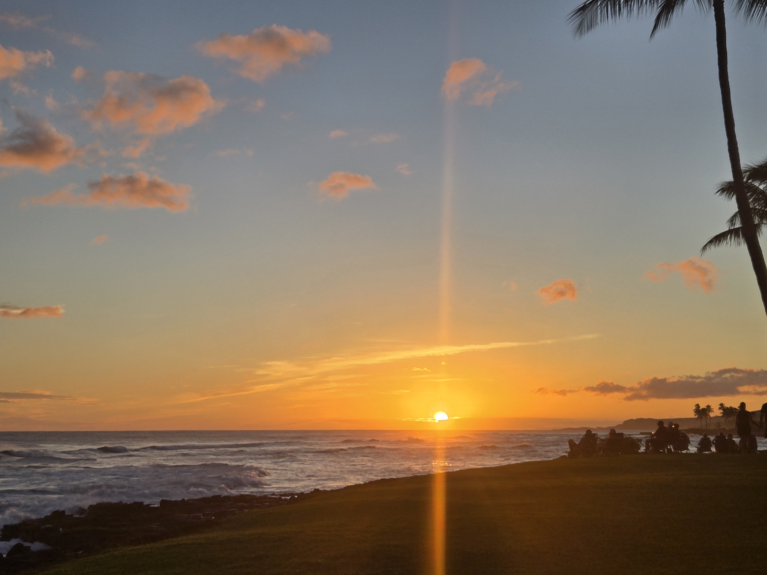
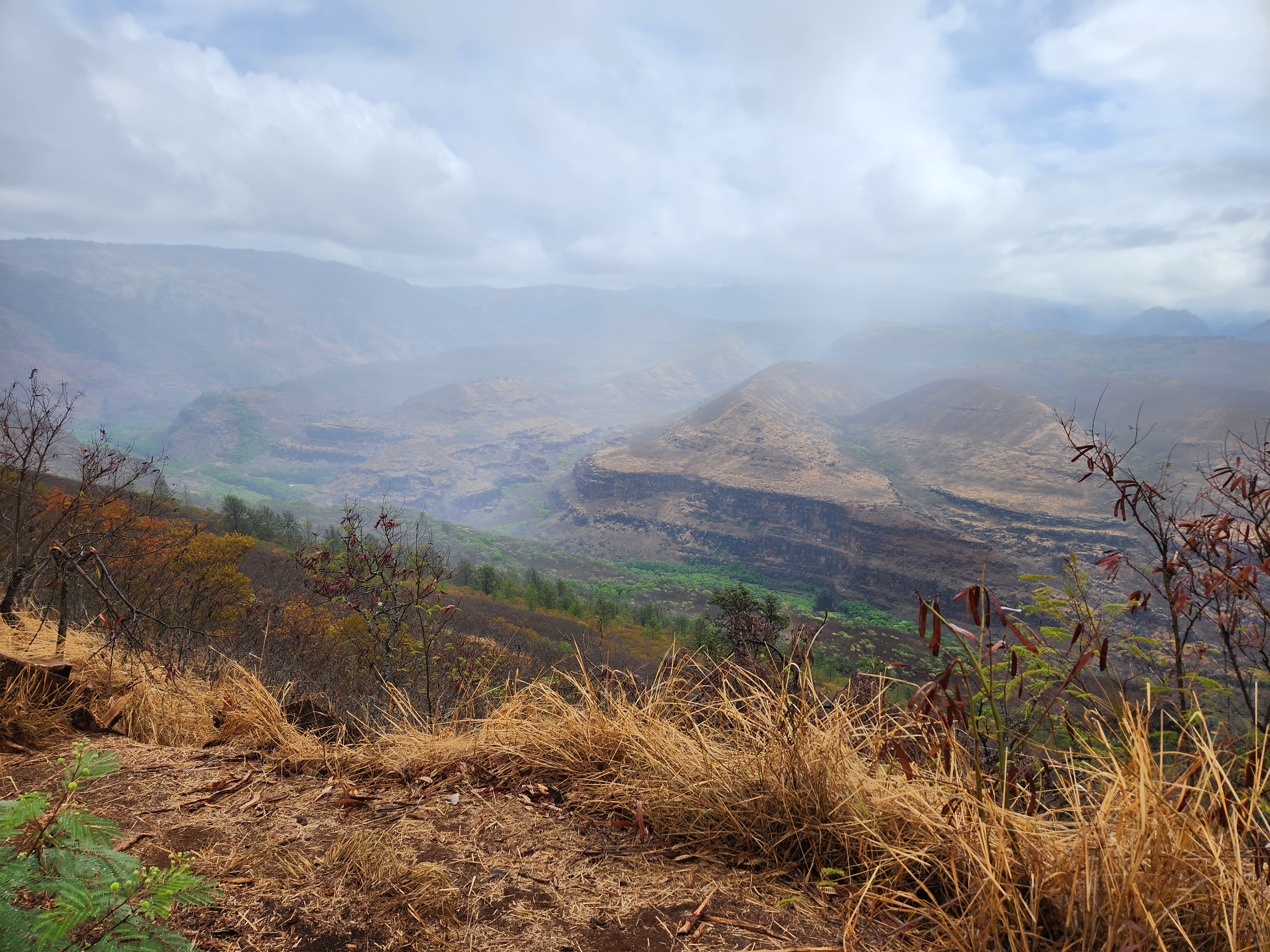
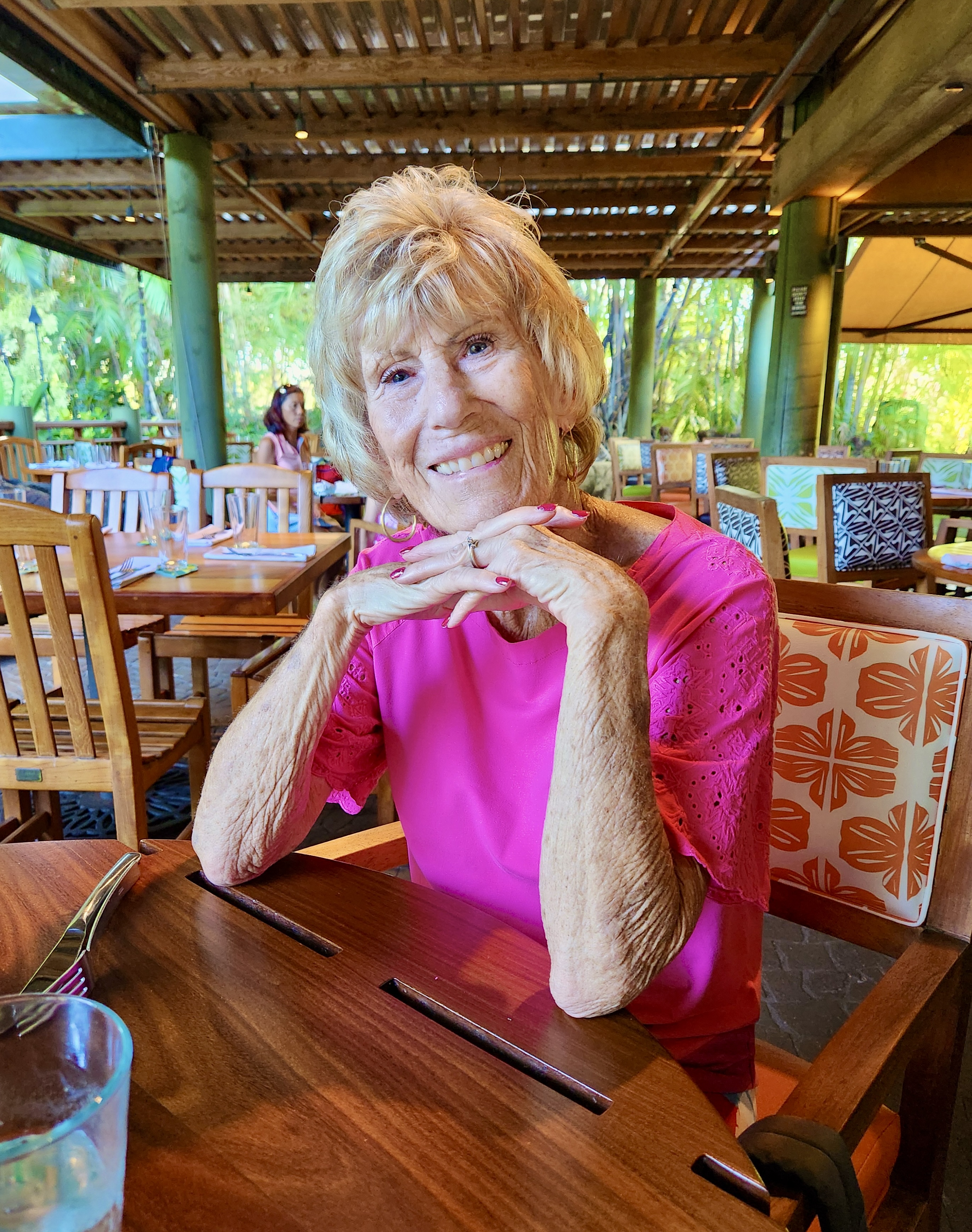
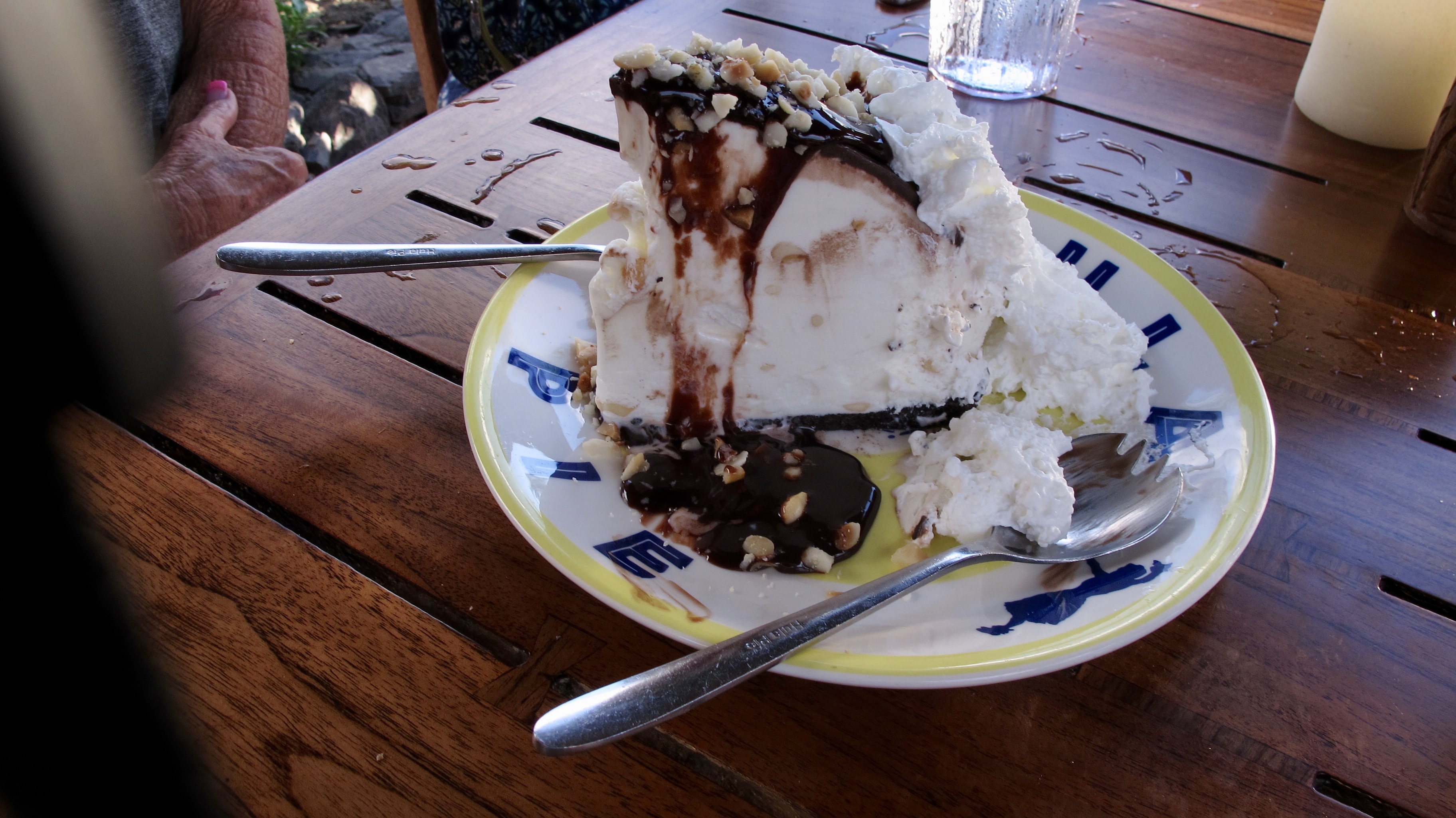
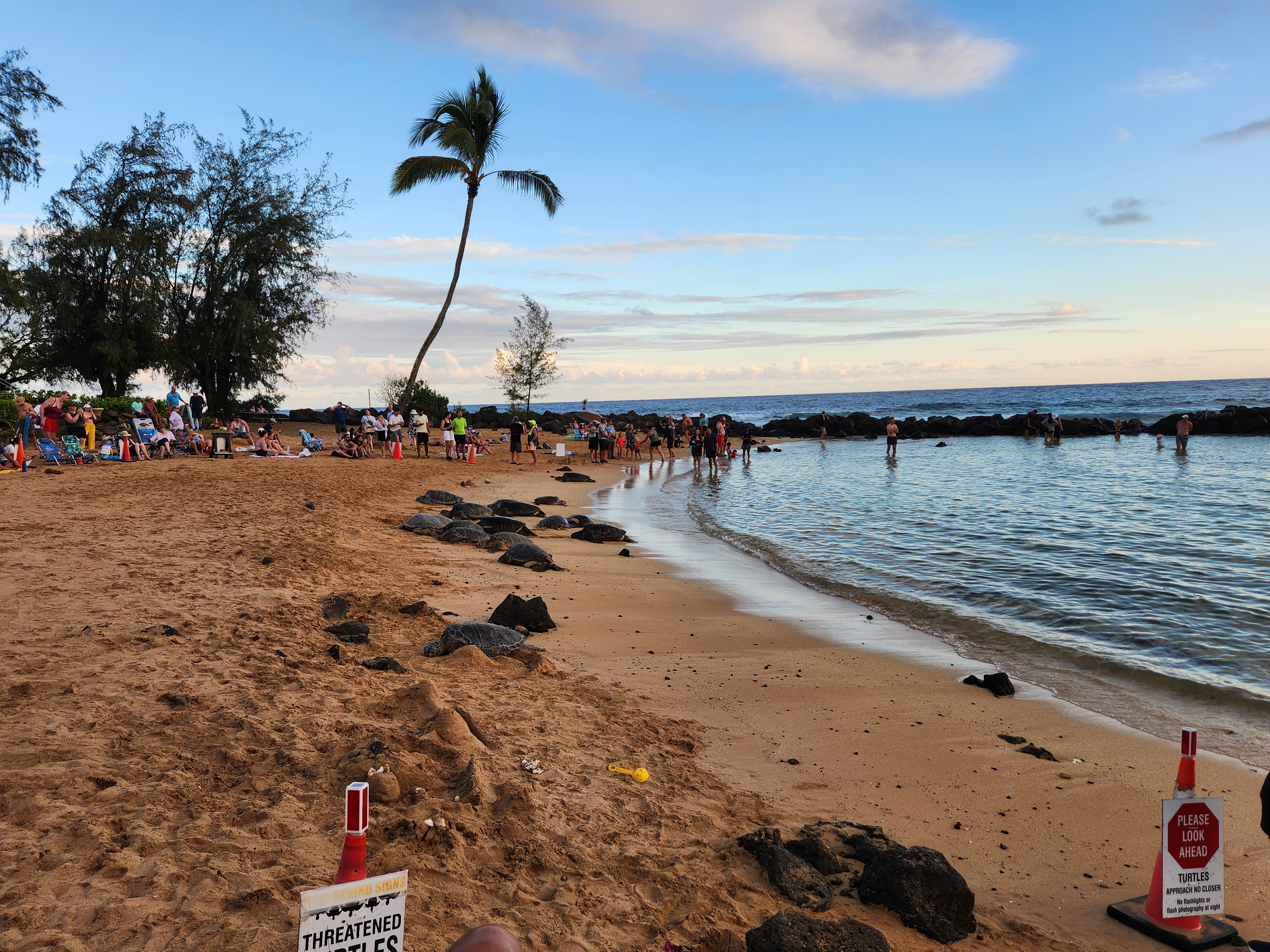
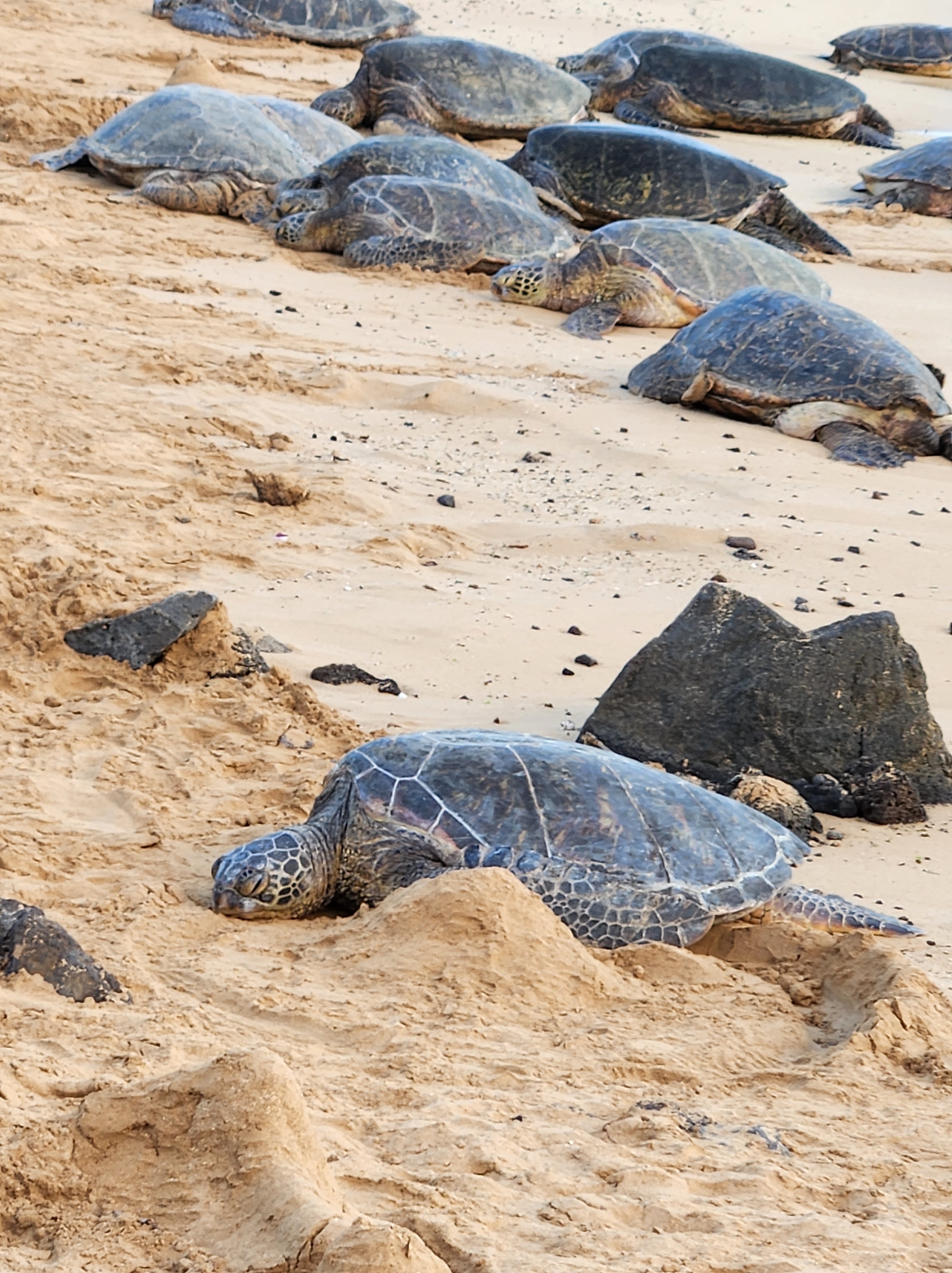
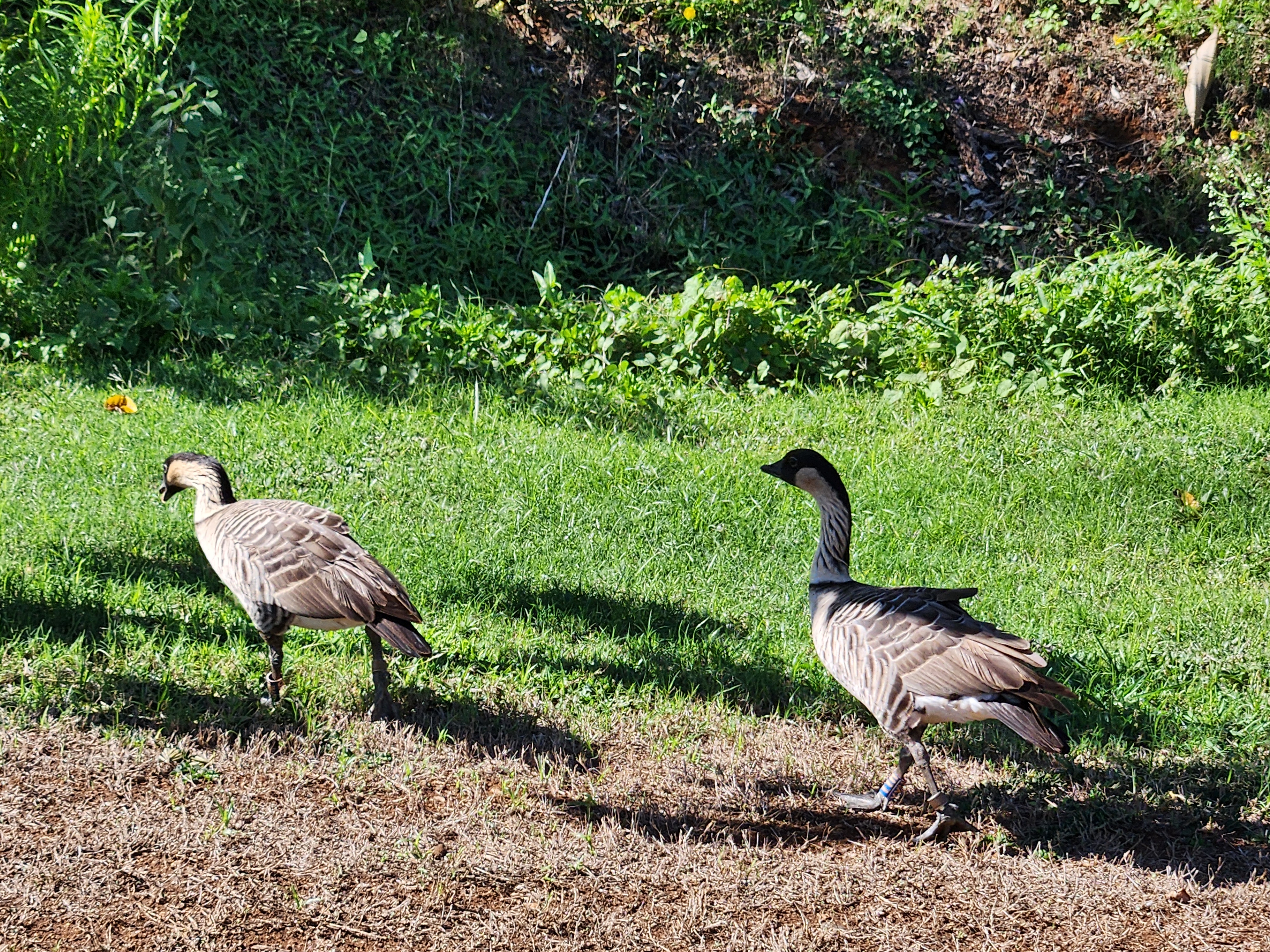
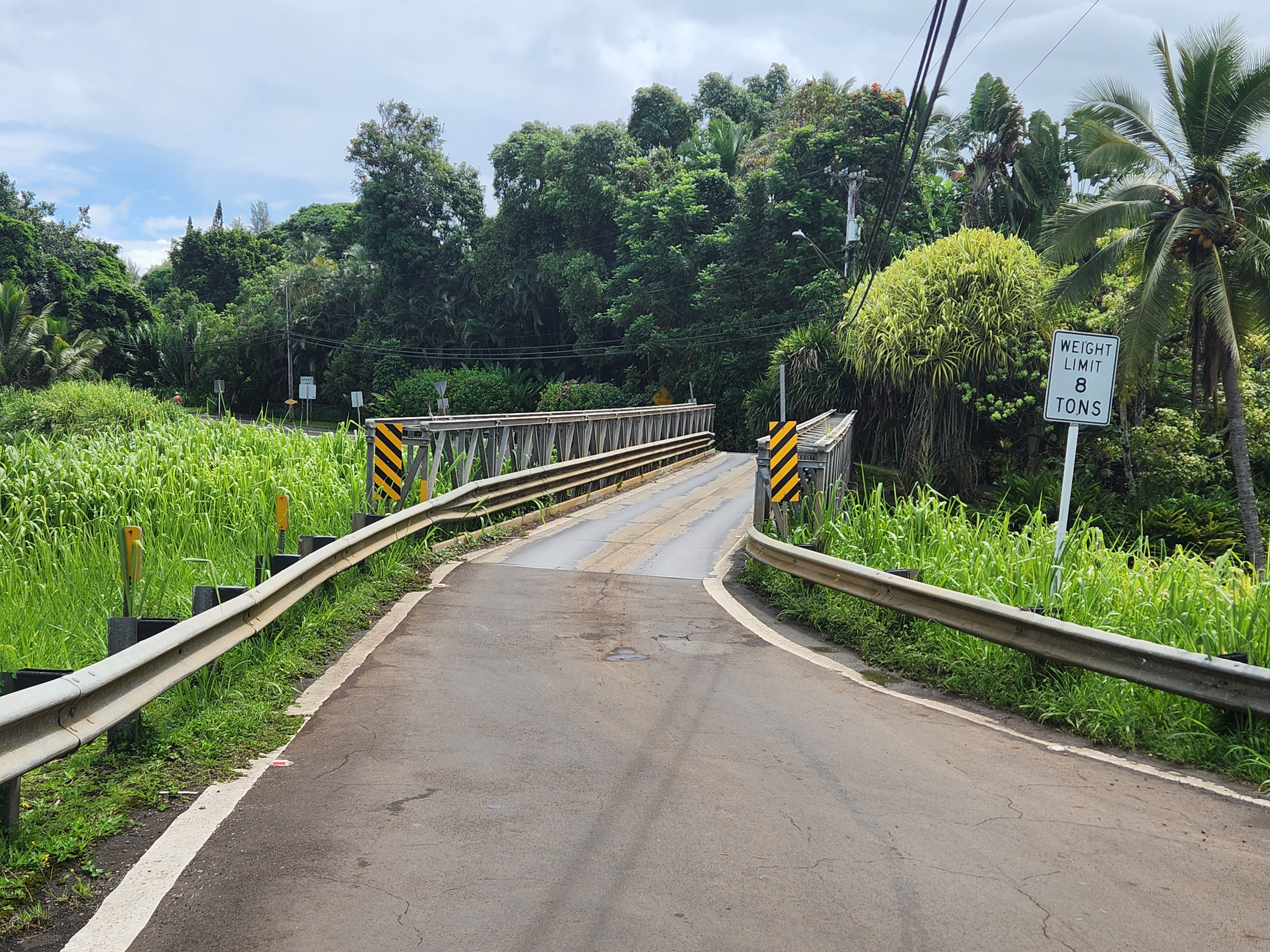
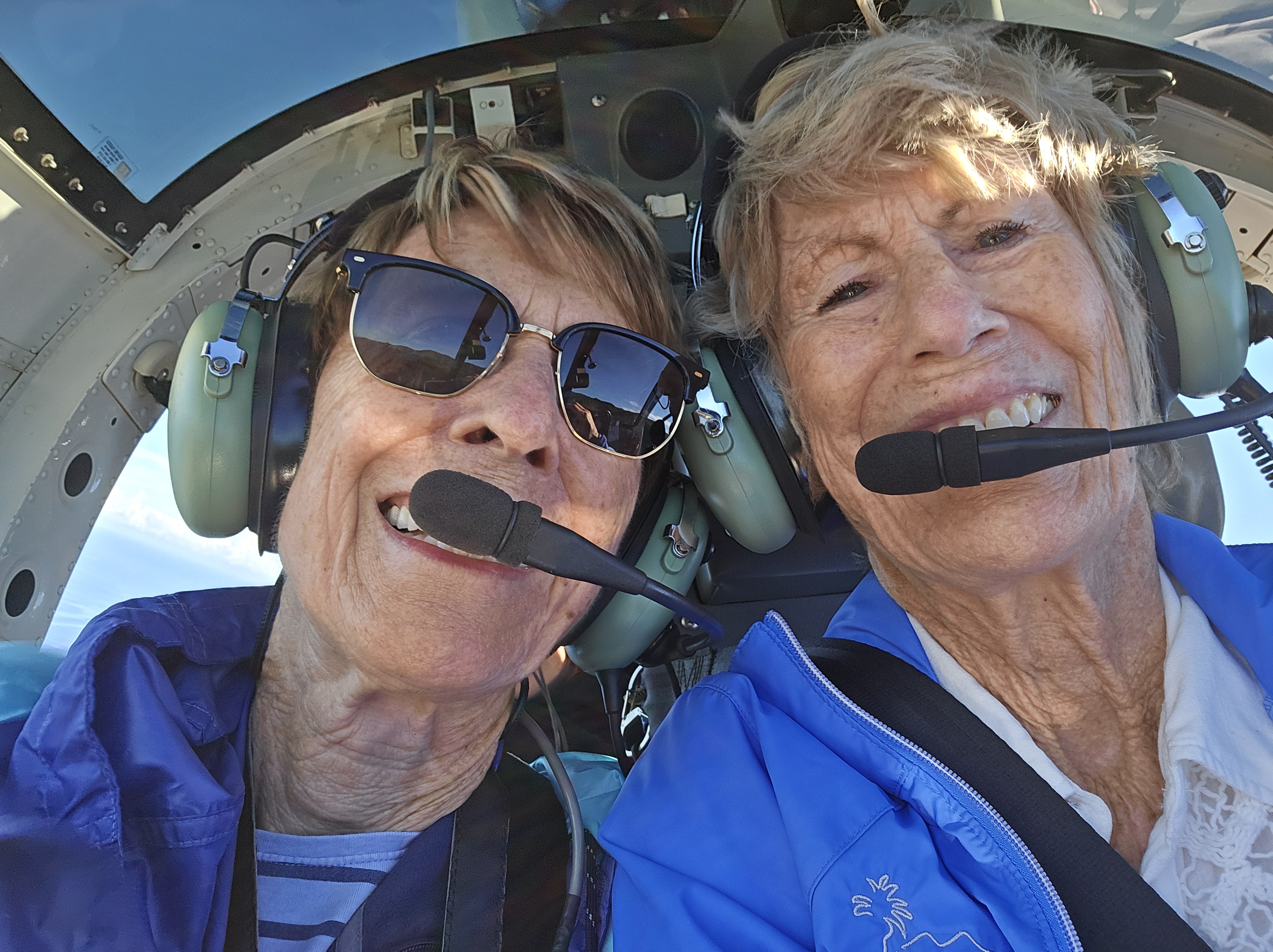
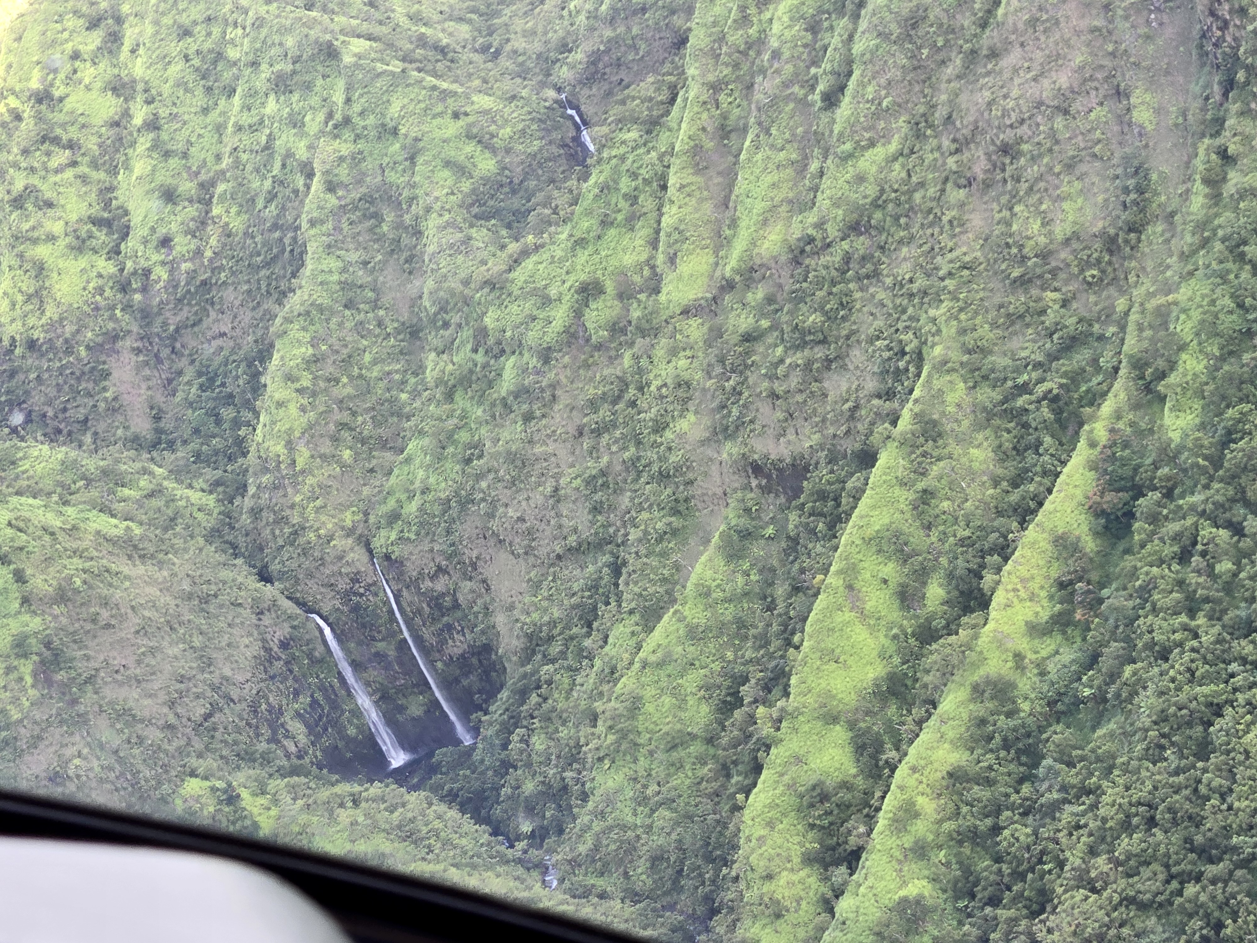
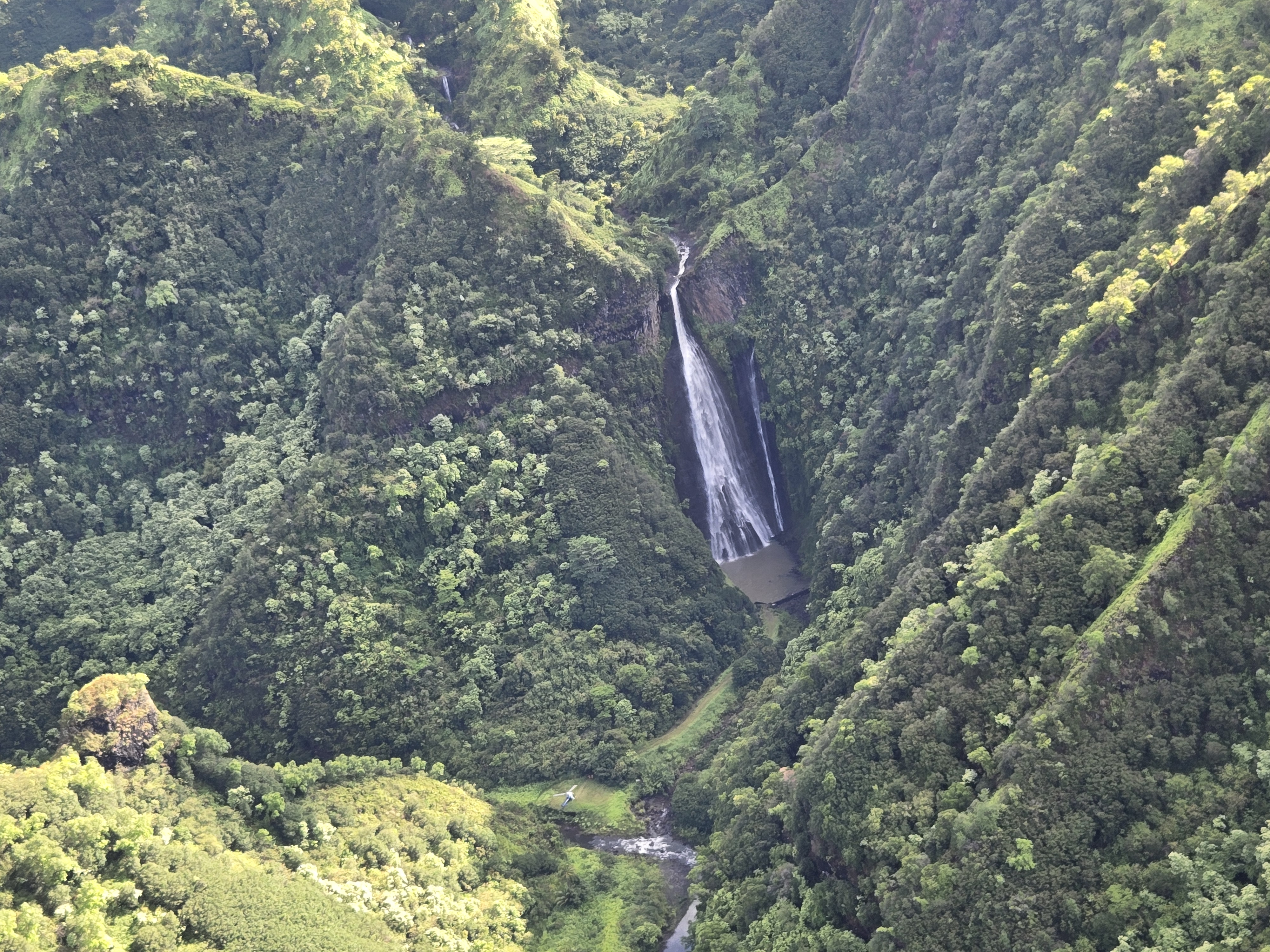
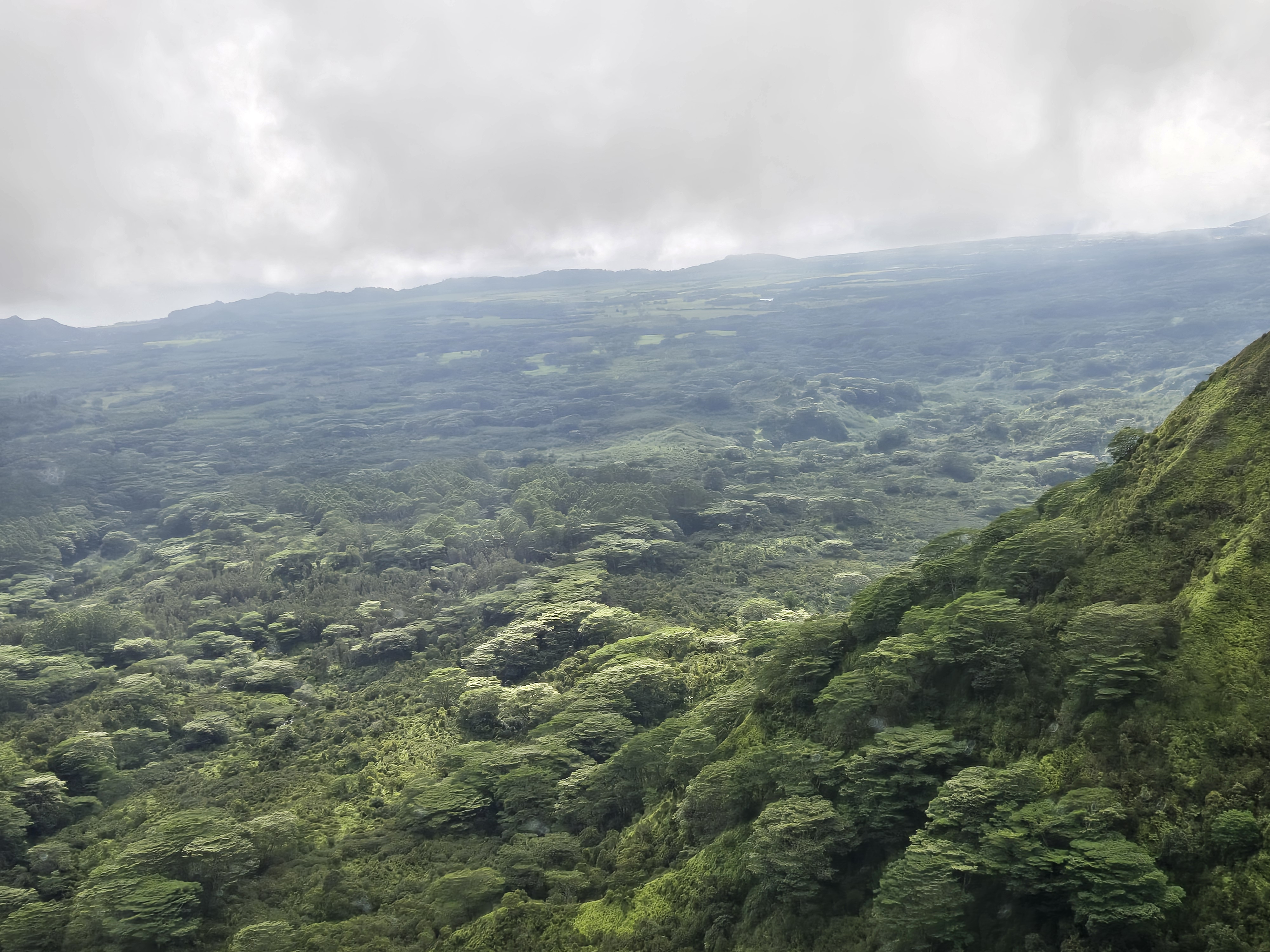
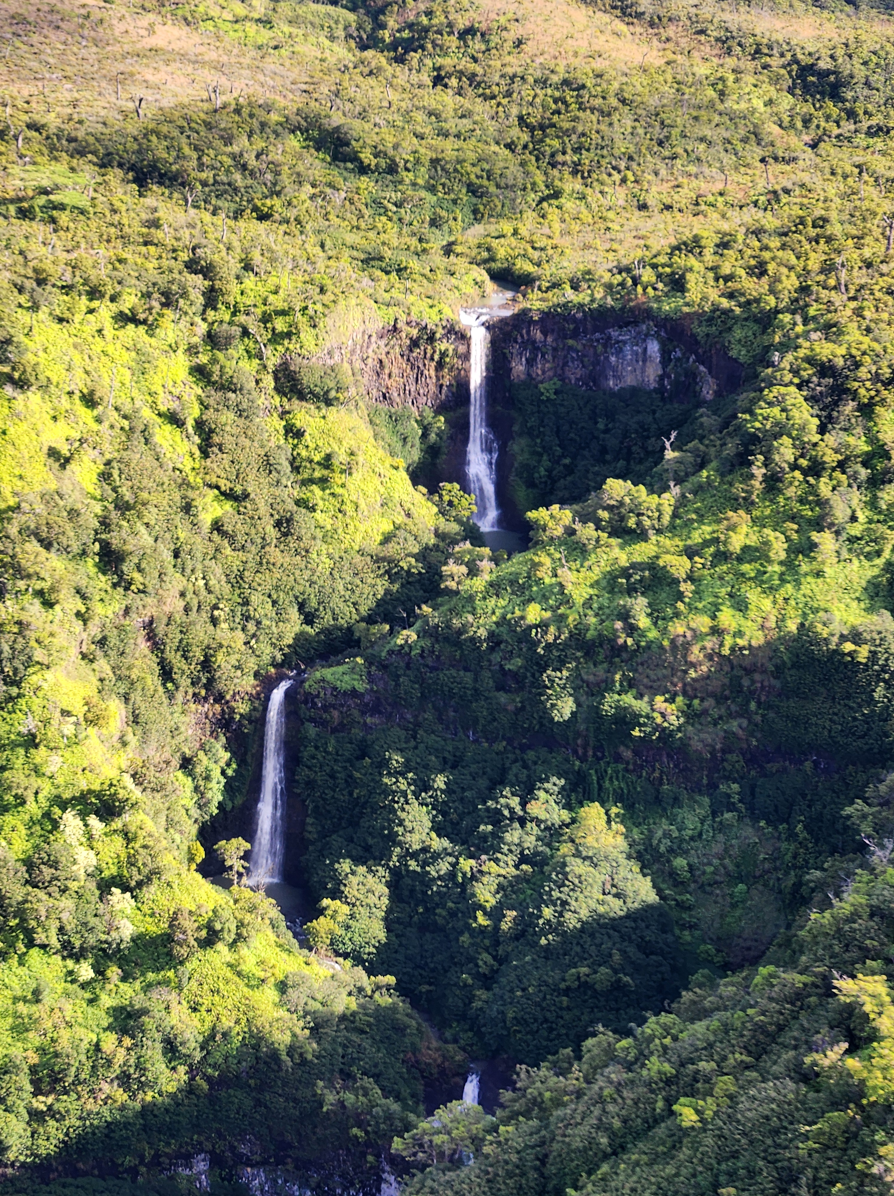
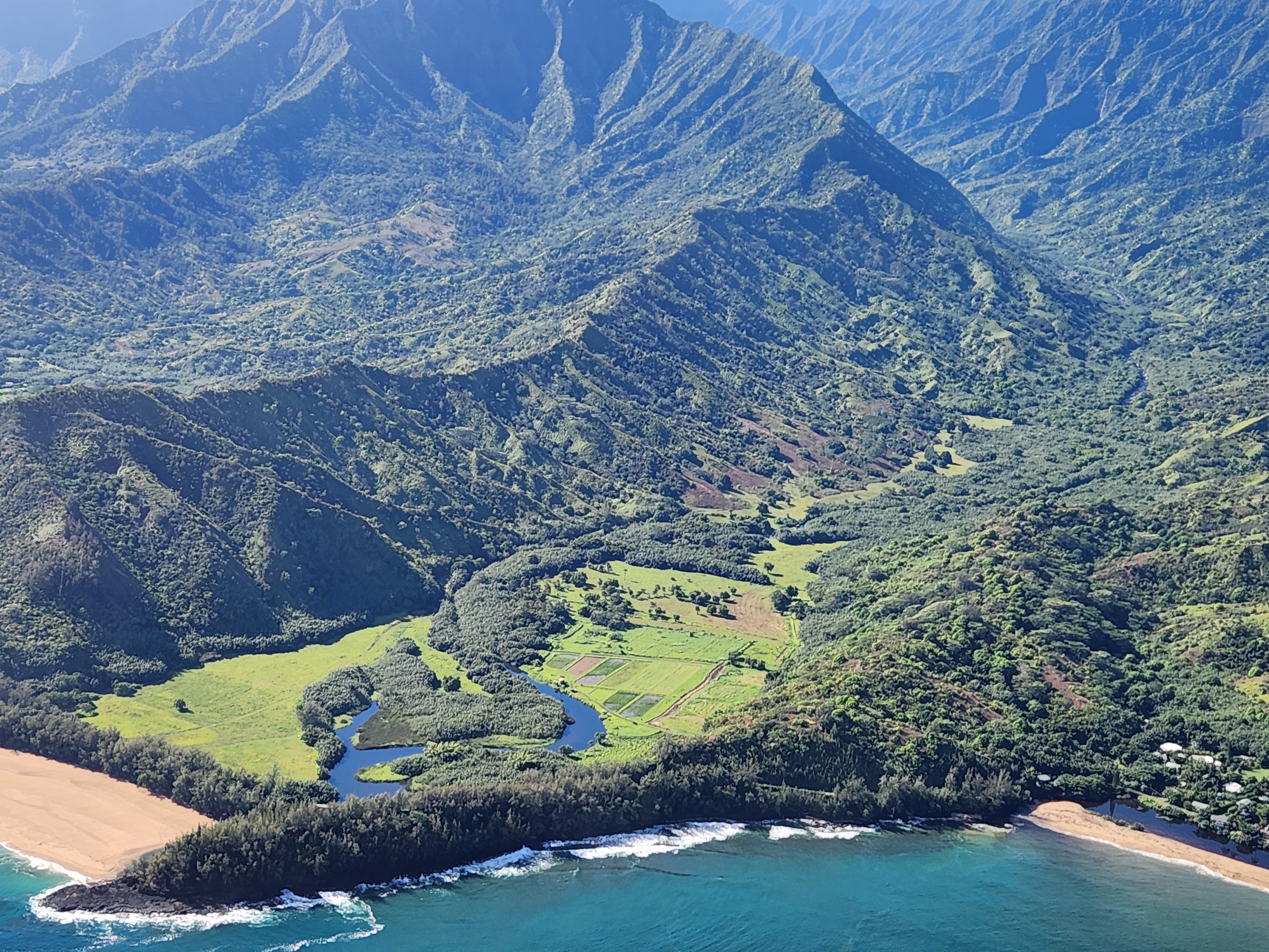
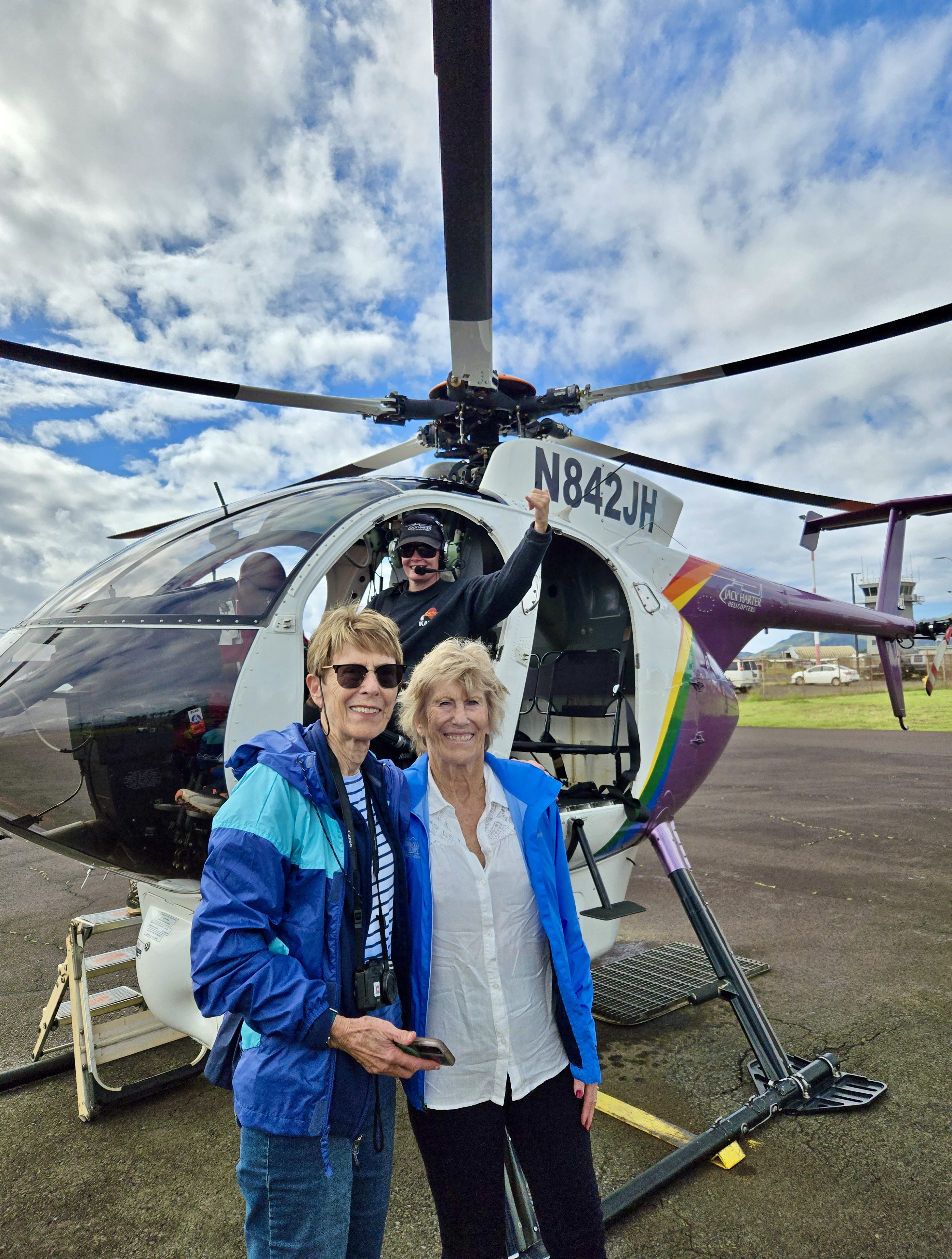
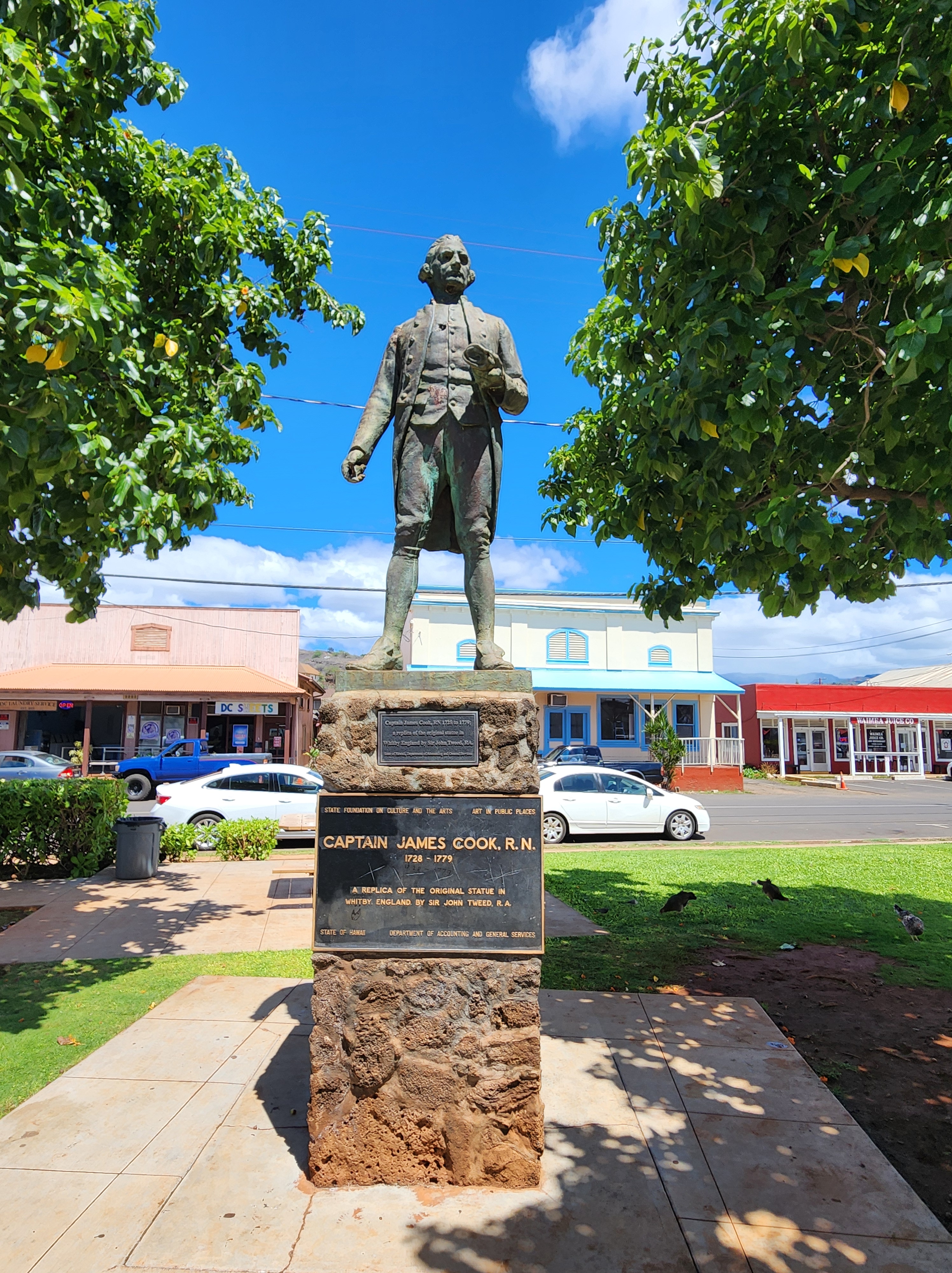
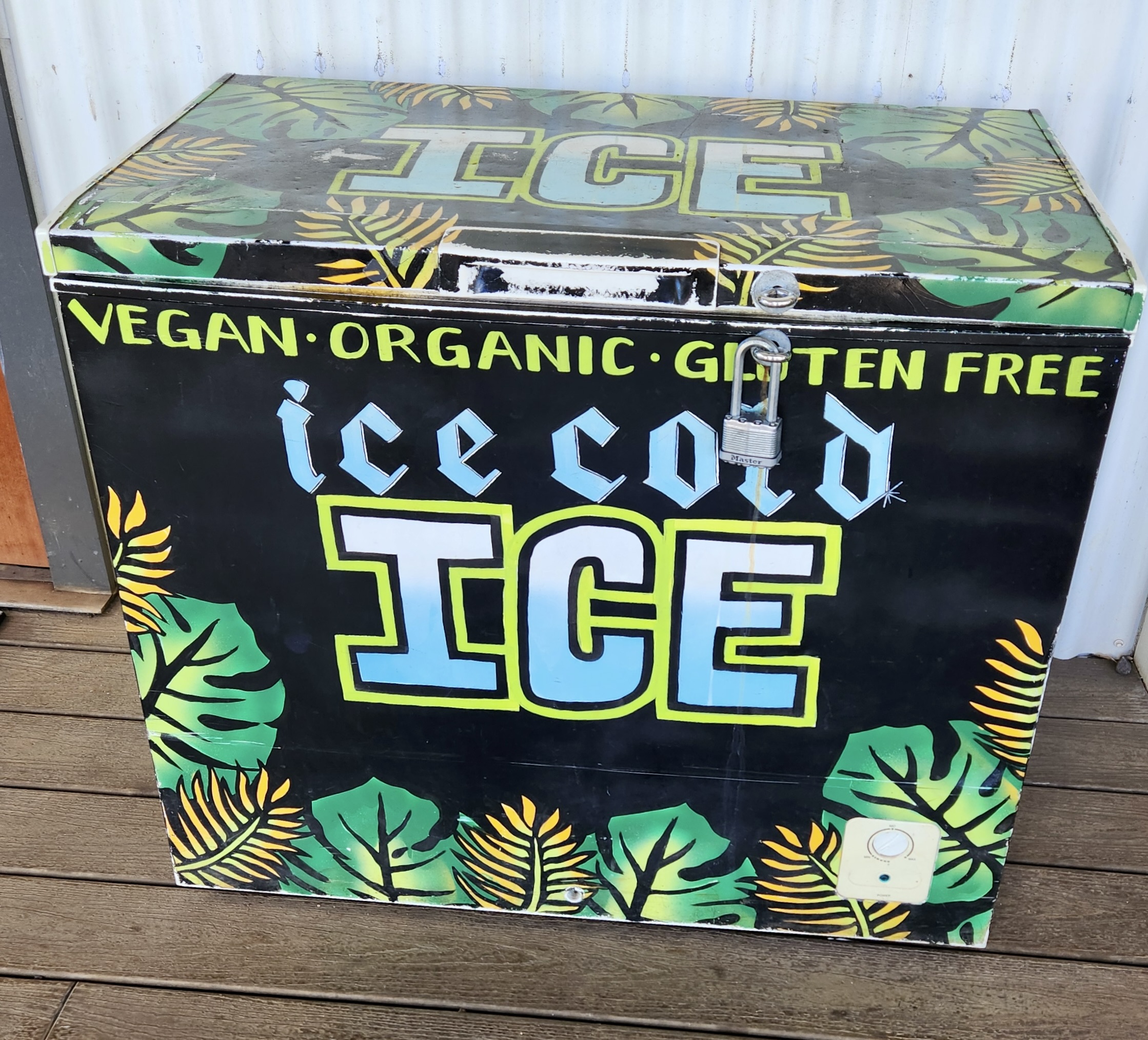
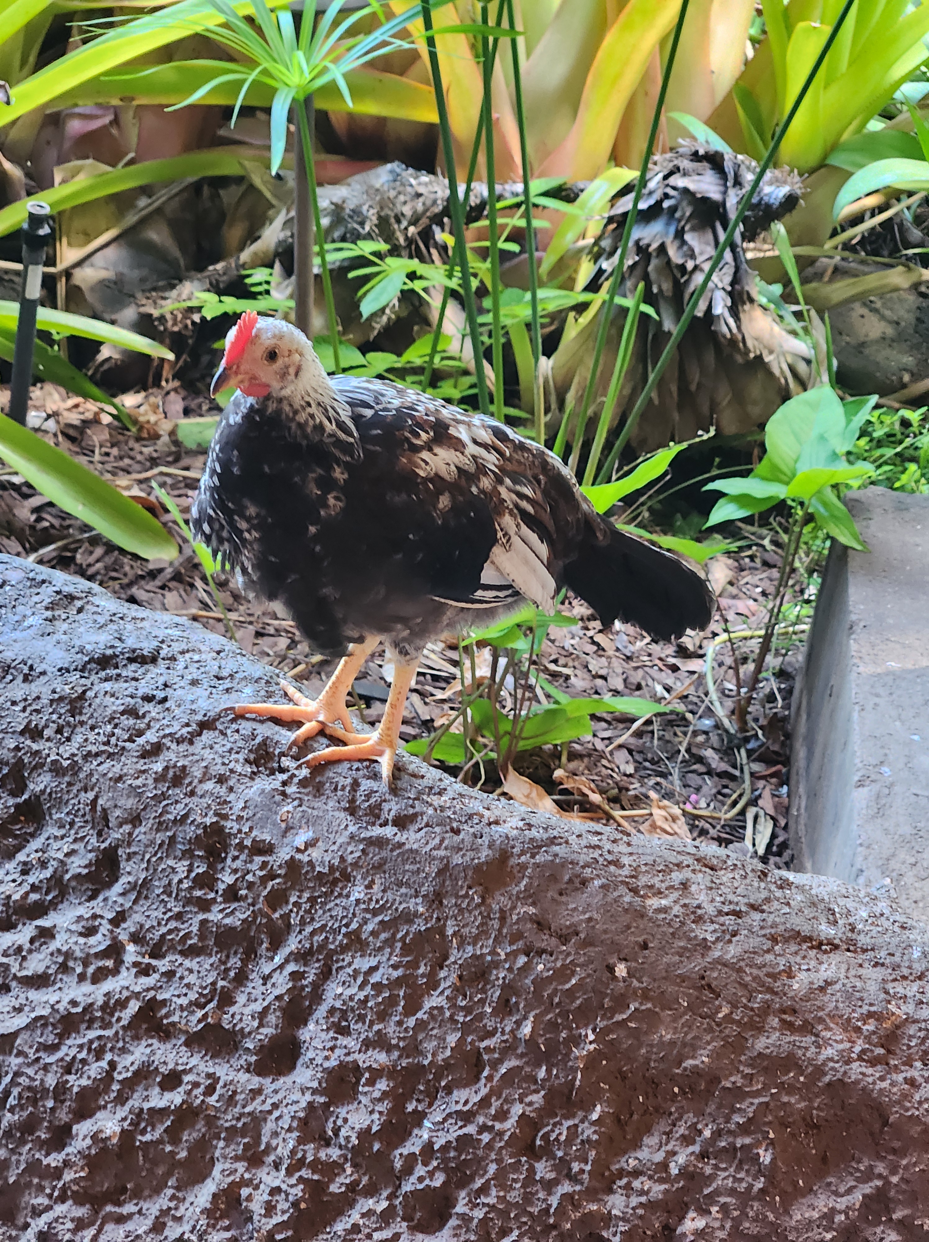
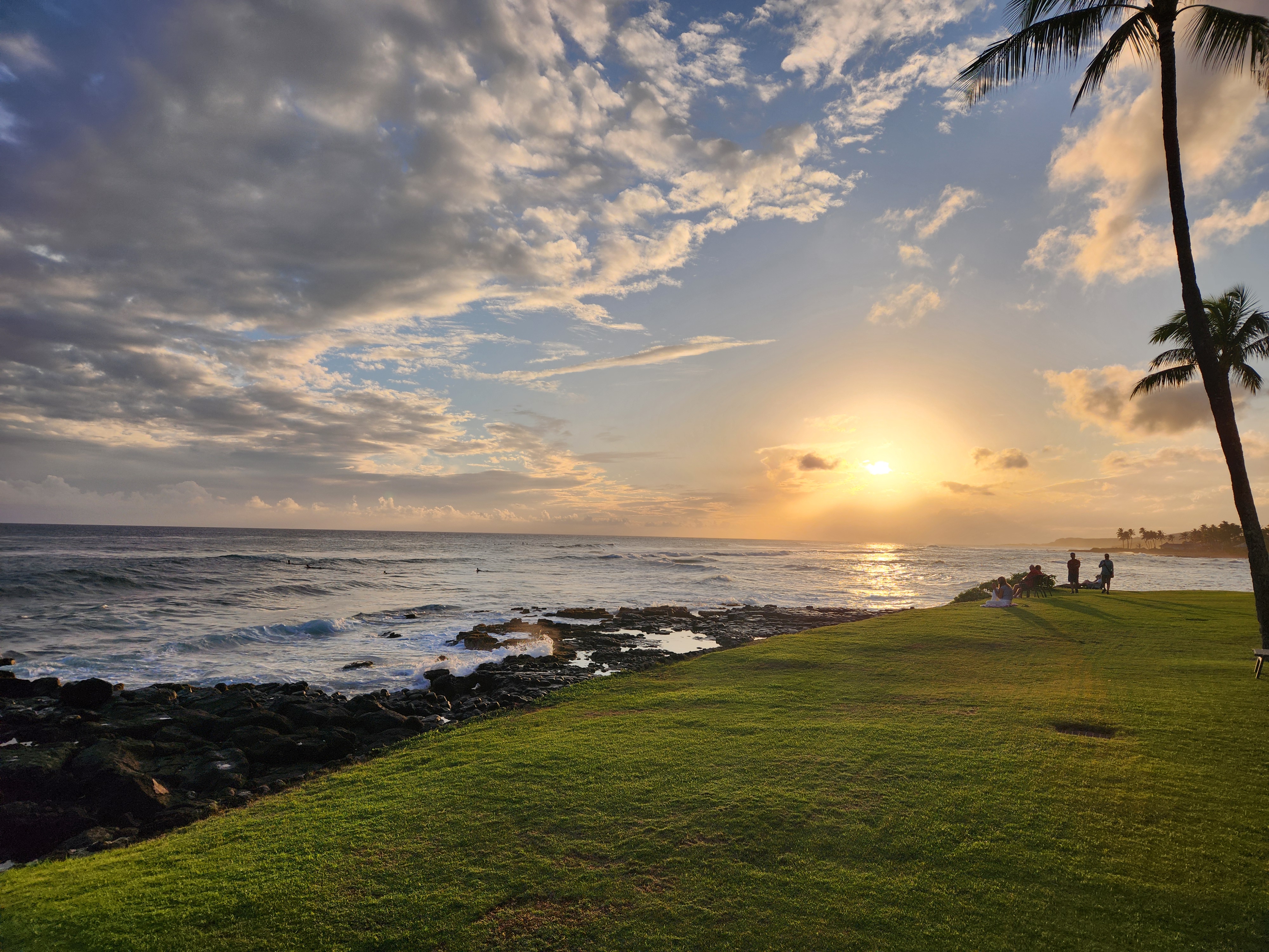
One of the first sunsets we witnessed in front of our Kauai home. It was so fun! Fellow Kuhio Shorites would set up their beach chairs, drink beverages, converse and watch the sunsets. We never had a blah eventideOf course, we visited the famous Spouting Horn just short way up the coast from our house. It gets its name from the hornlike sound it makes when it spouts. Fun to watch!We were greeted by one of the countless moa strutters. We were fascinated by the fact they were EVERYWHERE and no one bothers them. Jerri loves chickens and we took many photos of them.It was raining the first time we headed up to Waimea Canyon, a spectacular gorge, aka Grand Canyon of the Pacific. We didn’t mind the rain as locals had been telling us that they really needed the moisture.Our favorite restaurant near our place was Keoki’s Paradise. It’s designed so that you really don’t know you’re next to the main road. So relaxing, quiet and laid back. The food was so delicious that we ate there three times!Yes, we had the famous Hula Pie, a gastronomic delight!Every evening, green sea turtles beach themselves at Poi Pu Beach to rest for the night. This is not a usual occurrence at other beaches, so many people flock to this beach to watch them. We joined the crowd.We snorkeled at this beach the next morning and one was still resting. He must have stayed up too late. We saw quite a few fish but the beach was pretty crowded with other snorkelers.Our first helicopter tour postponed was canceled due to rainy weather. So we drove to the north side of Kauai where it was still raining off and on, just to see the sights and to shop at an ABC Store. We love these stores for their t shirts, trinkets, snacks and other things we think we need.As we were driving through Princeville, an exclusive community (from what we could see), we saw this sign and then our first nene, Hawaii’s state bird.Jerri and I had hoped to see these birds on Maui a few years ago, but they evaded us until now.The abundant cattle egrets were fun to watch. They love to follow a tractor or a lawn mower that turns up good snacks for them.There are several one lane bridges at the north end of the island that cause one to be cautious and wait their turn.We stopped by a stormy looking beach just to look. Many beaches are treacherous with rip currents and it’s not recommended to swim if there is no lifeguard and/or you are not familiar with the area. In fact, we passed a beach where authorities were looking for a missing snorkeler.I think this is Wailua Falls or possibly ‘Opaeka’a Falls. We didn’t see signs. They are beautiful but it was very crowded with little parking (we couldn’t get a space) and thus, spent hardly any time there.Our helicopter tour was the first one out for the day. Best time, I thought. The weather was iffy, but the pilot said it was a go. WHAT AN EXPERIENCE!We flew around the island and first went to Waimea Canyon and saw what it looks like in the sun.Beautiful falls abound in Waimea Canyon.Some of “Jurassic Park” was filmed in Waimea Canyon.Rugged Na Pali coast. You can’t get to this side of the island unless you hike or go by boat. The discoloration in the ocean is muddy runoff from recent rains.Inside the almost spiritual splendor of Wai’ale’ale Crater, over 3000’ high with rain clouds covering the crest.The sort of puffy looking trees seemed like one could fall on them and not be hurt because they would be so soft and pillowy. We know that’s not true but they look that way.Three fallsNotice there are no doors on the ‘copter and that’s why we look a tad windblown. So amazing to be flying about 100mph and to feel like we were doing about 25 mph. Chrissy, our pilot, was fabulous with her piloting skills and narration.We visited the town of Waimea where, in 1778, Captain Cook was the first European to sight the Hawaiian Islands and to land in Kauai.Apparently, some of the locals have an irreverent opinion of Captain Cook.Waimea also has a black sand beach. If you click on this photo to enlarge it, in the left center of the pic, a monk seal is on the beach.We also discovered gluten free ice on Kauai. This island has everything you’d wish for!
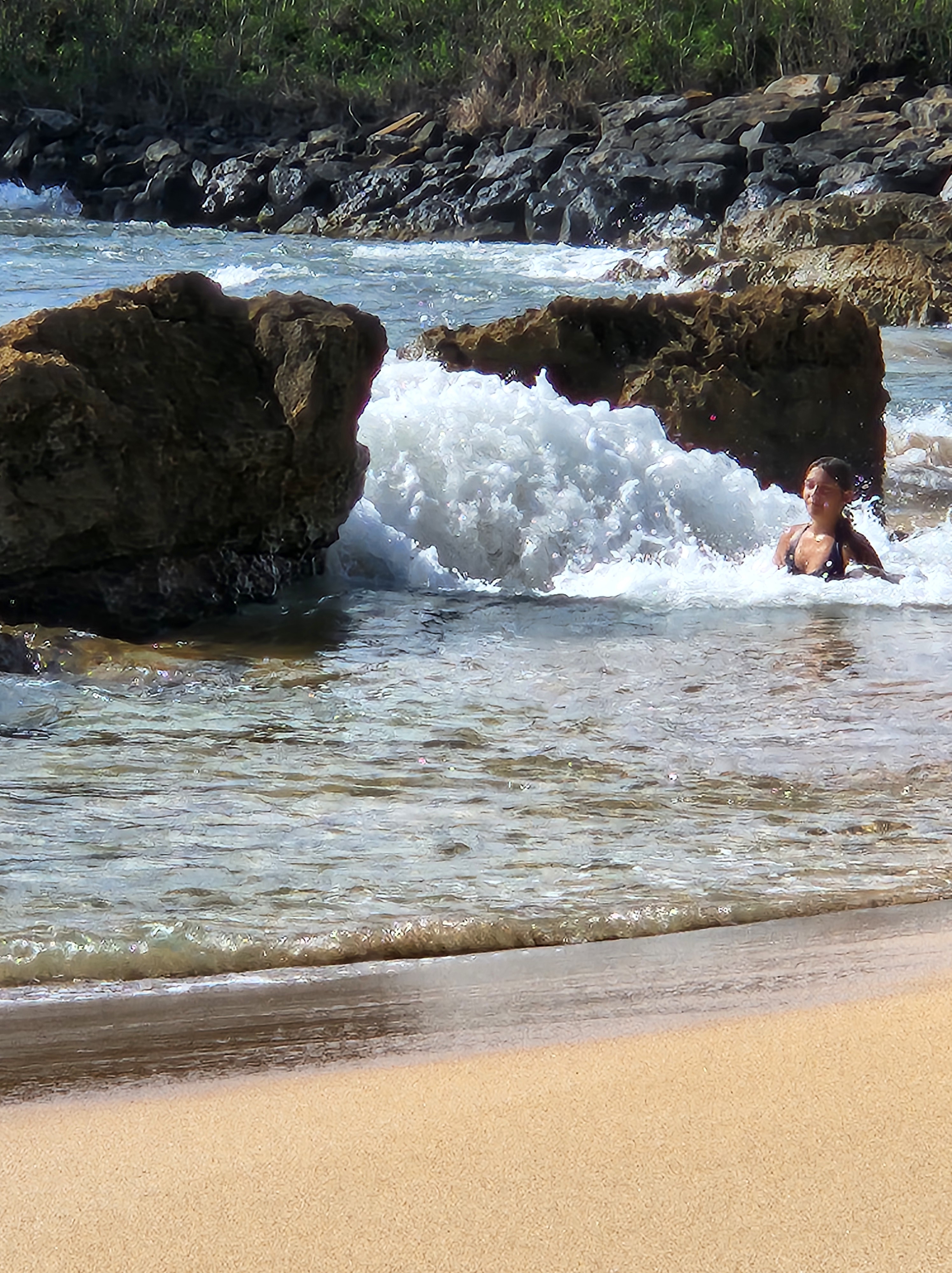
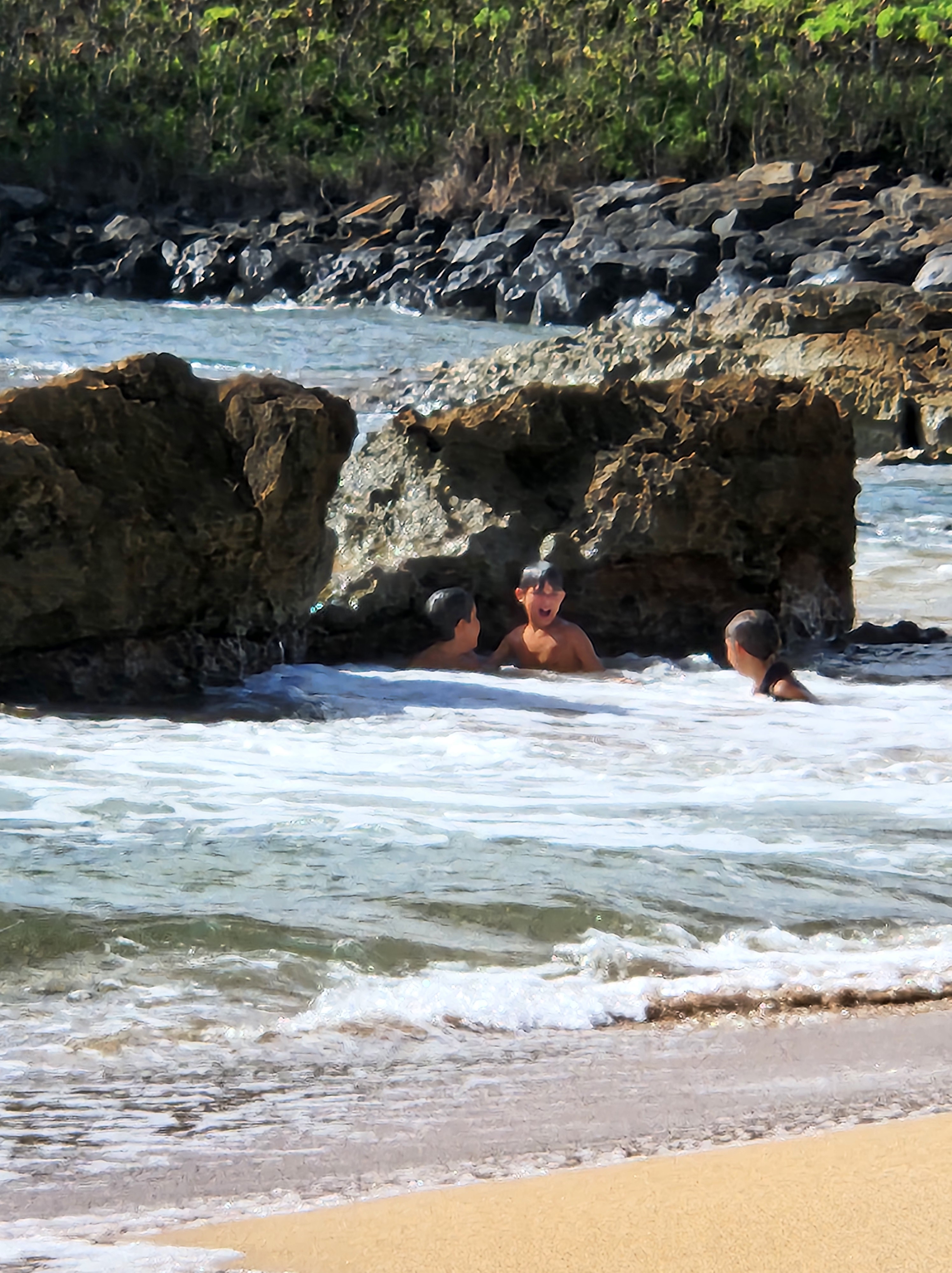
We discovered a small boat harbor that afforded nice snorkeling in calm water. There, we saw eels, various fish and some keikis having a blast playing in the water. Here, they are waiting for a wave to come between the two rocks.
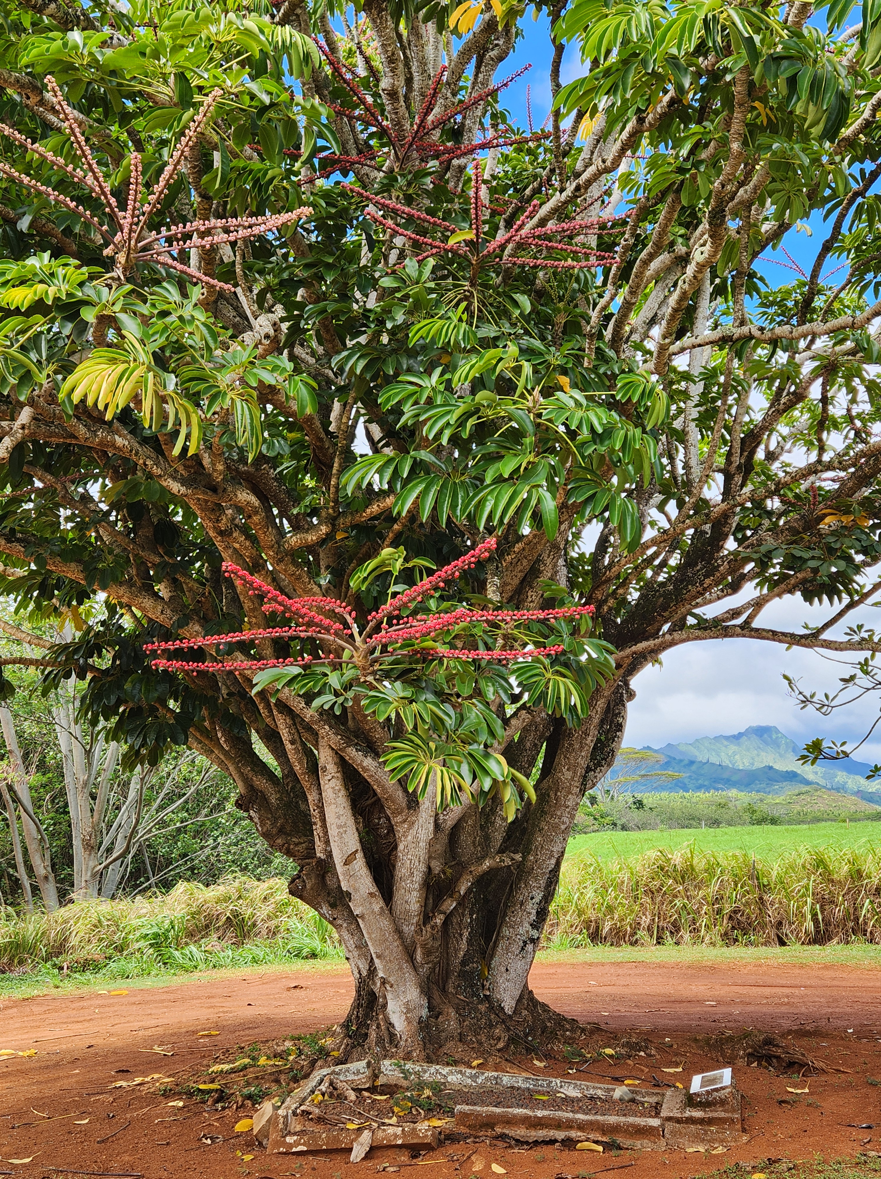
The wave comes and the two boys disappearThe aftermath. They laughed and giggled at every wave and had such a good time. We wanted to join them!We got a kick out of this repurposed theater in Lehu’e that has become a Senior Living Space. We wondered if the folks were “Living the Life of Riley” or “It’s a Wonderful Life.” A moa in Keoki’s beside our table.Twilight surfers in front of our unit.Getting ready for the sunset glow.A tree with funny looking berries on its branches. We were unable to find the name of the treeLast evening at Keoki’sAloha
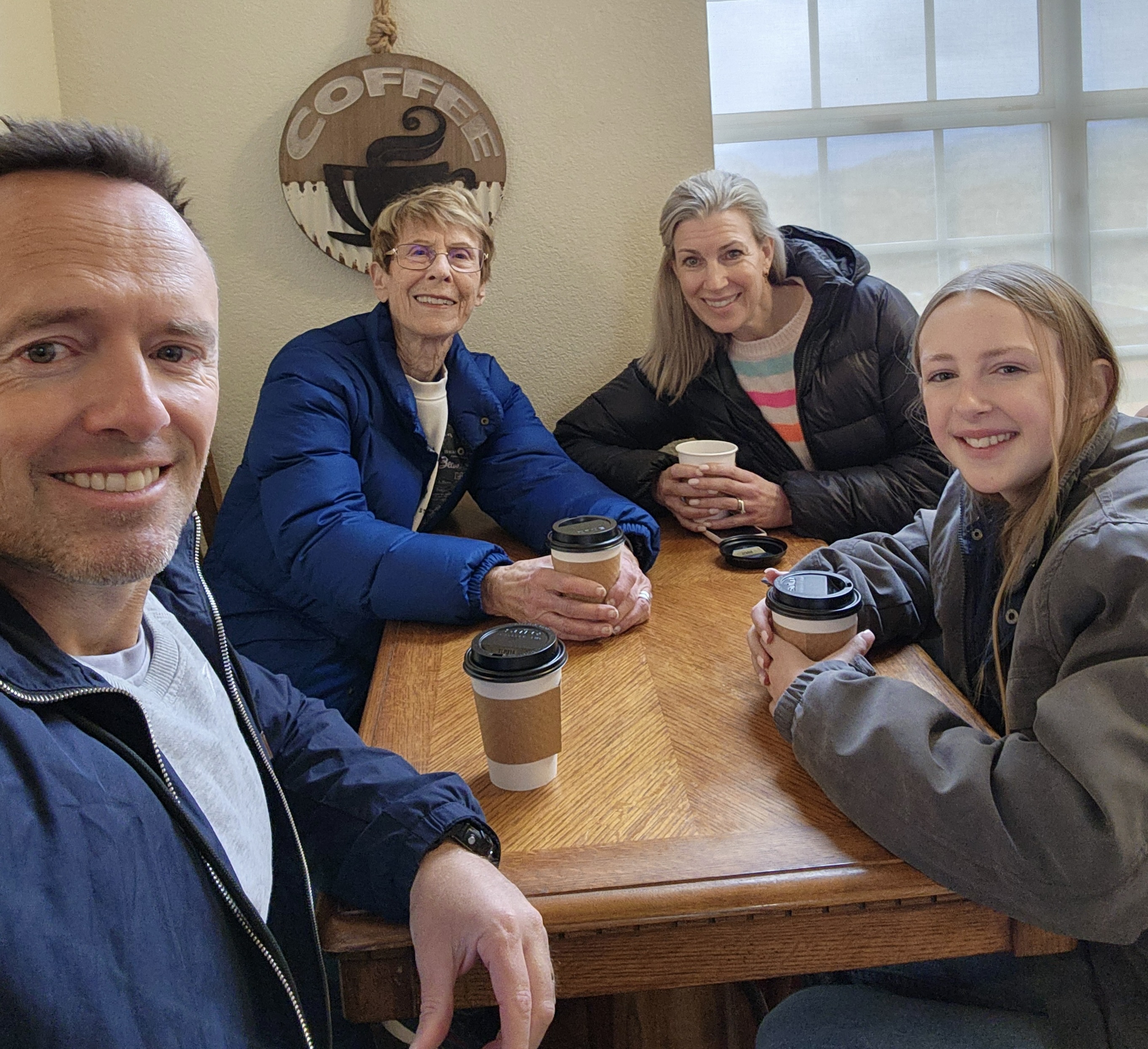
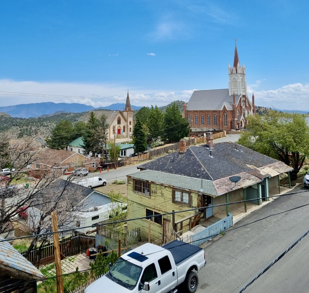
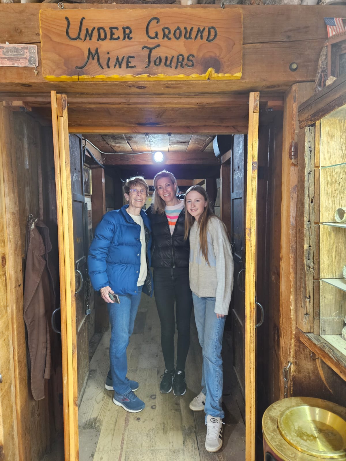
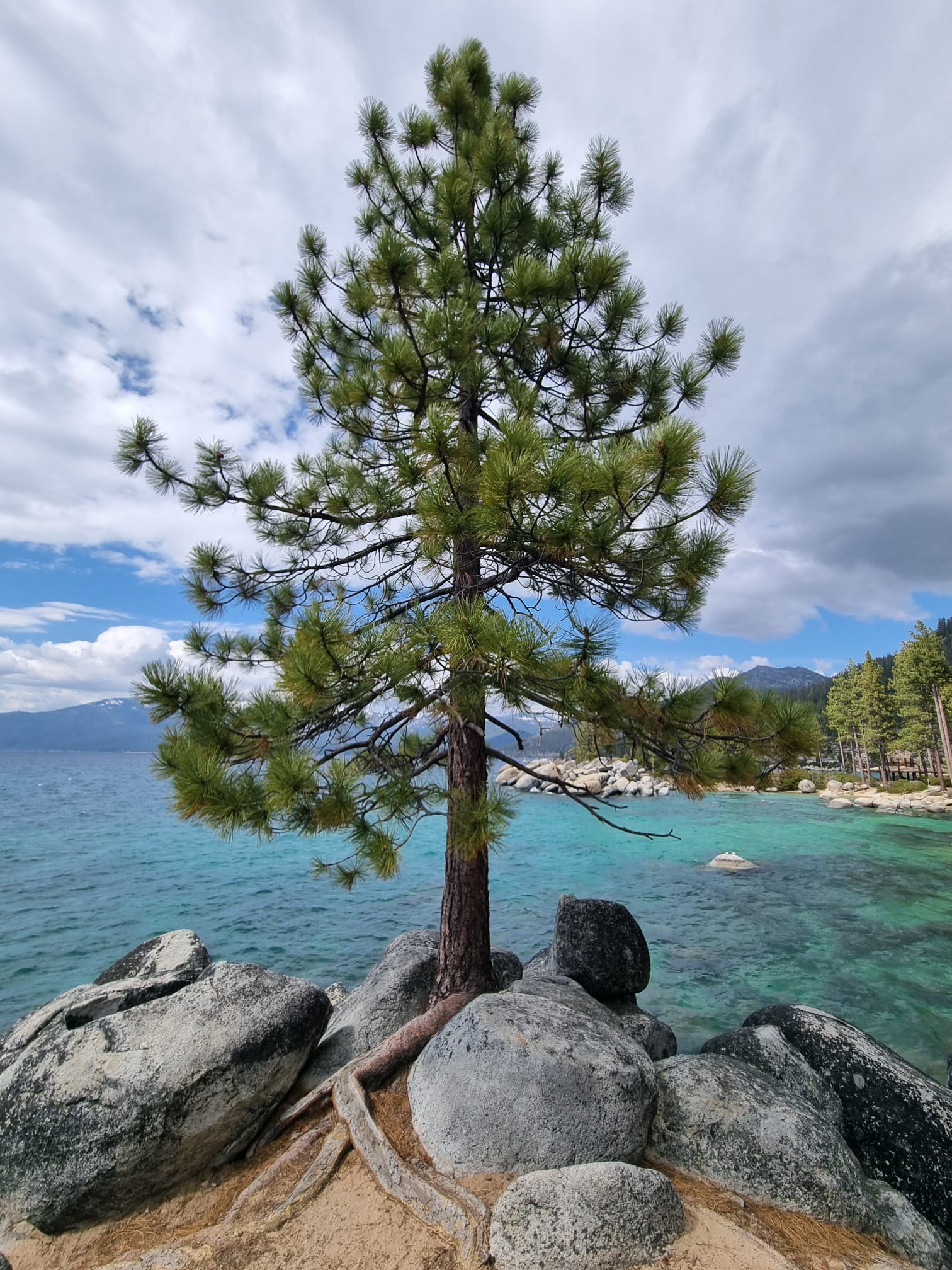
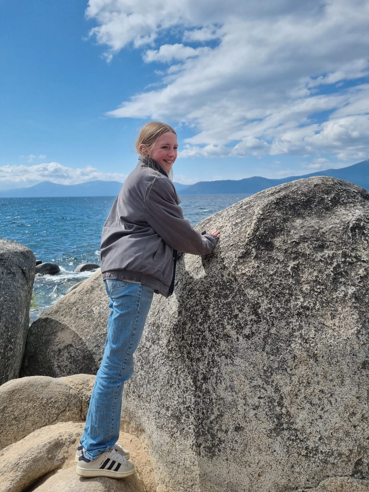
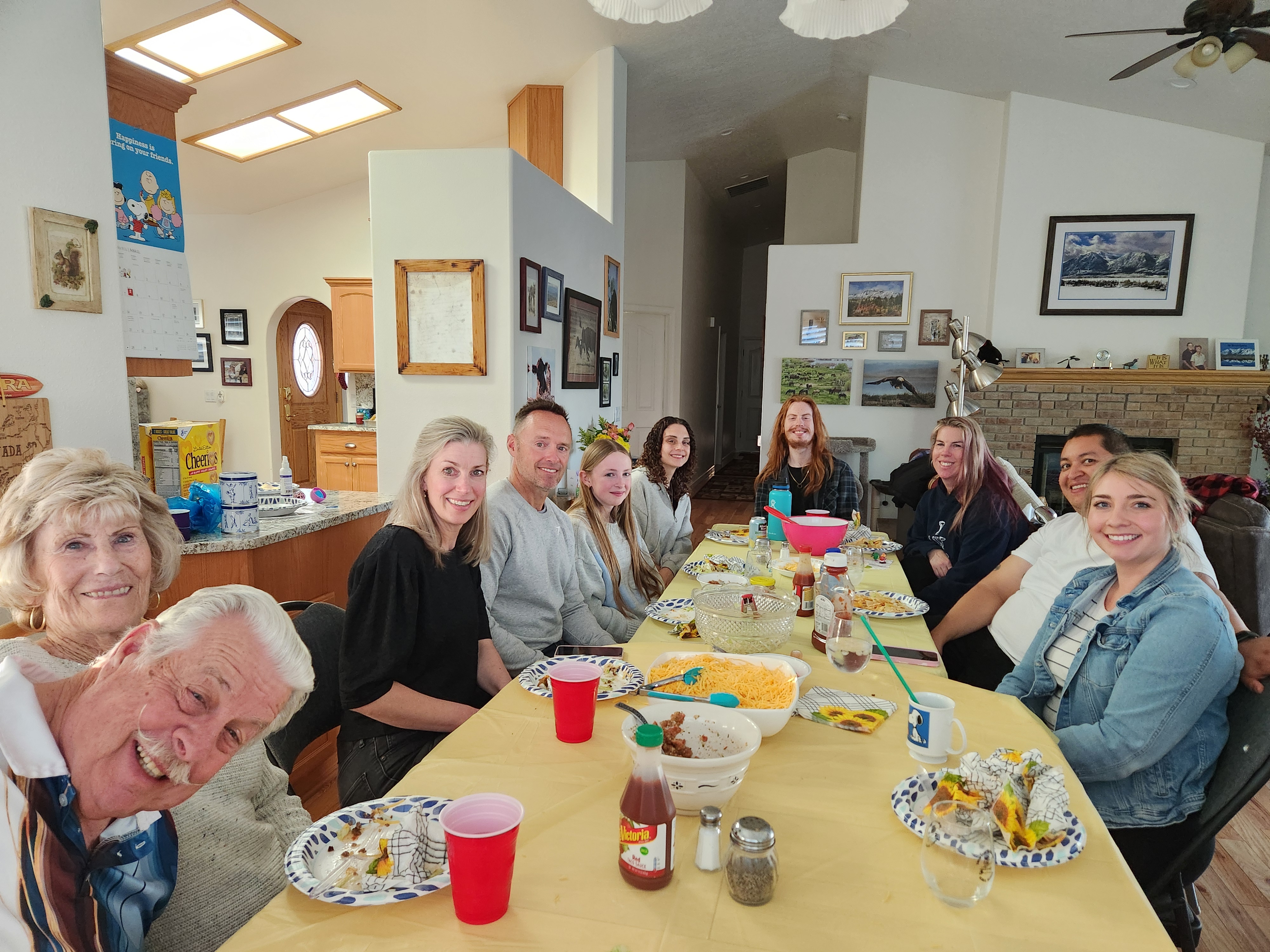
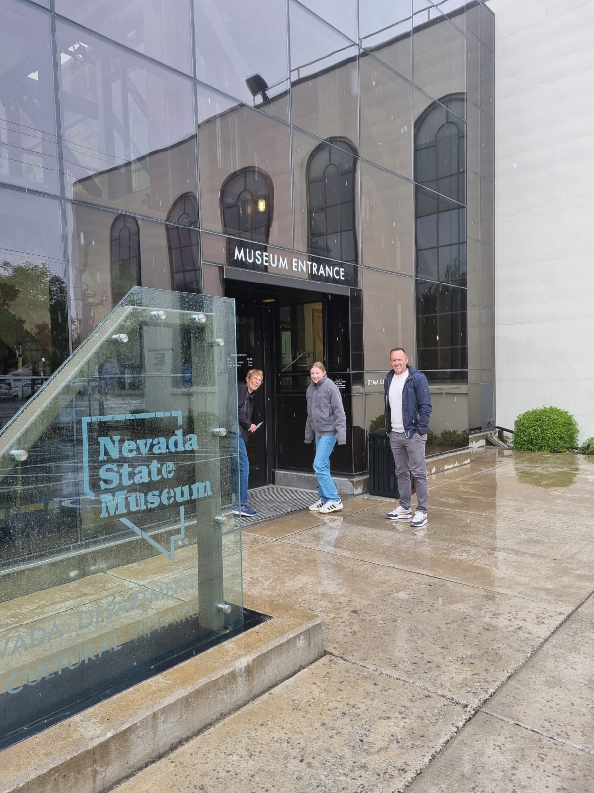
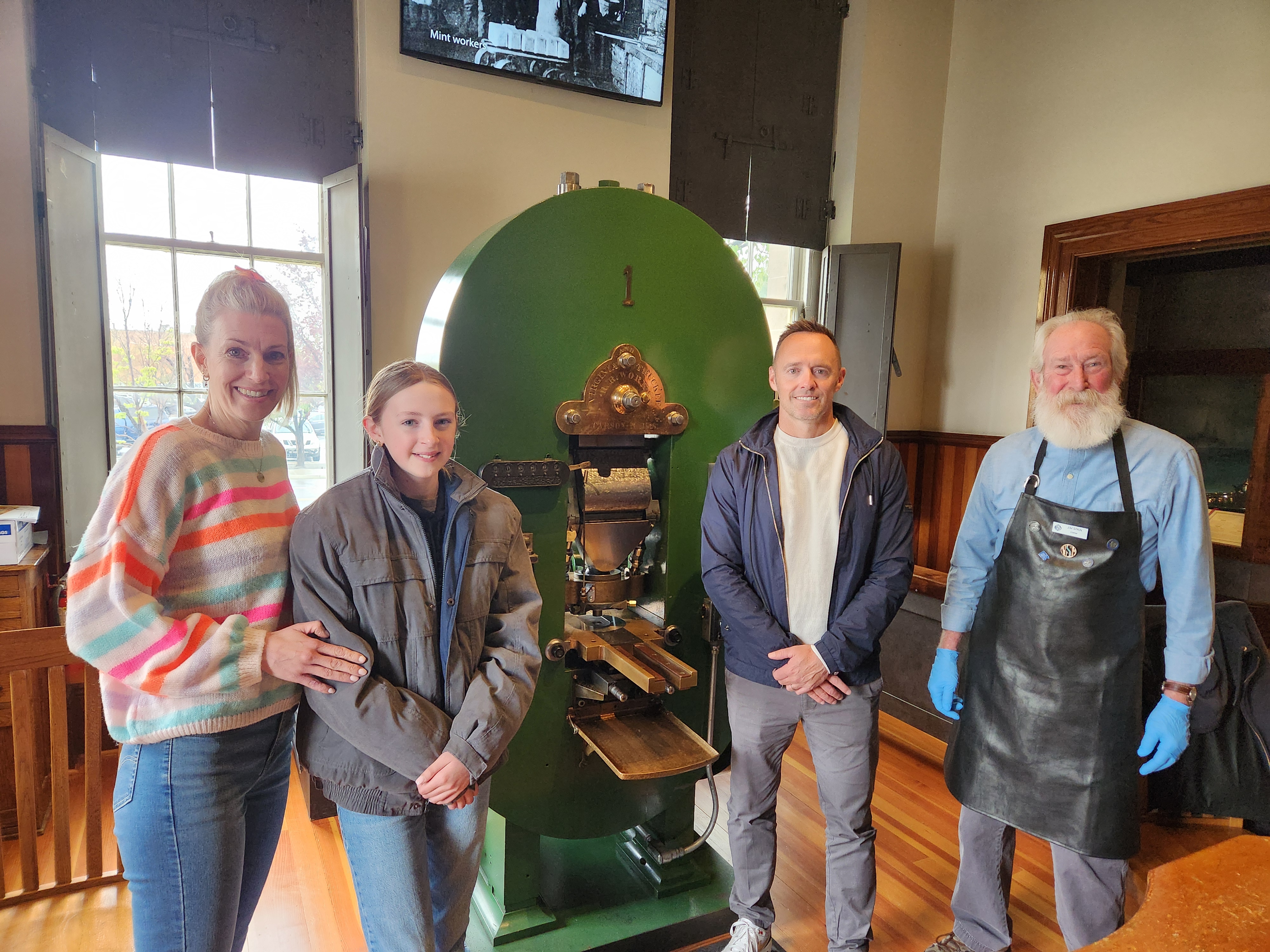
What a fabulous time I had with Michael, Floor and Kate, my Dutch family…aka Bob’s sister’s oldest son and his family. They made the long drive from Los Angeles to Minden after visiting Michael’s college haunts in Orange County (plus seeing a couple of Angels games. I hadn’t seen them in person for 8 years.The morning after their arrival, we took the long way to Virginia City in hopes of seeing wild horses. We saw only two, but that was okay. This view is from Geiger Grade with Mt. Rose above Kate’s head.Time for hot cocoa and tea as we got cold looking into shops and walking around VC (founded 1859 with an altitude of a bit more than 6100 feet). It was brisk that day.The clouds cleared for a bit to take a photo of St. Mary’s in the Mountains Catholic Church. It is said by some that on clear days, one can see at least 100 miles out to the east. I’m not positive about that but I do know you can see long distance.VC is riddled with an estimated 350 to 750 miles of old mining tunnels that can be found beneath the modern-day streets of Virginia City and we took a tour of one. It was interesting, but, definitely a place in which I wouldn’t want to work back then…dangerous, cold or scalding hot water, bad air and many more poor conditions. We were tough, though. We survived the tour!After lunch in VC, we drove over the Sierra Nevada to Lake Tahoe and stopped at Sand Harbor where the “family” tree is. This is where Bob’s and his mother’s ashes as well as my parents’ cremains are. Michael and Bob were very close while he was living with us and going to school. Bob was also best man at their wedding. Michael thought it only right to visit Uncle Bob and Grandma. It was special to me, too.In front of The TreeKate is out on a rocky point of Sand Harbor.Jerri’s tacos for family dinner. We feasted and there weren’t many left out of the four pans!Dinner that night was very tasty and fun. Lots of good conversation and catching up. A lot of changes in the family in the 15 years since Michael and Floor helped scatter Bob’s ashes. Kate and the little ones weren’t born yet. How time flies!Above photo is face on. Back of the head in this photo. But you can see Cruz and Mateo (two small tots – 2 1/2 and 16 months) and Darcy and Scott next to me.Kate’s new Nevada wild horses sweatshirt. She loves horses and is an accomplished horsewoman in The Netherlands.We visited the Nevada State Museum and took the grand tour.Of course they had to see the museum’s priceless artifact, the first coin press to arrive in what was then, the Carson City Mint (1869). It’s the only coin press in the entire world of its vintage that still works! Jim Spain, one of the coiners, was running it that day.Dinner was at the Charthouse above Lake Tahoe. It had snowed quite a bit that day and Kate enjoyed the beauty.Kate will be 13 this summer, and I felt we should celebrate it when I could be with her. After a fantastic dinner, the Charthouse treated her to a slice of mud pie and a candle. The other dessert is chocolate lava cake. YUM!
Lake Tahoe from the Charthouse. You can see the water along the bottom of the far mountains. The snowy trees made us think of Christmas. Love the Lake in all seasons!
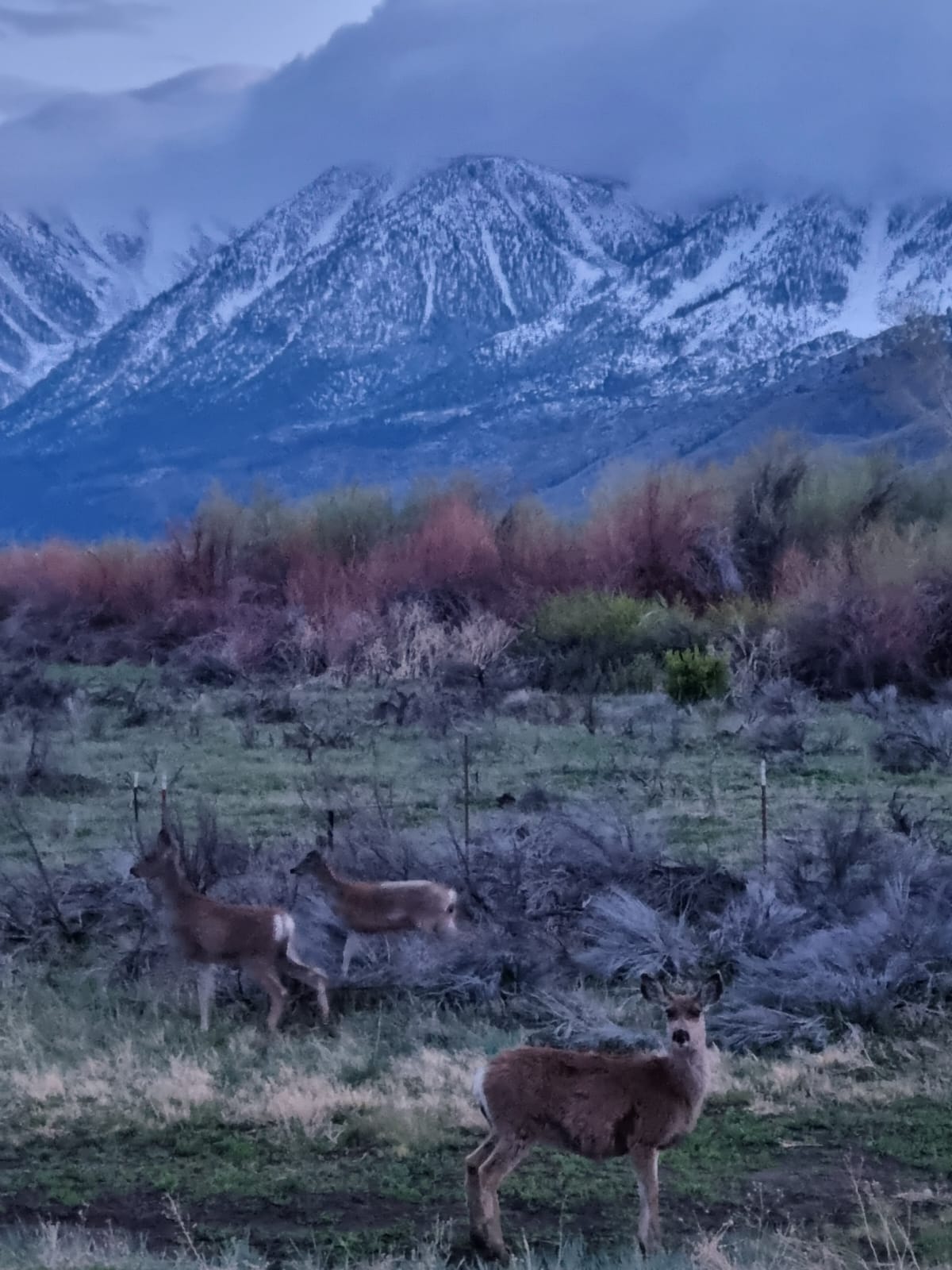
After dinner, I took them through Genoa to see the suicidal deer, which love to wander the streets and pay no mind to cars. We saw only 4 or 5 in town. We hit the jackpot on the main road out of Genoa. These are the sane deer. They live out of town. We saw 27 deer that evening! Too soon they had to leave on the next leg of their vacation. But they got a taste of Nevada, some weird spring weather and now know why I love being here. AND I got to spend some very special time with three much loved people. I’m so glad we had this opportunity to be together and that they made the trip to Minden
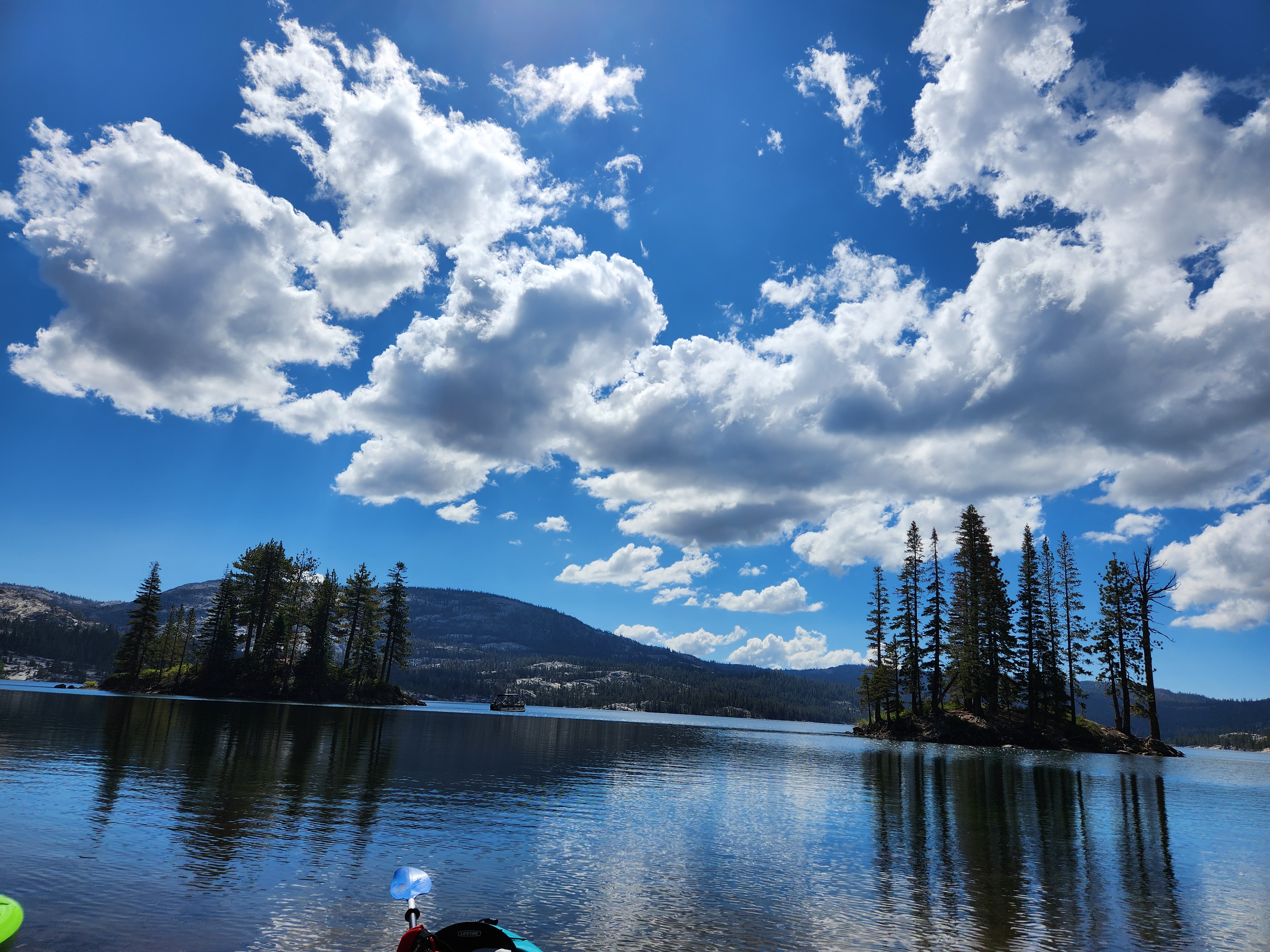
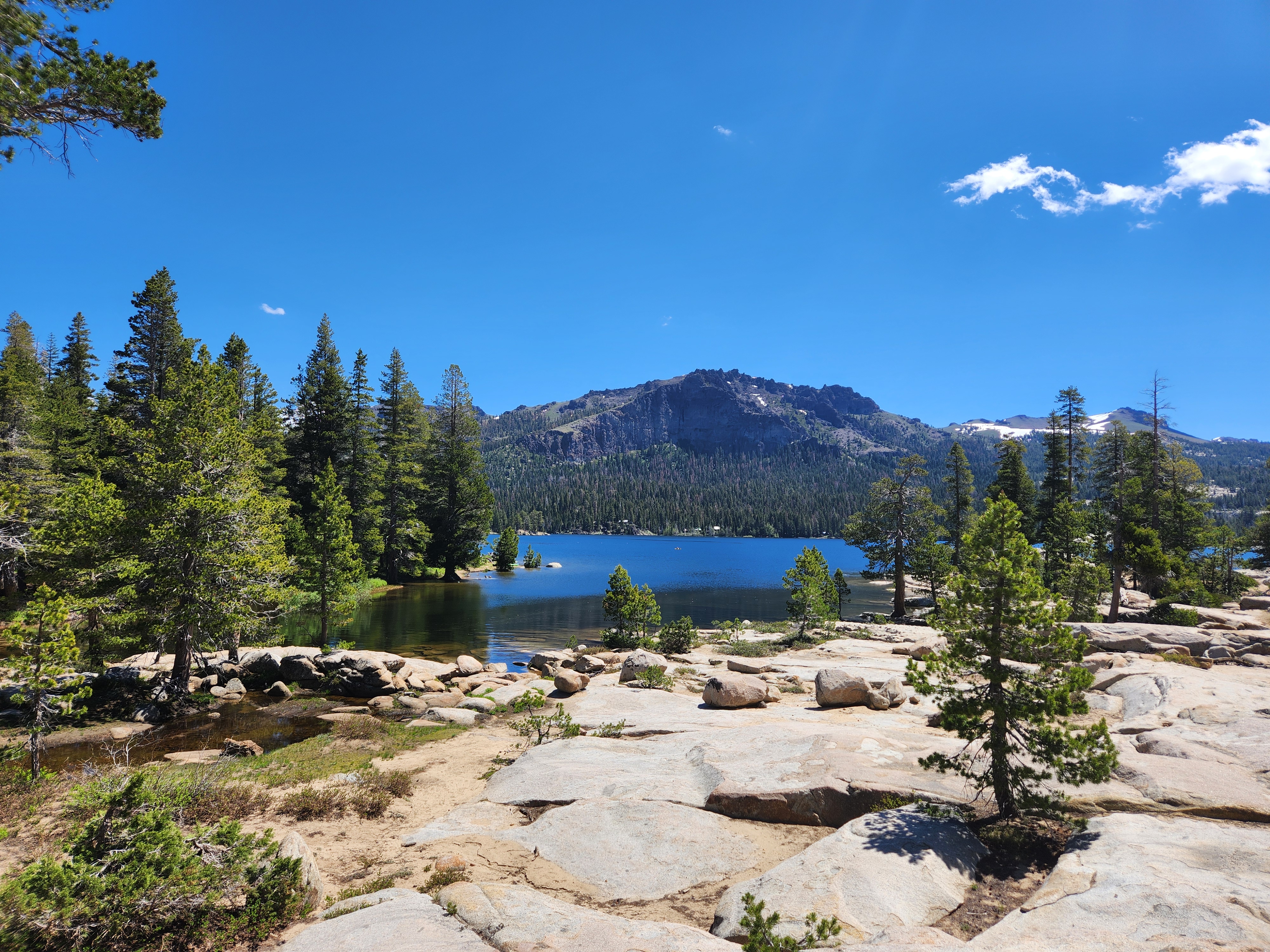
Yesterday was a totally fantastic day! Yay! We arrived at Silver Lake to find the sun shining, glassy water and …a lake that was much different than when we last saw it.
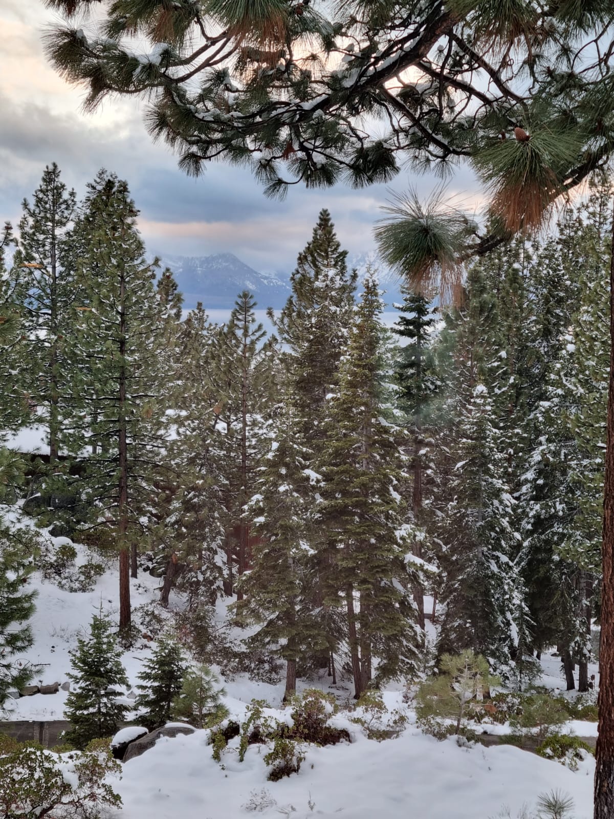
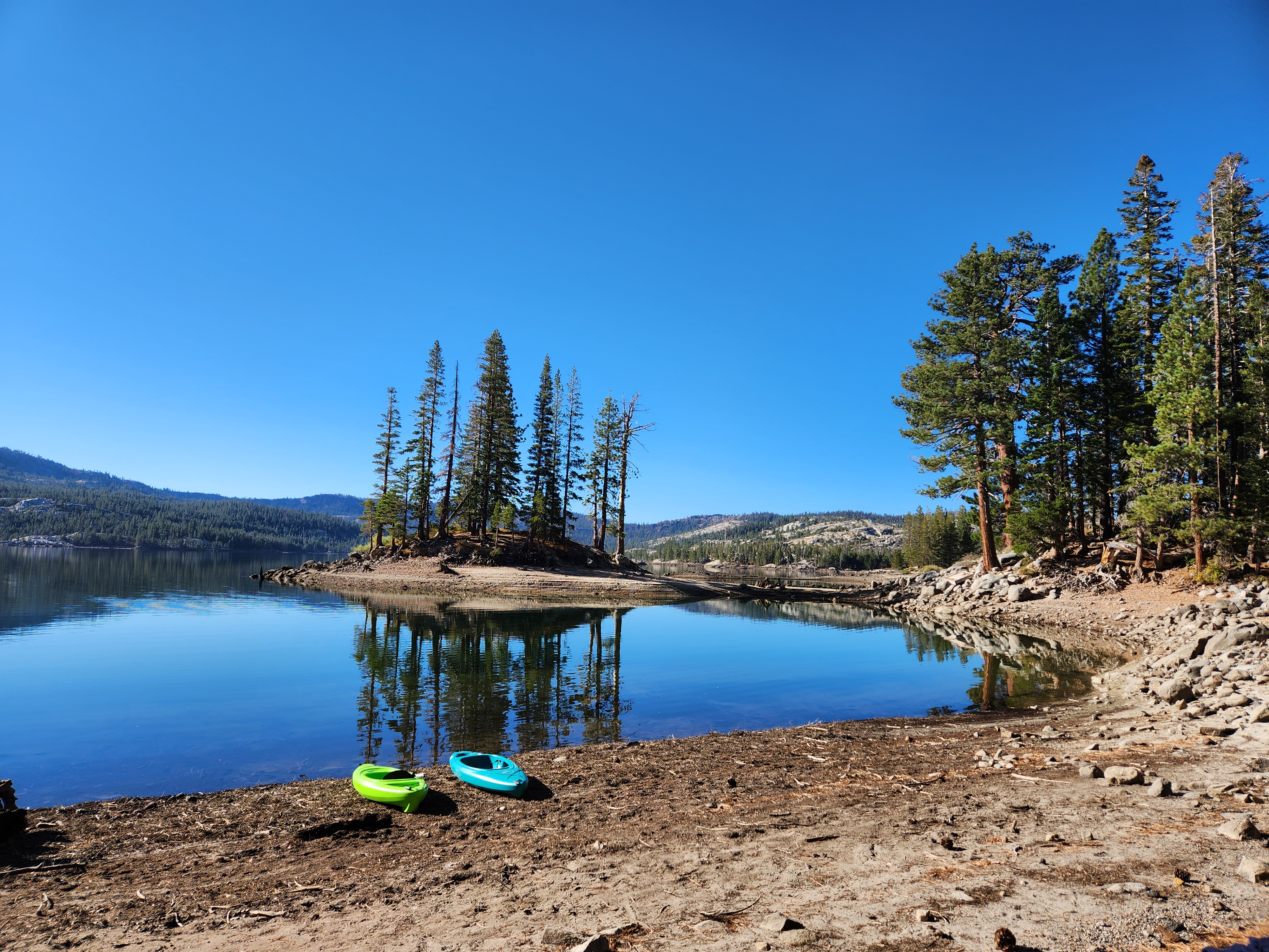
This is “our” lagoon where we sit and watch lake life go by. Note that it’s full and the two small islands are real islands. I believe this was in July and the first time we had a beach to sit on.Yesterday’s lagoon. A LOT of beach and the two islands have land bridges to them. ‘Twas amazing! We could see tiny critters running back and forth on the land bridge. I imagine they were looking for food to store up for the long winter.
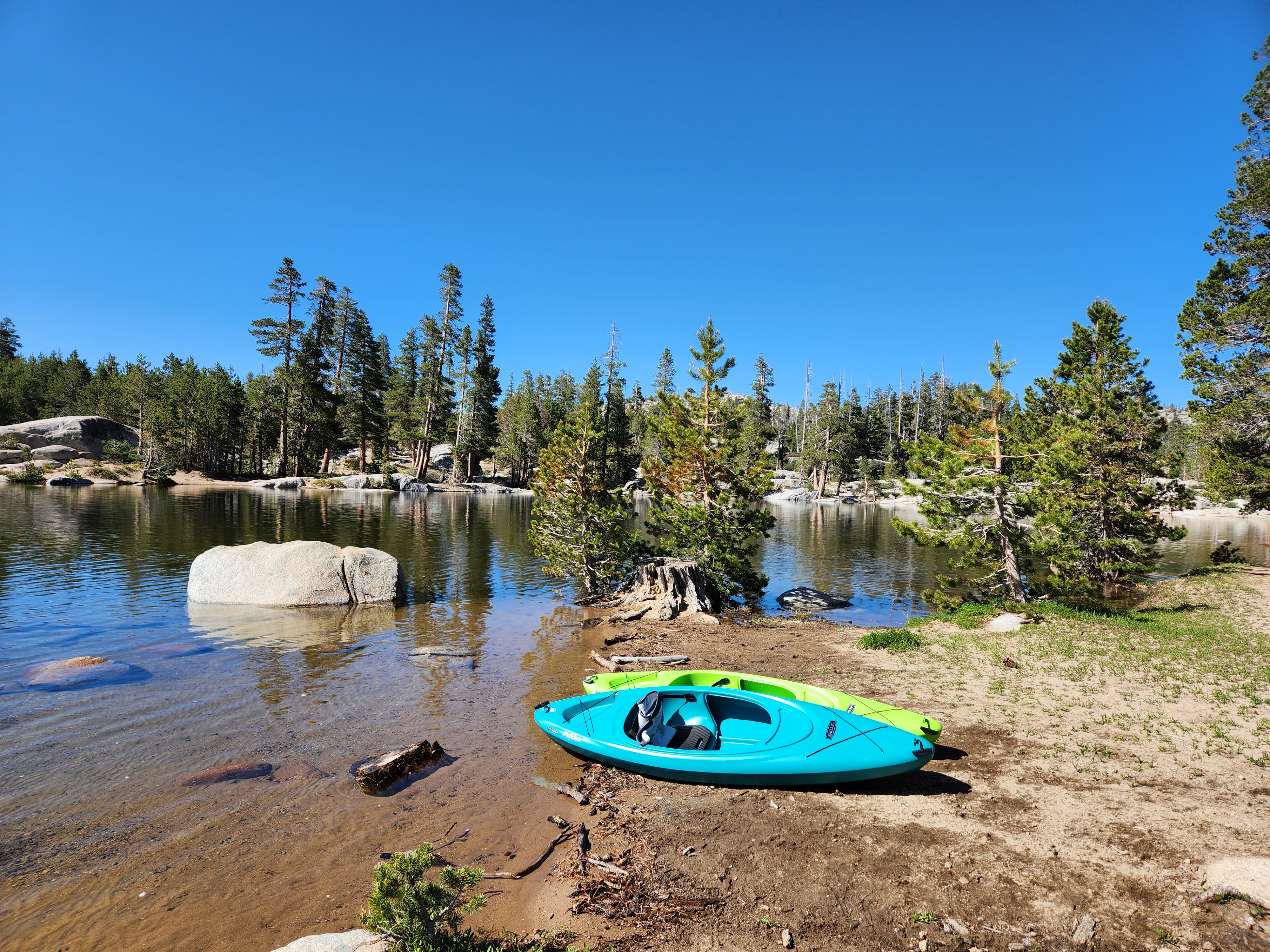
Well, Jerri and I set up our beach chairs, put on our life jackets (now called personal flotation devices or PFDs) and zoomed out in the lake to relish what will probably be our last time kayaking for this year. The air was nice and warm, but we could tell it wouldn’t be long before there are freezing temperatures.
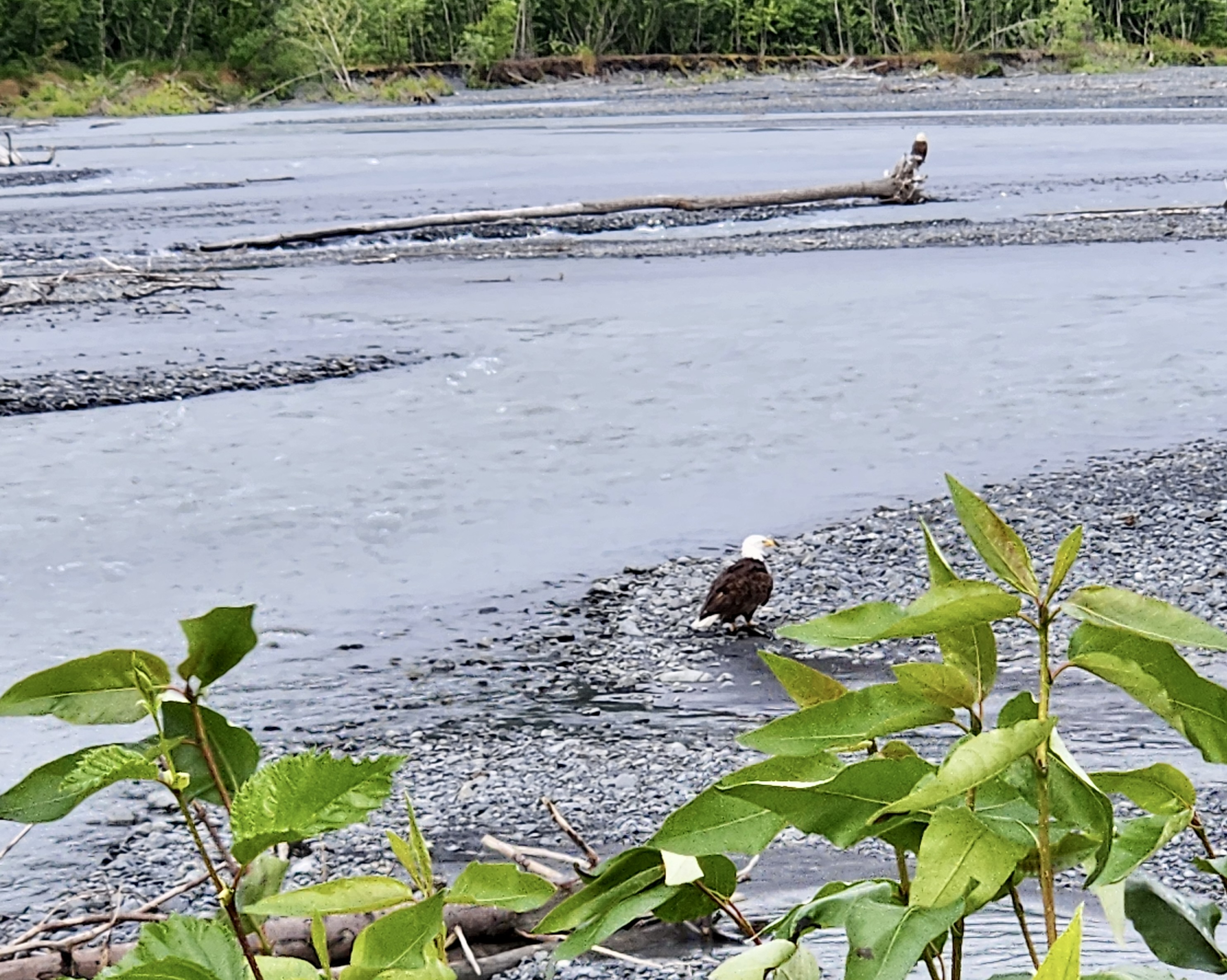
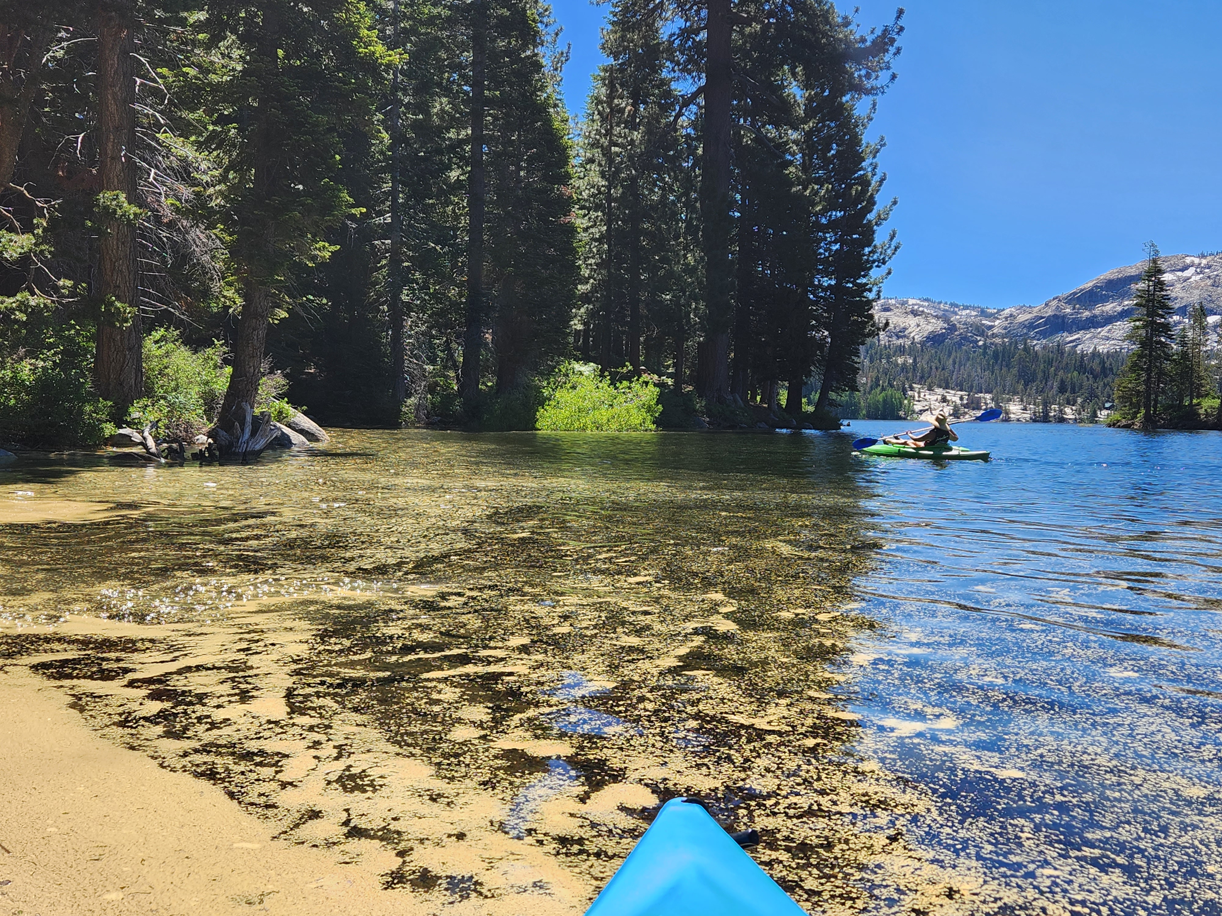
As we were paddling, Jerri noticed two bald eagles that seemed to be harassing a small flock of ducks. The eagles would dive bomb the ducks (mergansers?) and then the ducks would flap their wings and sort of “run” on the water. We don’t know if they had fish the eagles wanted or whatever, but we watched them for maybe 10 minutes repeating their actions before the eagles flew away. Sadly, no pictures as they were too far away. The “show” was fun though.We landed on the far side of the lake where we knew there was a small pond that had been fed by melting snow. We wondered if it had dried up. We hiked up some rocks and found our little pond. Yes, it was still there but much smallerOur second favorite lagoon and one we use at the beginning of the season (because it has a beach before our favorite does). Every time we have been there this summer, there has been a tiny waterfall feeding into this spot and one can hear the trickling of water. So pretty and serene. These two photos are from June and JulyThe lagoon (as we call it) is a fun place to play in because of varying depths and the water is very warm in some of the areas.This is sort of the same view as the one directly above, but perhaps a bit closer to where the water should be. We did not expect it to be bone dry.
This is our first time seeing the lake in October due to a heat wave and it being warm enough to kayak. We surely did have a good time and made the most of our time there. Our arms are sore today from all that paddling!
Here is the explanation for the decline and why it’s done. Silver Lake is a California reservoir and this receding is an annual occurrence because the water is used by CA for drinking water. Even if California does not need the water, the lake needs to go down so that it can receive the snow melt next spring to help prevent flooding and hold the water for when it’s needed.
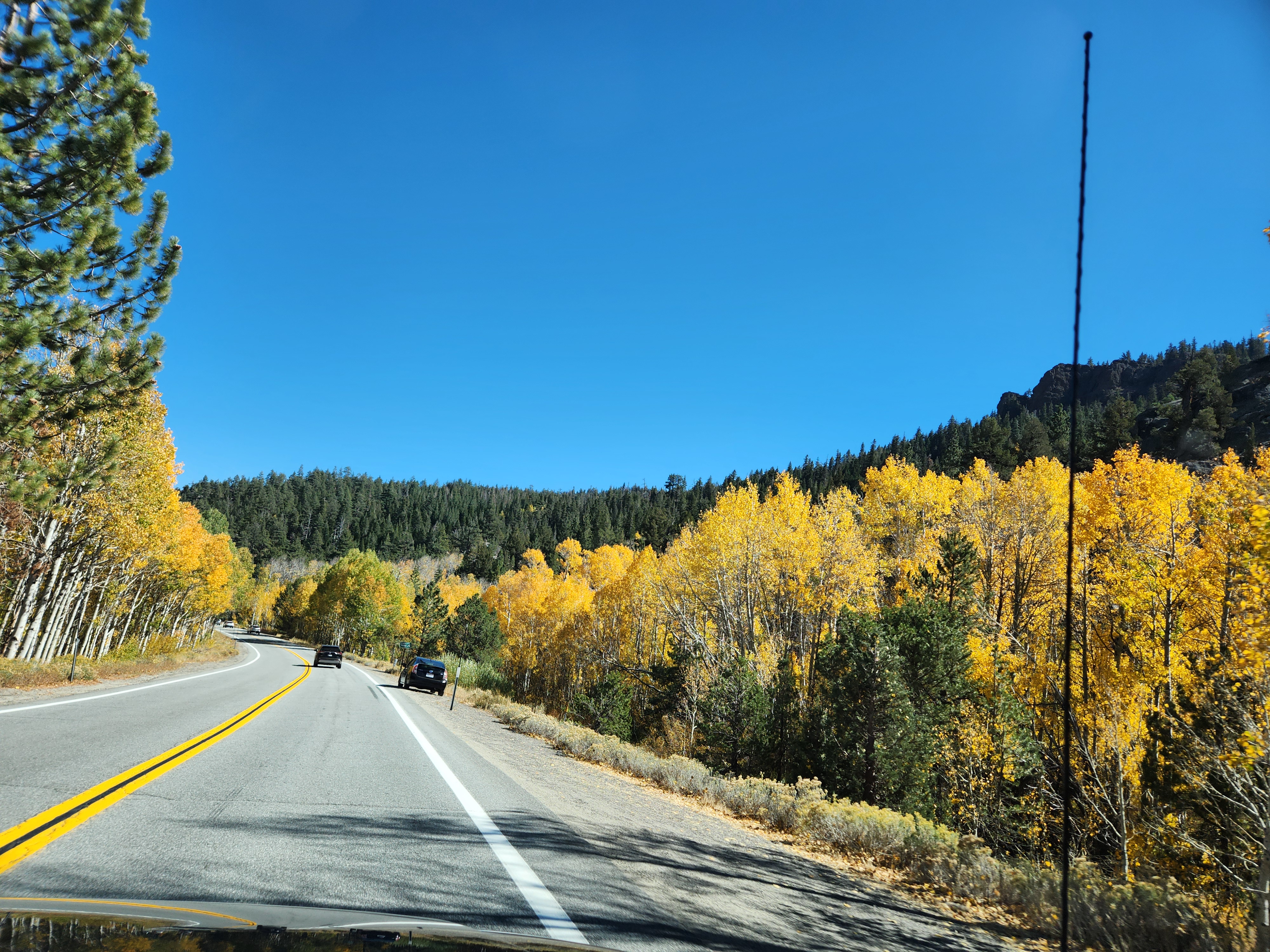
We could see that autumn is upon us during our way home. The aspens are quaking and shimmering in all their glory, making it a very pretty ride during part of the way home.
“North to Alaska” was a tune many years ago and we have always wanted to go there. Recently, the Carson City Chamber of Commerce offered a trip that was just right for us. No big ship cruise for us…we wanted to spend most of our time on land, save for a 6 hour cruise. Perfect!
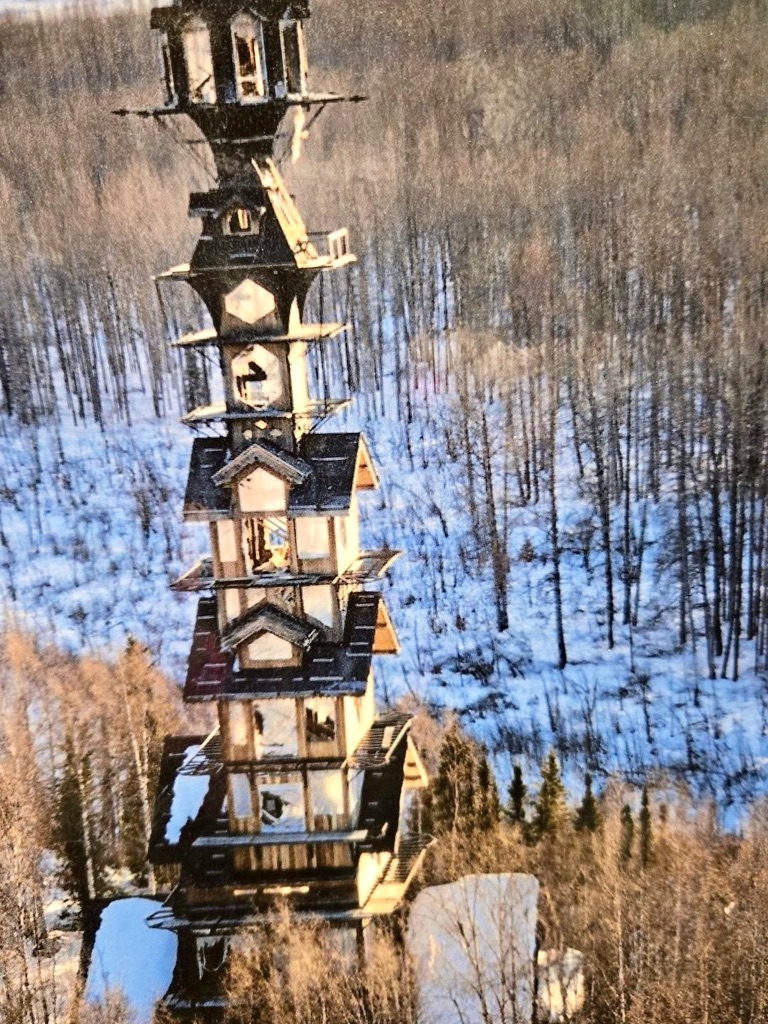
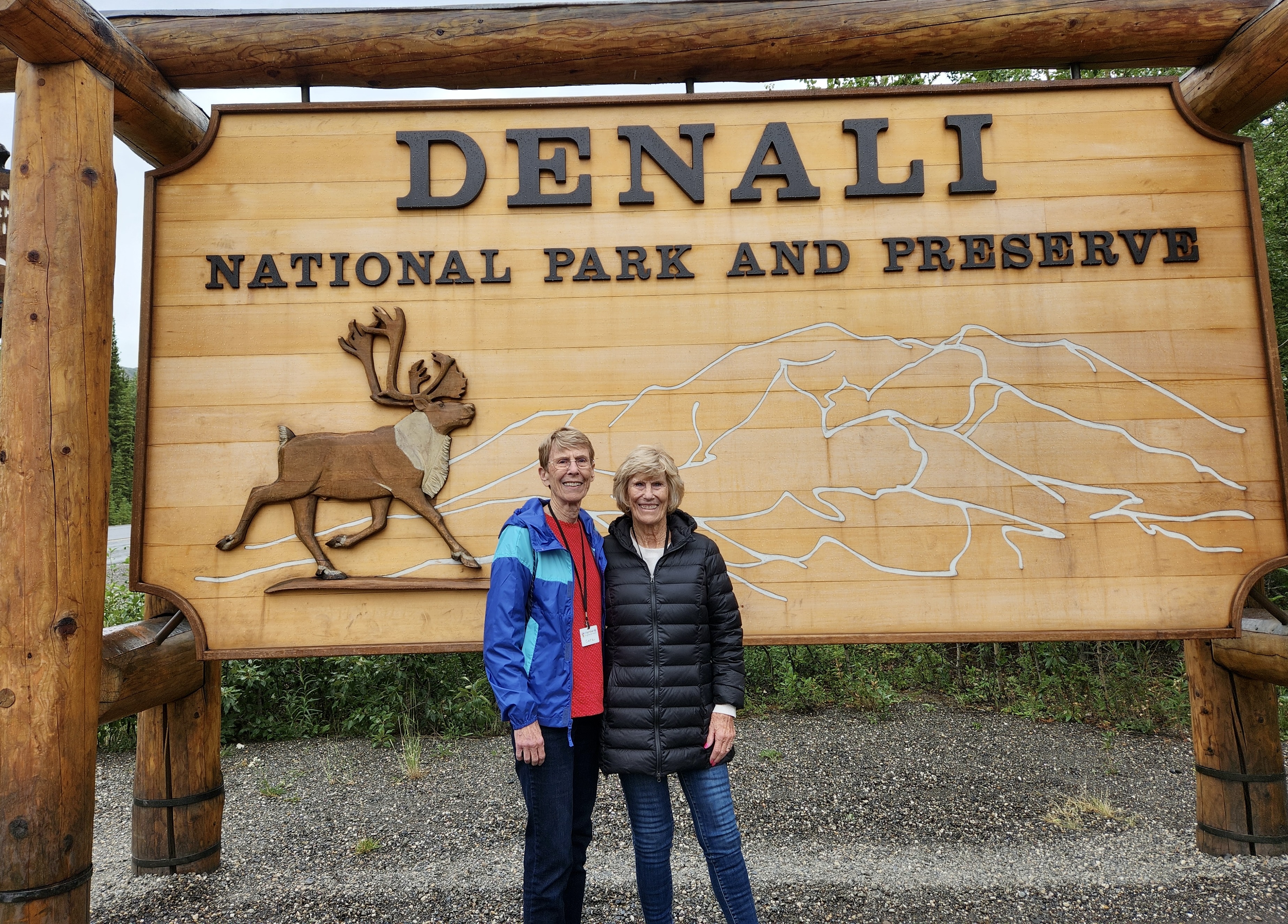
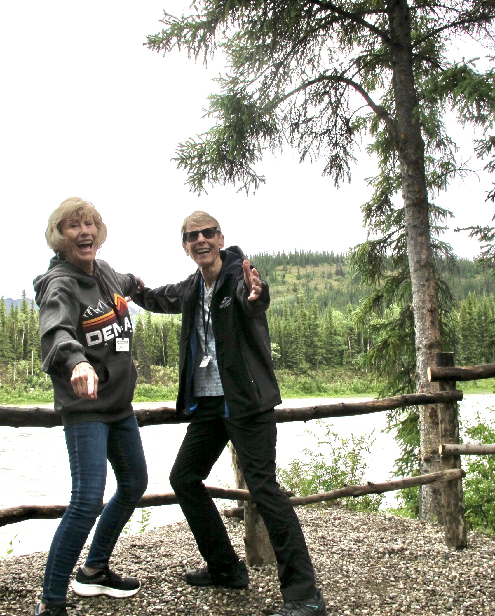
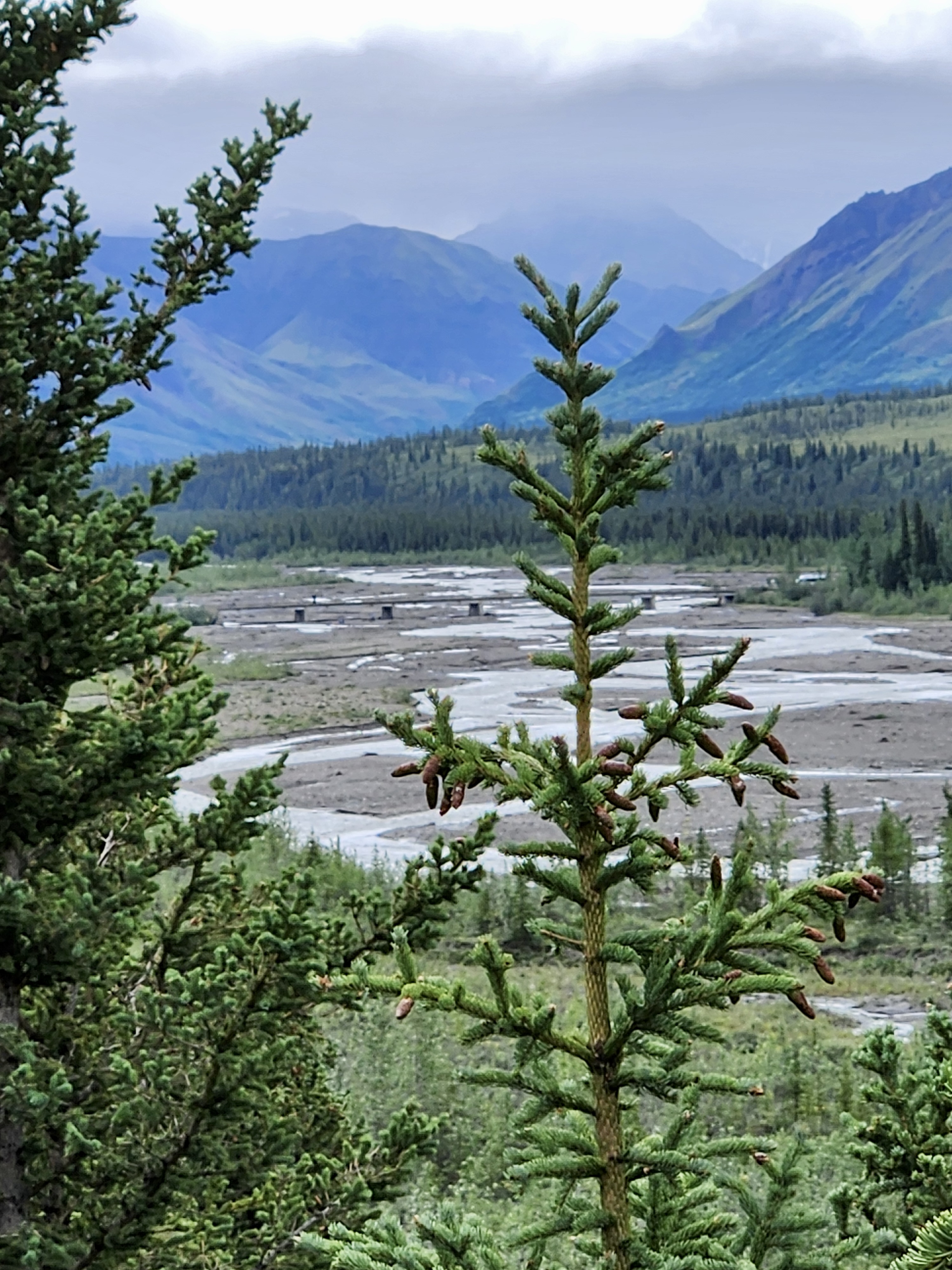
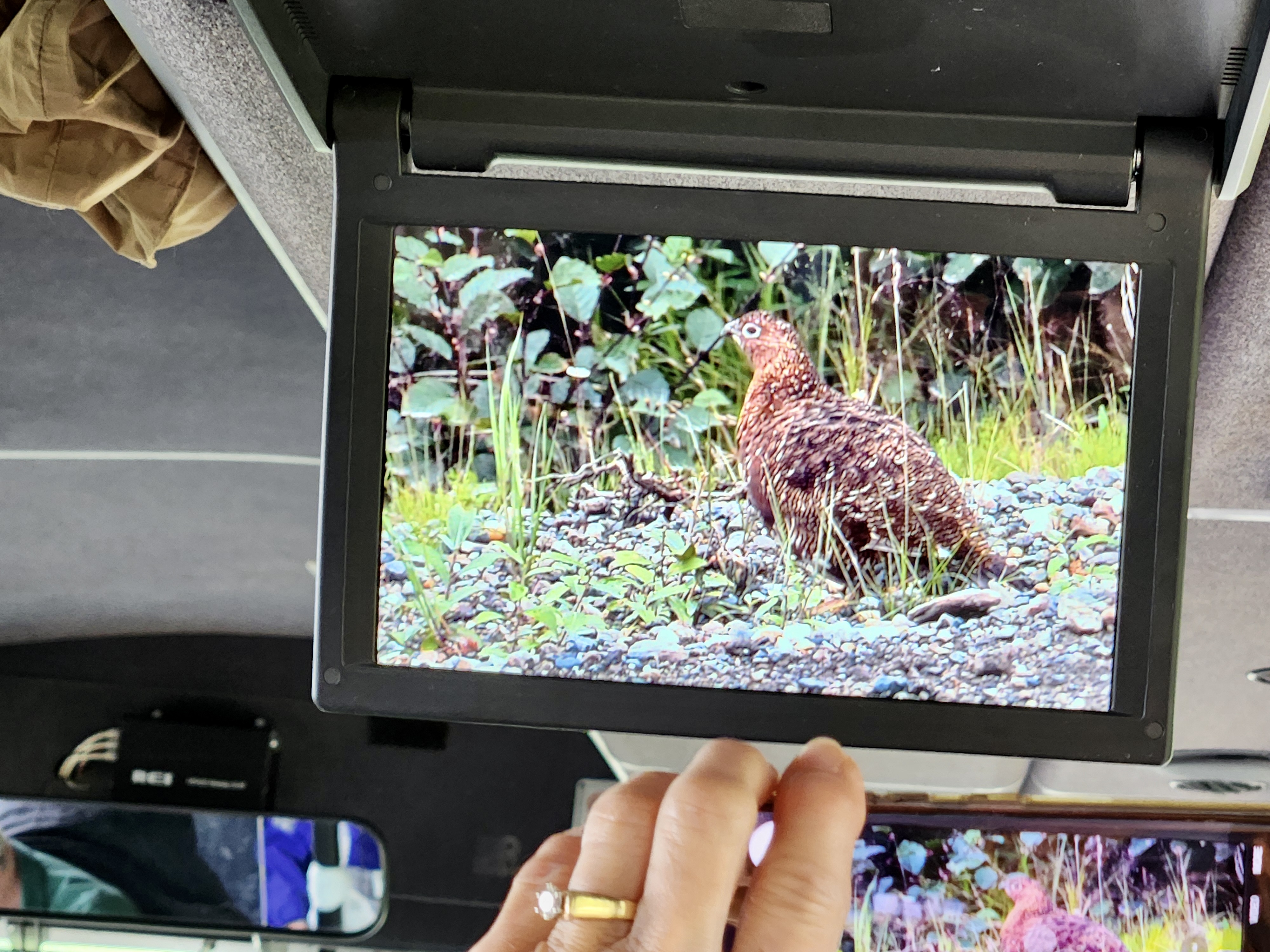
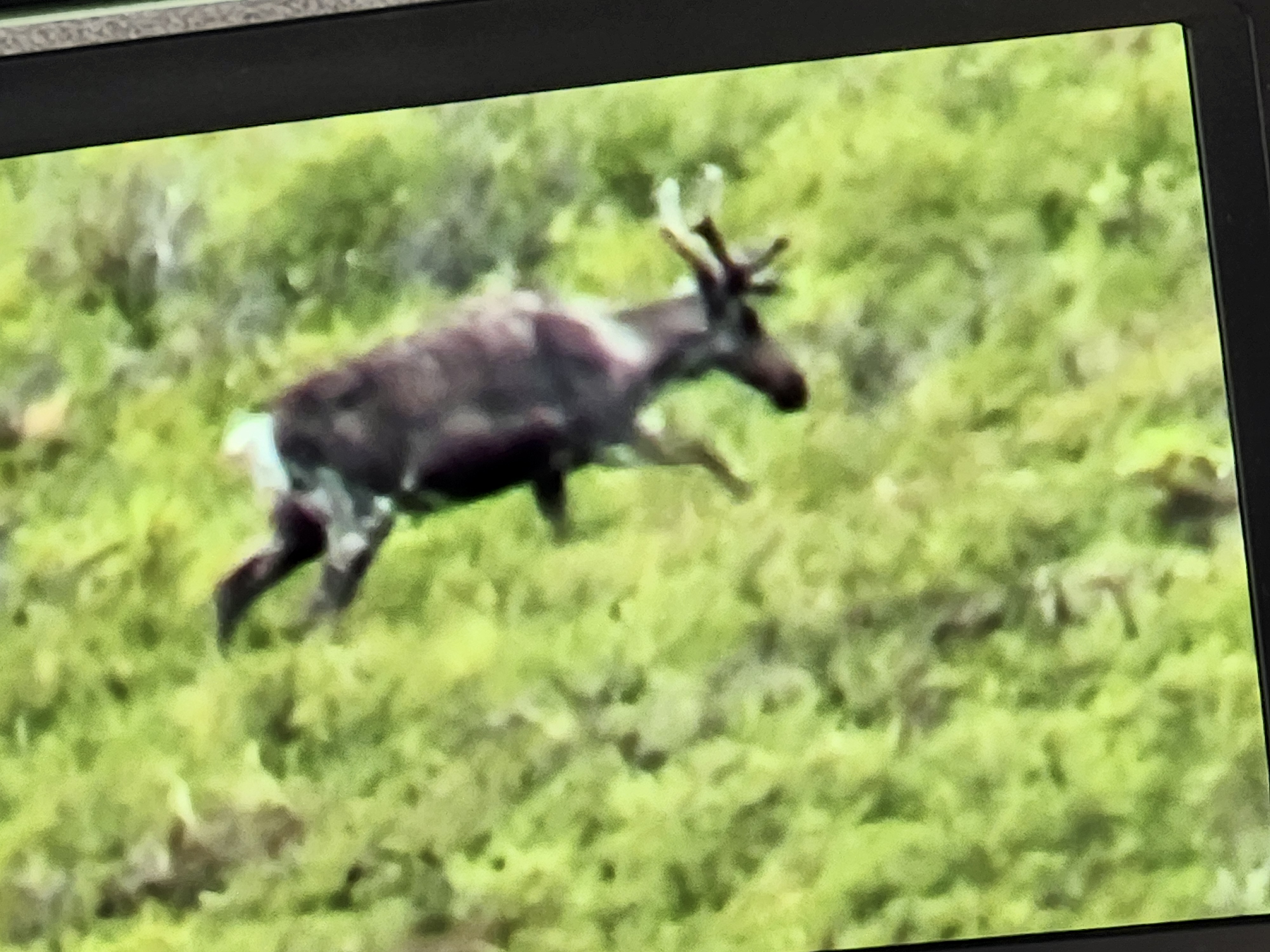
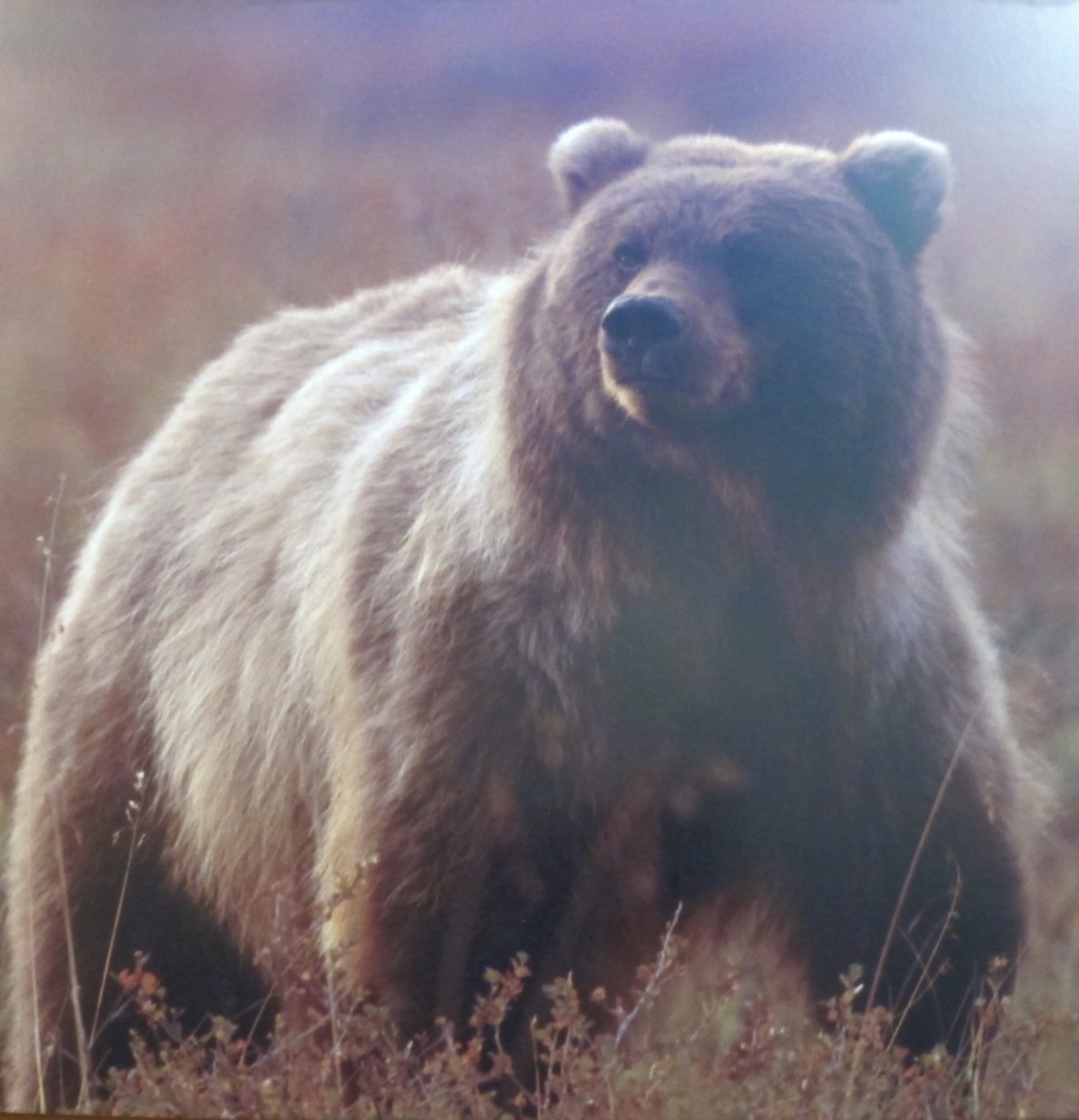
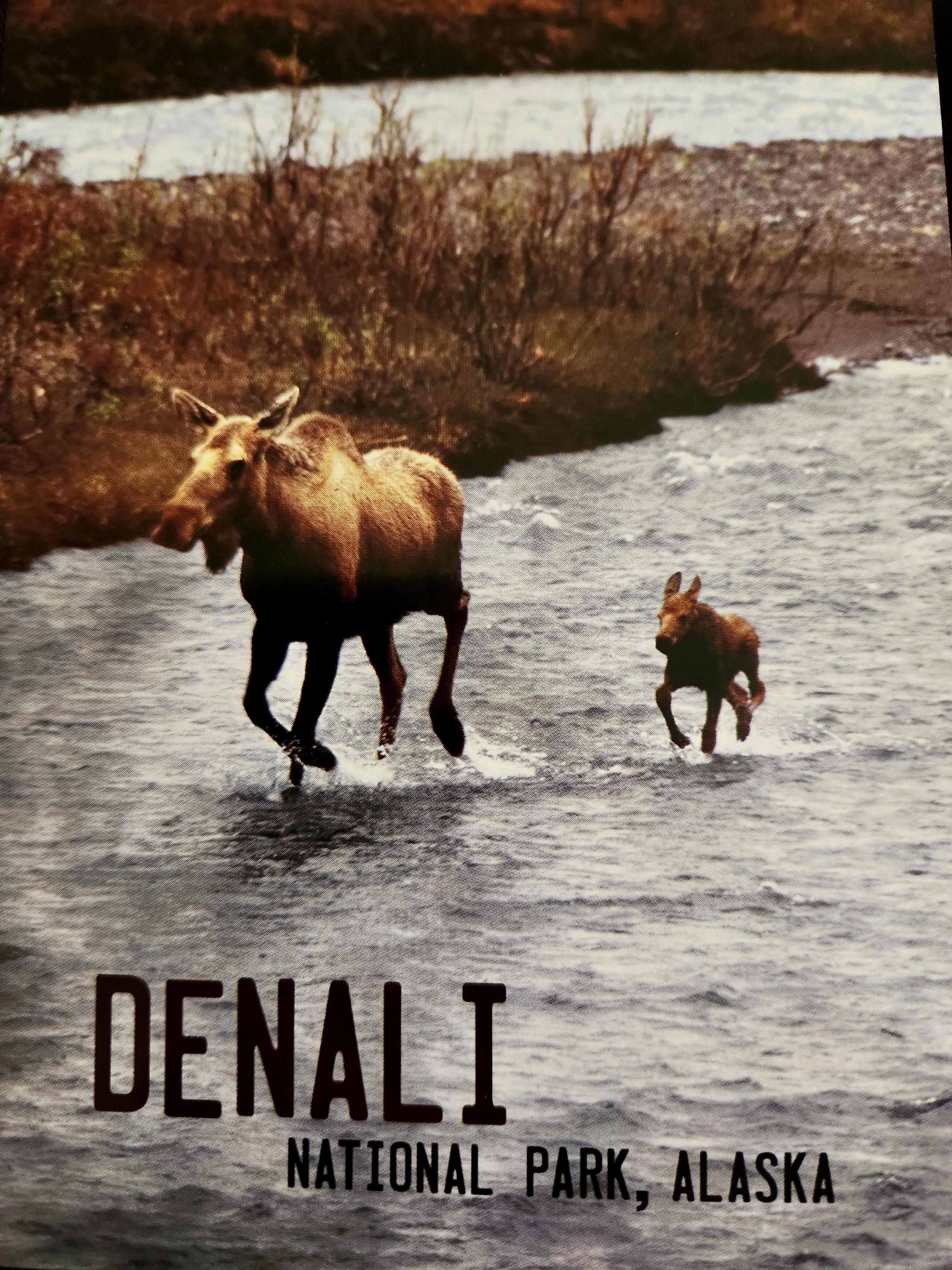
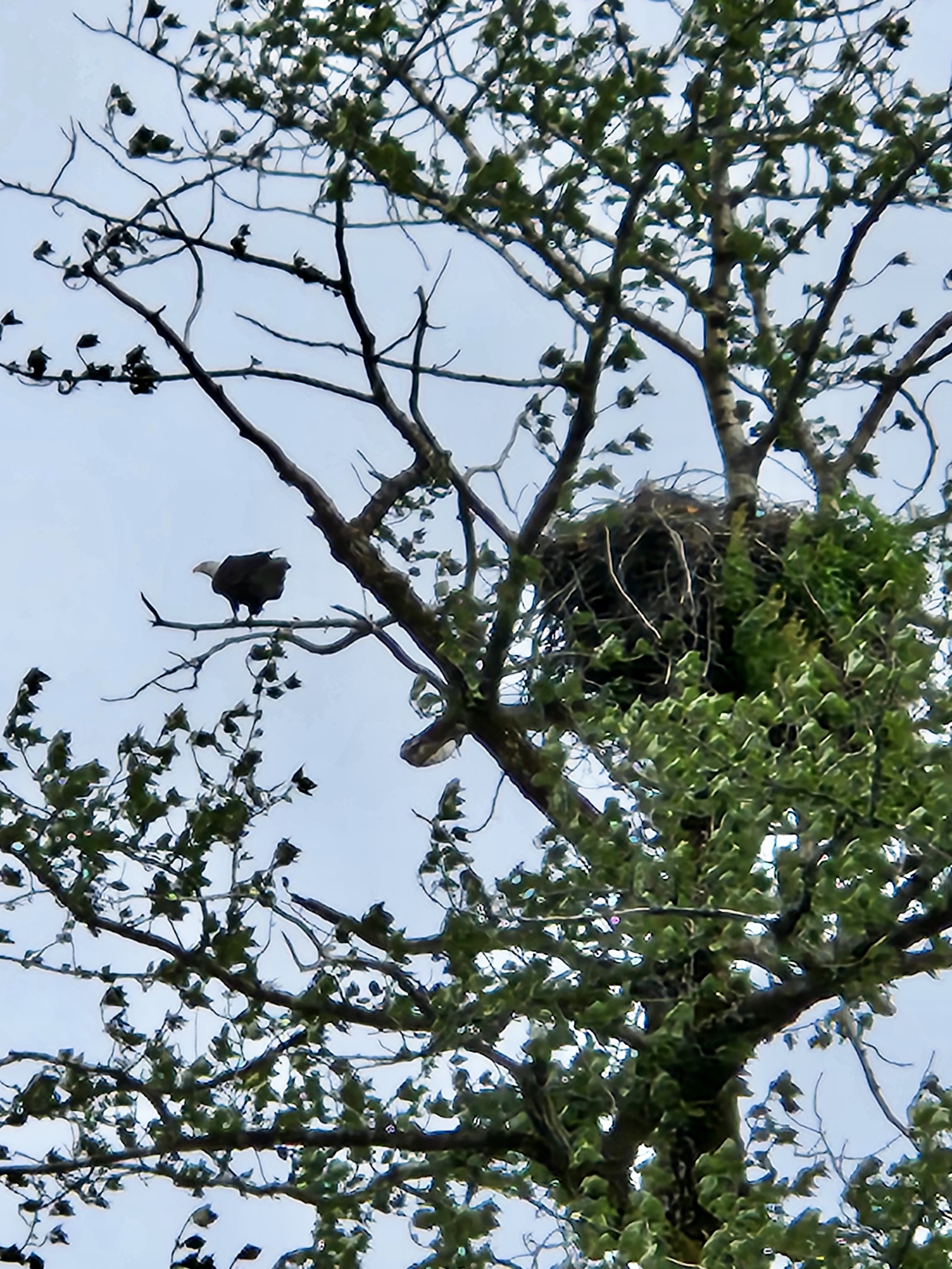
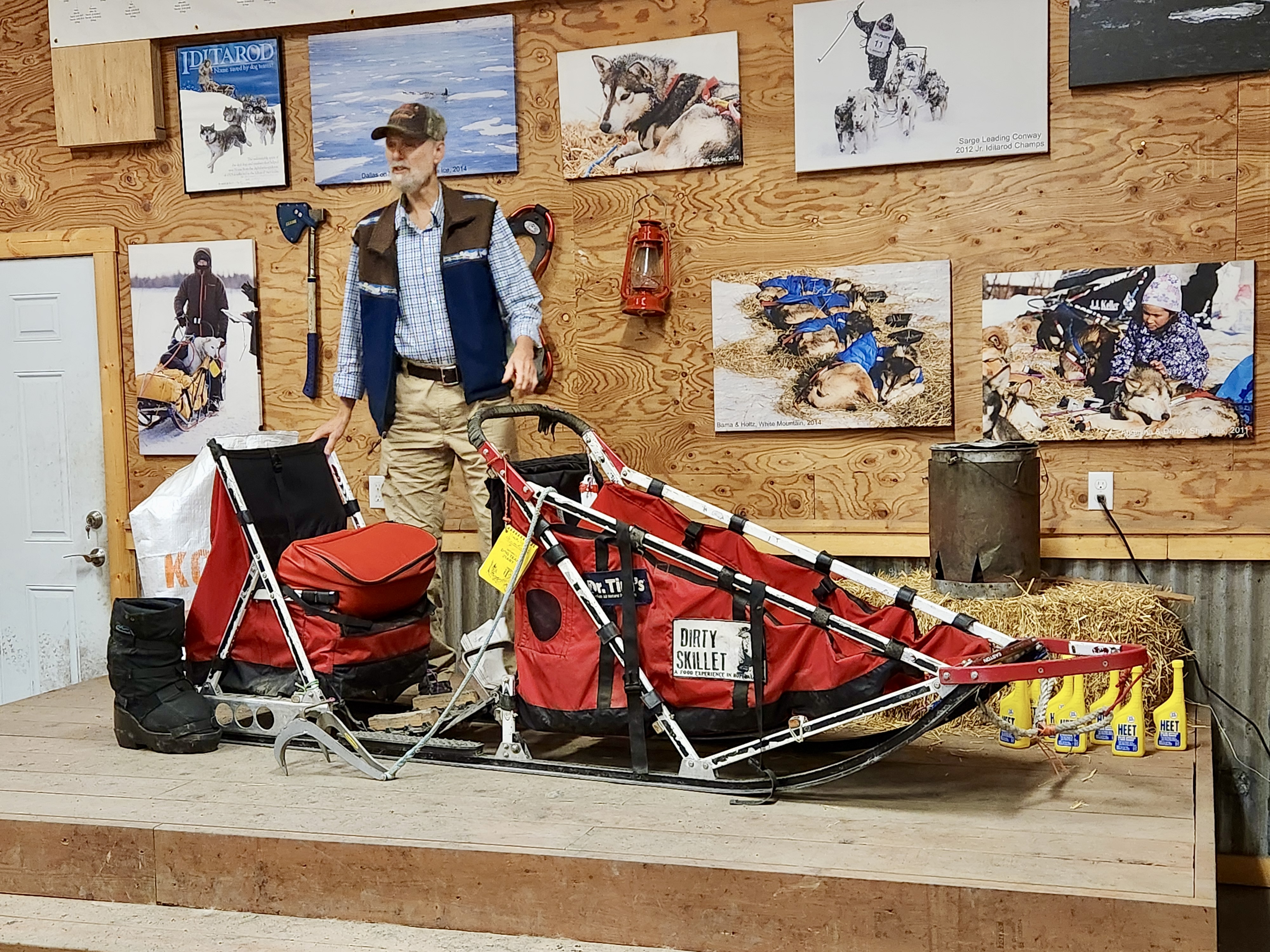
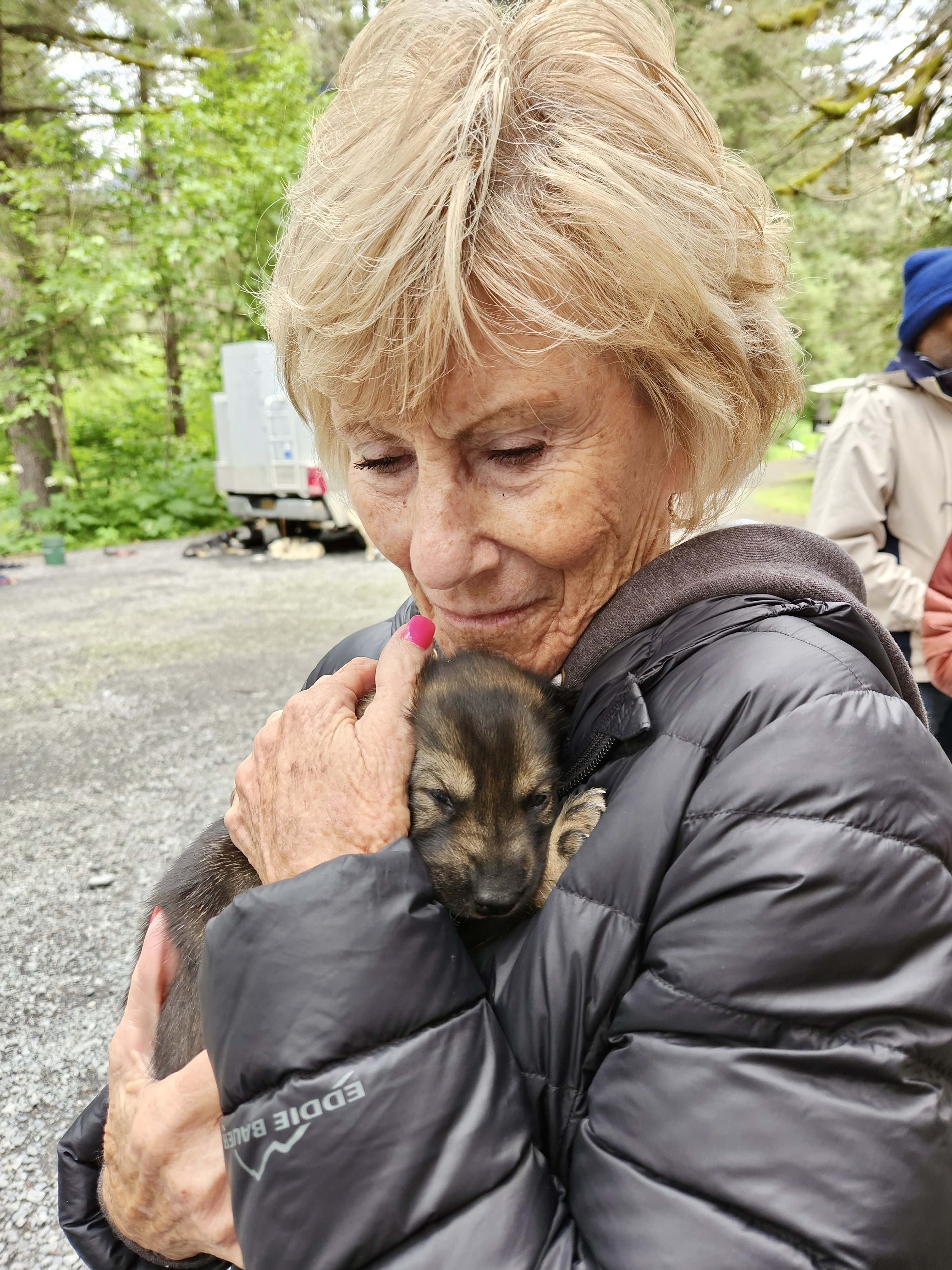
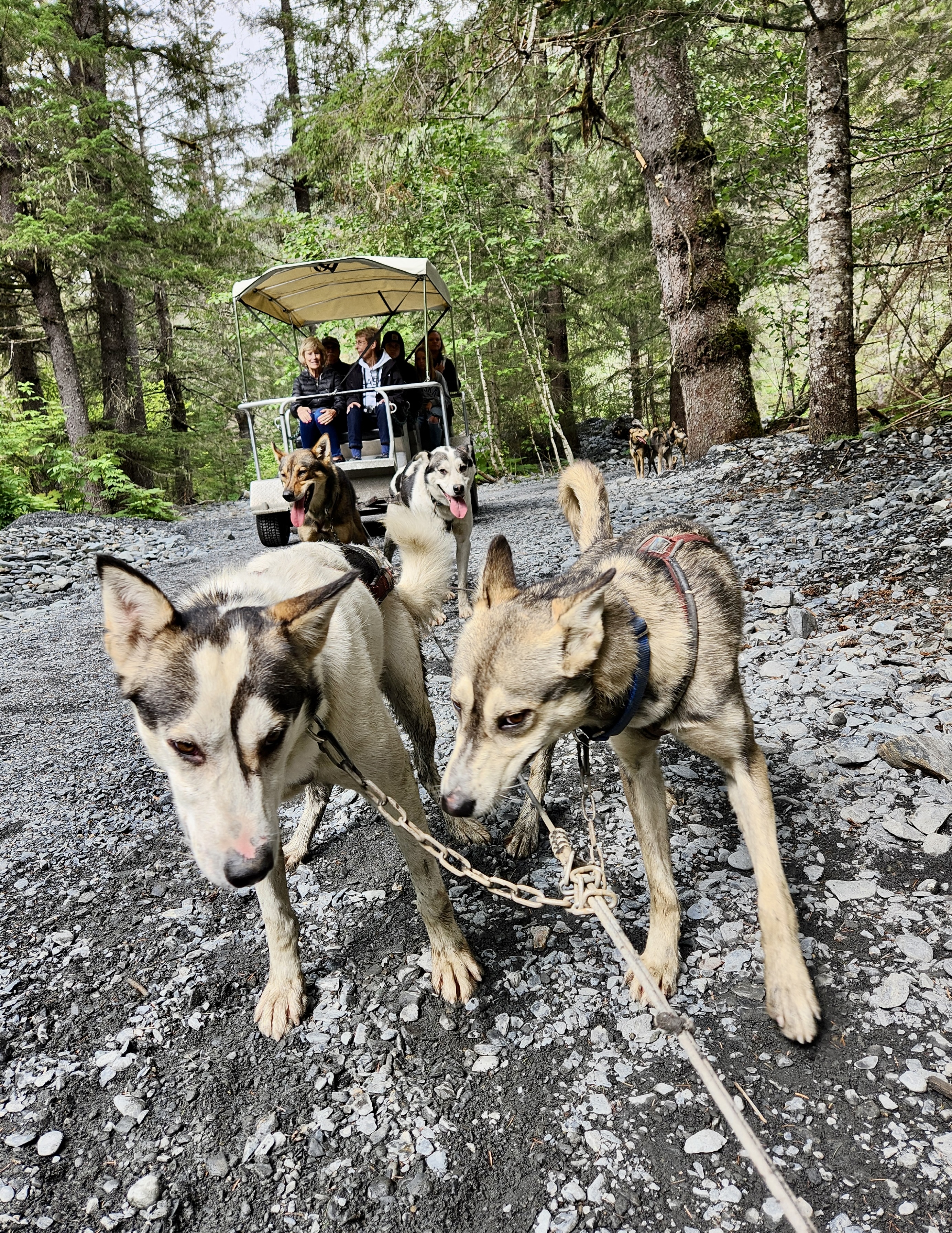
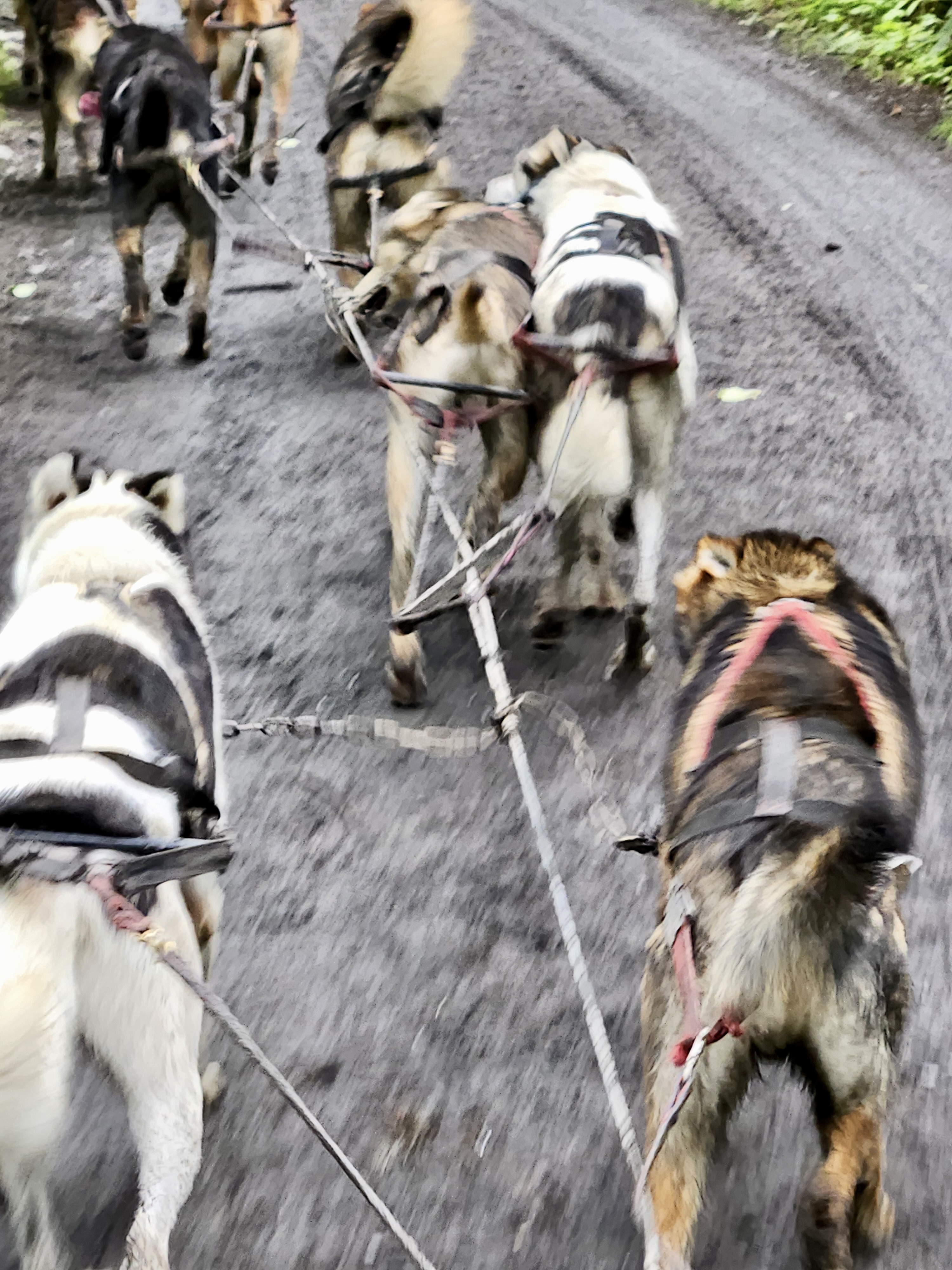
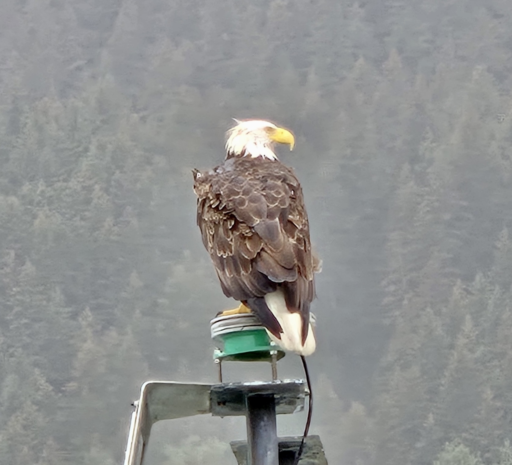
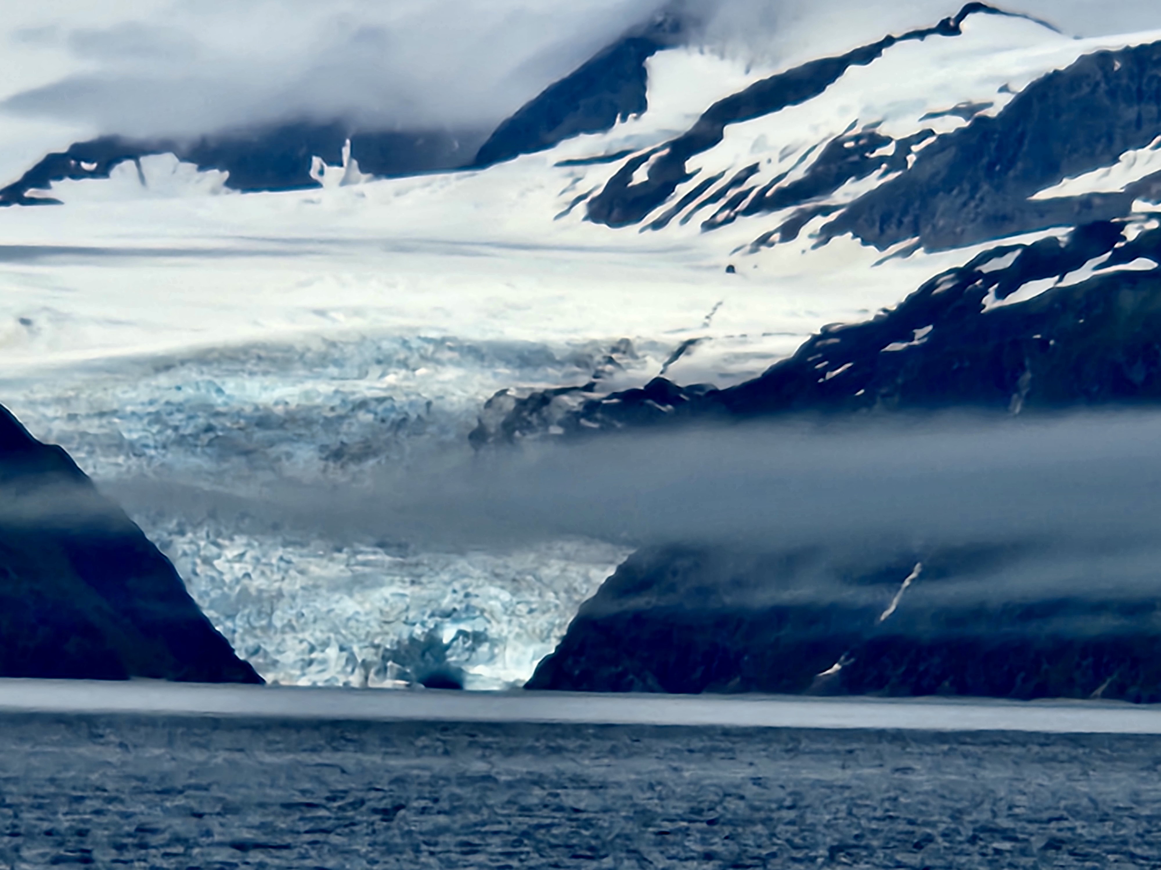
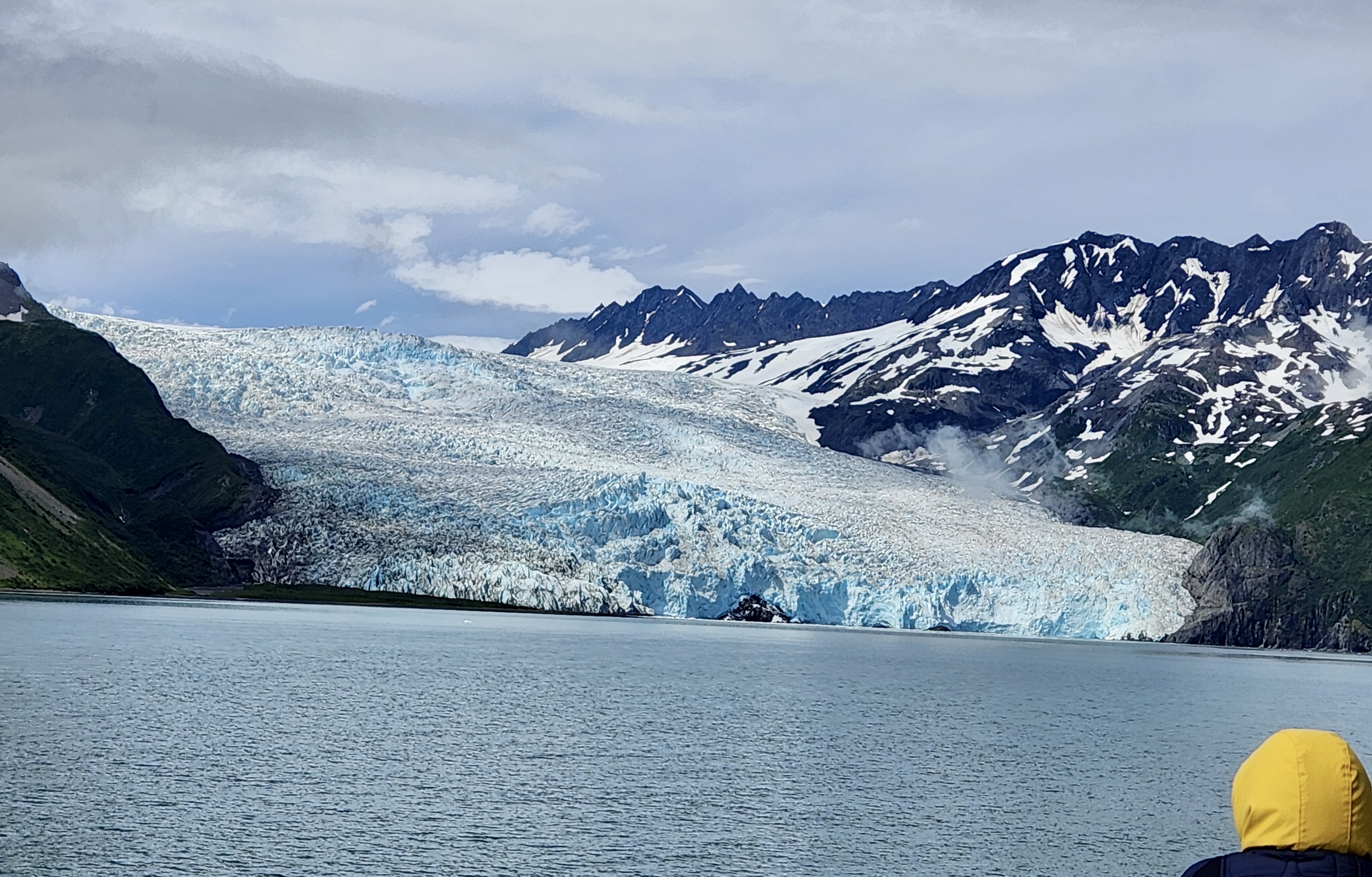
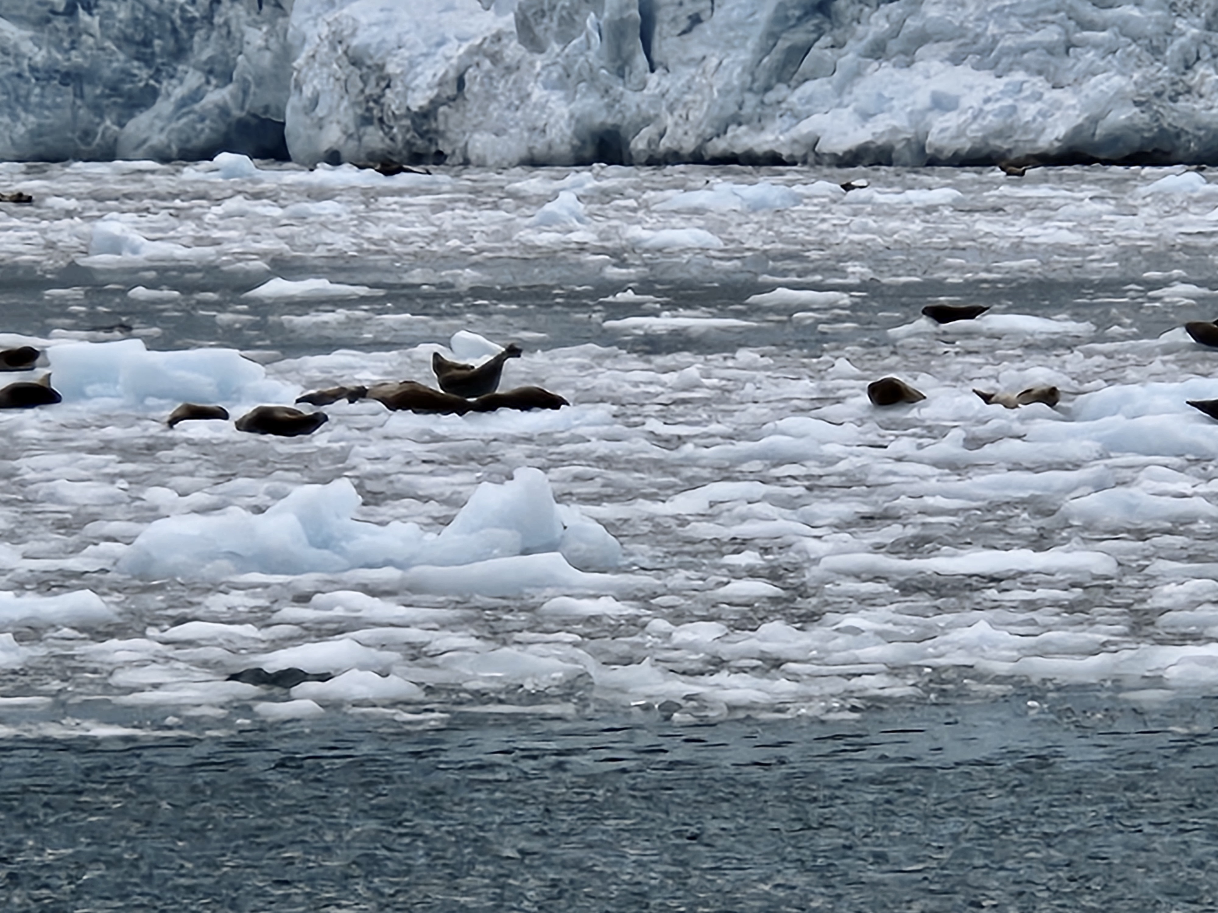
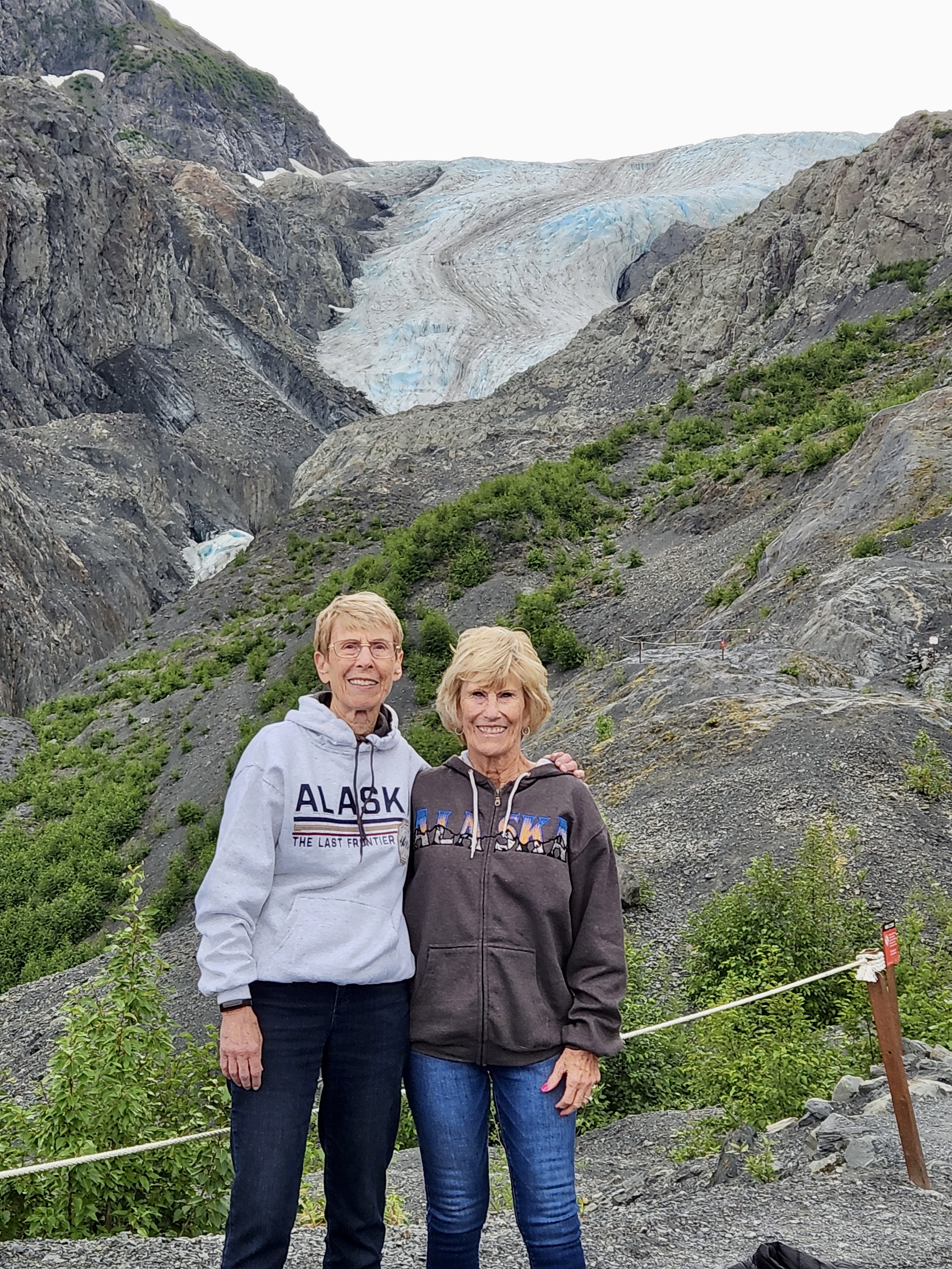
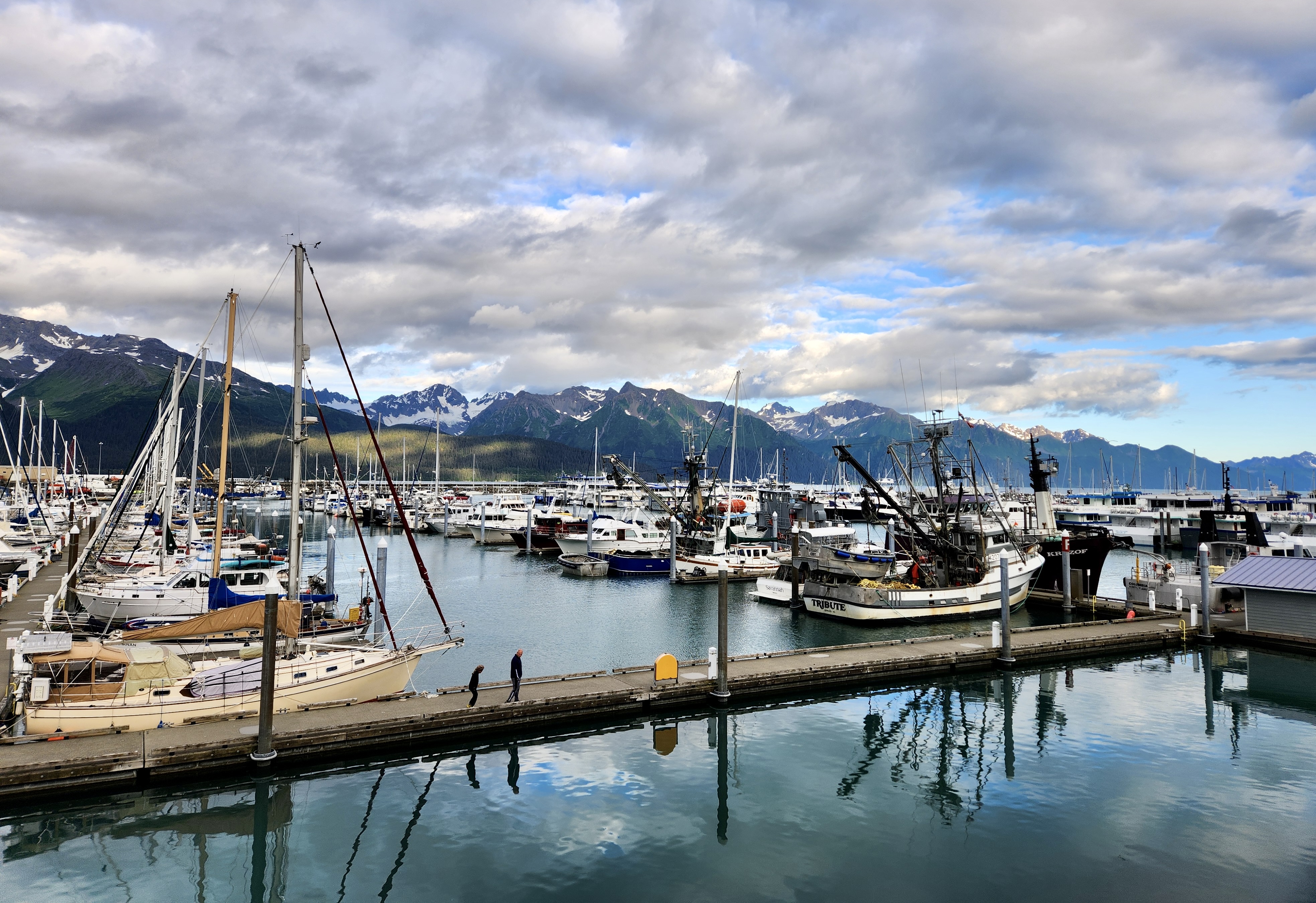
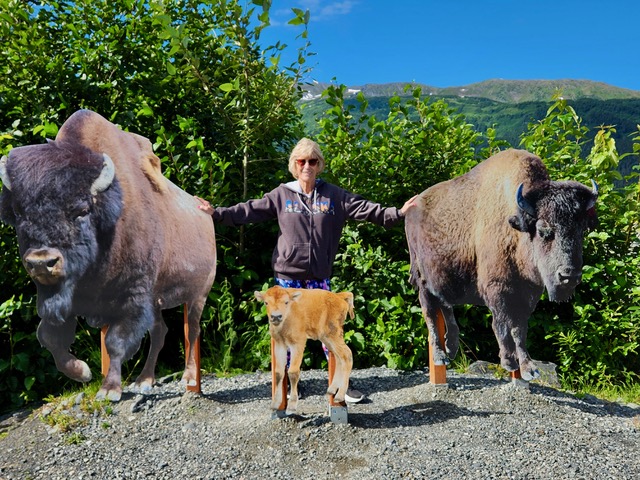
We landed in Anchorage and took the Alaska Railway train to Denali National Park. Sitting in the Dome Car and eating a good breakfast on board were a real treat. The journey was about 6 hours long with many good sights to see. We were told to watch for moose, bears and other critters. Jerri and I saw only 2 tundra swans. We are on Hurricane Bridge that is 918′ long and 296′ above Hurricane Gulch that feeds into the Chulitna River. The Gulch is named for the speedy winds that roar through the area. As you can see, it’s rainingThe Goose Creek House, aka, The Dr. Seuss House. Still unfinished, the owner wanted a house from which he could have an observation deck that had to be above the trees. It’s now 185′ tall and unoccupied. It takes all kinds, eh? (copied from another photo)Finally here in Denali National Park. This is a huge place – established in 1917, 9,492 sq. miles (a bit larger than New Hampshire). We weren’t in an area to see Denali until a day later and then it was covered with clouds. Ironically, we did get to see it from the Anchorage airport the day we left.Fooling around by the Nenana River, right in back of our hotel room complex. Along the line, folks began to recognize us as sisters. So, “The Sisters” became our moniker for the trip.We took a park bus 43 miles into the park in search of critters, fauna and other wonders. I believe this is the Teklanika River, a braided river due to meandering caused by silt and debris from glaciers.Our first critter, a ptarmigan, sort of like a grouse. The bus was equipped with a camera that zoomed in on the animal we were all trying to see. It was a good thing because then all of us got a chance to see something when standing bodies were blocking us. Shortly after that, we saw a fox kits playing in bushes, but they never slowed down to pose. Sometimes the bus camera wasn’t available and I took a photo. But this is a caribou afar.We did see grizzly bears as well as Dall sheep, but even the bus camera couldn’t get a good photo of them when they were high on a mountain and all we could see were moving brown or white spots.We never saw a live moose, but I really liked this post card. We were told they were all around us, but I don’t think anyone saw one except when we toured a wildlife center. Even then, Jerri and I missed them. That’s the bummer about being on a tour. One has to leave when the leader says so. 🙂Jerri and I with cloudy Denali in the background.This really amused us. Someone paid $300 for 2 signs telling the tour buses to stop for 10 minutes because this area is a Dall sheep crossing. Apparently they do cross the road on occasion but they were in the high country when we were there.Dall sheep from a photo in the hotel lobby. Wish we had have seen one up close and personal.Fireweed lines many road, dirt or paved. It appears after fires and then keeps reseeding that makes the roadsides very pretty. Honey and jam are made from this plant.Turnagain Turnout. This background almost looks fake, doesn’t it? It really did look like that and we found out later that Dall sheep were on the mountain behind us.It’s amazing that after all the snow and really cold weather, these beautiful ferns pop up as if they never had any cold trauma.Alaskan bears are BIG!A bald eagle near its nestThe eagle getting ready to fly to the above nest with a fish. Its mate is in the distance.We visited a dog sled camp and observed a demonstration of an Iditarod sled and all the gear. The family that owns this camp has won the Iditarod several times, which is a huge accomplishment. “Iditarod” means “distant or distant place” from the Athabascan people of interior Alaska. Jerri with a 3 week old future dog sled champion. Being held is part of the pups socialization process and we get to enjoy their little puppy noises and warmth.Dogs taking folks for their mile and a half ride. They love to do this and are very eager to run.What are ya doin’ Bro??? The dogs stop a couple of times on the trail for photos…and, generally, they do what male dogs love to do. This summer camp was all male because the girls tend to distract the boys while training.Godwin, on the right, is only 11 months old and learning the ropes, so to speak. His partner, Rotini, is trying to teach Godwin personal space and nipped at him a couple of times. Notice that these dogs aren’t the traditional huskies. They are bred for endurance and strength and are basically mutts.Godwin didn’t get the message and joined Rotini on the last leg of the journey. Rotini was not amused.Emma, our Alaska Gulf and Kenai Fjords National Park cruise captain, took us on a marvelous 6 hour cruise. Man! They come young these days!Jerri took this photo in the rain near Seward at the beginning of our cruise.Those black bumps you see out there are humpback whales doing a “bubble feed.” They dive down as a team, swim around a bit, exhale bubbles that force the fish up to the surface where they will eat them. The white things you see are gulls taking advantage of the fish coming to the surface. The captain told us where they were coming up because the birds sense the bubbles and flock over to the right area. An amazing experience! I think we must have spent at least half an hour watching this happen. I finally put my phone down and just watched the spectacle. Jerri’s photo as I never got a good one.Resting Steller seals. Jerri’s photo. We also saw many puffins and gulls, but they were too small for good photos.Holgate Glacier. Part of this glacier is a mile thick. Aialik Glacier, more approachable than Holgate was, but still a mile wide.Harbor seals on the ice that has caved off of Aialik Glacier. We did get to see and hear some calving. The noise was deafening and sometimes scary because it echoed off the glacier walls. What we saw was relatively small compared to what you see in spectacular videos of glacier calvingYou can see it was cold (at least for us wimpy warm climate folks)Exit Glacier, near Seward, AK. It is so called because Seward has been in the path of several tsunamis (one of which virtually destroyed the town in 1964). The planned evacuation path at one point was this glacier. I was quite proud of us because we had to hike uphill a bit over a mile to the best viewpoint and we zipped up there ahead of the pack and not out of breath.Exit Glacier is receding as this chart shows. The white blob to the far left is where the glacier was in 1815. It has since retreated to farther back than the 2007 line shows.Jerri with Resurrection River from the glacier in back of her.Seward Port on our last night in Alaska. We really enjoyed being there. Harbor seals, sea otters and many birds abounded here.A black bear at the Alaska Wildlife Conservation Center. This was our last tour before going back to Anchorage.Don’t pet the fluffy cows! Bison are native to Alaska and naturalists are “growing” a herd to reinstate them to their historically natural Alaskan areas.Musk Ox occur in some regions of AlaskaAngie, our intrepid tour director and Kjersten, our super bus driver. They kept us on task and got us to the best placesNot the greatest photo, but here is proof that we did see Denali from the Anchorage Airport.
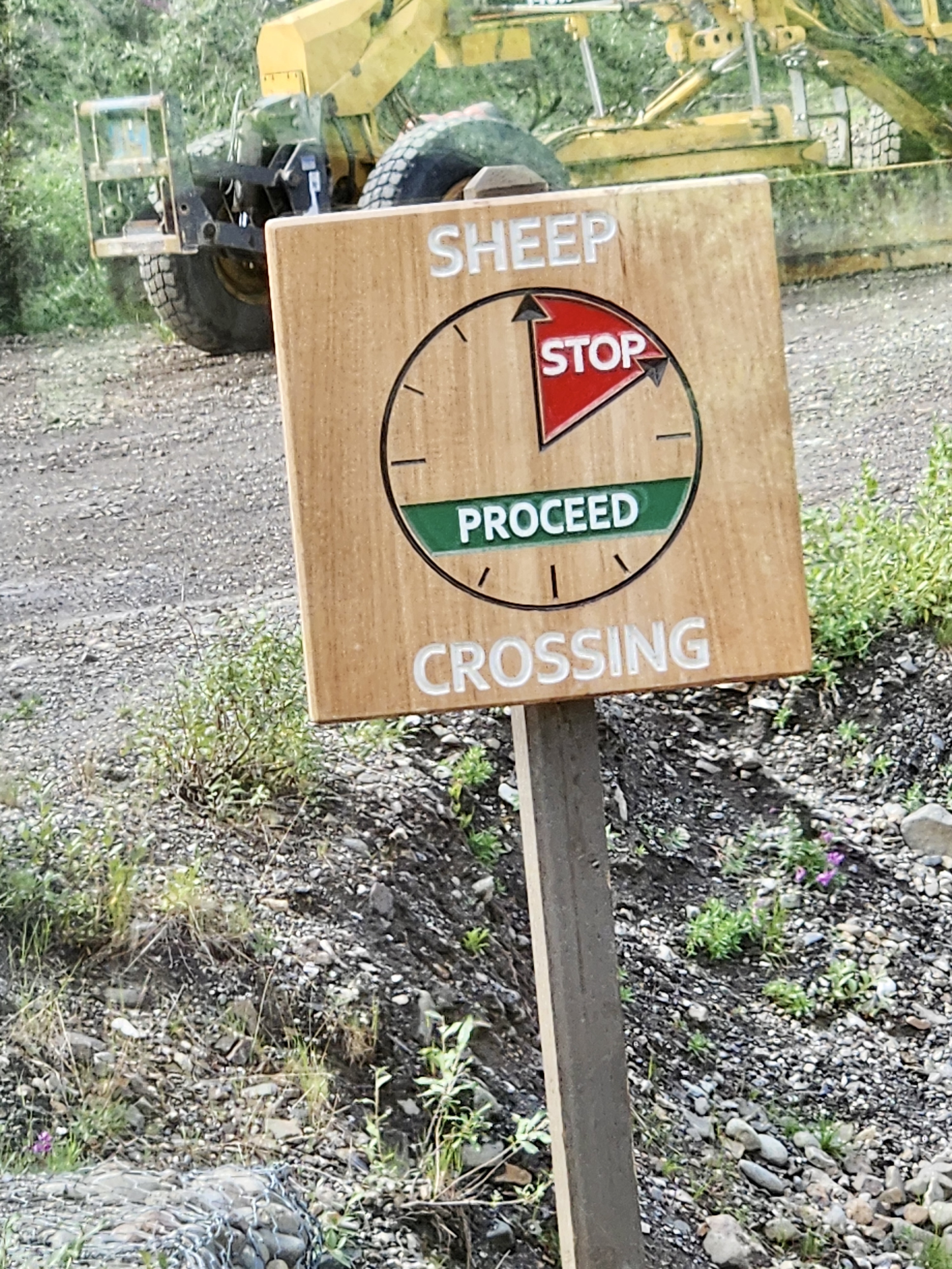
Last fall, I wrote about The Earl of the Back Yard and now I’d like to bring you all up to date with back yard happenings. Some same ol’, same ol, and some new stuff. (You can click on a photo to enlarge it)
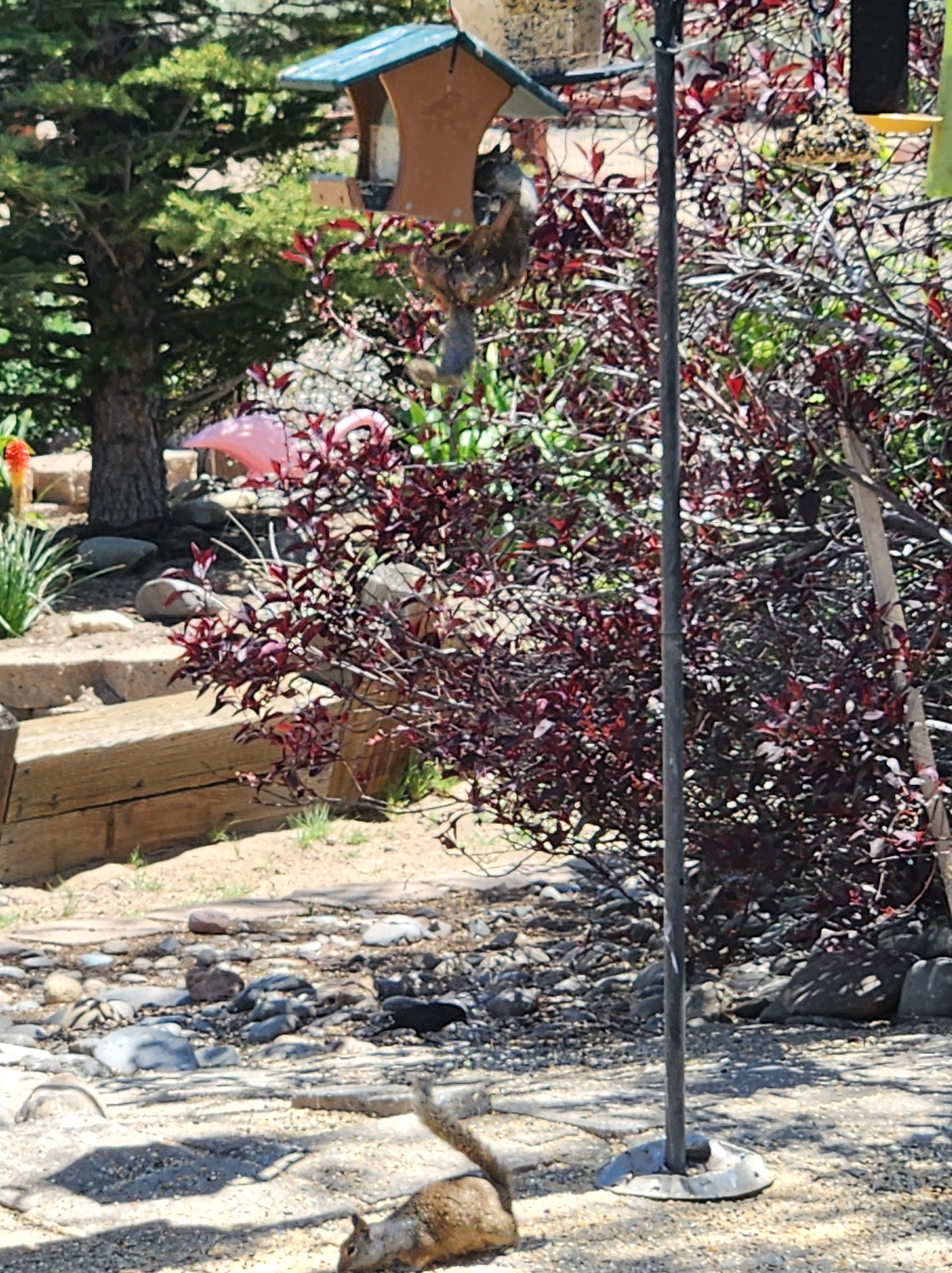
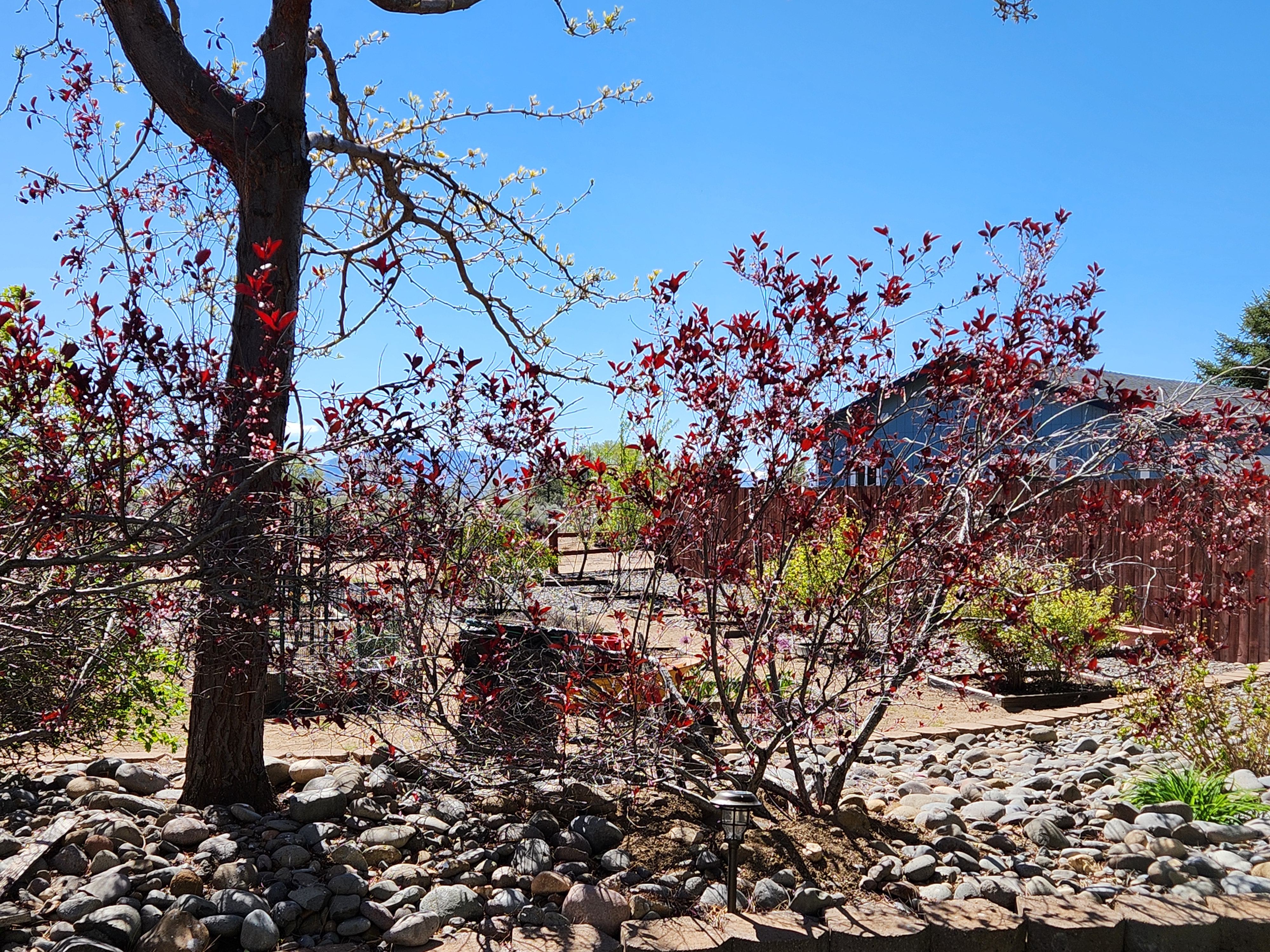
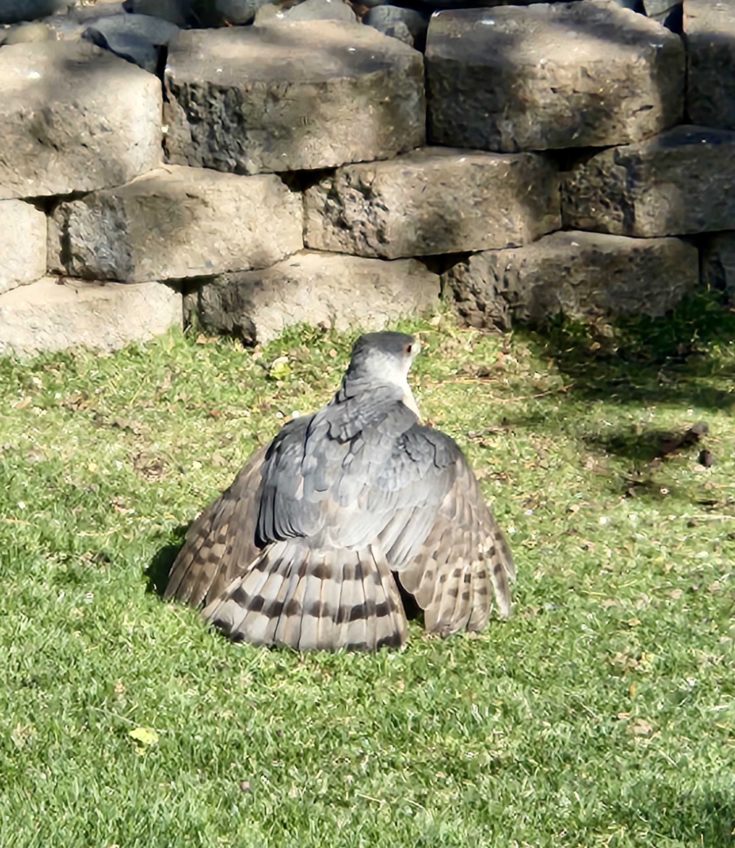
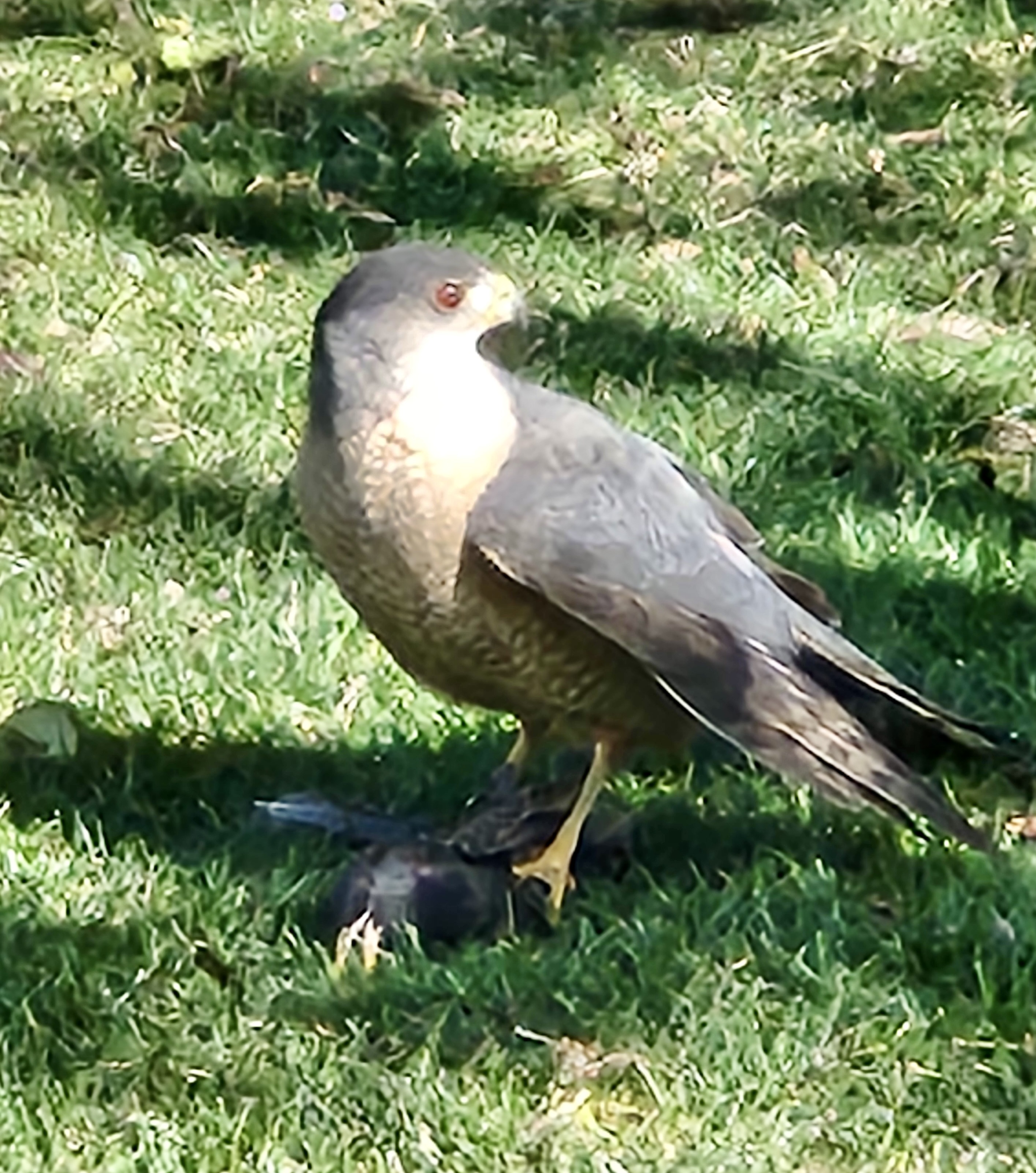
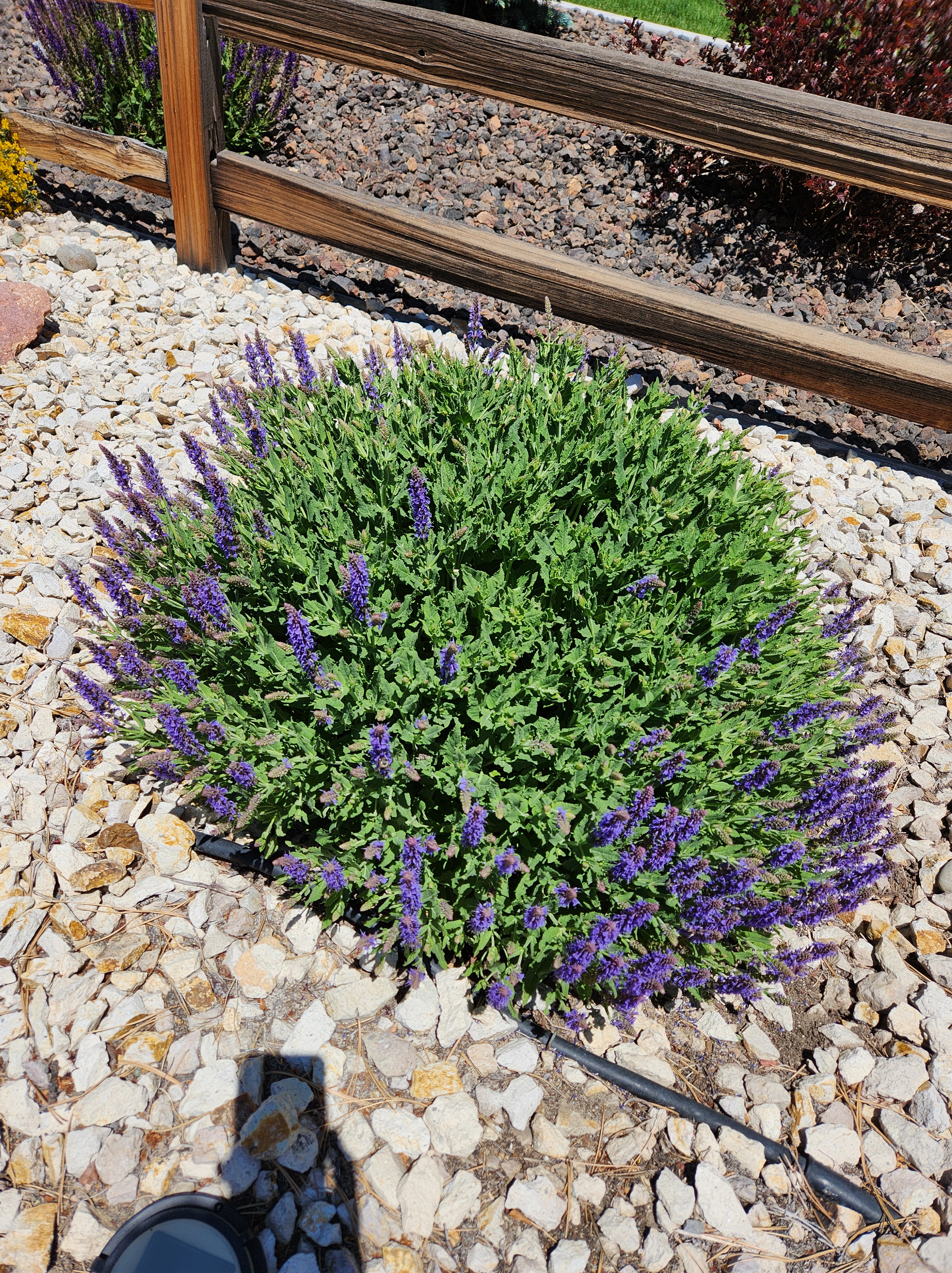
The Earl is still with me and now he’s brought his entire extended family plus all his neighbors. At one point, I counted 13 of the varmints just on my lawn! They don’t understand that hospitality only goes so far! He’s hanging from the feeder and is sharing some of his food with a brother on the ground.Earl has learned he can just hop into the feeder rather than stretch and then hang onto the feeder. Much easier to chow down from this vantage point. Doves are feeding in the backgroundThis poor bush had broken limbs from the harsh storms of 22-23. To add insult to injury, some of the squirrels decided to build a condominium amongst its roots. That’s their dirt you can see piled up at the base of the plant.The above shrub was taken out and this new Cardinal Candy was planted recently. It’s supposed to be a larger plant and will have red berries in the fall. So far, the squirrels have left it alone. Fingers crossed.Dean has discovered he enjoys hunting lizards in the backyard (he goes out only with strict supervision)Sometimes, it’s a matter of life or death in the backyard. I happened to witness a Cooper’s hawk catch a starling in mid-flight and caught a few photos. Upon catching the prey, the bird extended its wings protecting his catch while he secured his grip.A profile of the hawk before he flew away with his meal. Sorry it’s not a sharper image
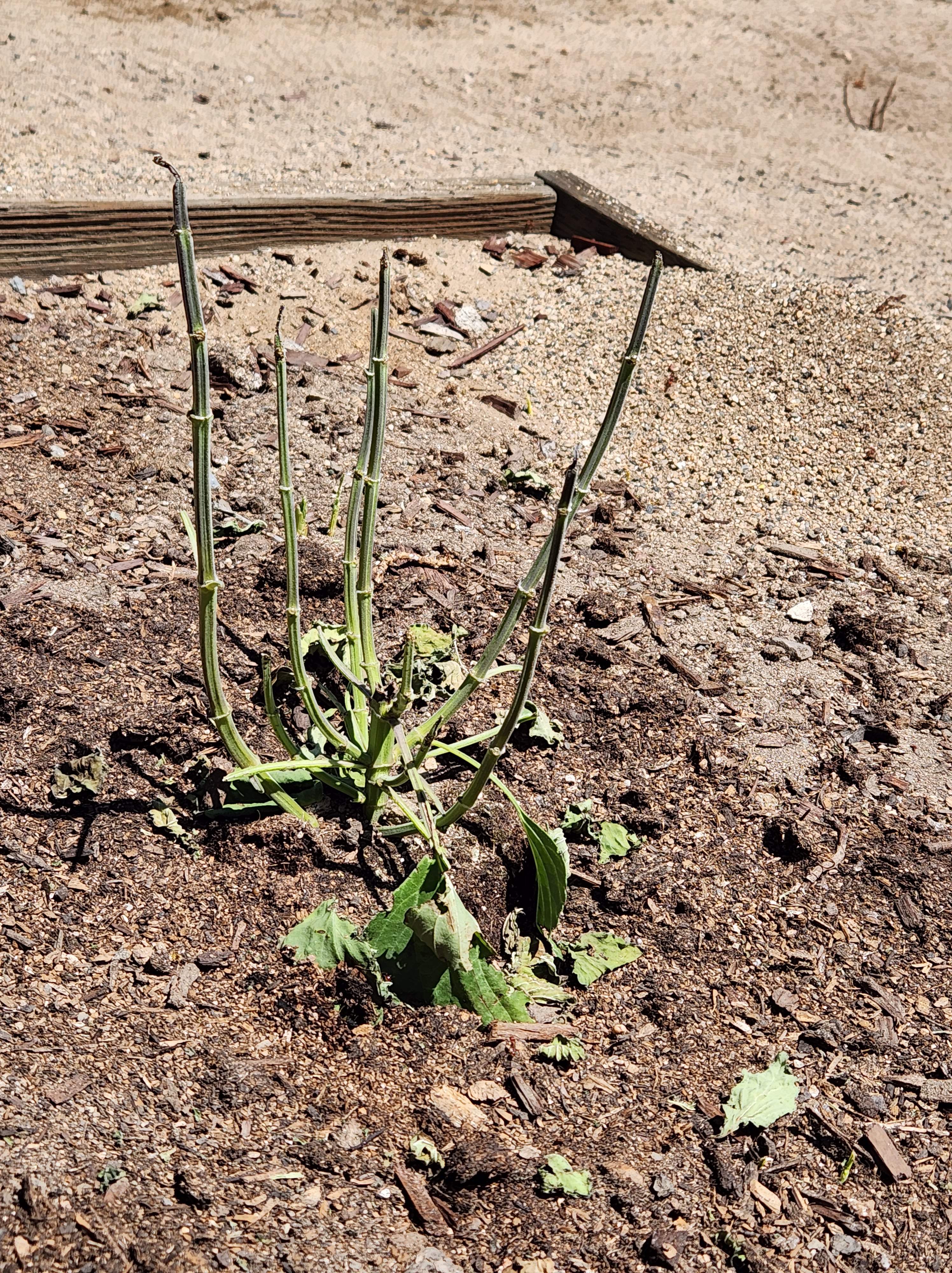
Another life and death situation in the back yard. This photo shows what the next photo should have looked like.
A stripped salviaTHE CULPRITS??? Ants taking pieces of the salvia leaves to their nest.
I think a mystery has been solved in my backyard. For 2 springs, something has gotten into the raised garden (with fencing and netting) and stripped off the leaves my plants. No holes or anything. This spring, I’ve twice planted some pretty plants in an unprotected area. Twice they’ve been stripped. Finally, I noticed huge red ants are doing the damage. I have watched them chomp pieces of leaves and carry them back to the nest! Now I need to decide whether to kill the nest or let them be. I don’t know exactly what that would entail but I know I don’t want them to sting me. Those stings are very painful and raise a good sized welt.
As for my raised garden. I’ve already decided to wait until fall and then plant a bunch of milkweed and penstemon to attract butterflies and other insects. I’ll be happy to watch them in lieu of my plants being carried underground to feed a bunch of antlings (antlets?)
The last photo I’d like to share is of three of my plants in the front yard. Lupine, peonies and brilliance (that’s the name of the pretty yellow plant)
Sometimes I feel like a farmer with some successes and some not. It’s a good thing I don’t have to depend upon my green thumb to survive.
Someone had told Jerri and me that we could take the Ranger from our houses through the mountains to her granddaughter’s house using trails cut out by many other off roaders. Of course, we wanted to see if we could find our way and the following is the adventure of that day.
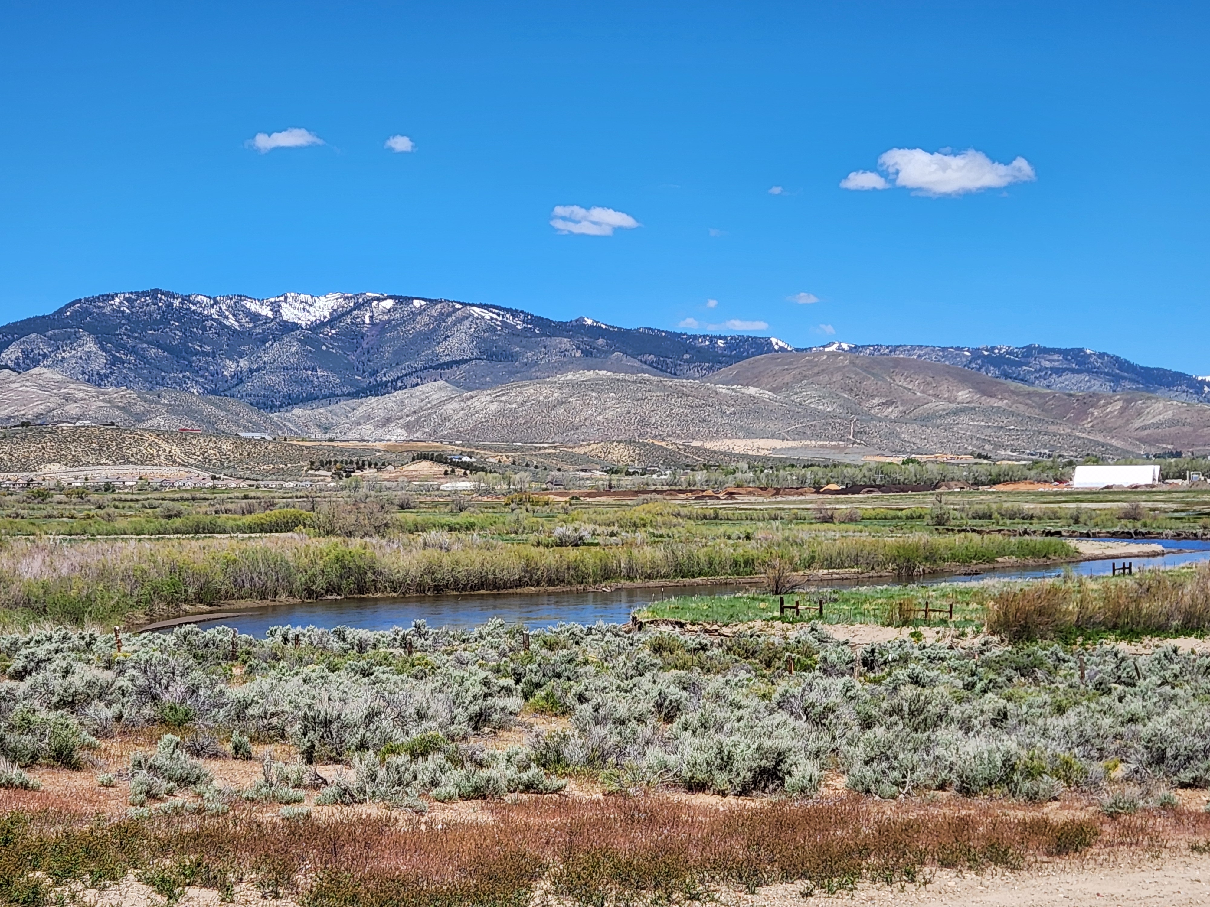
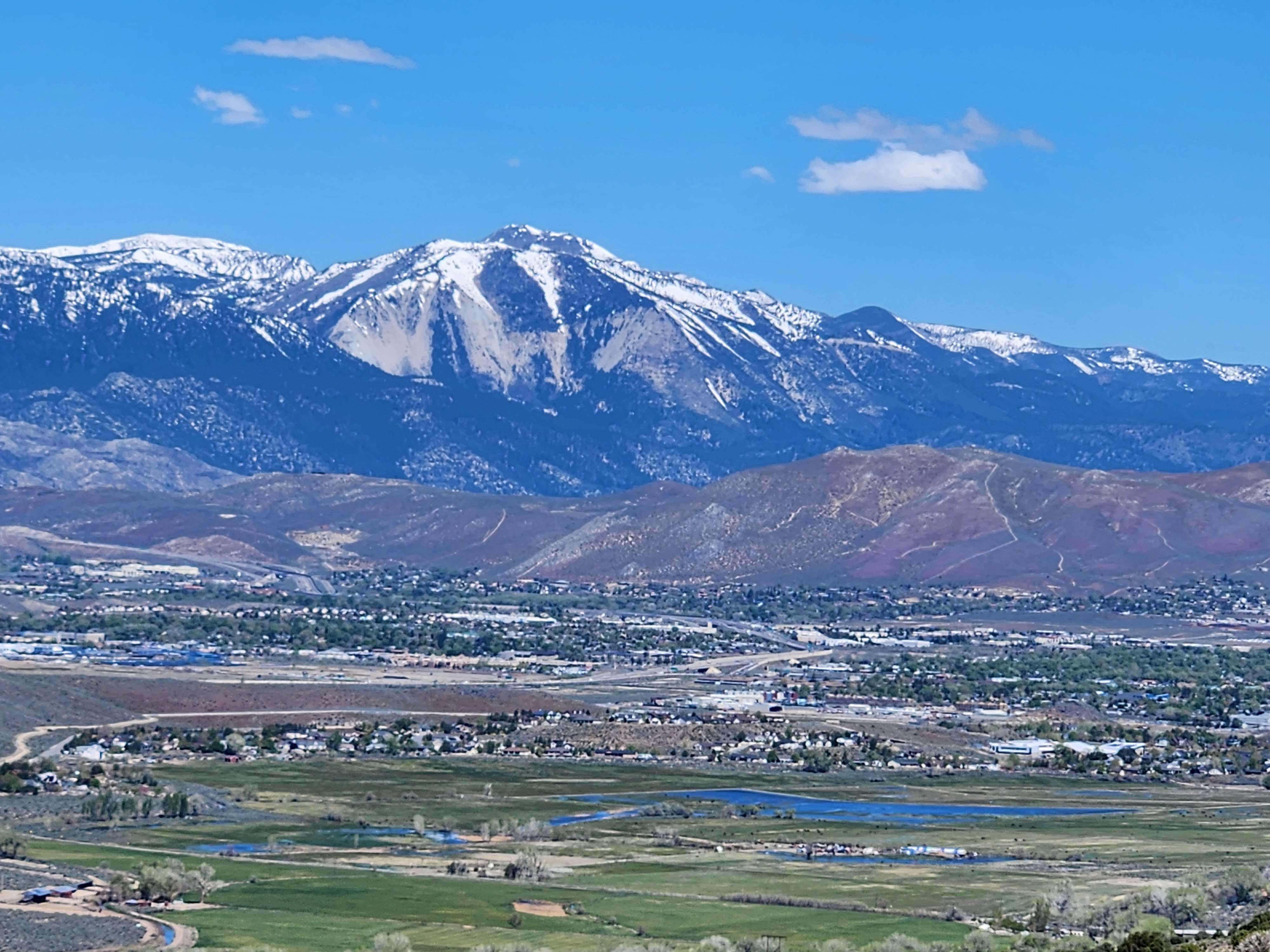
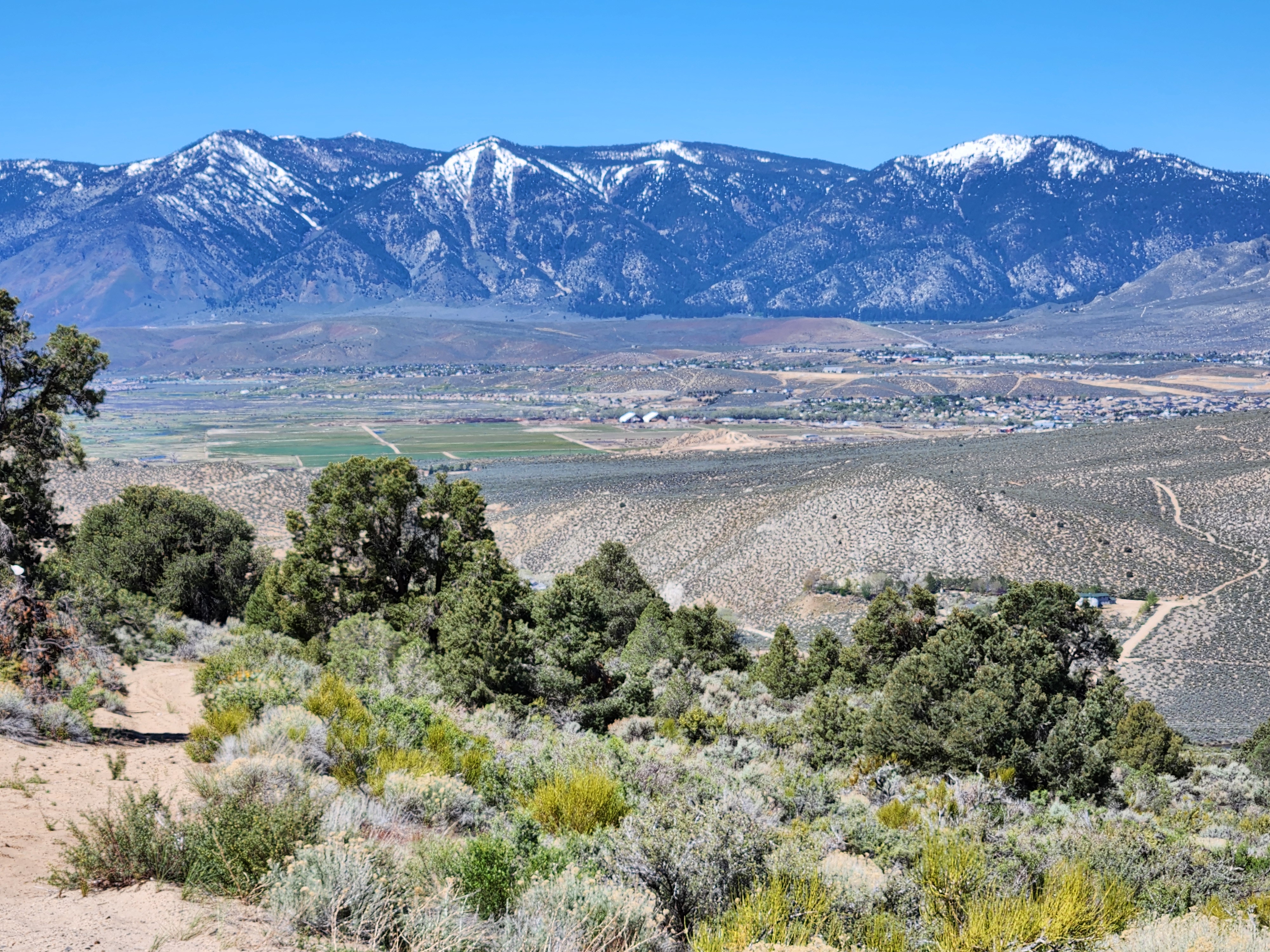
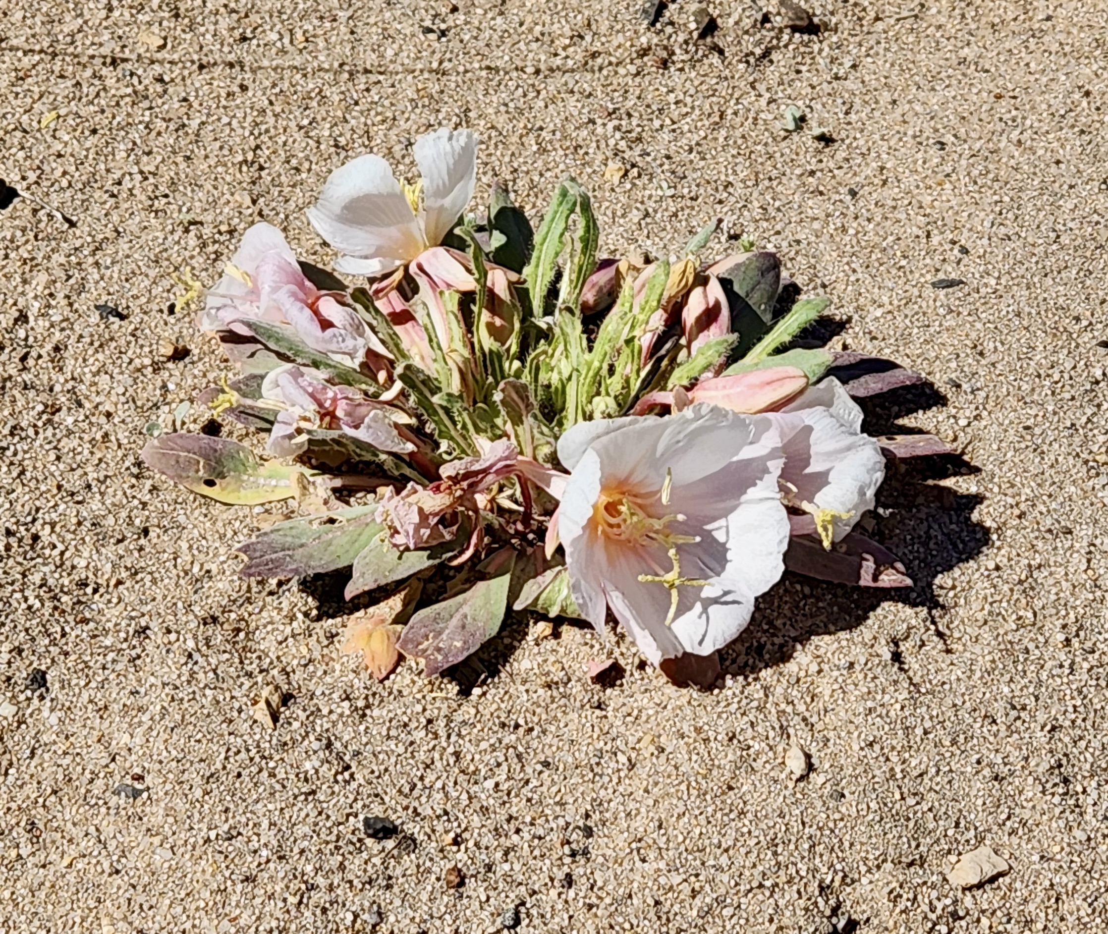
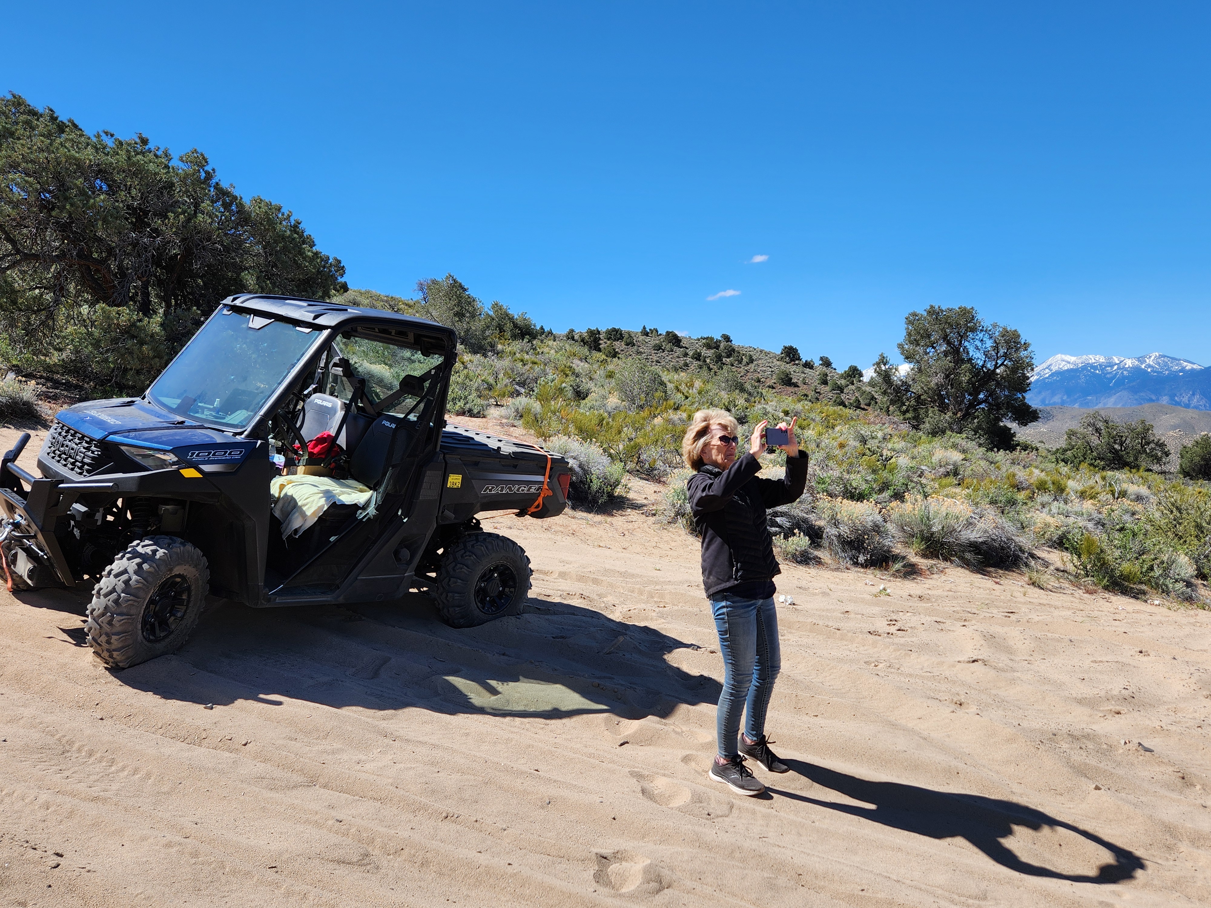
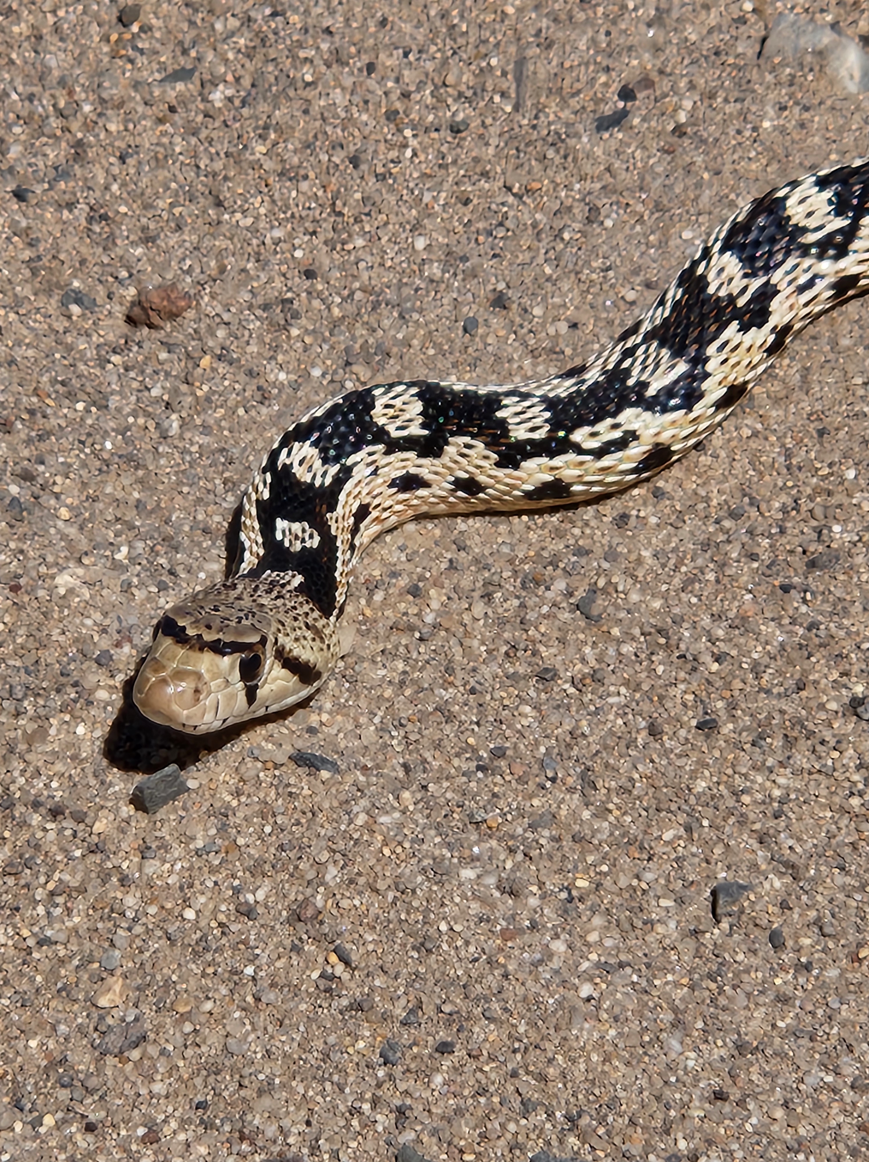
The Carson River is not far from where we live. We ventured into the Pine Nuts (the range to the east of us) and followed a power line road for quite a way.The power line road sort of petered out and we wandered around trying to find the absolute right way. We could see where we wanted to be, but the trick was getting to the right connection without getting onto a paved road. The Ranger is not street legal and often the gendarmes look the other way. But we wanted to do it legally. Unfortunately, our final road turned into a motorcycle run and it was just too dangerous for us. As we turned around, we saw this sign and laughed. (This was a gully and NOT the road)So, we turned around and headed for home. BUT, we saw another road that would take us higher to give us some better views. This one was really fun! Prison Hill is to the left.A view of Slide Mountain and a portion of Carson City (Eagle Valley). Yes, part of it actually slid away down into Washoe Valley just north of Carson City. The mountains/hills you see between Carson City and Slide Mountain are a portion of the Virginia Range. Looking the other way, we could see the north end of our Carson Valley.A tufted evening-primrose (according to my flower book)Some Mormon tea plants… a different taste, but not a bad tea.Lots of arrowleaf balsam plants to add some color to the hillsidesThis is an example of desert peach. Those thorns are very mean if one is not careful.Jerri taking some photos that she’s already posted on Facebook. It was very sandy where we stopped and hard to tromp around the area. Since we had jackets on, you might wonder if it was warm enough for snakes to be out and about. Yes, they were, and we were very careful where we walked.As we began to go down the hill, we encountered this guy just sunning himself across our road. We estimate he was more than a yard long. Locally, he’s called a bull snake.We knew he wasn’t poisonous, so weren’t very concerned when we got out to look at him. He wasn’t moving and wasn’t even sticking his tongue out. I thought, at first, he was dead, that we had run over him when we went up the hill. I petted the back of his neck and he still didn’t move. Eventually he did stick out his tongue and then moved off the road enough so we could pass him without running over him. This guy was the first snake I’ve seen out in our wildlands, and I’ve been here almost 11 years. Glad, though, it wasn’t a rattlesnake.
We didn’t accomplish our goal to getting to Sierra’s house, but now we have an excuse to try again. No matter what adventure we take next, we know we’ll have a lot of fun.
It all began in the sandbox in kindergarten, many moons ago, when Diana and I became friends. What a marvelous friendship it has been and one that I have cherished for, lo, these many years.
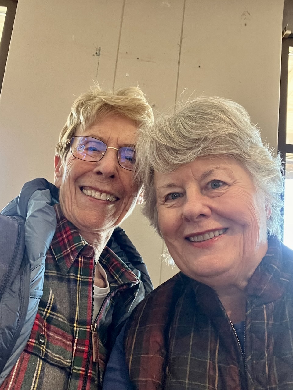
As fate would have it Diana and her family lived in the Carson Valley when I moved here in 2013 and they welcomed me into their fold. It became a habit to watch Sunday Night Football together and when they moved to New Mexico, I invited myself to watch the Super Bowl with them. I wanted to see their new place and get to know their environs. What a beautiful, historical place this valley is. Technically, they live in El Prado, a small community outside of Taos, but they are in the same valley.
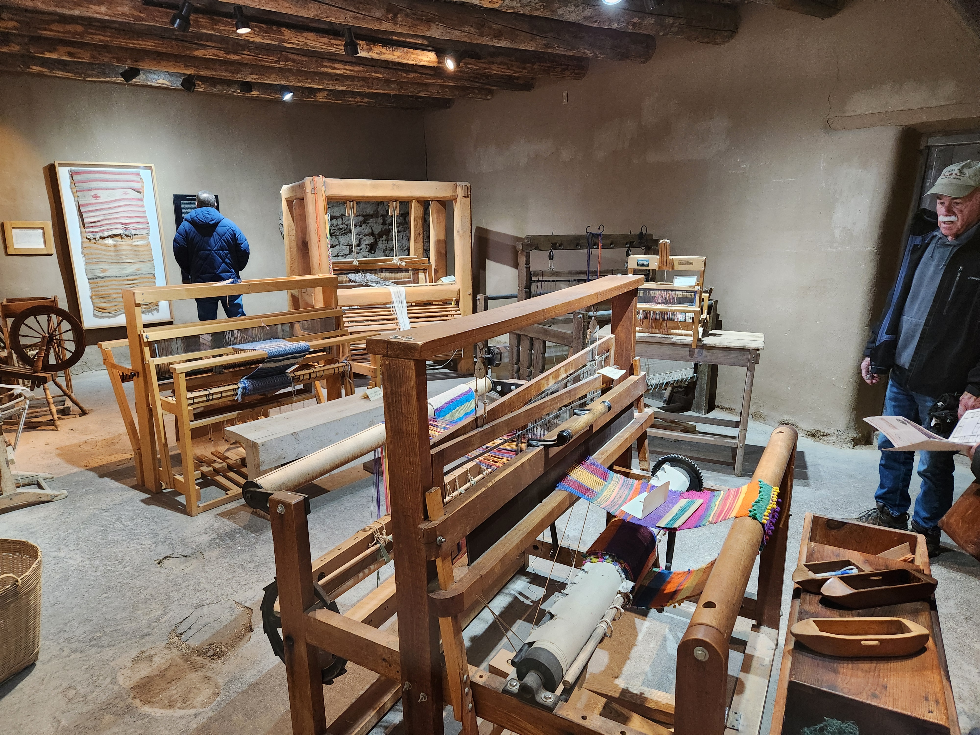
First things first. Food! Orlando’s might look like an old Taco Bell or something akin to that from the outside, but the ambiance and food inside certainly aren’t.There is a reason why people line up before the 5 pm opening to get in on the first seating. My mouth waters just thinking about those vittles.This is La Hacienda de Los Martinez, built in 1804 that eventually contained 21 rooms and two placitas (courtyards). The two-foot-thick adobe construction and windowless exterior walls was designed to serve as a refuge for family and neighbors. In a sense, it was like a small fort, containing living quarters, blacksmith shop, weaving room, chapel and other needed areas. La Cocina (kitchen). People could sleep on the platform above the floor area working area.The weaving roomEscarpines (wool stockings), an important trade item in the 1800s. The hacienda served, in part, as a small factory with workers washing, carding, spinning and knitting the wool. The entire process took about 30 hours to make one pair of socks.An horno. The “h” is not pronounced in Spanish. So, we say “orno.” These ovens are in countless yards throughout the area. The same silent “h” goes for hacienda = acienda.
I’m including some websites for those who are interested in learning more about the sites we visited. Otherwise, I would write way too much for the casual visitors. You’ll be able to see more pictures if you click on the URLs.http://www.aztecnm.com/fourcorners/newmexico/taos/HaciendaDeLosMartinez.htm
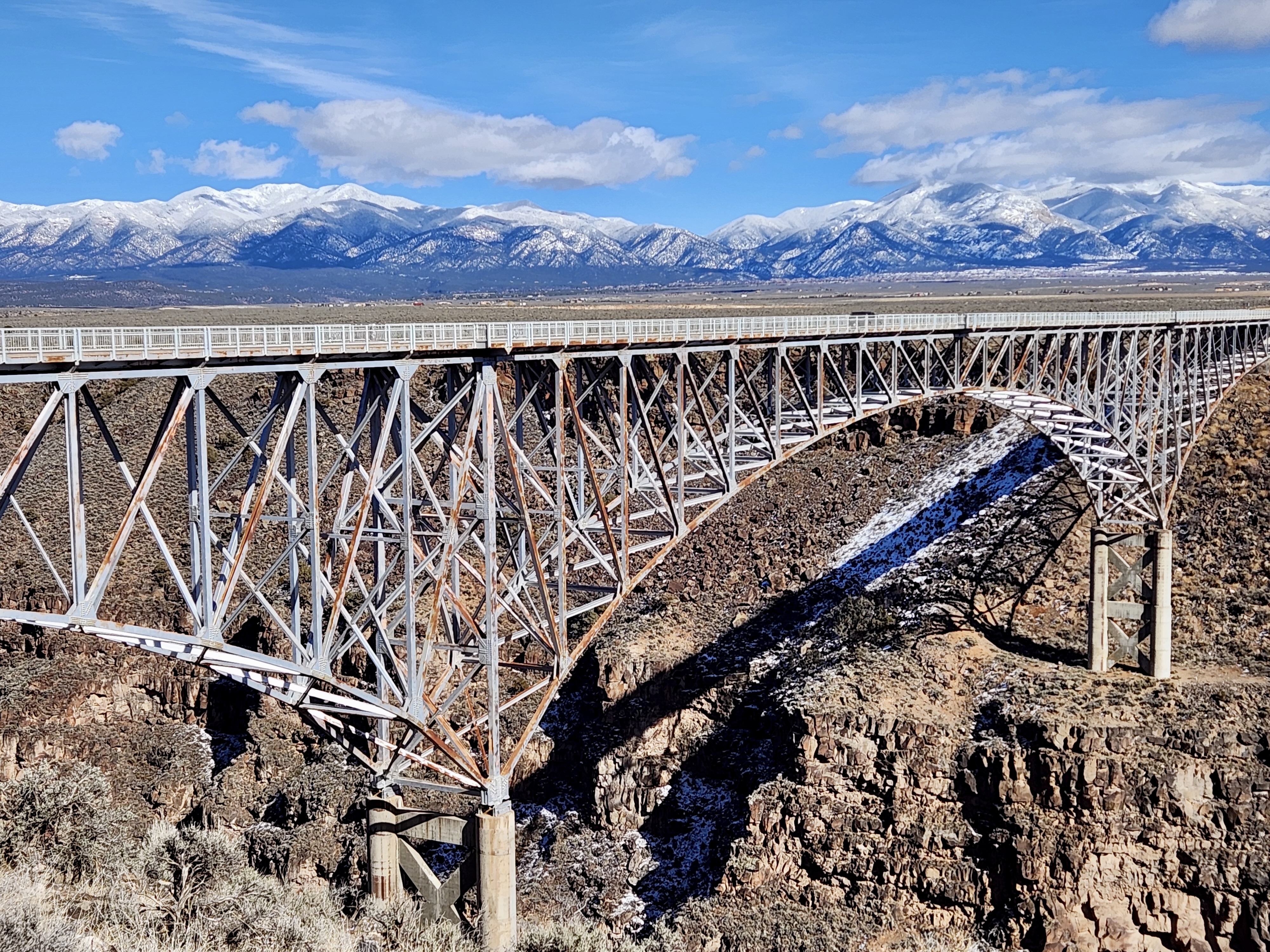
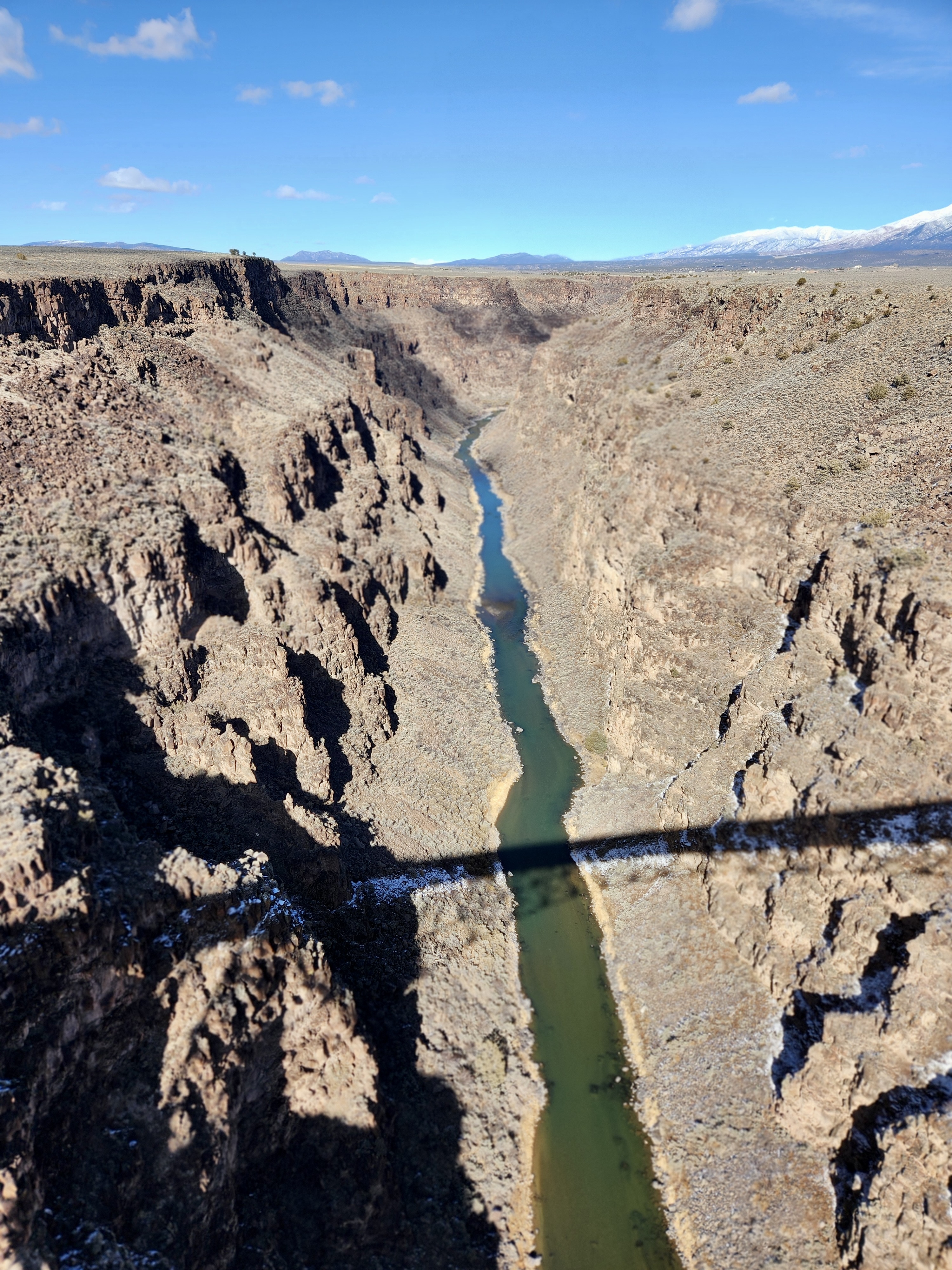
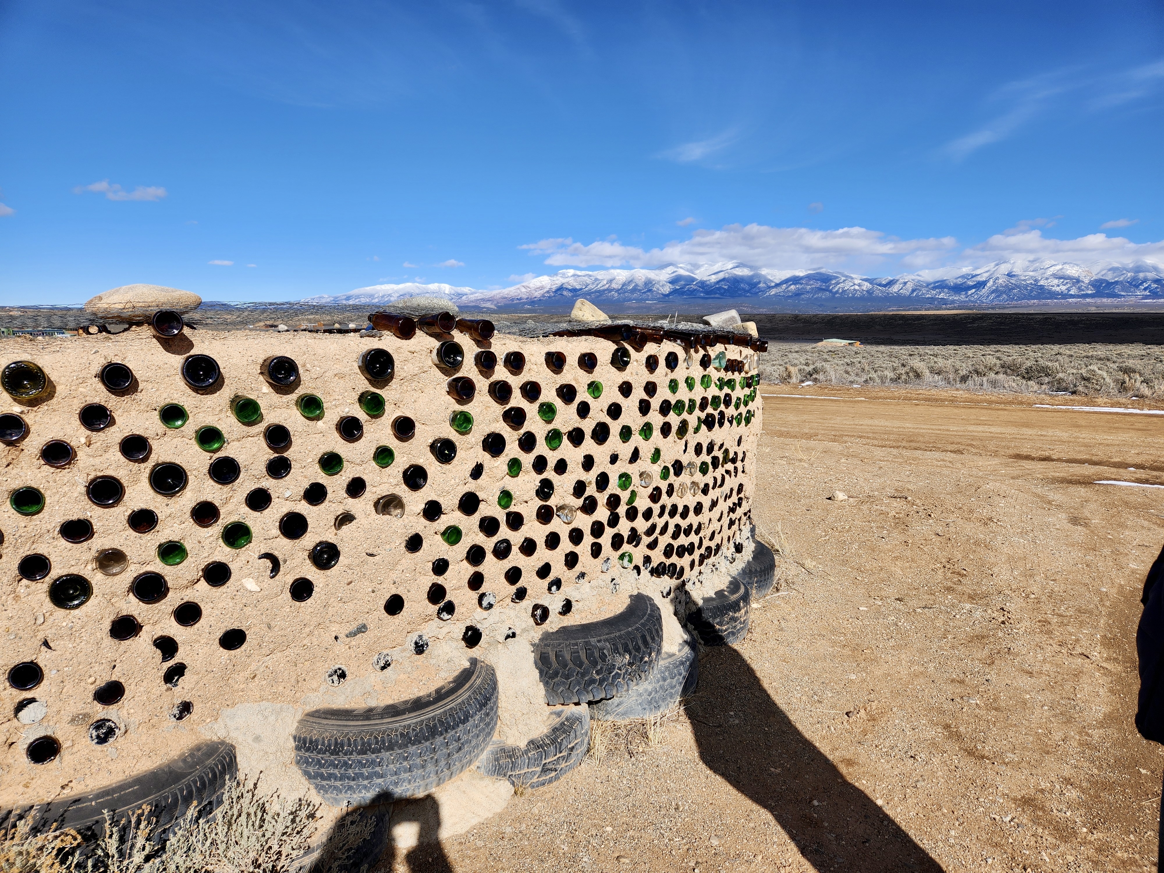
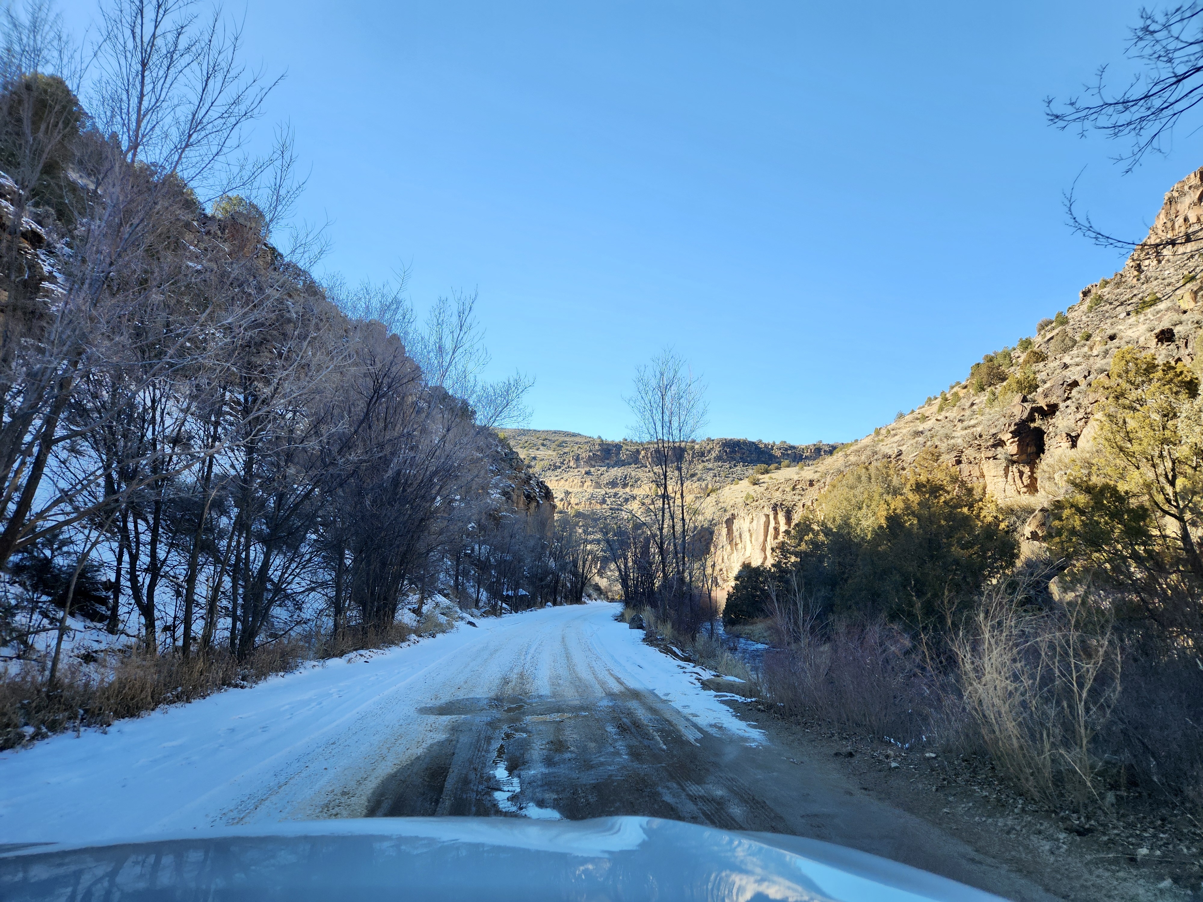
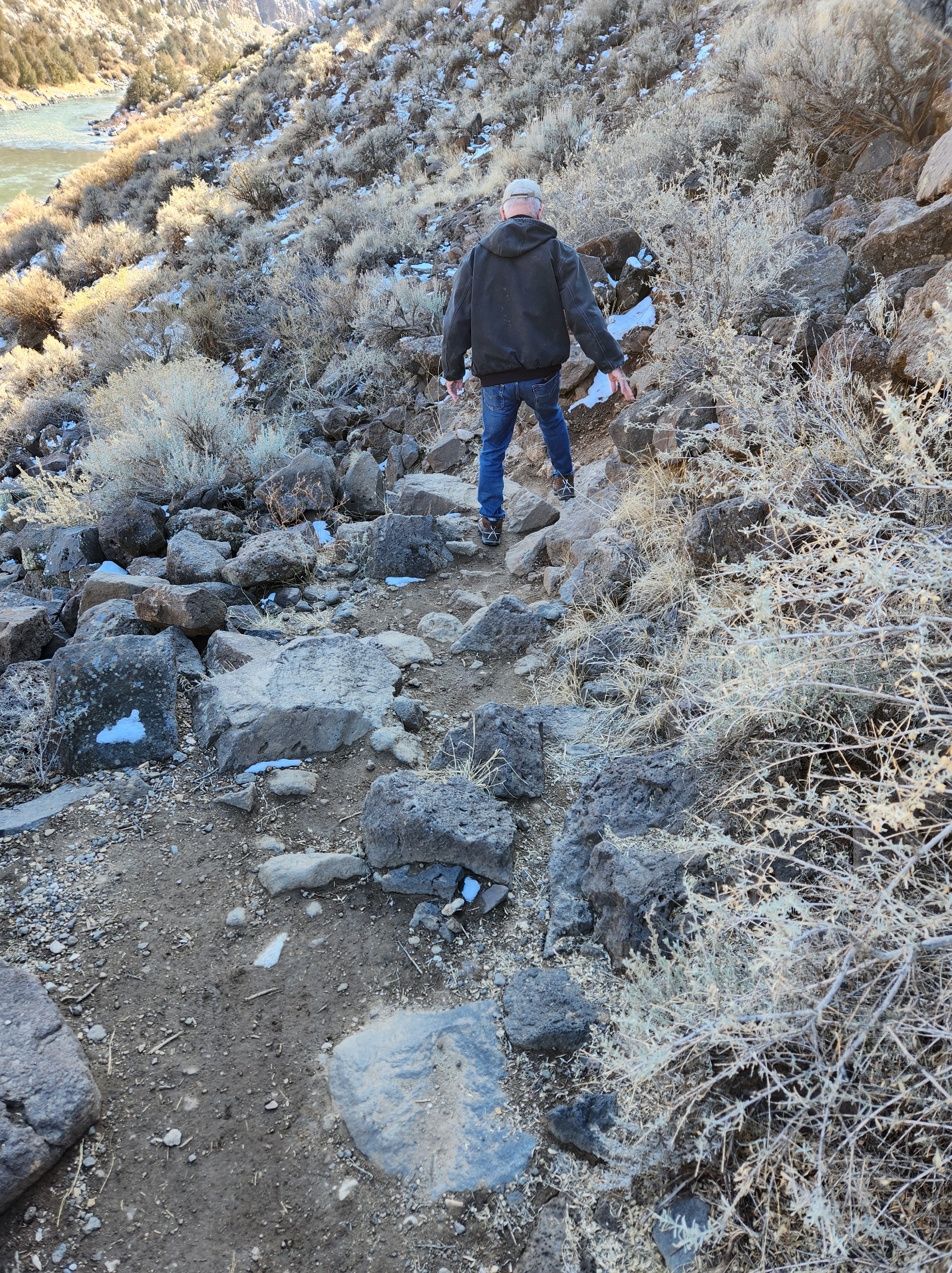
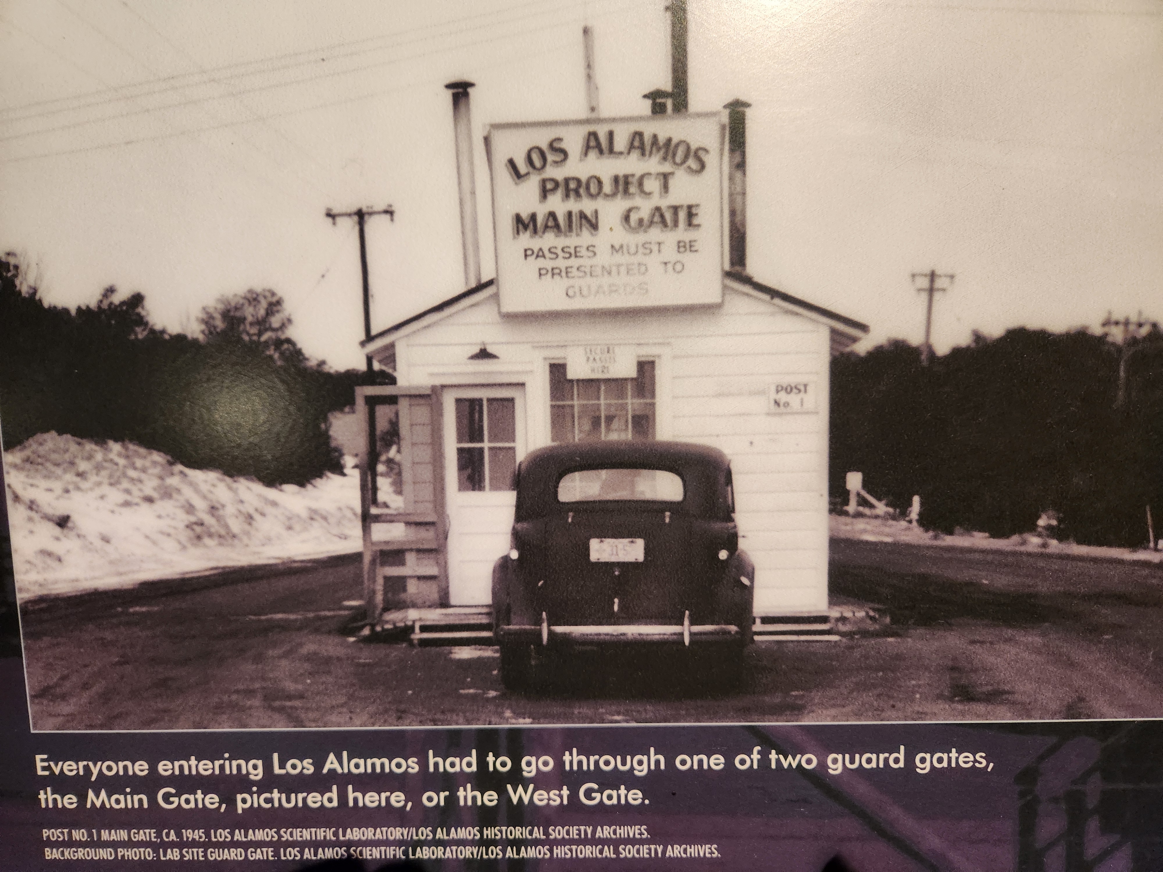
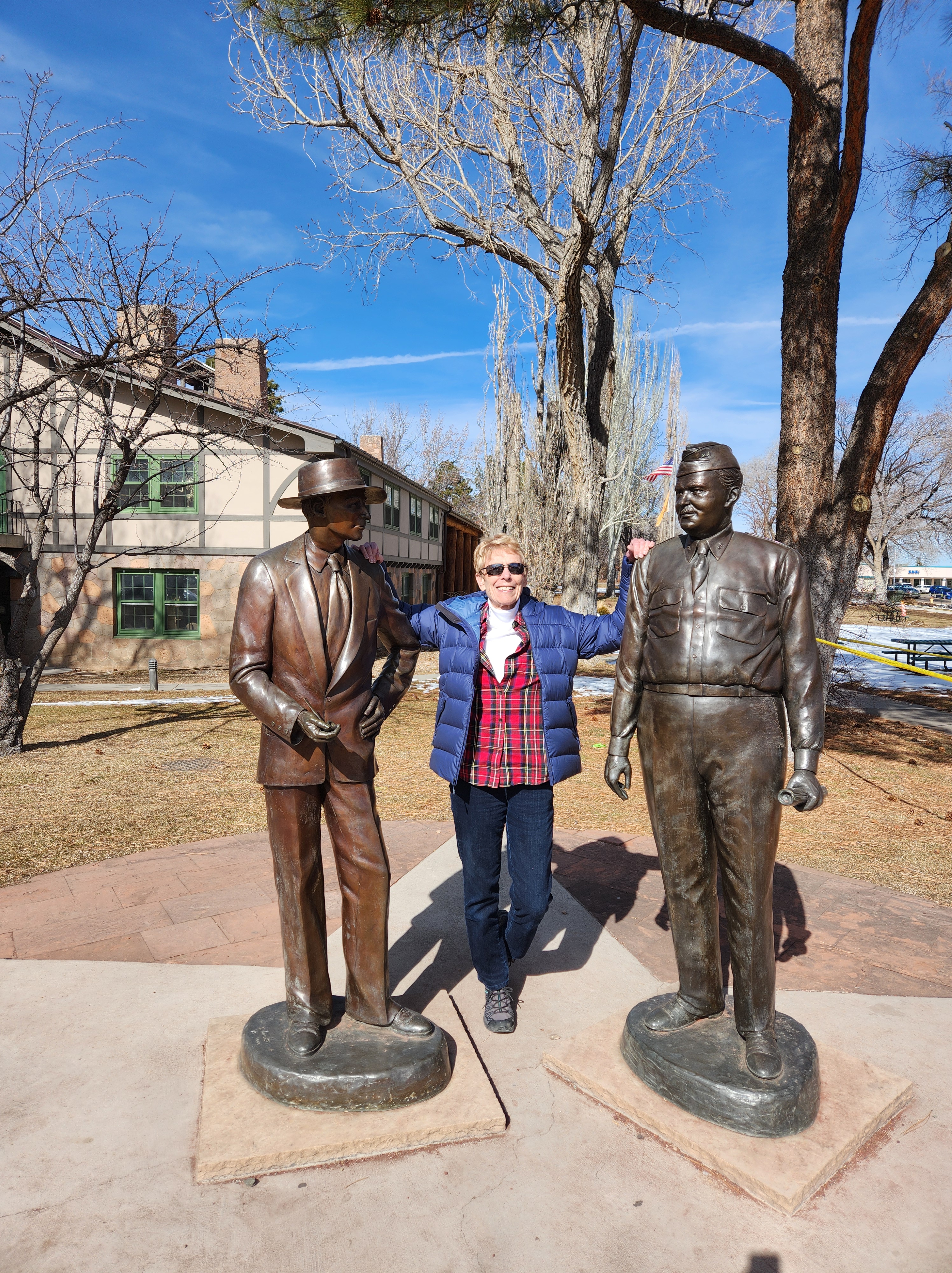
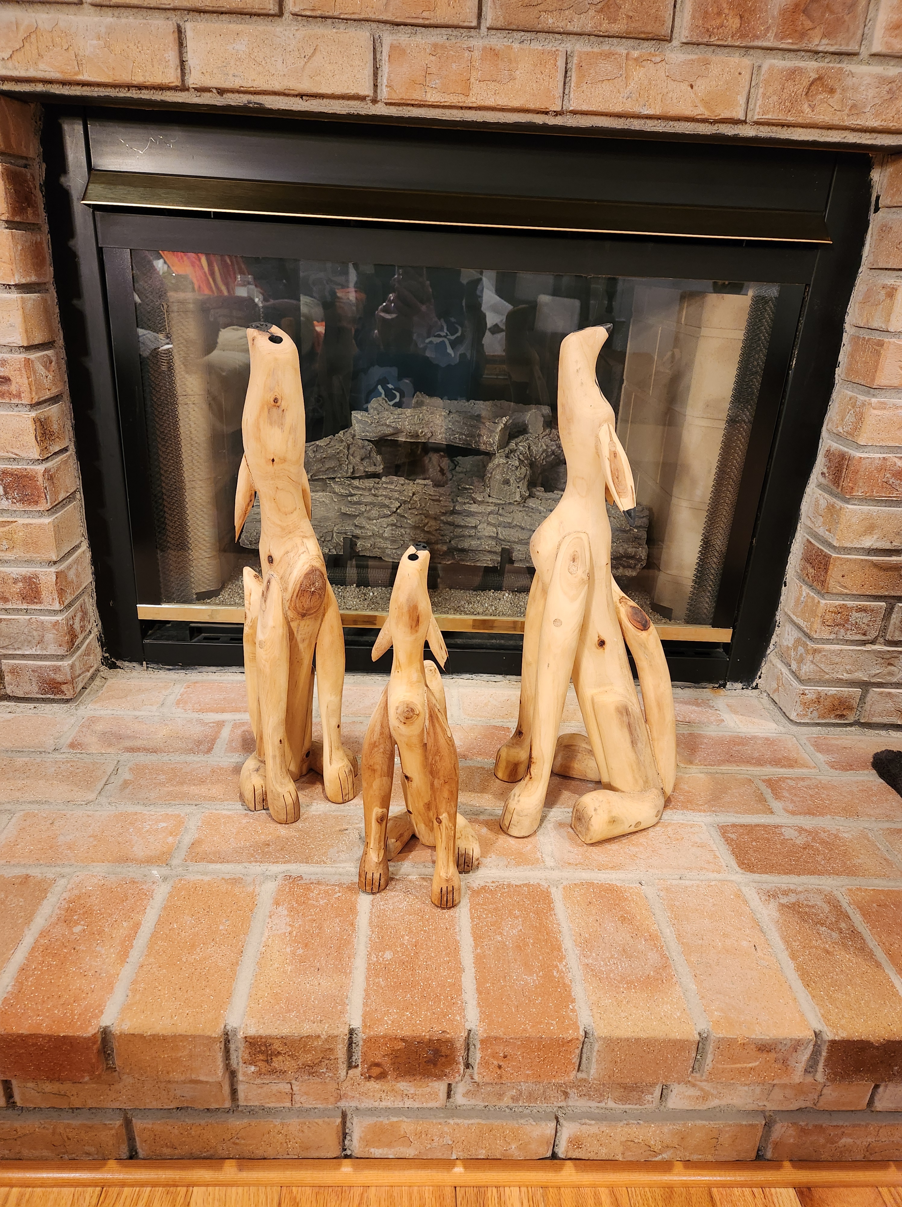
Another place we visited is the Rio Grande Gorge Bridge. Yes, it’s the same Rio Grande that flows between Texas and Mexico. The gorge is massive and deep, making it a bit nerve wracking to walk out on it. If you’d like more info, click on this link. https://taos.org/explore/landmarks/gorge-bridge/Jim, me, and Zoe on the bridgeLooking toward the Rio’s source, way off in the distance. https://www.americanrivers.org/river/rio-grande/ Looking down 650’Just a few miles from the Rio Grande Bridge, is the Earthship Biotecture area. A very interesting, self-sustaining, off-the-grid community. Google Earthship, Taos, if you would like to learn more. My server wouldn’t let me include their website.An Earthship houseAn Earthship wall. If you’ve visited ghost towns around the West, you may have seen some bottle houses. Maybe those old pioneers were into recycling before its time (except for the tires)Descending into the Rio Grande Gorge north of the scary bridge to see another bridge…the John Dunn Bridge.It crosses the Rio Grande near the confluence of the Rio Hondo. It was built in 1908 by John Dunn who transported travelers and mail into Taos and housed travelers overnight at his hotel near the bridge.Jack and I getting ready to hike to the hot springs a short distance down by the river.Two guys who took our photo. The interesting person in the photo is the dude behind the guys. He had just finished bathing in the hot springs and came up the trail with no shirt on. (It was COLD in the shadows!) Hanging from his belt were beautiful pelts that he had tanned himself (a raccoon and a pine marten that he had named). They were roadkill, so at least we don’t have to feel sorry for the critters. Sorry that I didn’t get a front on photo of him.Jack going down the trail to the hot springs. We had to really watch our step.Man in the hot spring. He said it was about 99º and was quite comfortable. (He does have shorts on in case you’re wondering) I have no idea what those “eyes” or spots are in the photo. They were not visible to us. People left their names on rock even in 1925. The spider to the right is not an old petroglyph.Diana is a docent at the Couse-Sharp Historic Site. I tagged along on one of her tours to learn more about Couse and Sharp as well as the Taos Society of Artists. Diana kept us engaged for the entire two hour tour. There’s a lot to see! http://couse-sharp.org/ https://www.taosartmuseum.org/taos-society-of-artists.htmlDuring a snow day, we all watched “Oppenheimer,” an Oscar nominated movie and that led to curiosity about Los Alamos and what goes on there today. Research labs are still in Los Alamos and military is still present guarding secure areas. We visited the Bradbury Museum that was amazing and overwhelming. So much to see and not enough time. The Los Alamos Historical Museum was also enlightening. https://www.tripadvisor.com/Attractions-g60730-Activities-Los_Alamos_New_Mexico.htmlJ. Robert Oppenheimer, me, and General Leslie Groves -both primary figures at Los Alamos during WWII.Near Los Alamos is the Bandelier National Monument where ancestors of present-day Pueblo Indians have lived in and around for thousands of years and continue to do so today. The ladder leads to a cavate dwelling, which, I believe, was a natural indentation in the rock and then hallowed out more from the soft volcanic rock. https://www.nps.gov/band/index.htmView from inside the cavate.All too soon, it was time to hop on the plane in Santa Fe and go home. But not, before I captured this sunset view of the Sangre de Cristo Mountains from the Jacobs’ living roomMy thanks to the Jacobs’ hospitality and Zoe’s vitality and love for making this a very special adventureP.S. My little coyote family carved from pine in Taos.
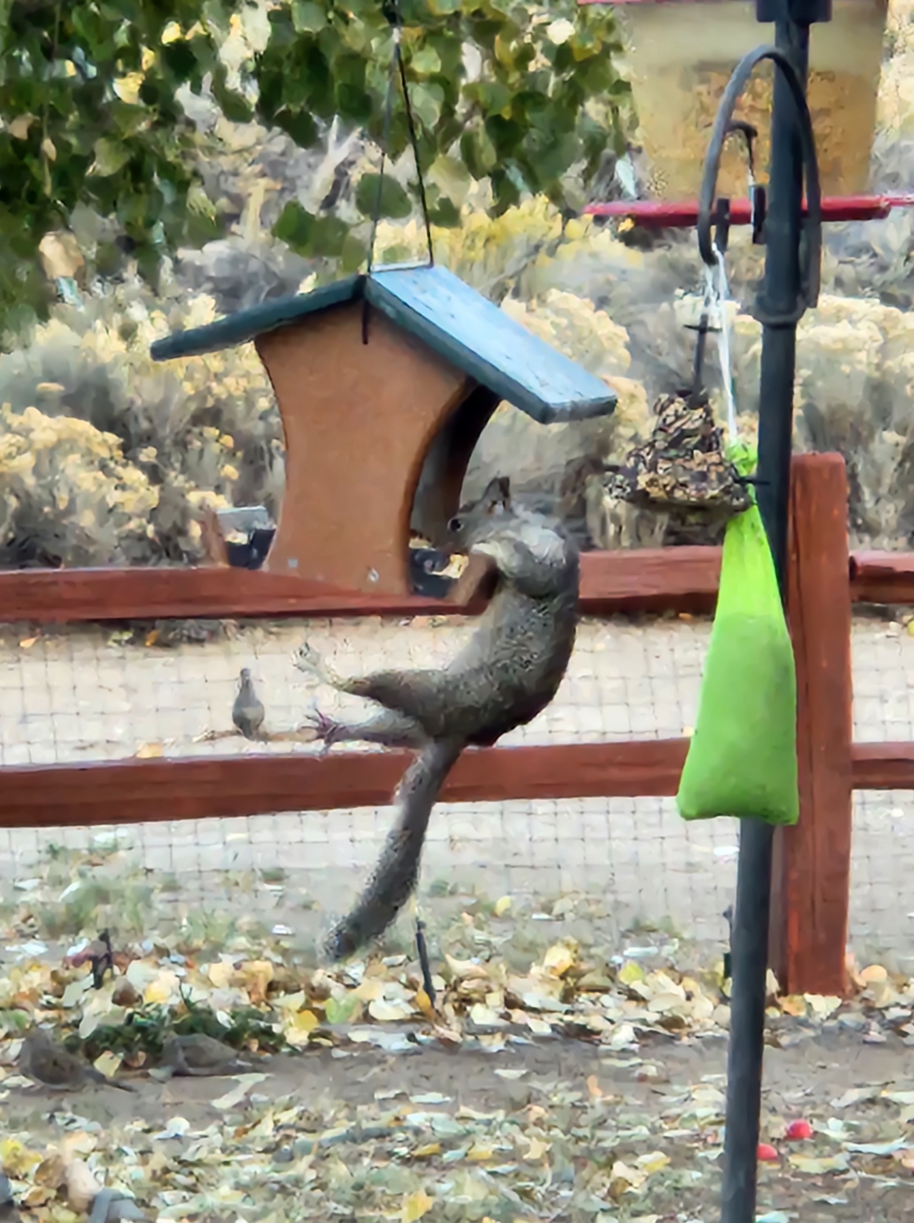
This is how my backyard squirrels think of my BIRD feeding area. Their own personal supermarket with a complete squirrel menu just for them. This is not totally true, though. There are no acorns here; just wild bird seed, suet, fresh water and occasional apple peelings from apple pie or applesauce creation. All my critters love this feast.Earl Squirrel shinnies up the pole and makes the loooong stretch the the seed house.Occasionally, Earl’s back feet slip and he hangs on for dear life while he balances himself to adjust his grip. Note the mama quail in the background watching Earl’s antics.Then Earl hangs on while stuffing his cheeks with tasty wild bird seed. He is a muscular, strong dude to be able to hang on for more than a minute or two. The quail is still watching.Finally, Earl tires and/or gets his fill of that flavor and decides to climb the nearby tree for a dessert of suet. This is not once in a lifetime event for Earl Squirrel. I have watched him and his friends do this time after time.
The crows and starlings love to eat the suet, too, when they visit the suet tree. Some are a tad smarter than Earl as one crow or starling will peck and peck, trying to get good bites while their friends wait down below for the suet crumbs to fall. They don’t have to flap their wings and work so hard to get their snacks. All of these antics bring me much joy and amusement to watch my critters go through their daily survival routine. It’s fun living here.
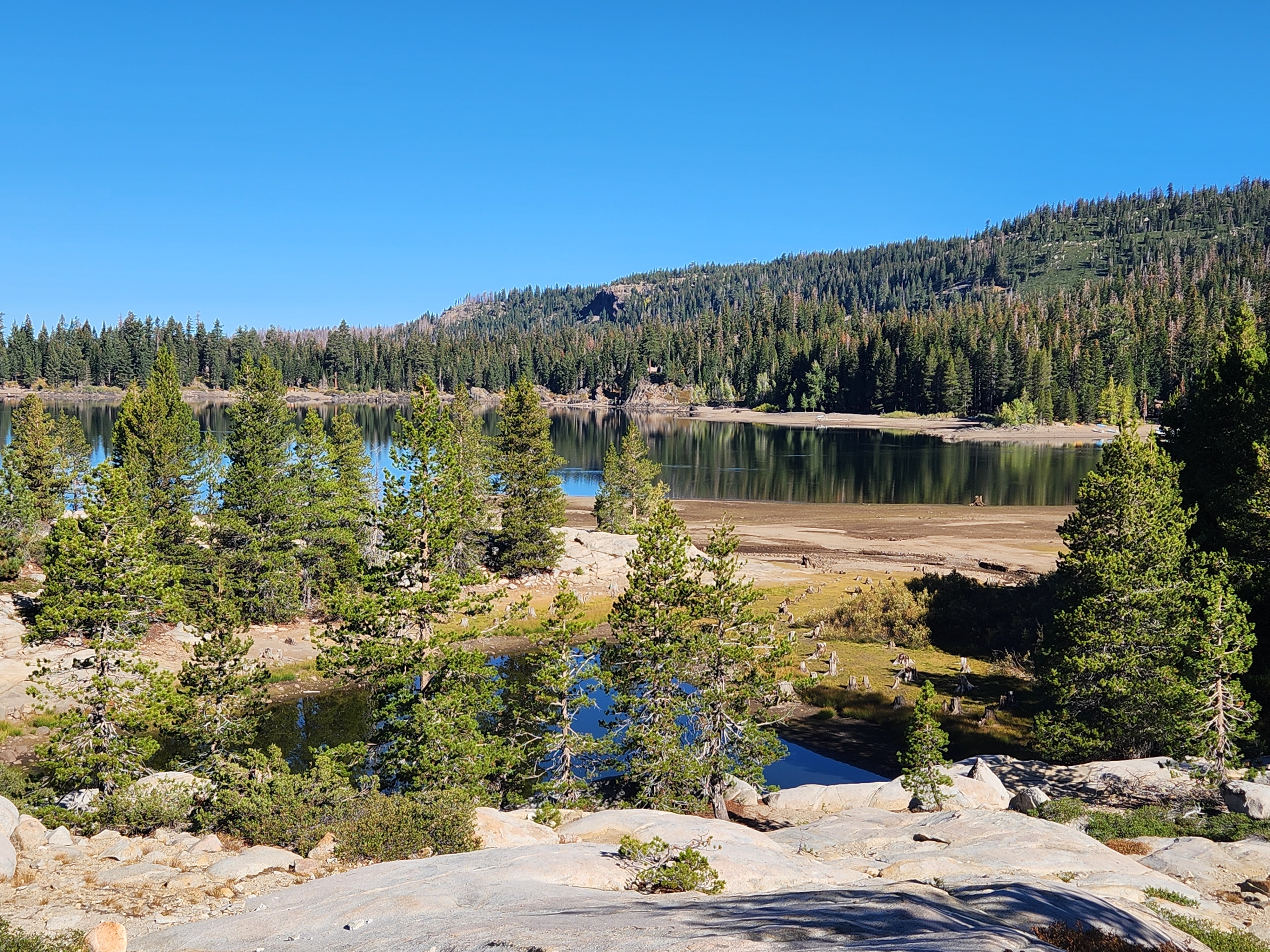
This past winter was long and hard and it seemed like forever that there was still snow and ice prohibiting any kayaking whatsoever. Around the first of May, Jerri and I took a ride up to Silver Lake to check out conditions. What we saw made us believe that we would not be able to kayak at our beautiful Caples or Silver Lakes until July. It turns out we were correct.
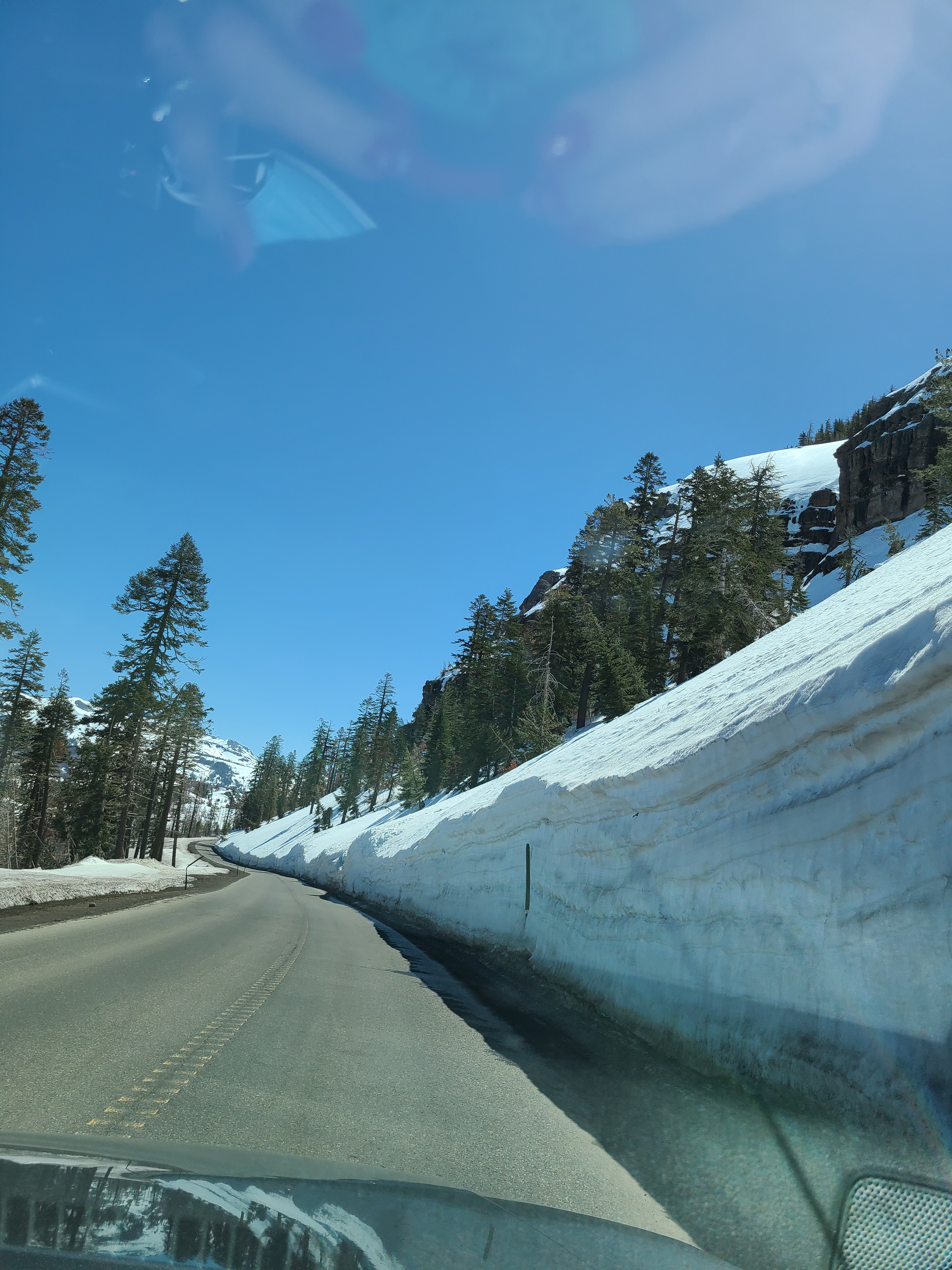
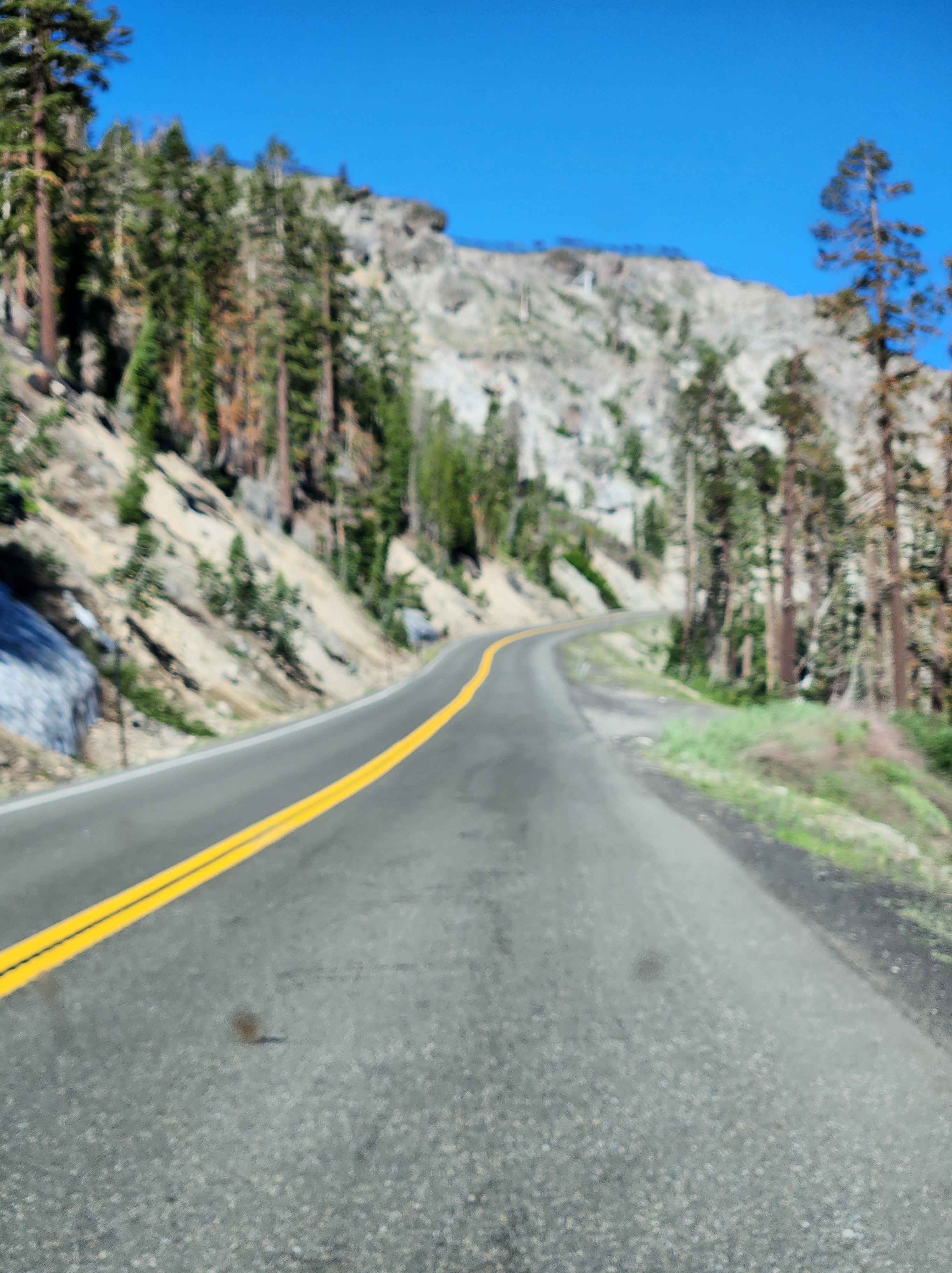
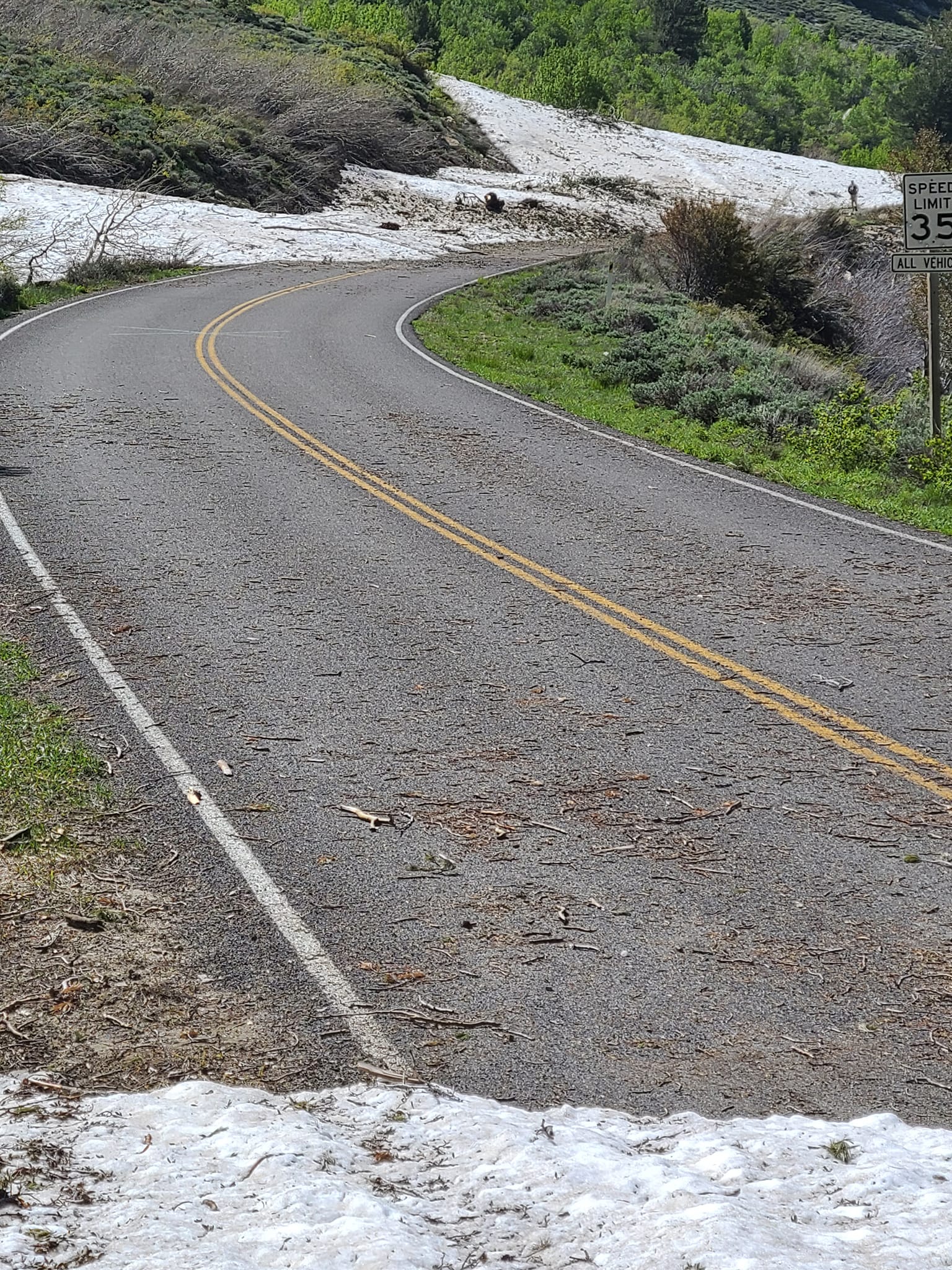
Prevalent sign on Highway 88Hwy 88 in avalanche areaSilver Lake with some water going out the dam. Technically, Silver Lake is part of the El Dorado Water Irrigation and Recreation Areas that stores water for thirsty Californians. Logically, the lake level goes down as the summer wears on. For you techies, the lake is at 7200’ elevation and, when full, covers about 525 acres. Its outflow is the South Fork, American River. Couldn’t find the depth, but I’m sure parts of it are 100’ deepUnder all that snow is a road beside that Kit Carson sign. It is the one we take to our favorite beach.he avalanche area going the opposite direction. Everything is looking good! That white patch to the left is a wall of snow. Sorry the photo is blurred somewhat. The road isn’t very smooth.Silver Lake is ready for us! Jerri is already picking up speed to get out there and zip around the lake. Actually, we don’t zip. We take our time to check out the scenery and enjoy the moment.We checked out our favorite beach…it was flooded. Do you see the yellow stuff on the water? That is pollen. The pine trees are loaded! It was a lovely day!5 Canada geese. They generally cruise around the circumference of the lake or perhaps their special area looking for vittles. It was a good day for critters. We saw 2 deer, mergansers (a type of duck), a vulture, many blue jays, chipmunks and golden mantle squirrels. We know bald eagles and ospreys inhabit Silver Lake but did not happen to see them on this trip. Looking at Silver Lake from “our special lagoon.” We love this place because as time passes, our lagoon becomes shallower and much warmer. It is so much fun to play in, take a dip or just sit on some rocks with our feet in the water. During this trip, the water was rather cool and deep (maybe 6 to 8’). No dipping this time. No photo either. It only looks like an arm of the lake, not a lagoon.I think this is Alpine Penstemon. There was quite a bit of it near where I took the previous photo. Other flowers were still in bloom as well.Our camp site with new towels. We are so blessed to be able to get out and enjoy what nature offers us. Can’t wait to go again next week
The Sister Trip was to go to Washington, D.C. and we were SO excited about it. BUT, the night before departure, we received a text that advised us our early morning flight was canceled and we couldn’t get on a flight until two days later. Major disappointment was in the air. We recalculated and opted to take a trip that has been on my bucket list for several years. This new trip turned out to be one of the best ever. SO much fun!
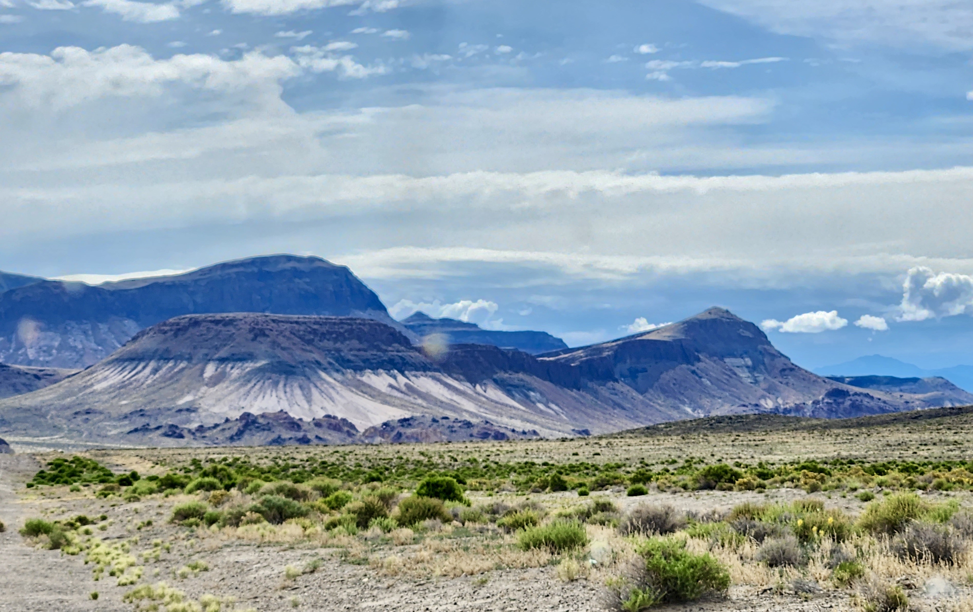
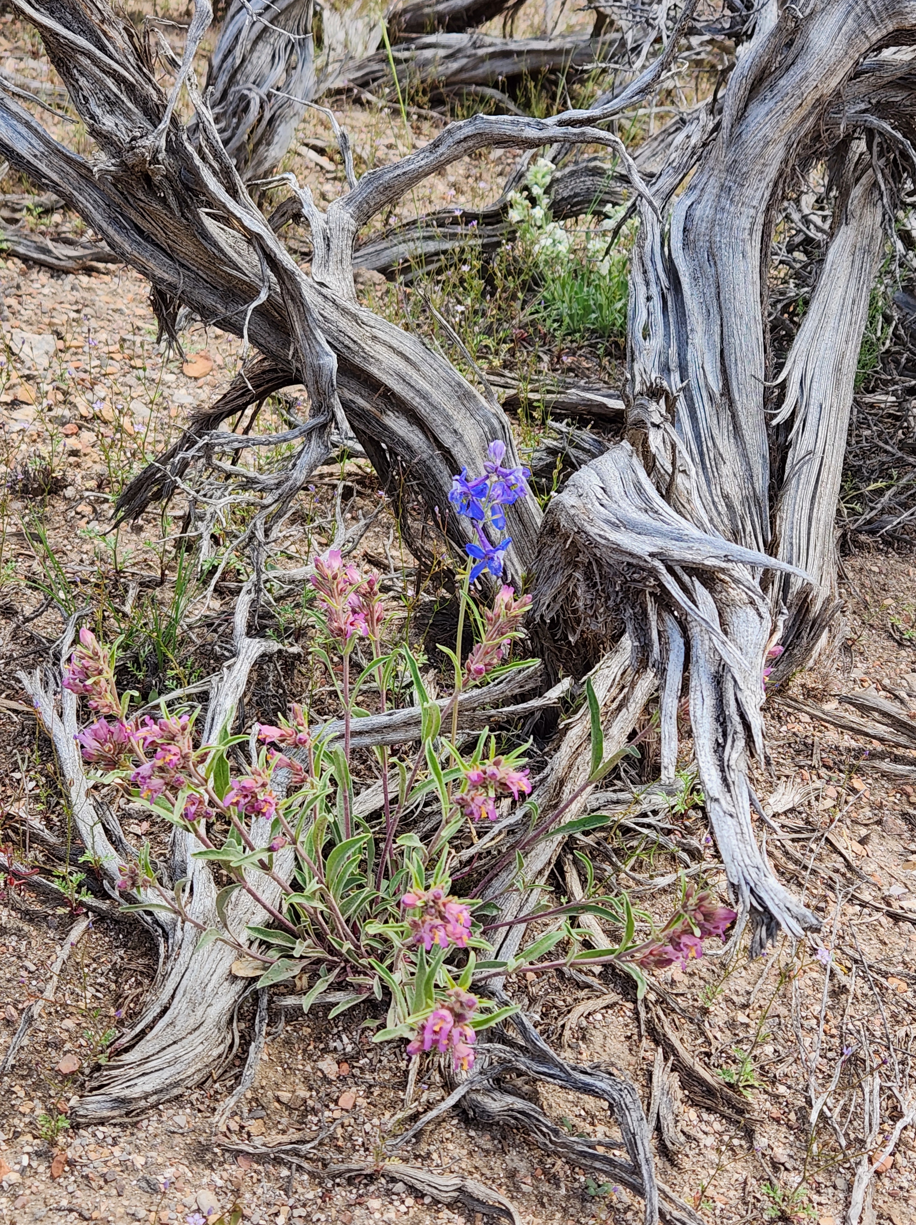
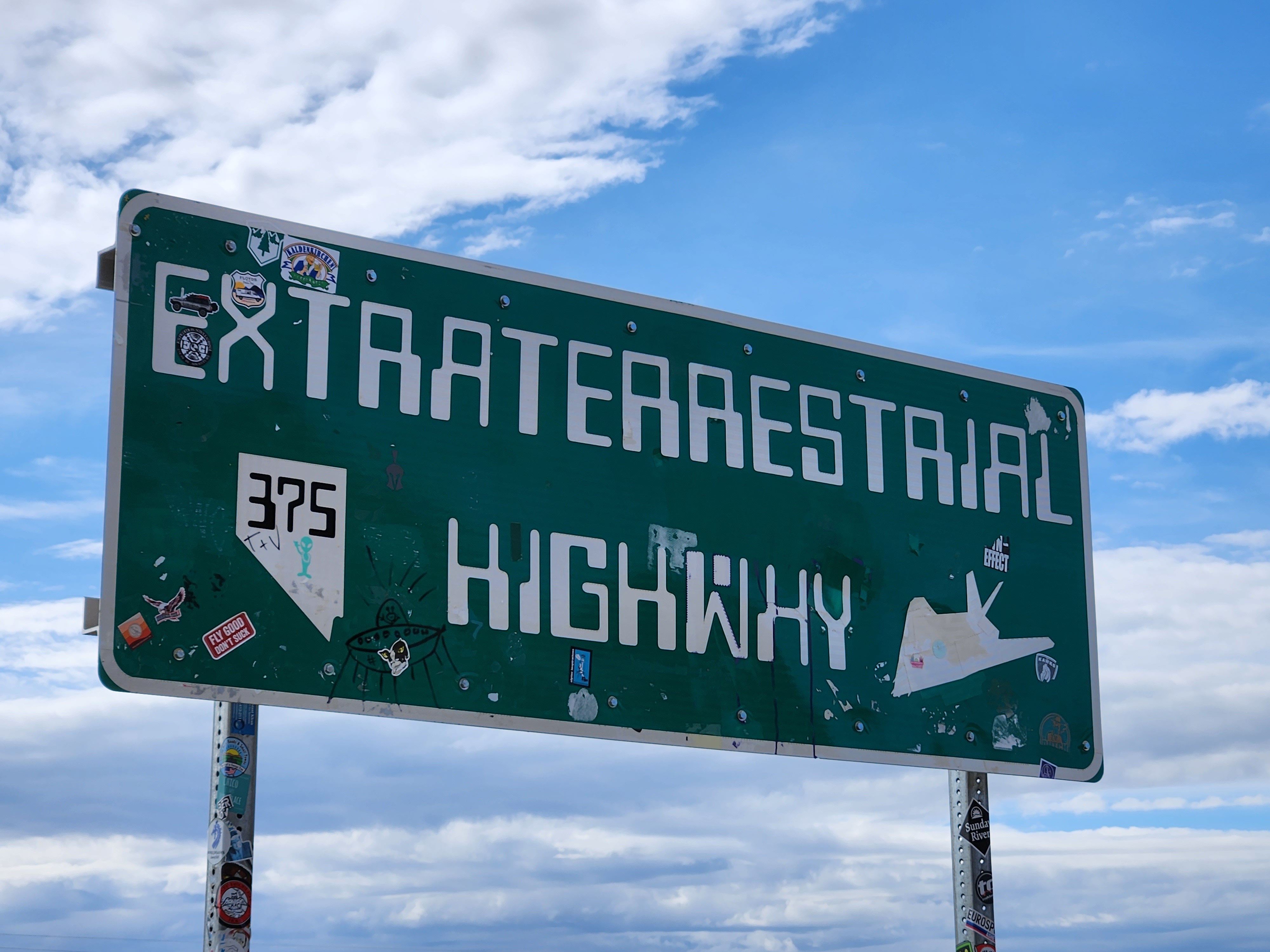
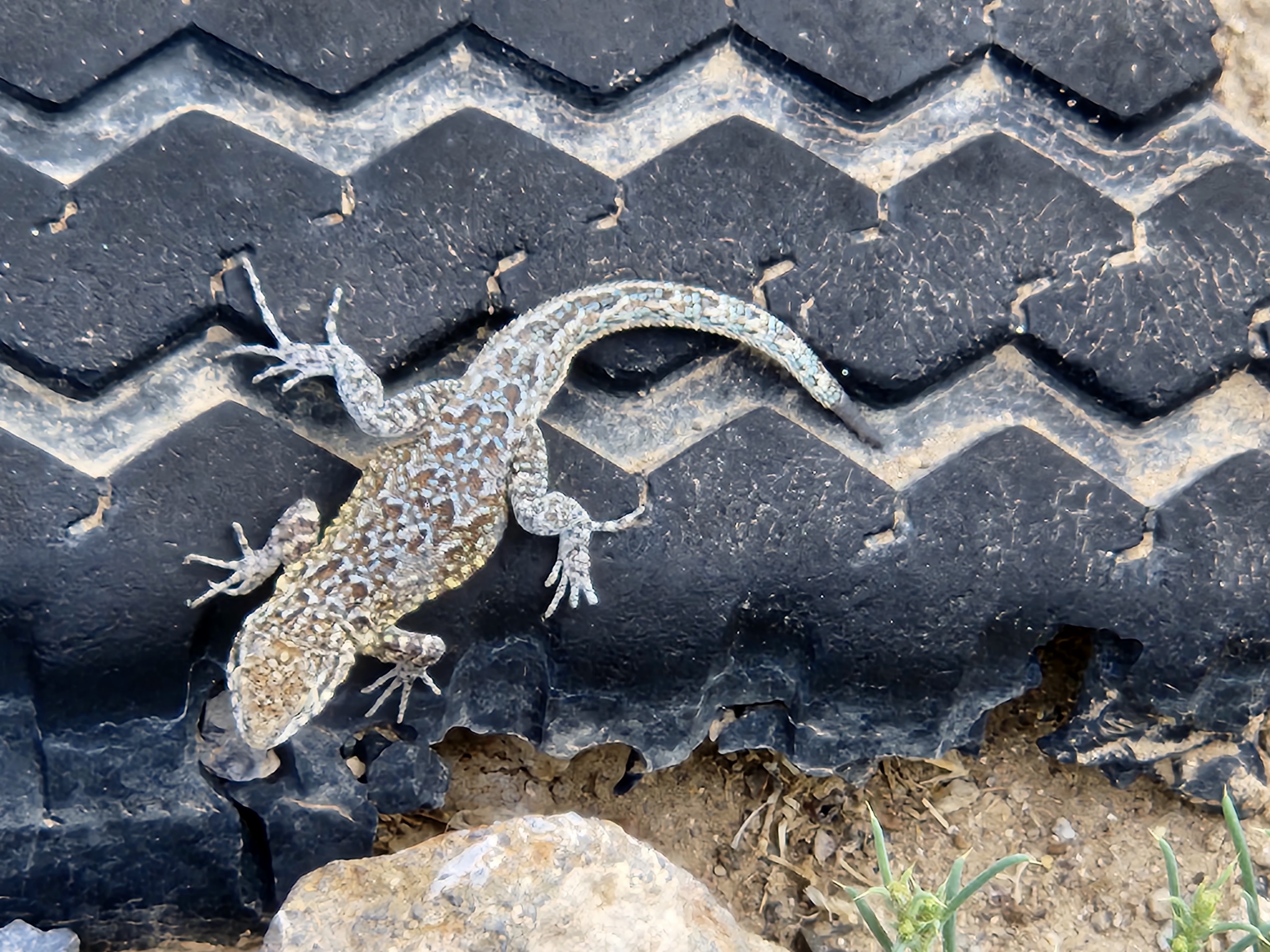
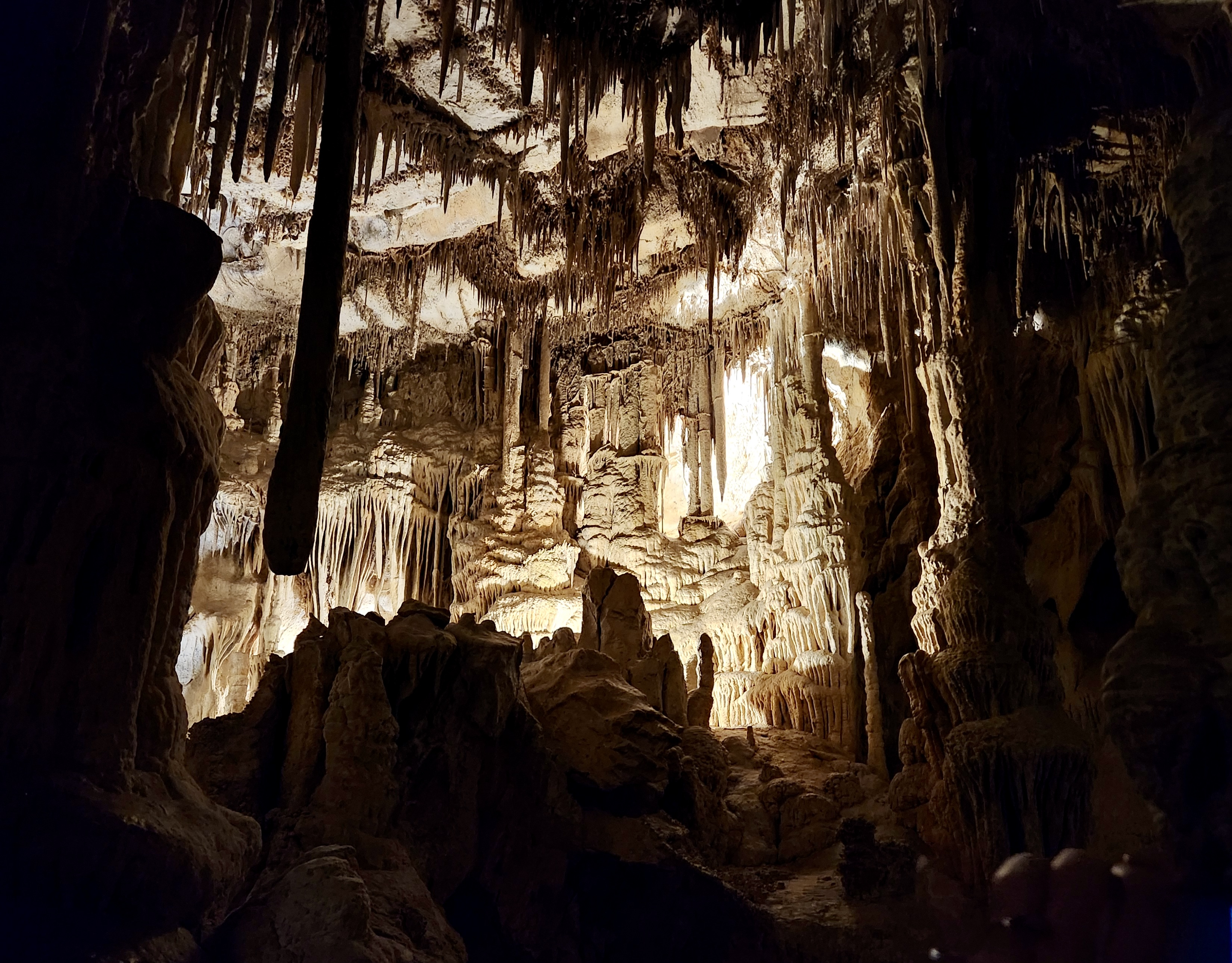
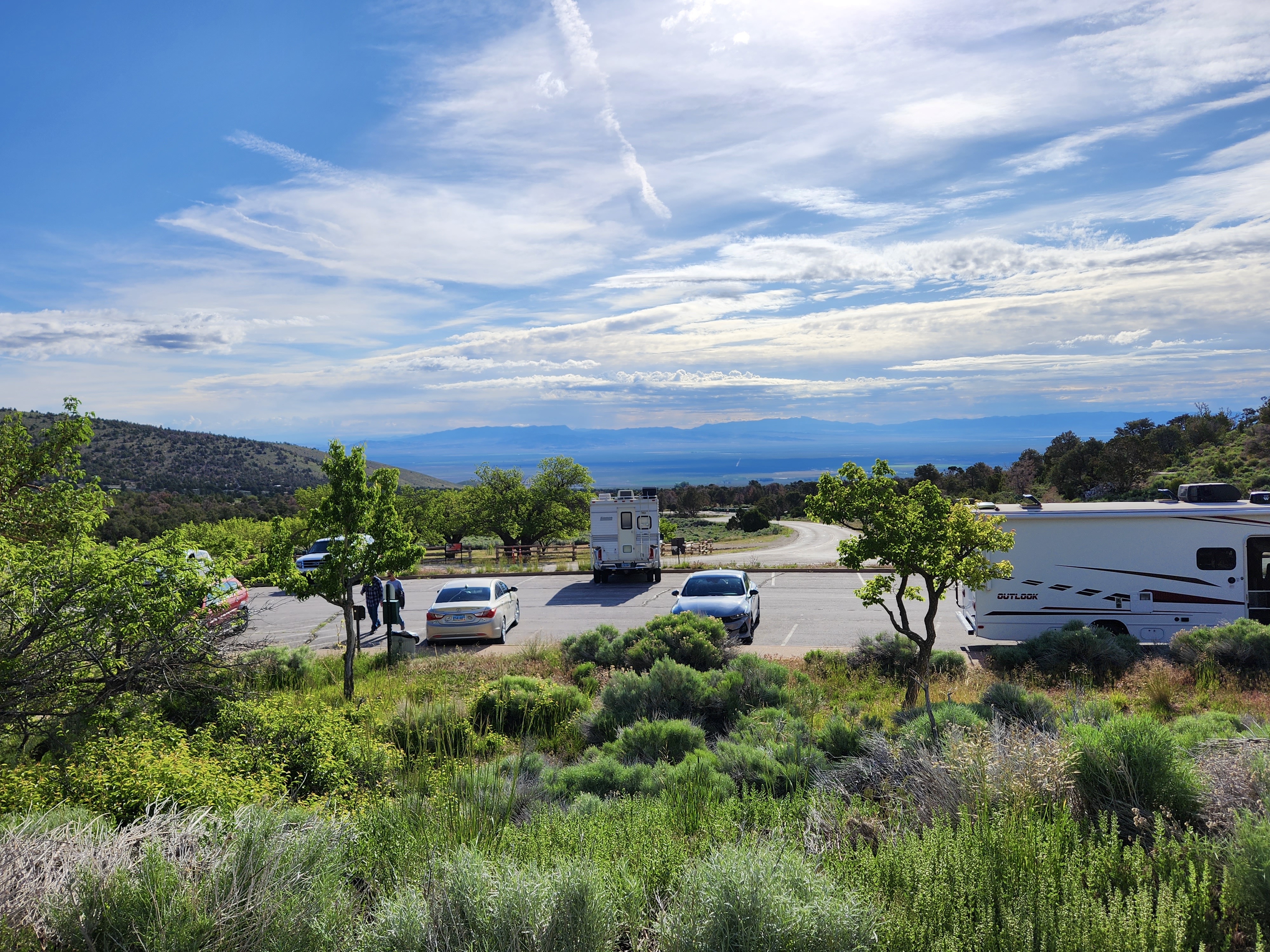
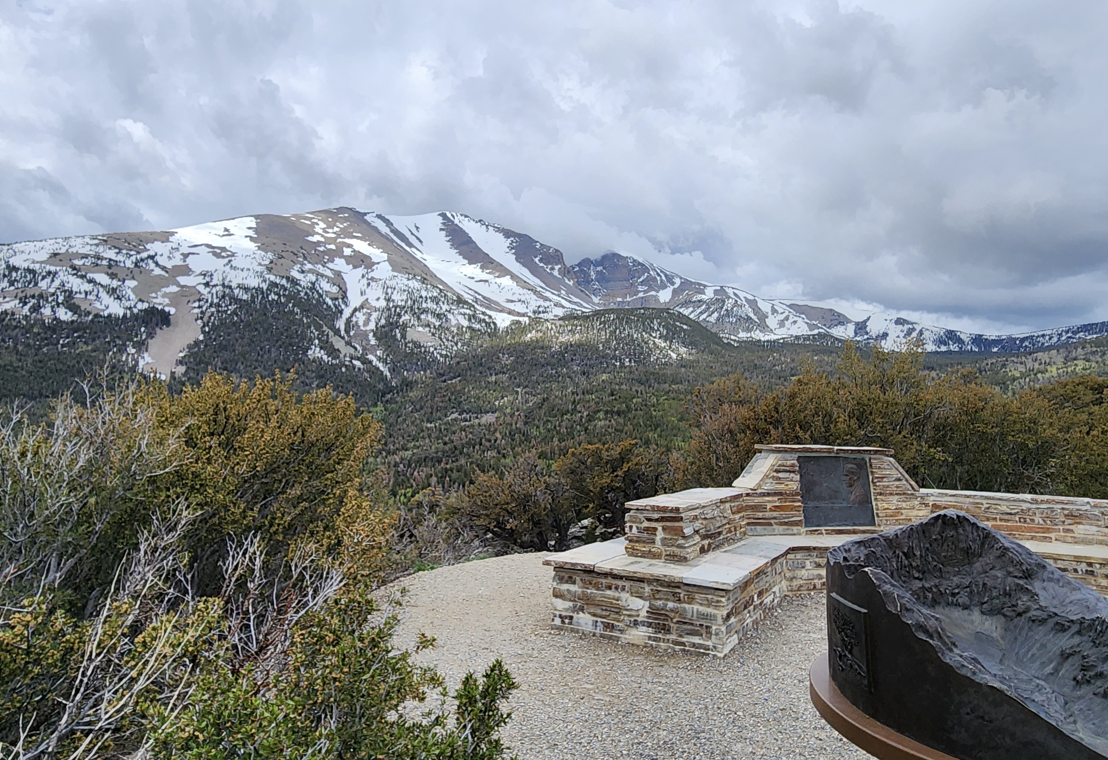
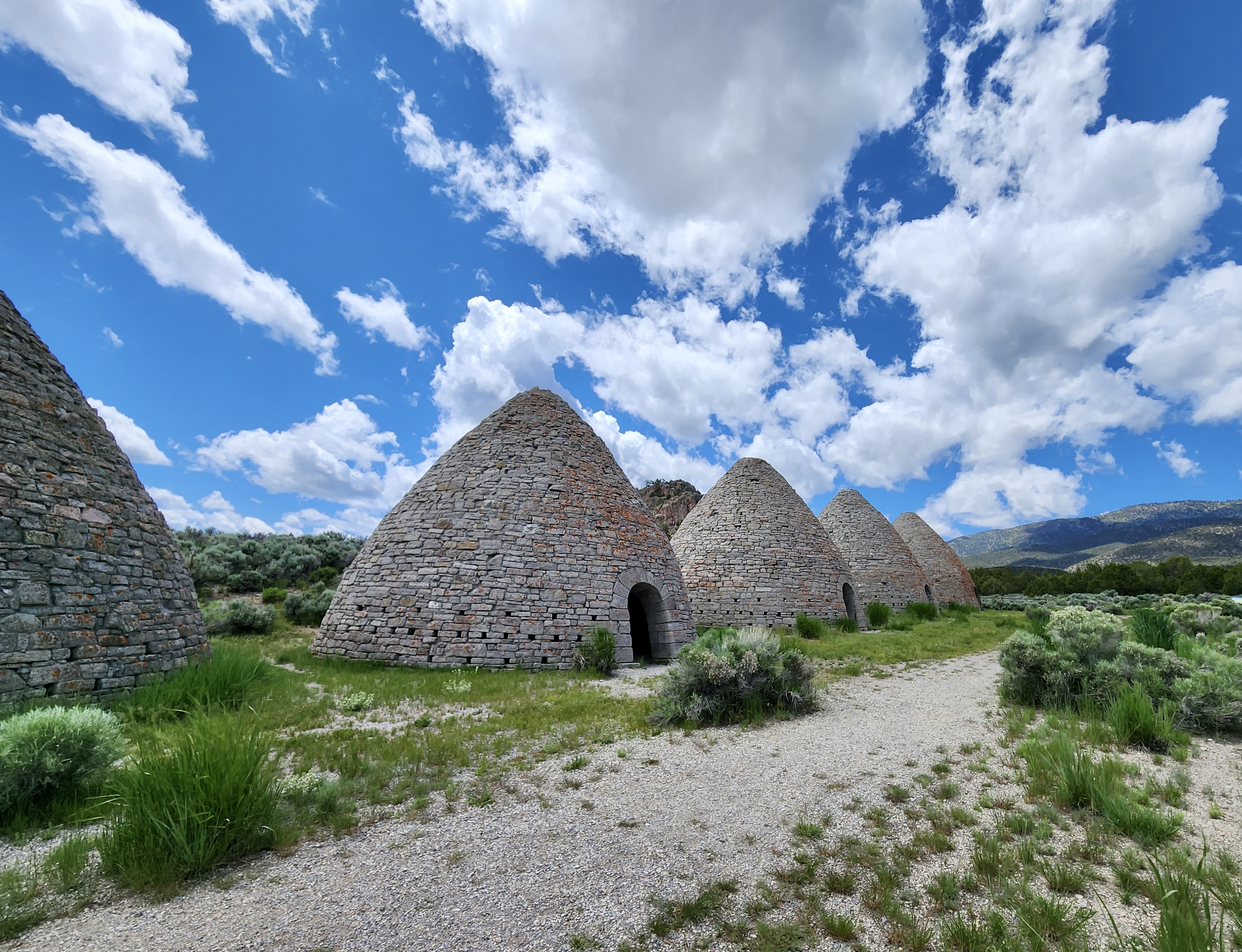
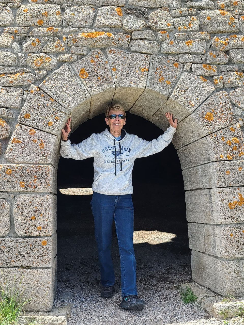
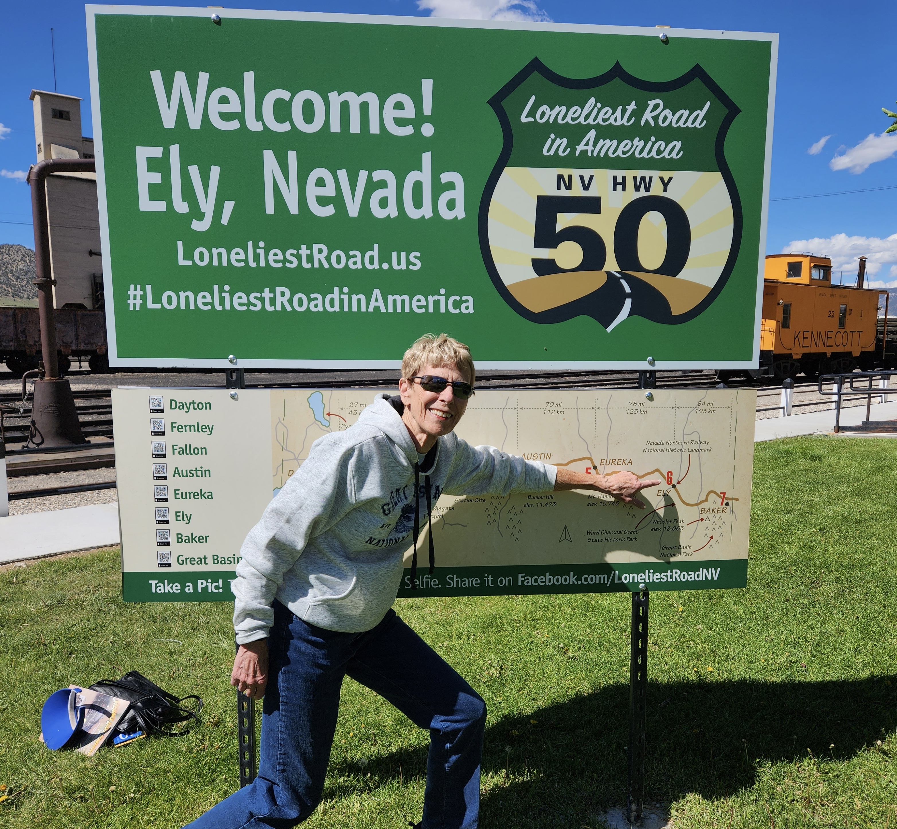
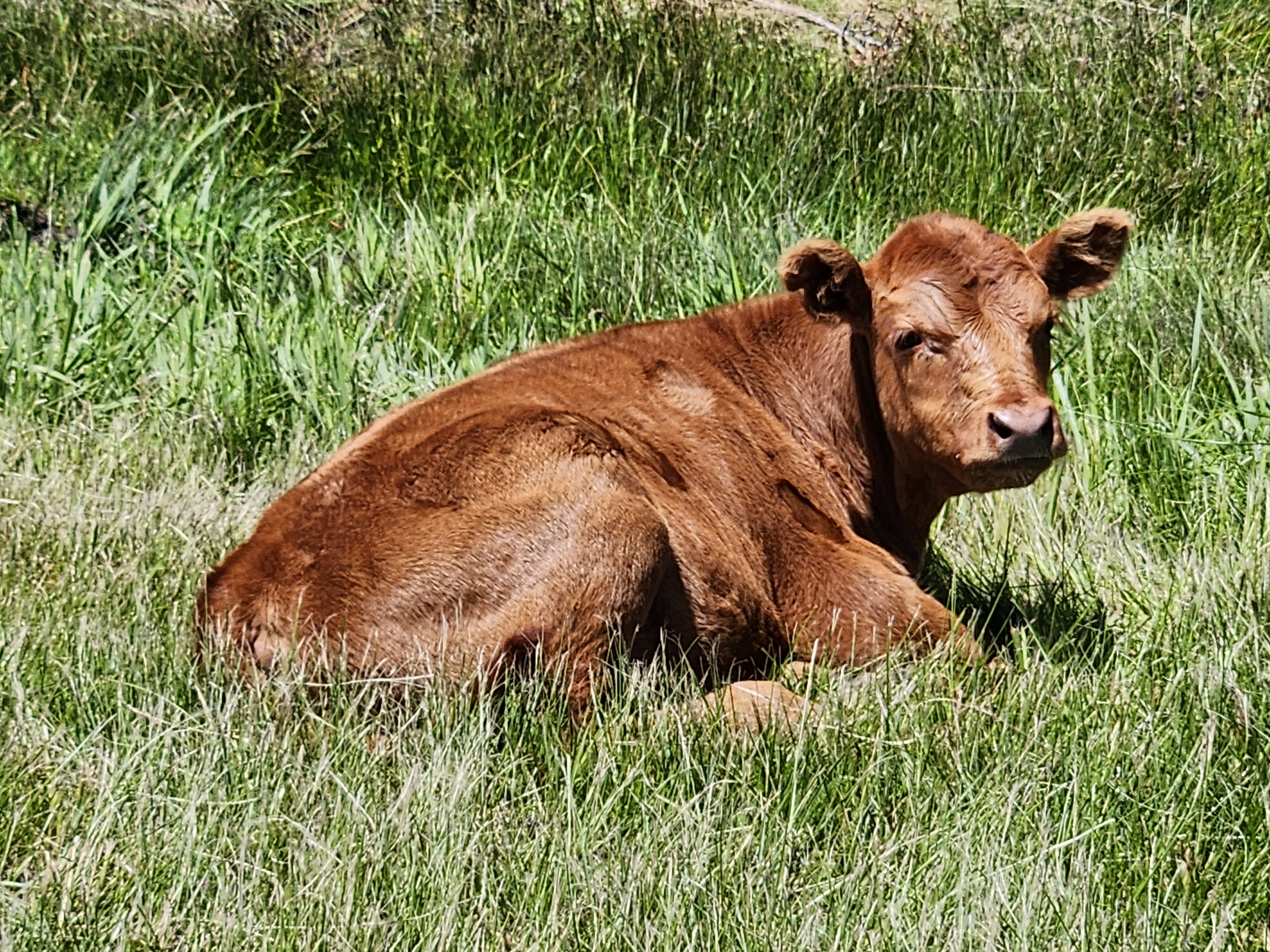
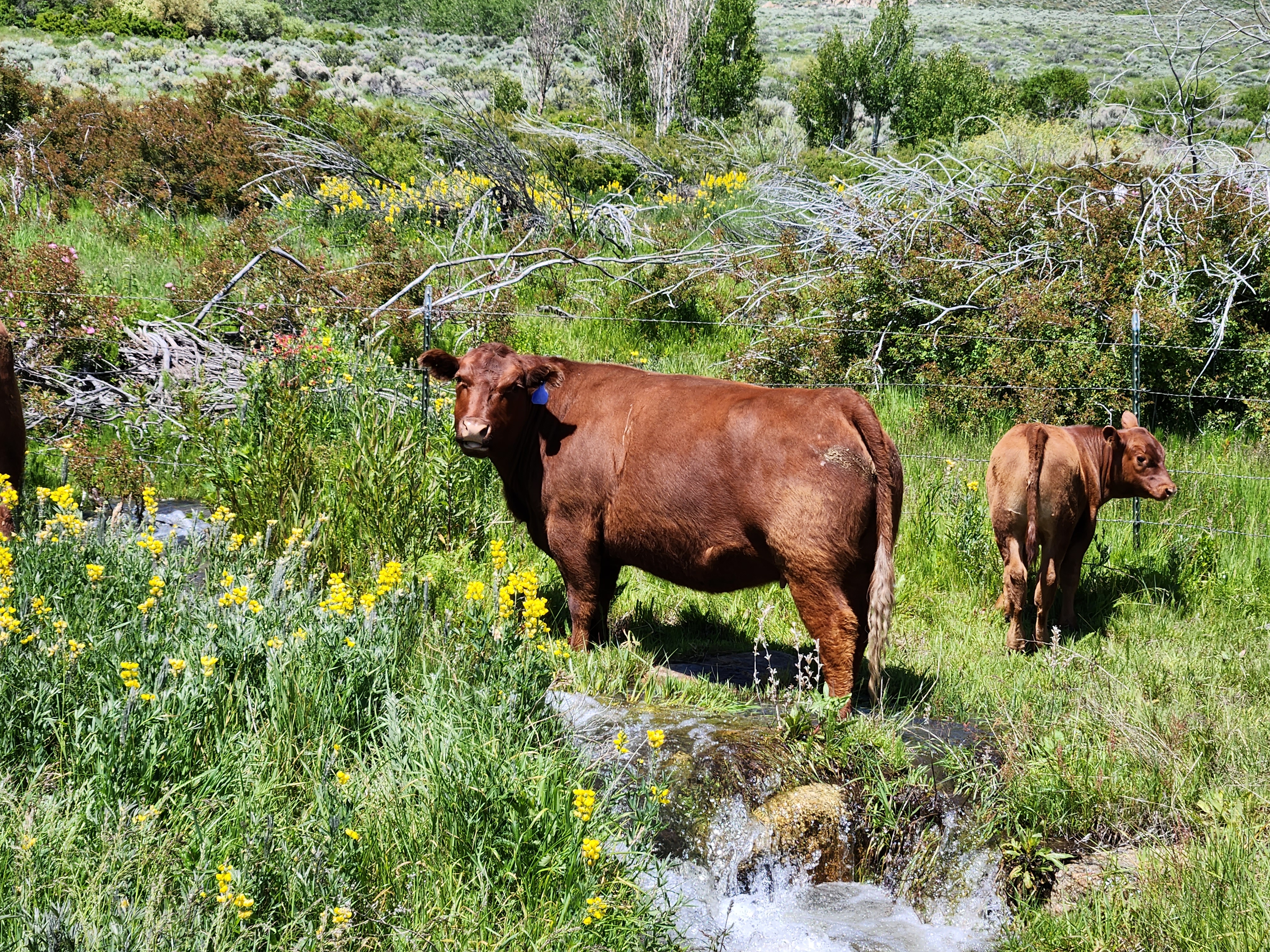
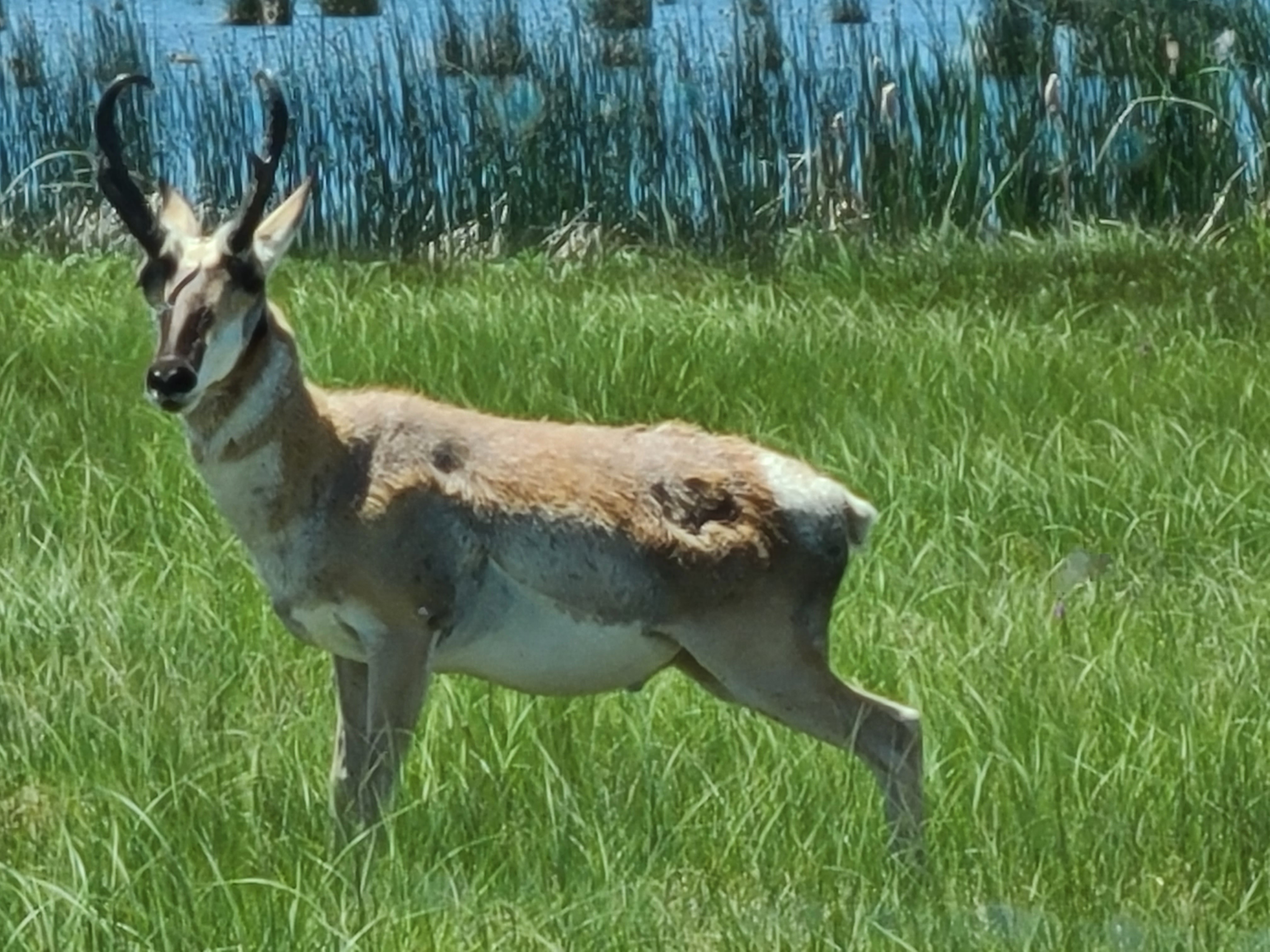
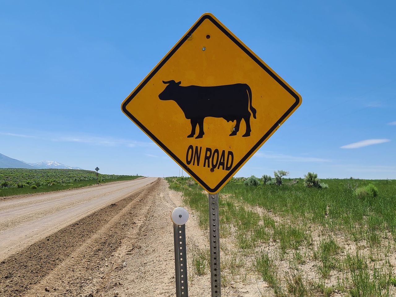
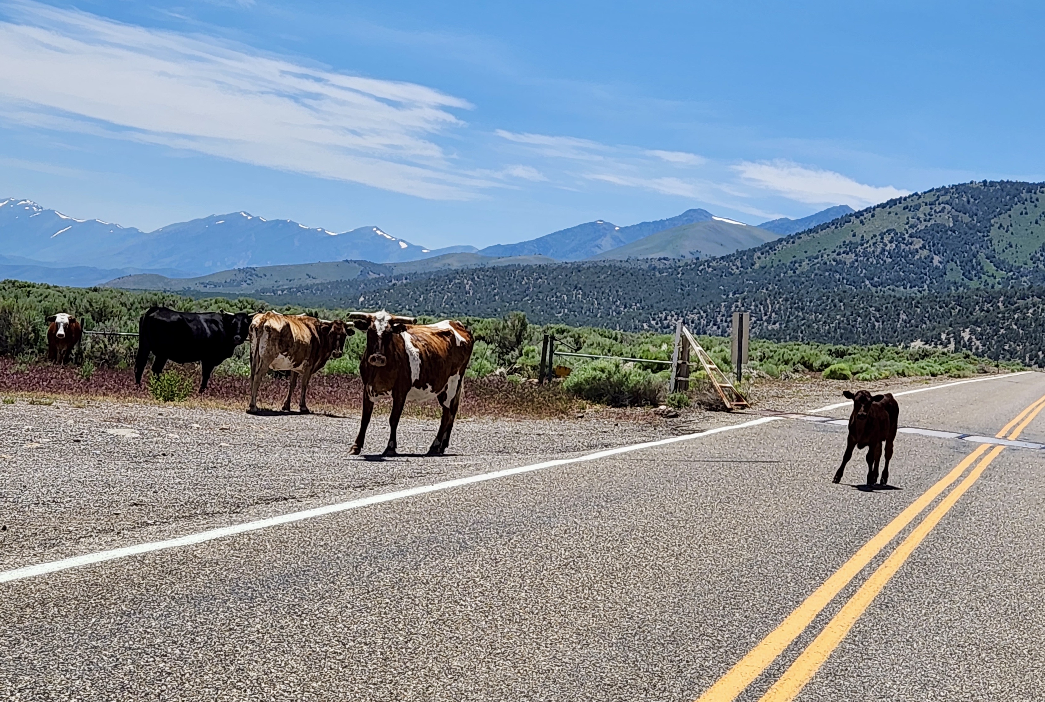
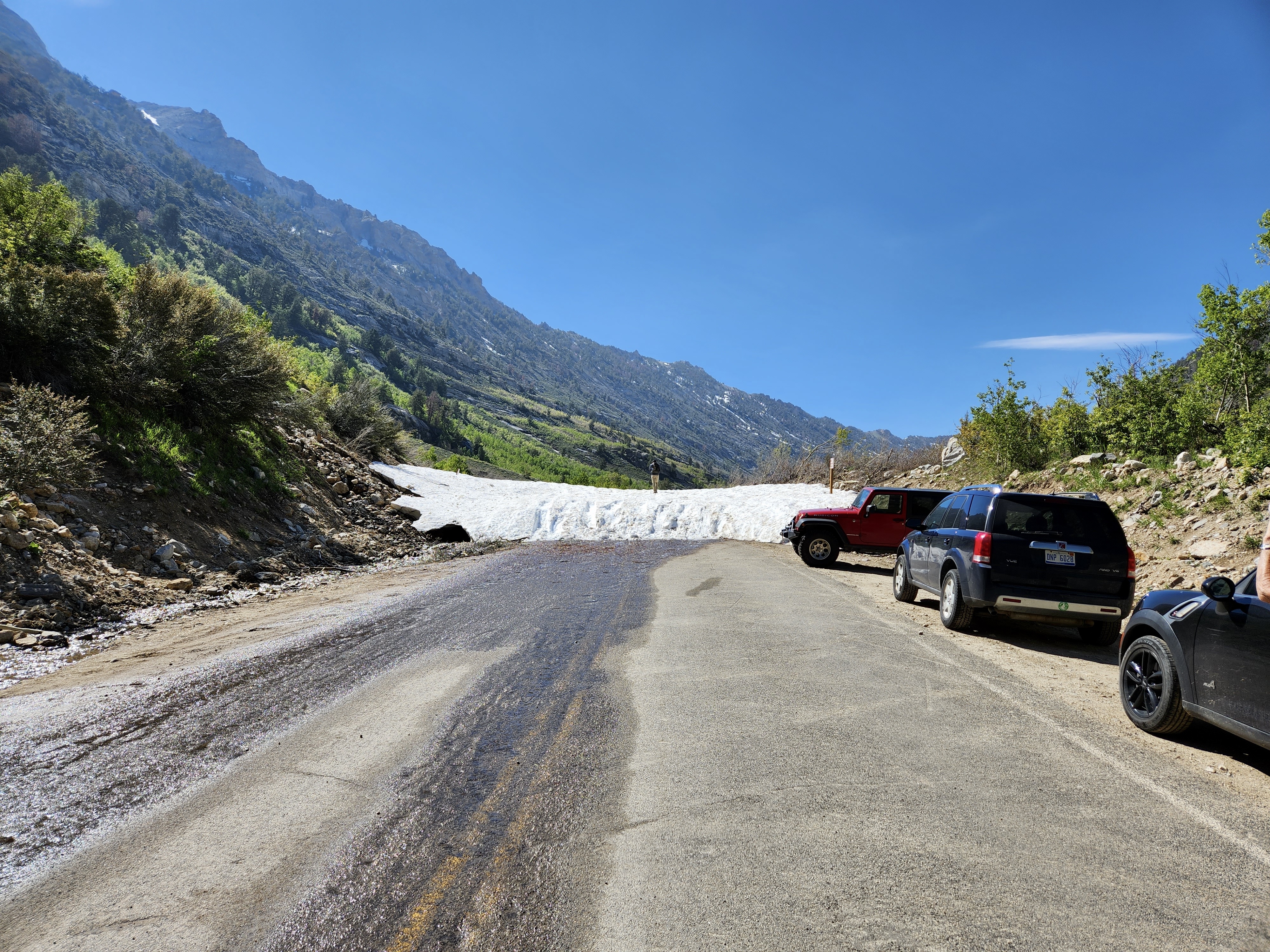
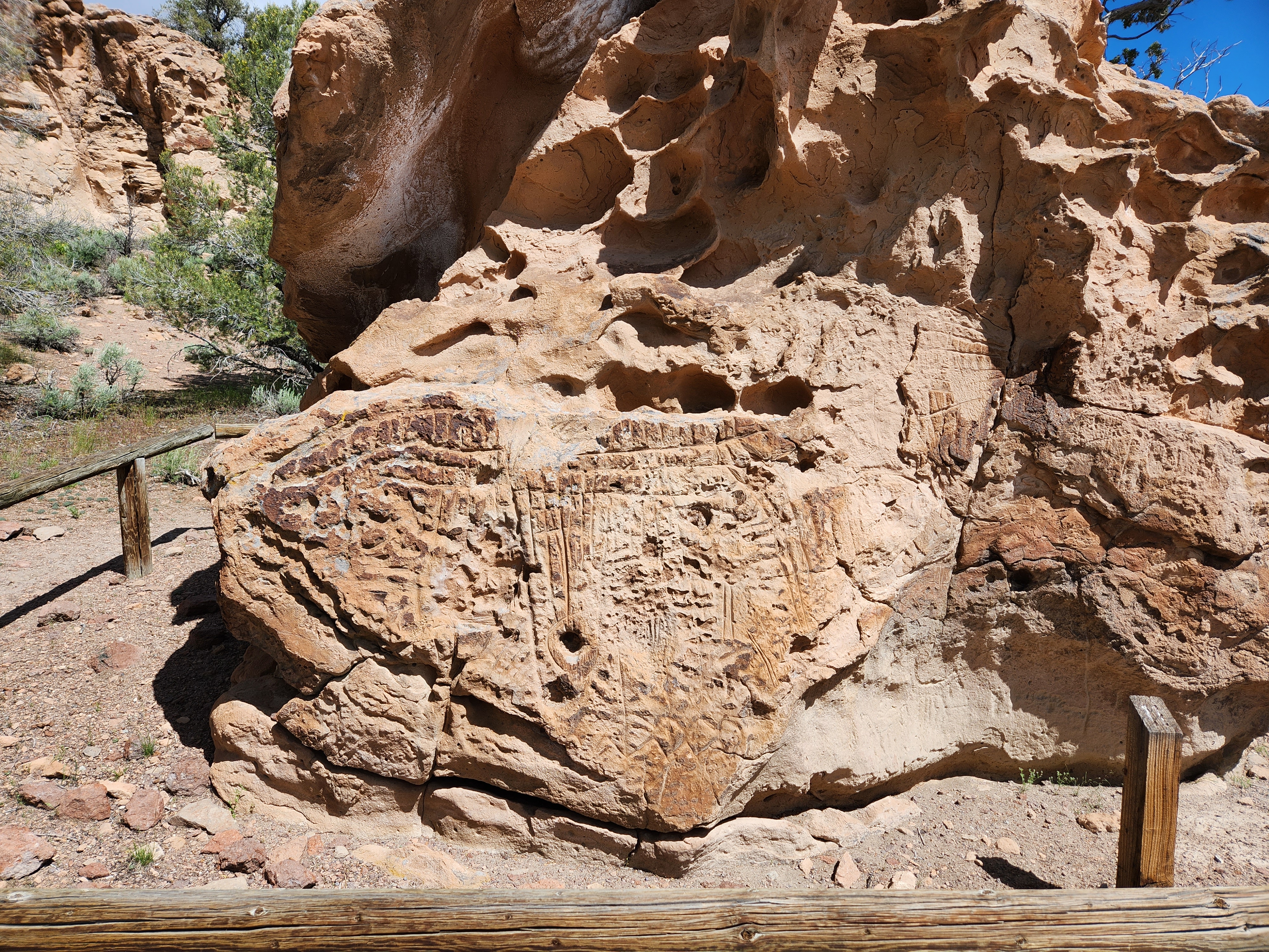
Our first night was in Tonopah, more in the south-central portion of the state. We stayed at the Mizpah, an historic hotel dating from Tonopah’s early 1900’s boom times. It is haunted but all I felt was the bed shaking in the middle of the night. I do know people who have seen and/or felt presences.East-West highways are few in Nevada and that is why we went south in order to go east. As most of you know, we had a long, cold winter and rainy spring. That weather brought us gorgeous desert flowers, lots of greenery and…road construction. It’s practically a season here in Nevada.A view from one of our construction stops. If you look closely on the bottom right corner, you will see some yellow flowers.A dead juniper with flowers growing among its rootsEven NDOT got into the ET spirit using far out font for this sign. Nary an ET did we see, but we did see the old shack and a lizard sitting on top of an old tire.Cathedral Gorge is like visiting an alien planet. The dramatic landscape of eroded soft bentonite clay creates all sorts of small slot canyons in which one can play and explore.Looking up in one of the slotsLooking down on a Nevada rest stop for weary travelers. While there are some very nice stops, we did see more than one like this one. 🙂During the first few years of Pioche, NV, boom days, it is said that 72 men “were buried with their boots on” before anyone died of natural causes.This is a long view of Boot Hill Cemetery in Pioche, NV. Supported by towers, the cable and buckets are part of a transport system taking ore to a smelter. It went over Boot Hill.We have always wanted to see a bristle cone pine tree and almost had a chance after we visited the Lehman Caves. But the road was still snowed in and we did not have any snow gear in which to climb a trail that we couldn’t see. So, we settled for a fake shot in the Lehman Caves Visitor Center.The Lehman Caves were extraordinary! A fabulous tour with bats and all! (We saw only a couple of bats near the entrance as that is where they roost)Every turn, we saw new formations and interpretations.Looking east from the entrance of the Lehman CavesMr. Wheeler, Nevada’s second highest peak at 13,063′The Ward Charcoal Ovens, used to burn wood into charcoal for use in nearby smelters.After only 3 years of operation, the boom waned and there was no more need for charcoal. Later, the ovens provided shelter for prospectors, stockmen and outlaws. They are now part of a state park.Our next major stop was Ely and the Nevada Northern Railroad, a 56-acre complex that has become a living museum (and also a Nevada State Museum and a national historic landmark). We really enjoyed visiting the museum, seeing steam and diesel engines plus many pieces of original equipment. All of these artifacts, large and small, are maintained by volunteers.A rotary snow blower.Our first stop along Nevada’s “Loneliest Highway.” This was our only stop on it for a couple of days because we toured other areas. Then we went home on that “lonely” highway, which isn’t quite a s lonely as they would have you believe.The next day was a real treat. We visited the Ruby Lake Wildlife Refuge that lies along the eastern foot of the Ruby Mountain Range. Getting there was a blast. We were on a dirt road that wound its way through idyllic ranch land with lots of visual candy. Lots of cattle on the road, wandering in and out of pastures. Apparently they like the grass alongside the road.Who you lookin’ at?Wetlands filled with fish, ducks, other critters, flowers, tules and other reeds.This is the best illustration I have seen of our Native Americans using tules to build their canoes/boats to use in the wetlands. Tules were also used to make baskets, decoys, sleeping mats and more. Our local people did this also in wetlands about 60 miles east of us.This pronghorn stood and posed for us for quite a while. This was taken from inside the truck because we were besieged with mosquitoes.It was like being attacked by “The Birds!” There were hundreds of them all over the windows. Oddly enough, there were none on the other side of the wetlands where people were fishing. Obviously, they knew something we didn’t.Yellow-headed blackbird also taken through the window.These signs are all over the place on dirt and regular roads where it is open range.This little guy didn’t want to move and Mama was beginning to snort and move toward us. We edged away as quickly as we couldOn a shortcut across the Ruby Mountains heading toward Elko. A very pretty drive.Lamoille Canyon – formed by a glacier and then waterThe 12 mile long Lamoille Canyon Road cut short by an avalanche…not just one, several.Standing on the first avalanche while looking at the second. Since we didn’t have proper shoes and were slipping a lot, we turned around and thought of the old saying “Discretion is the better part of valor.”Continuing the Highway 50 sagaAs it was Sunday and almost everything was closed, we did not spend much time in Austin.These creatures ( aka – katydids or Mormon crickets) greeted us in Elko and also in Austin. They literally cover the road and make it look as if it has become an ugly red river of some sort. We saw signs in Elko that said to be careful of slick roads because so many has been run over. I don’t think they bite but they are scary looking, eat all they can and crawl over everything. I saw a few that were maybe two inches long. Ick! This one is a female.Petroglyphs at Hickison Recreation Area on Highway 50.
We continued on Highway 50 through Fallon, Fernley, Dayton and then home. The Churchill County Museum in Fallon is very well done and worth the visit. I learned quite a bit there. Dayton’s museum is in an old schoolhouse and also very interesting with many donations from local residents and other donors.
Since Nevada is well known for its wild horses, you may be wondering why there are not cool photos of them. We must have seen at least 50 of them during our almost 1500 mile adventure. They were always quite a distance away and they are very skittery if one tries to get closer. These two were sort of close to the highway but continued to shy away from us. This is the best shot we got and, as you can tell, it is the end!