
Weather-wise, it’s been an amazing year so far. We’ve had better than average snowfall in the mountains, the wettest January in more than a century and gale force winds here in the Carson Valley. I’ve been lucky and have sustained little damage while friends have lost 100 year-old cottonwood trees, fences, roofs and power and sustained mud and water damage.
This past Thursday and Friday brought a new round of relatively warm storms that caused snow to melt in higher elevations and all that water has to go somewhere. Nearly all the major roads in and out of Carson Valley were closed by late this past Friday morning. For those of you who don’t know, Highway 395 (the primary road from Minden to Carson City) sort of bisects the Valley and when it’s closed, we have problems. That’s when we know that we can be very isolated because when that happens, other highways are closed as well due to bad weather.
Jerri and I went to Carson City Friday morning to do important errands and didn’t get back before 395 closed just north of where I live. Water was gushing over the road. It was an amazing sight. Of course I didn’t have my camera but I went out yesterday (with the camera) to retrace our route to show you some of the things we saw as we had to go more than 20 miles out of our way on a dinky country road that isn’t designed for heavy trucks and hundreds of commuter cars. You can imagine the size of the potholes that are only getting bigger because no repair work can be done until wet, icy and inclement weather is done for the year.
What amazed me most was how fast the water had receded after the rains stopped. The Carson River had gone down a few inches, Highway 395 was open, and some debris had been cleaned up. Following is part of the story that I was able to record on camera. (You will be able to see more detail if you click on the photo)

Sunrise on January 27 with snow still on the ground.

The Carson River is breeching its banks at Cradlebaugh Bridge on Hwy. 395.

Friday, that tiny settlement you can see in the back was totally isolated. The Sheriff’s Dept. used its armored SWAT vehicle to rescue 10 people stranded by fast moving water. The river is adjacent to their property.
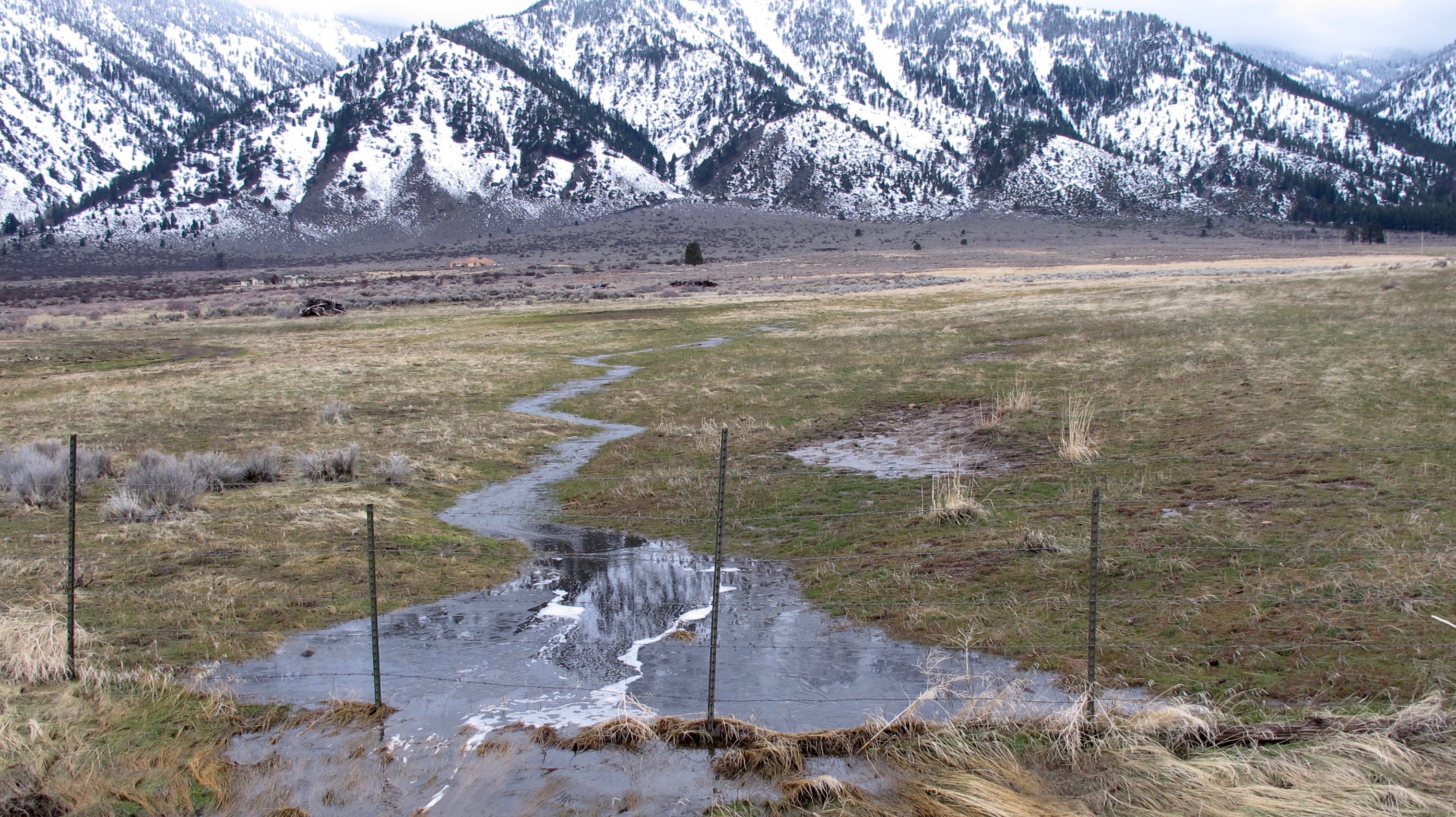
Tiny rivulets and streams were spawned by the rain and snowmelt. They seemed to be everywhere I looked.

This may seem like an odd place to take a picture. But normally, this is a dry area where a large earthquake fault can be seen this escarpment. The melt has to go somewhere and this became a natural stream.
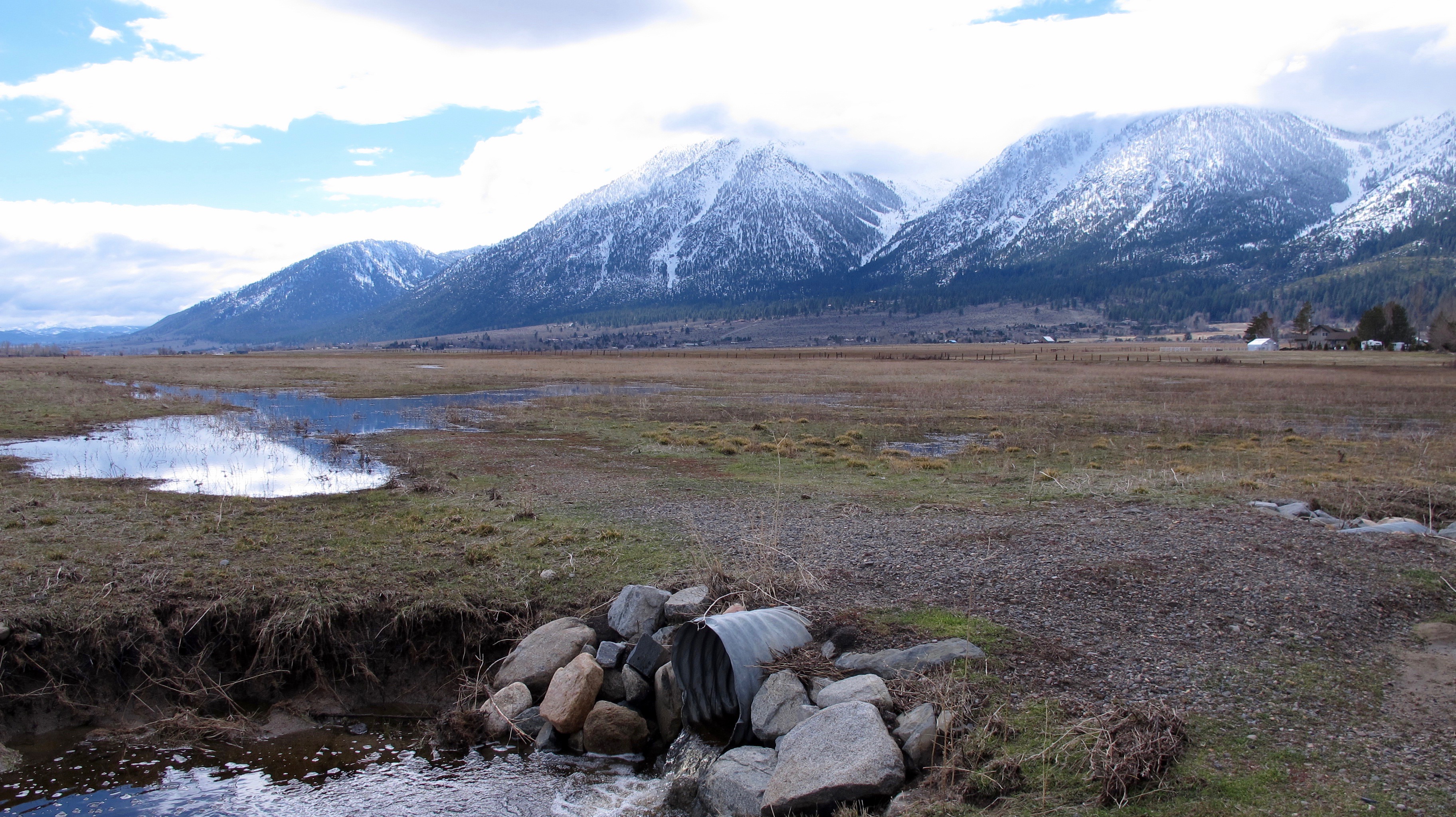
Two days ago, this area was flooded and one wasn’t able to see this culvert pipe much the road it’s next to

Somewhere under this water is the main east-west road to Genoa. This property belongs to James Settlemeyer, one of our state senators. Photo by Record-Courier
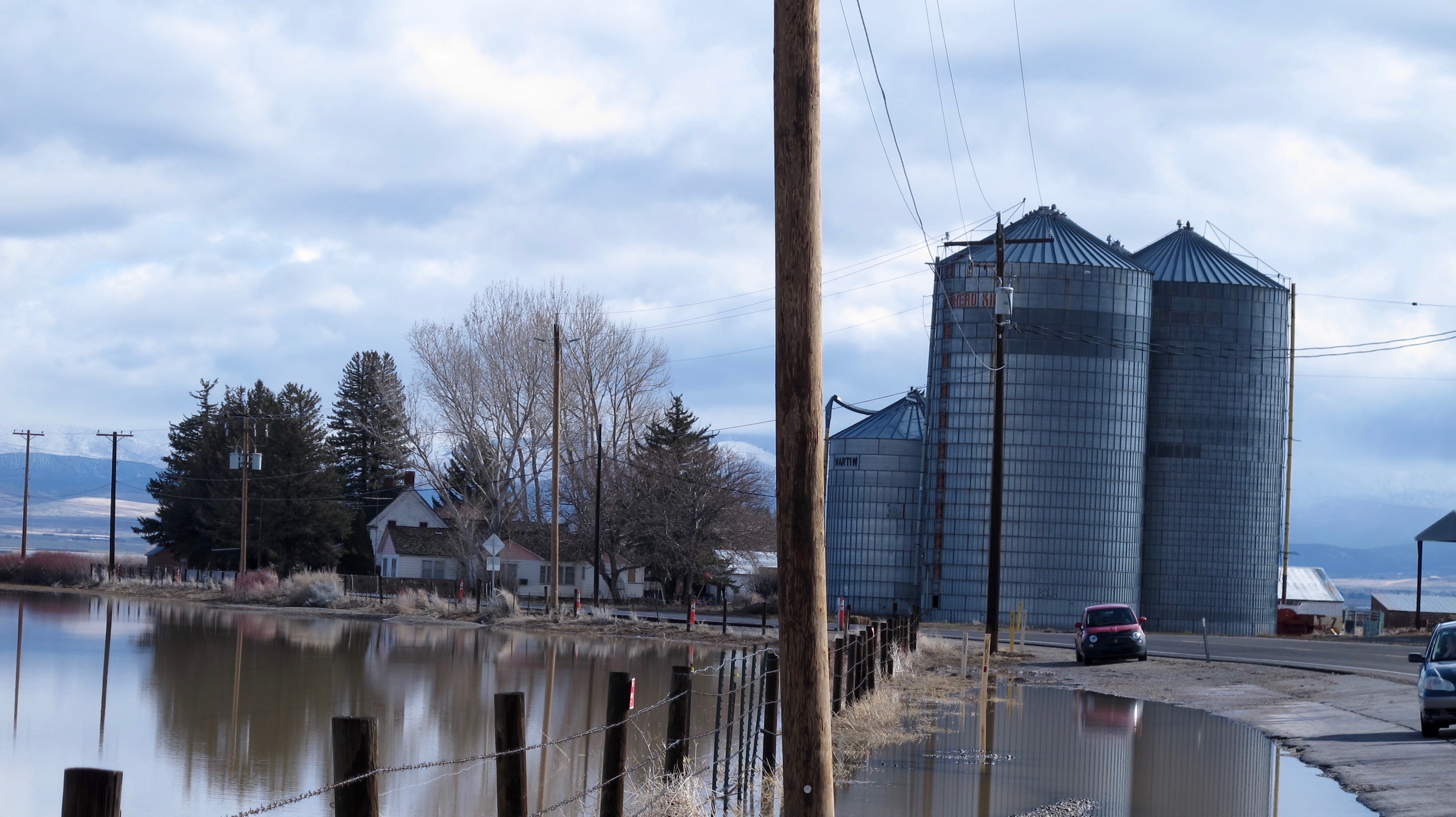
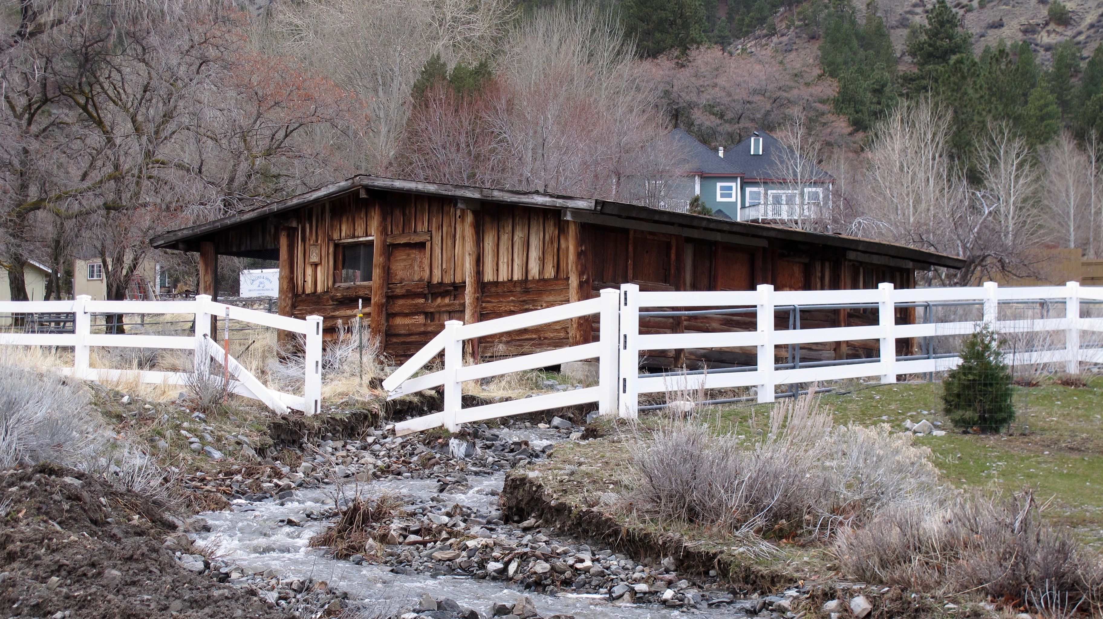
This isn’t the same scene but the house is the same. You can see how much the water receded in two days. Genoa Lane has been reopened. Look for these silos in a later picture
A picture I showed you in a recent blog.
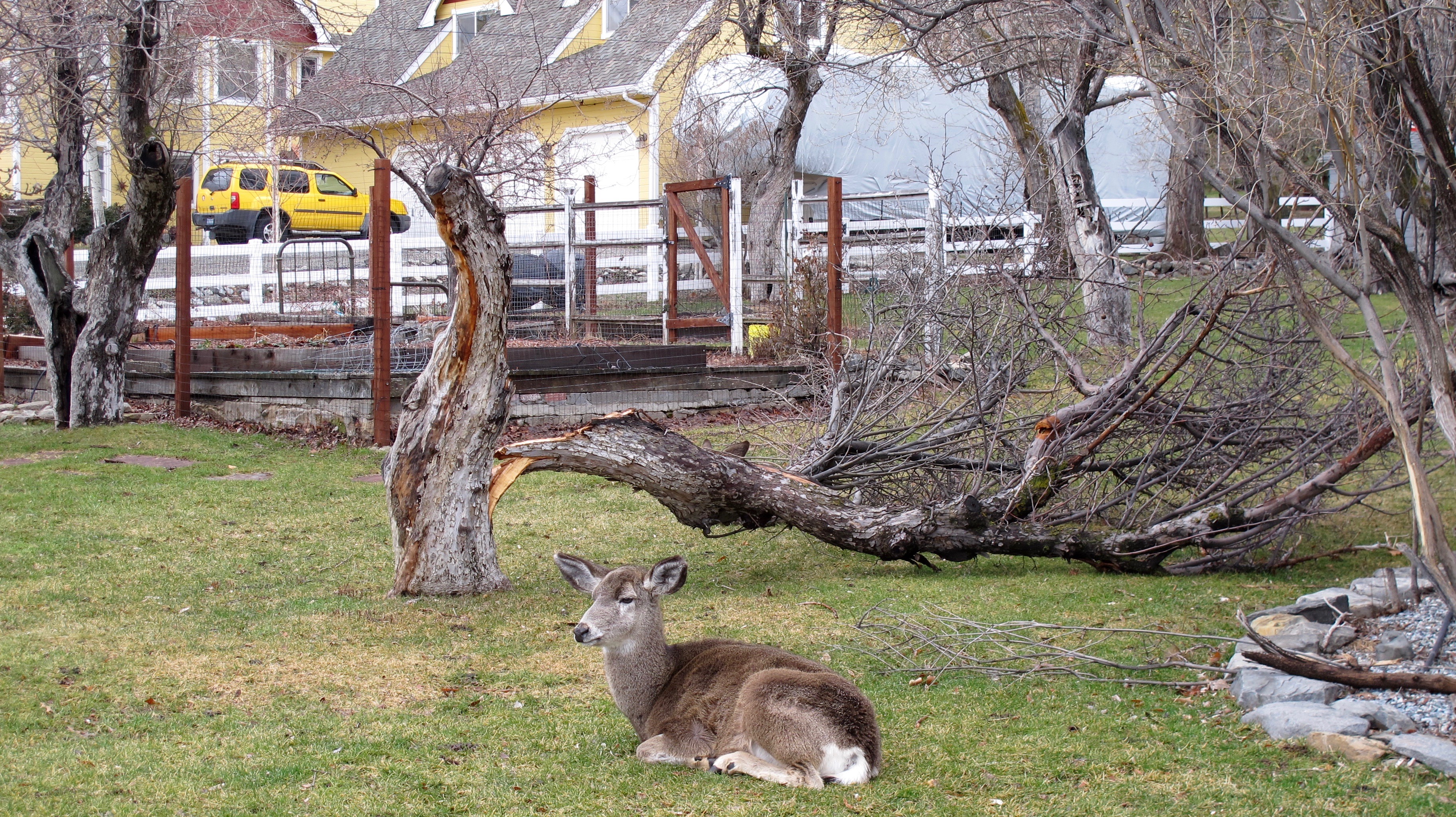
The same tree after our 80 mph winds. This yard is a favorite of the Genoa deer
A broken fence might be the least of the owner’s problems here.
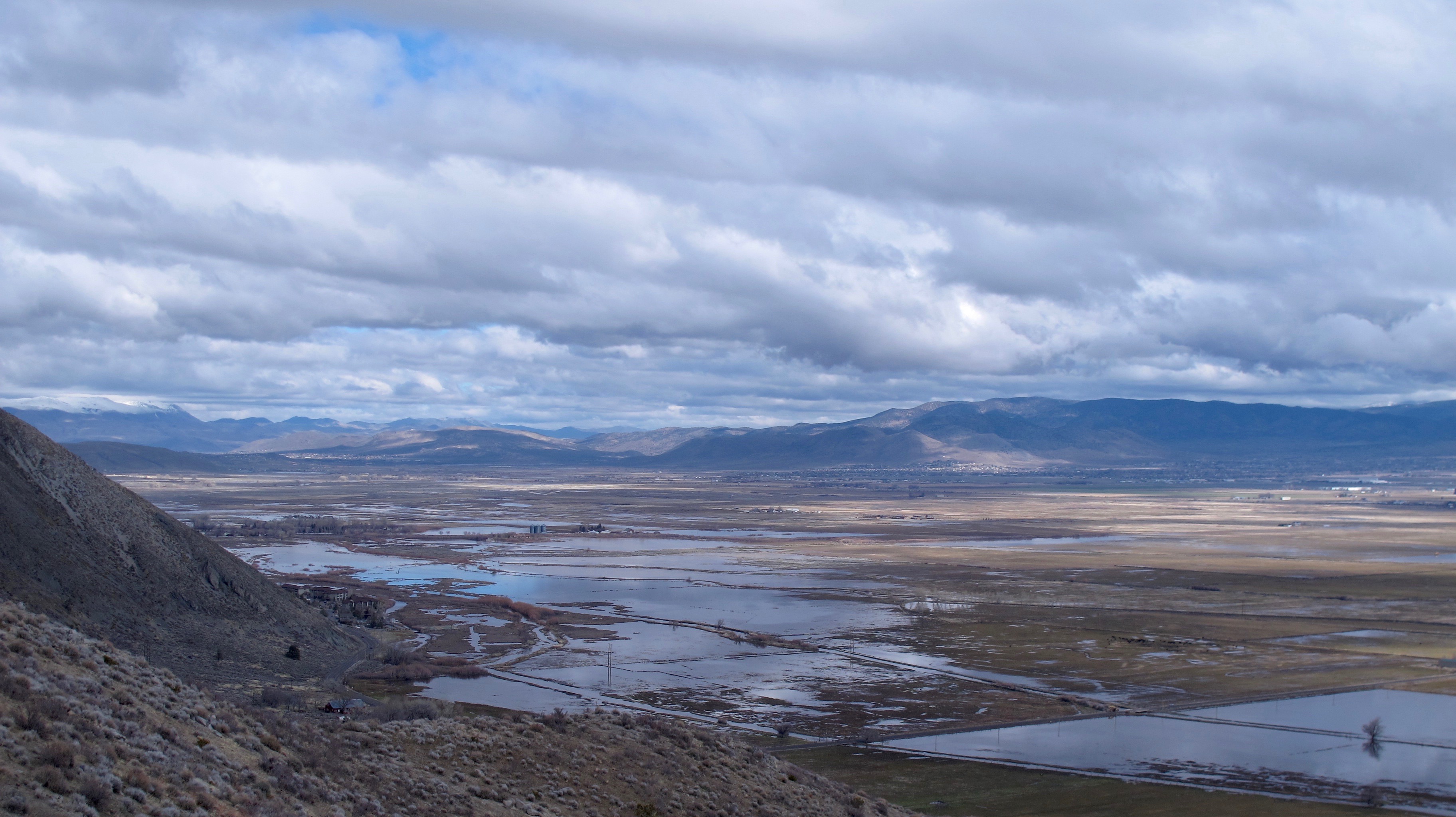
Looking north from Kingsbury Grade. Wally’s Hot Springs is the enclave at the bottom left that sort of juts out near the water. The Settlemeyer silos are also in this picture.
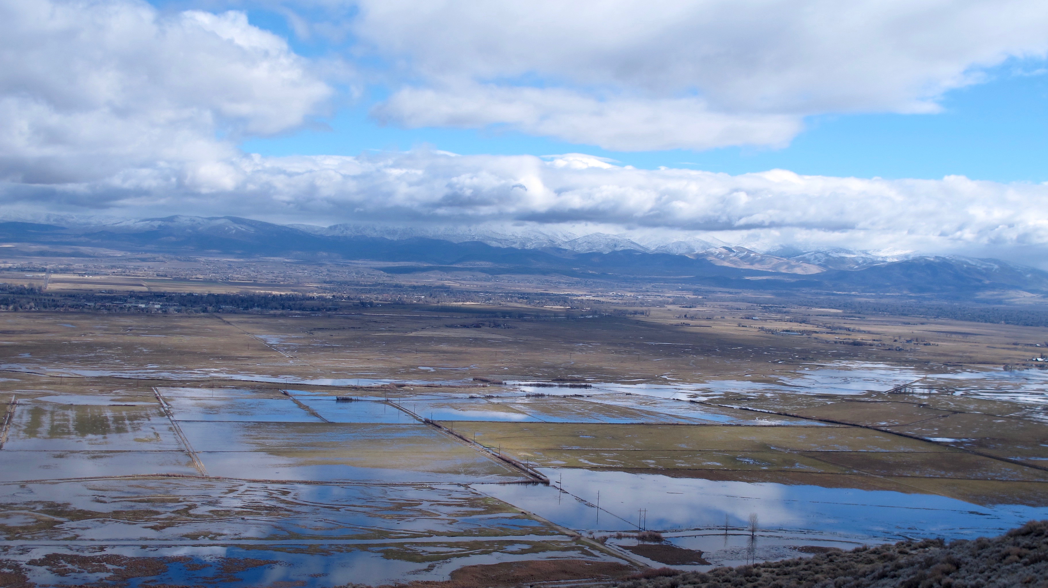
Looking southeast from Kingsbury Grade. Most of the flooding is between the Sierra Mountains to the west and Highway 395 on the eastern side.

This giant pond is in open range country right next to Stephanie Way, one of the main roads into what is called the Johnson Lane area. This area has been flooded since Christmas. At one time, the ice was so thick, I think we could have skated on it. All we needed was a Zamboni to get it ready for us! My house is about a half mile to the left.
You may be asking why is there so much flooding. One factor is that the East and West Forks of the Carson River merge near where you see most of the water. Warm rains that arrive one after another cause excessive snow melt that runs off into already saturated ground. The rains have come so often that we didn’t have a chance to dry out enough to allow more saturation. A hydraulic engineer can name many more factors, but these give you an idea. I have to give credit to Douglas County for having worked on flood prevention for times such as these. They were quite unprepared for the 1997 flood and this time, they have been able to stave off terrible loss around the county by stationing resources in critical areas. Yes, there has been expensive damage, but without their plans, better weather prediction technology and residents who have tried to prepare for floods, I do believe it would have been a lot worse.
I think one of the positive aspects of all this water, which, by the way, has helped our drought situation, is that we might have a gorgeous display of wildflowers this spring.

Great shots and discussions. I admire your tenacity to return the next day to document. Shoo
Wow…thanks for the photos… a lot of water and with the good possibility of more storms and more sudden melting things may become worse…Stay dry and by well…Sam