
Jerri and I read an article in the Nevada Appeal describing a cool hike that takes off from State Highway 208 going to Yerrington, about an hour southeast of Minden. It was a good thing that we left relatively early as the hike was longer and more strenuous than we had anticipated, plus it was hotter than we had anticipated.
After you’re over the first ridge, the trail winds along next to the river for a while, then takes a sharp right up through the canyon. It’s a slow ascent to the summit which provides some great views of the surrounding area and mountains, then it’s a little steep and rocky through the next canyon you return you to the beginning. Description of the hike by a previous hiker.
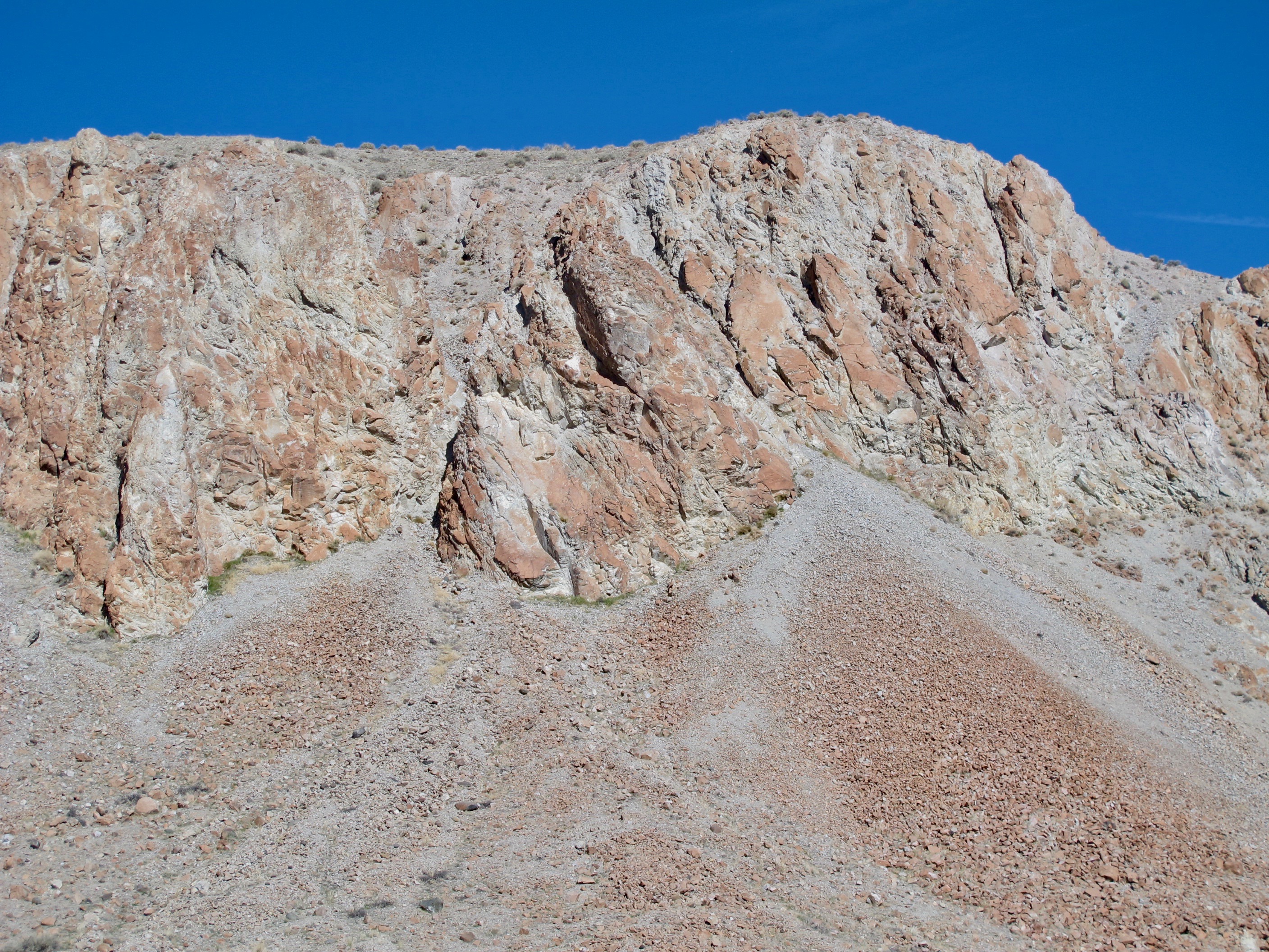
As we got over the first hill and were in relatively isolated territory, Jerri commented how quiet it was. Just then, we heard a rattle of rocks and we witnessed a small landslide coming off a bluff. We were in no danger as it was a good 150+ yards away. (If you want to enlarge the photo, please click on it)

As we walked on, we noticed the same hill became more vibrant in color.
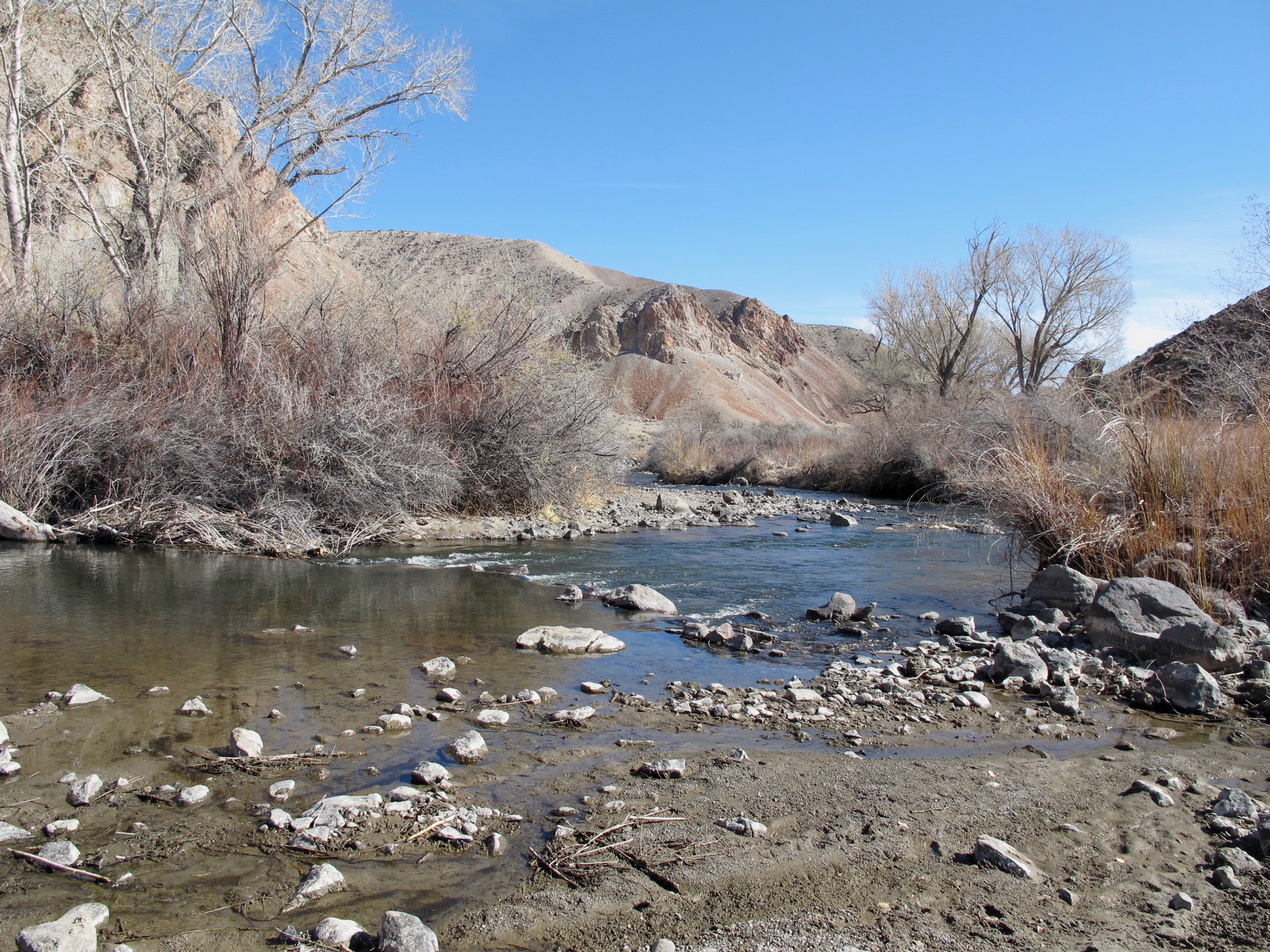
We walked around said hill and found the west fork of the Walker River. What a pretty riparian place. Critters such as ringtail cats, beaver, and raccoons find shelter and food here. Raptors and other birds are abundant in the area. Alas, we didn’t see any critters except many lizards.

Believe it or not, the highway is not even 30 yards away from the river.
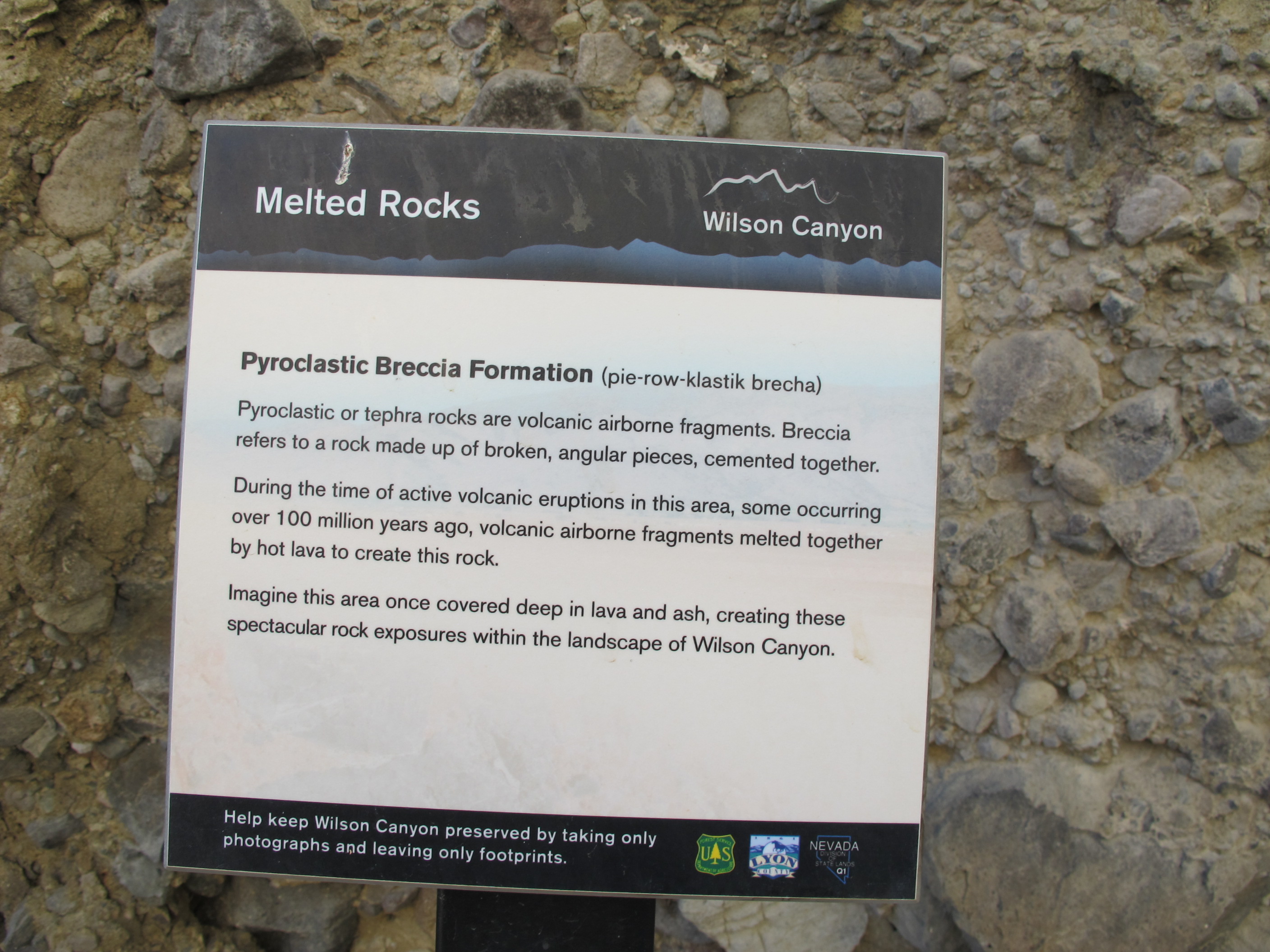
Here is one of the signs explaining geology and/or plant life with some of the melted rocks behind the sign.

This is what the Melted rocks sign described and what the rock looked like from a distance.
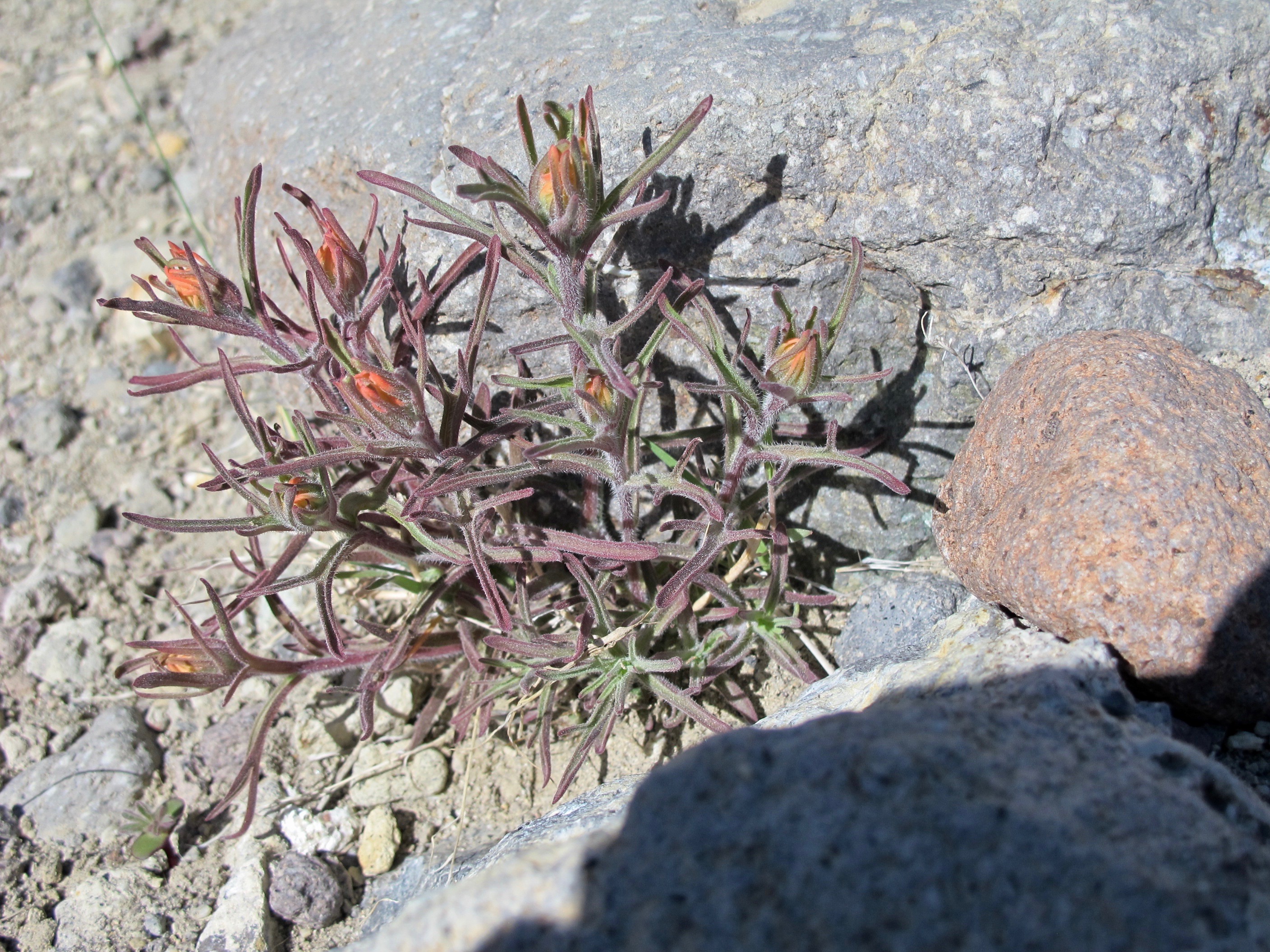
We saw many plants such as Mormon Tea and several sage plants. But the Desert Paintbrush was the first colorful plant we saw. I believe this is also called Indian Paintbrush and guess these signs are PC.
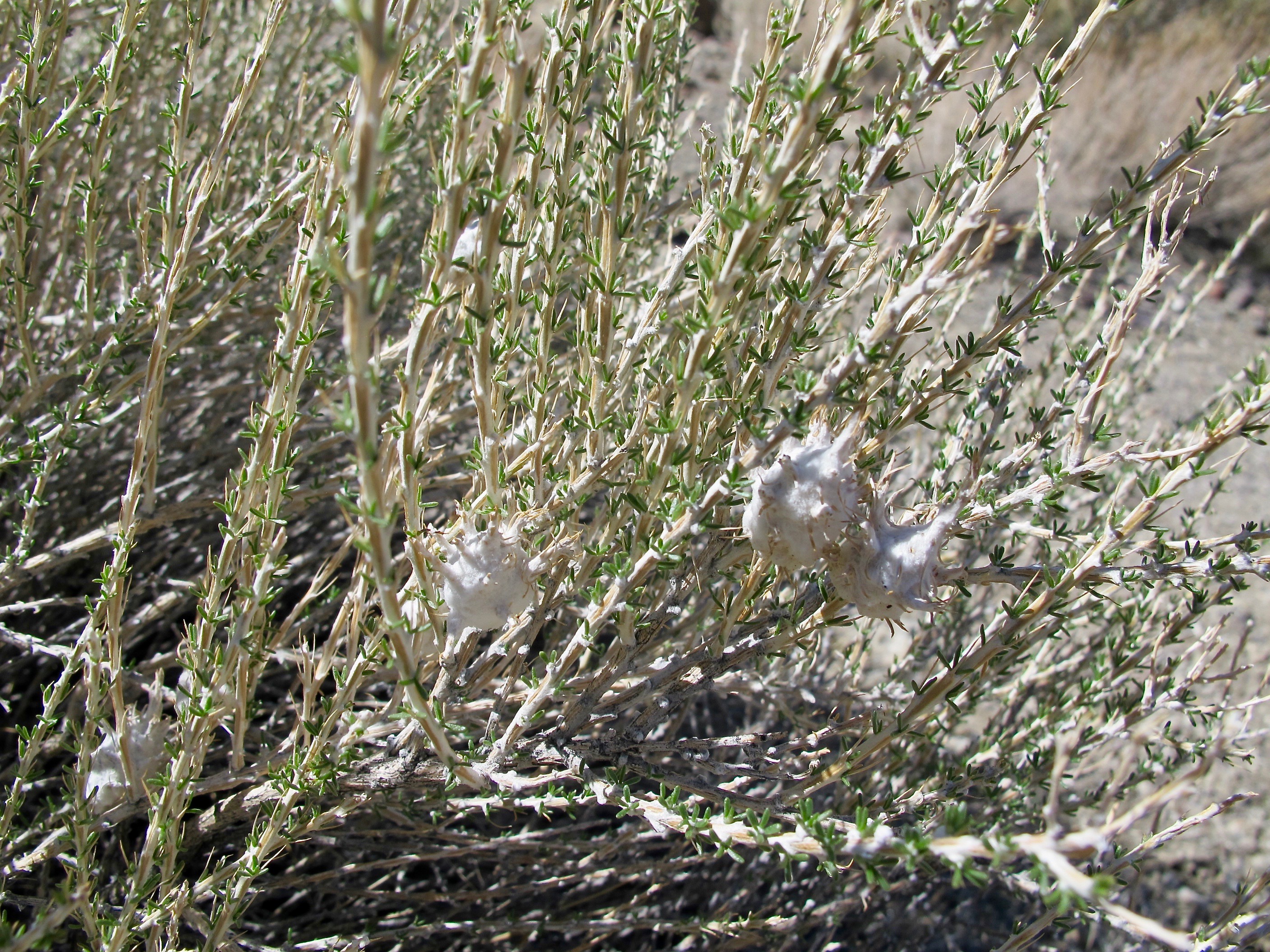
Another plant was the Little Leaf Horsebrush. The small white things are not buds or blooms. Jerri and I believe they are egg sacs of some sort of insect or critter. We didn’t take one apart because we didn’t want to disturb what must have been a lot of effort by whoever was the mother.

The Appeal article said there was only an 803’ elevation gain. Apparently, that gain doesn’t happen with just going up a short route. Here is a view looking back on the trail we had just climbed and this was basically just the beginning. The Walker River and the highway are just behind those scraggly trees
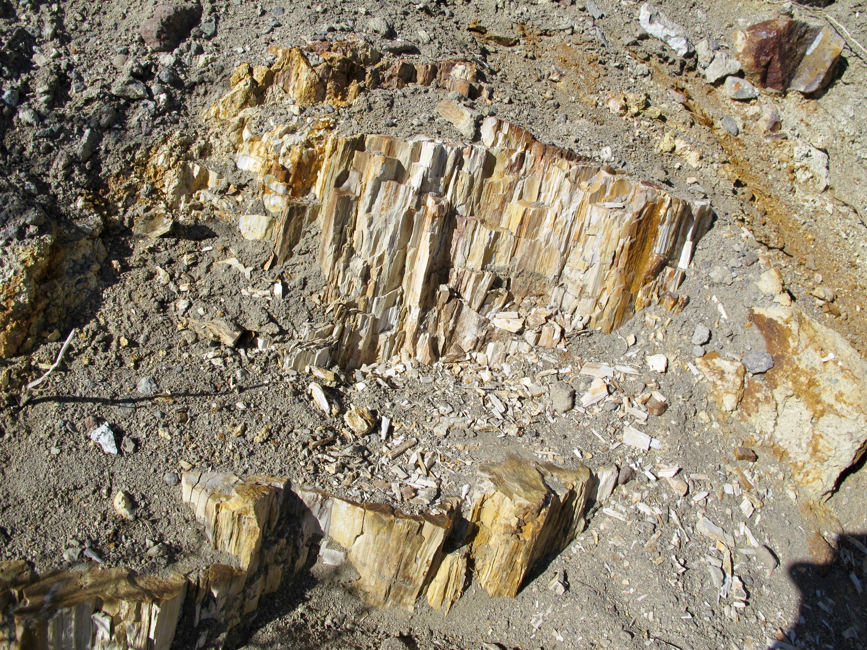
We had already learned that our trail went through what was a very large ancient lake, hence trees must have been there. I read somewhere that an oddity occurred here where cottonwoods and pines were growing near each other. That seems weird in today’s climate. We were excited to see petrified wood and even identified it before we saw the sign
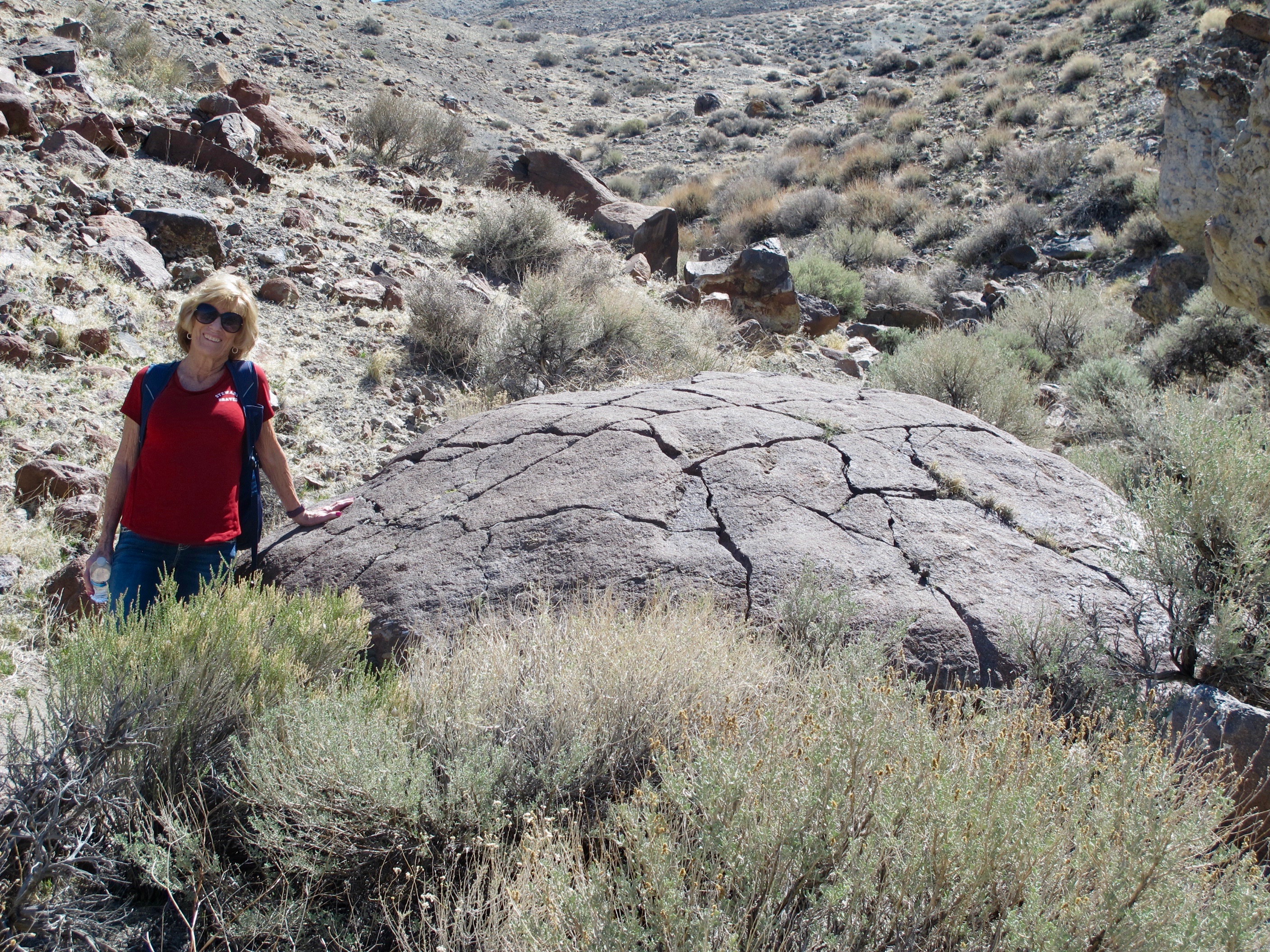
As we walked on, I espied what looked like a giant petrified tortoise. Jerri is standing beside it to give some perspective of its size.
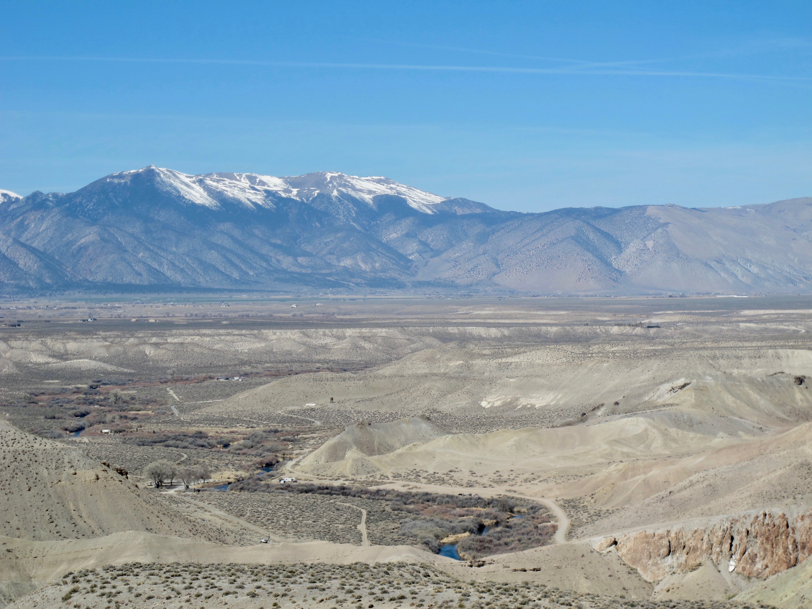
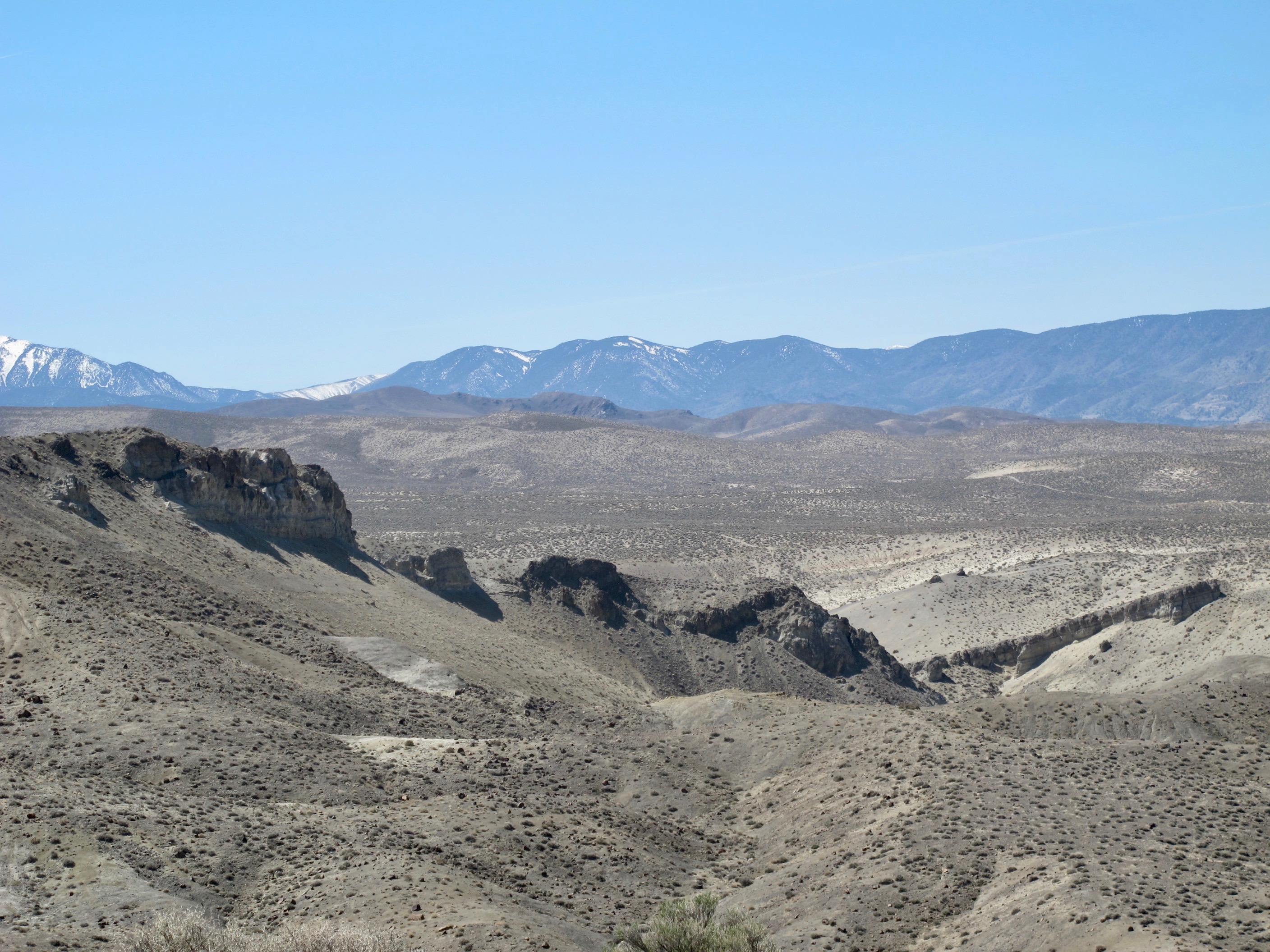
By the time we climbed to the view point, we felt like we’d climbed to much higher than the approximate 6000’ level. The vista is of several mountain ranges and large valleys. It must be really pretty at sunset, but this is what you get on a very bright mid-day photo. I believe the snowy mountains are part of the Carson or Pine Nut Range. The Walker River is in the lower center, not far from where we parked the car.

As we trekked downward, our next point of interest was the Slickenside. Yes, you read it correctly. A slickenside is a smoothly polished surface created by frictional movement along two sides of a fault. Its surface is normally striated in the direction of movement. Tremendous heat is sometimes produced causing the minerals to fuse and form a ceramic surface. The ceramic-like surface can be seen in this photo…the shiny part.
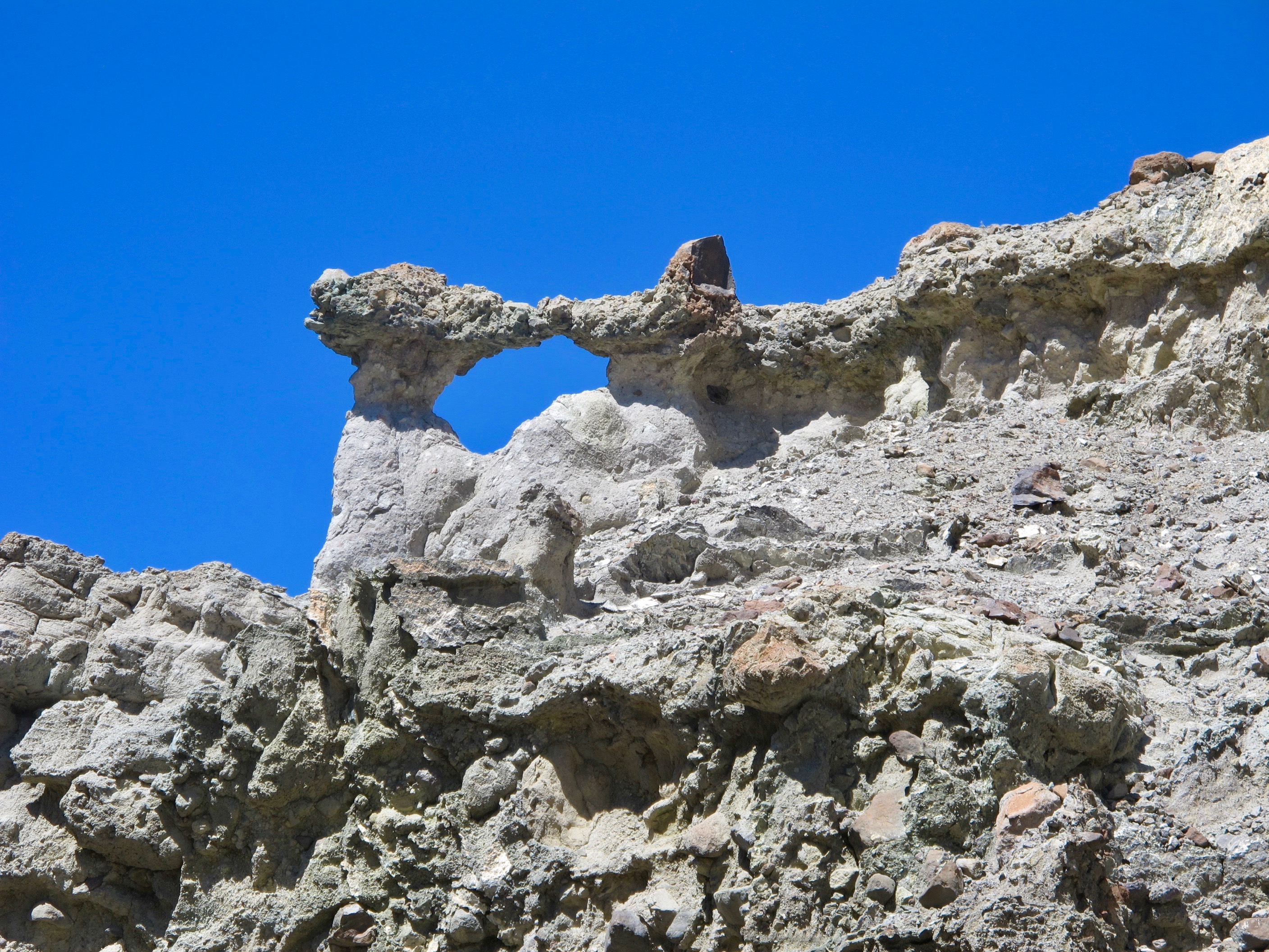
We turned around to continue our walk through a dry wash, looked up and this is what we saw. A small short bridge. Note the color of the sky. This is not edited.

At one time, this was a very tall tree. It’s now petrified into the yellowish, reddish, whitish rock in the foreground.
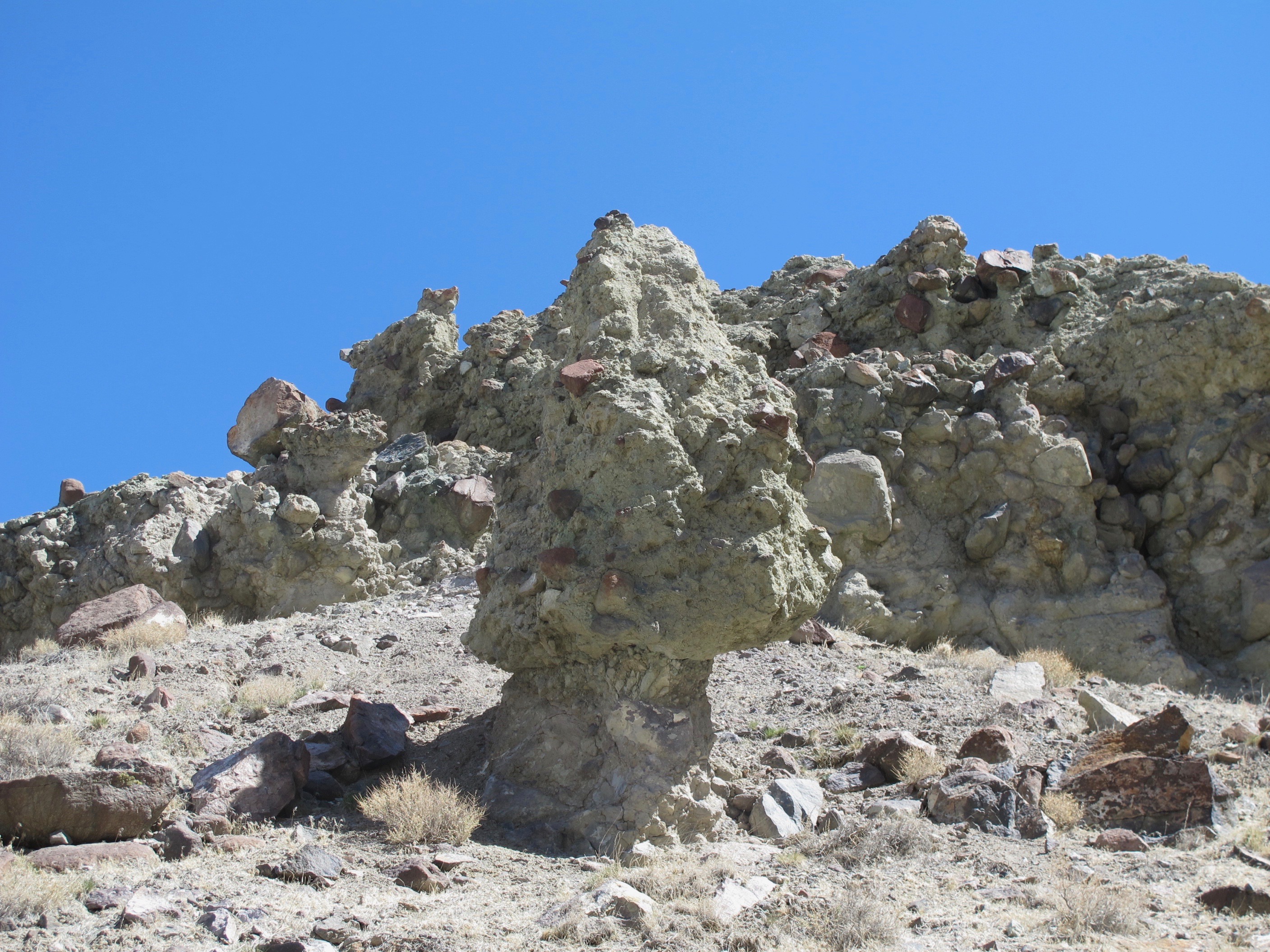
One of the last fun formations we saw were the hoodoos; a tall spire of rock that protrudes from the bottom of an arid drainage basin. Some people feel they are eerie looking and perhaps evil.
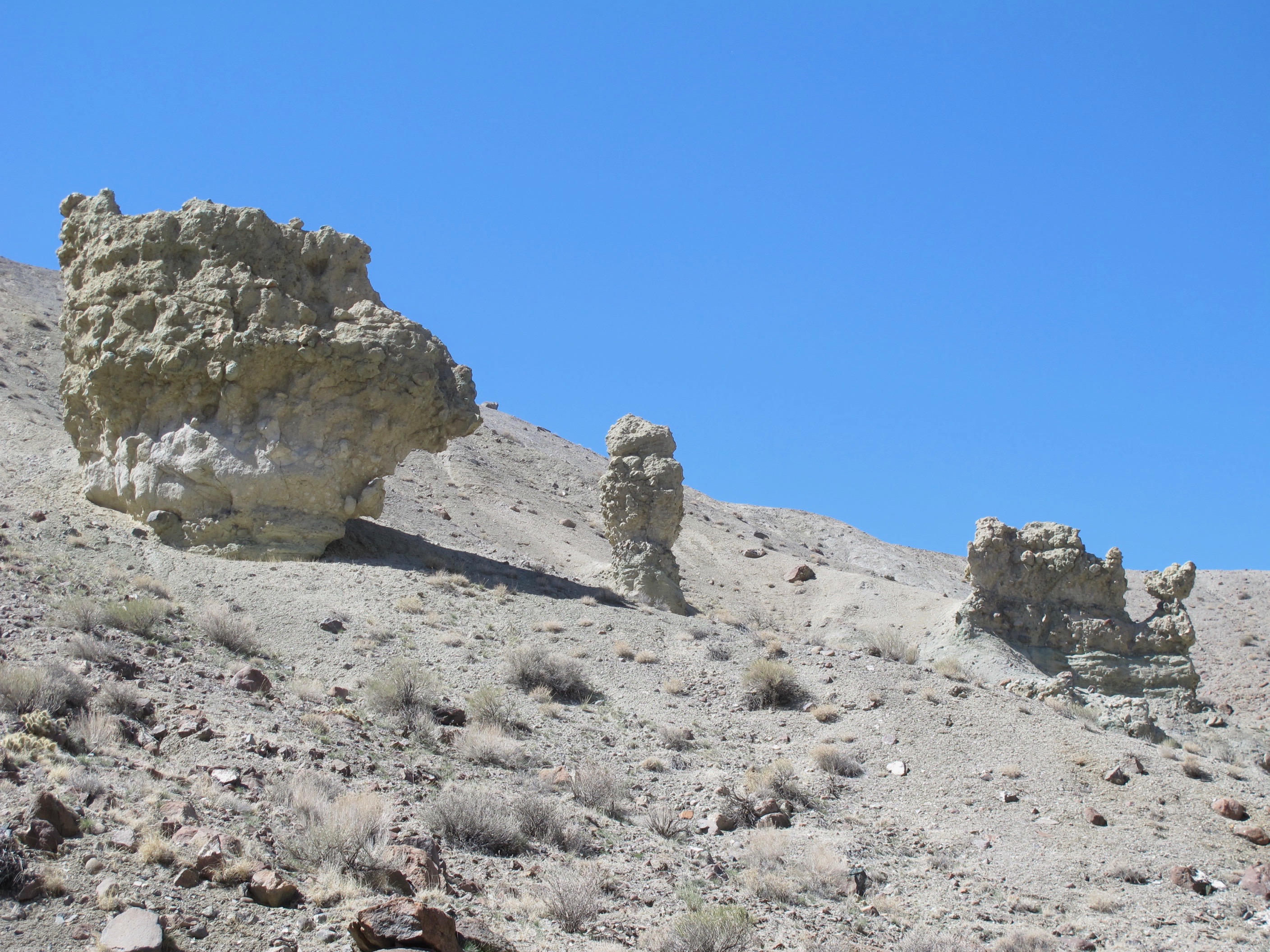
Hoodoos consist of relatively soft rock topped by harder, less easily eroded stone that protects each column from the elements. They typically form within sedimentary rock such as those we encountered along our trail or in volcanic rock formations.
This adventure was our first of the year and we surely did enjoy it. The Appeal article said the trail was only 3.5 miles long, but by the time we reached the peak of the last hill, we thought it might have been about 10 miles long. While we had food and water, we didn’t have enough water and that was a big mistake. We were pretty dry by the time we got back to the car. Luckily, we each had another bottle in the car. Lesson learned.
This is also my first go around with the new Word Press format. It’s going to take a few tries to learn the new tricks they have provided, but I hope this issue gets the point across that we enjoyed ourselves and learned some lessons.

Gorgeous pictures of a fascinating landscape, Cora!. This is what I’ve always expected Nevada to look like. Thanks to your marvellous Buzzard Notes I know now there is a lot more to see in your state – and all is beautiful. Did you find out how that impressive giant petrified turtoise came about? Ayway, thank you so much! Love, Angel
>