Archive | Uncategorized RSS feed for this section

Meeting Little Kate and Her Parents in Phoenix, AZ

25 Feb
Kate Summer practicing her leg lifts.  All she needs is a tutu.

Kate Summer practicing her leg lifts. All she needs is a tutu.

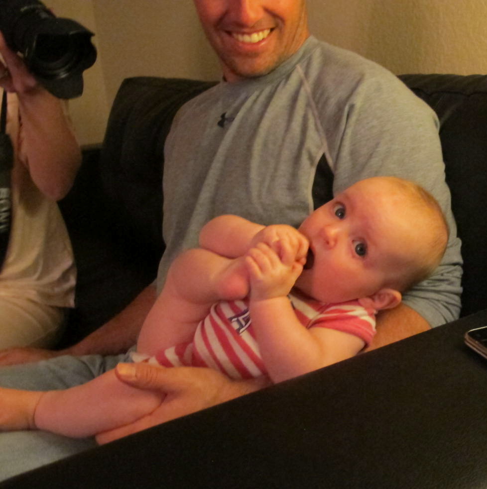
Meet little Kate, my newest great niece who, in this picture, is just a week shy of being six months old.  I am sure she is going to be a ballet dancer as she loves to kick her legs and practice her flexibility.  She has quite a personality and uses her smile and pretty blue eyes to get attention.  She doesn’t fuss much except when she’s hungry or needs to be changed…and even then she’s not a holy terror.

Kate’s daddy, Michael, plays baseball for the Dutch National Baseball Team and was in Phoenix/Scottsdale area for spring practice and to try out for the Dutch World Baseball Team. (He did make the team and is now in Taiwan awaiting the opening game on March 2.  They will be playing South Korea).  Floor (Michael’s wife) with her Aunt, Jolanda and Uncle Reinier flew out  to enjoy some sun as well as catch some games and good bargains at the outlet stores.

It wasn’t long after I arrived that we all piled into a rented van and drove to the San Francisco Giants’ training facility (I believe Michael said this was where the Giants minor leaguers train) to watch Michael’s team play the Paradise Valley College team.  The Dutch won handily and looked with their hitting and fielding.  It reminded me of old times when Bob and I would go to the Cypress College games to watch Michael play.

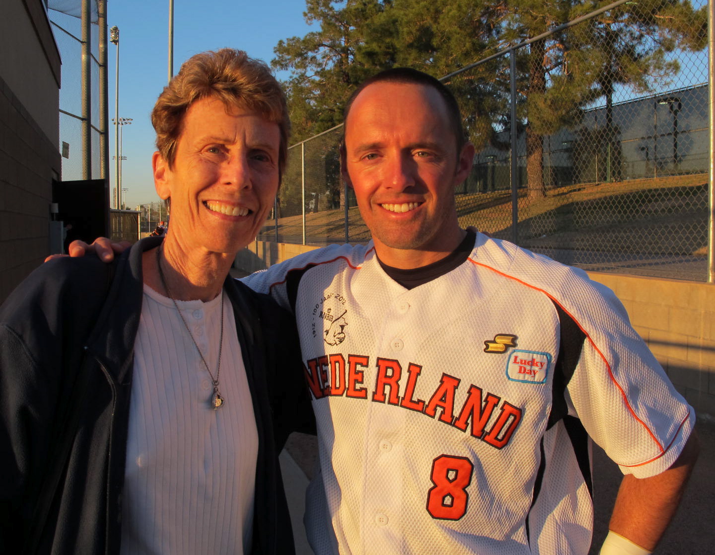
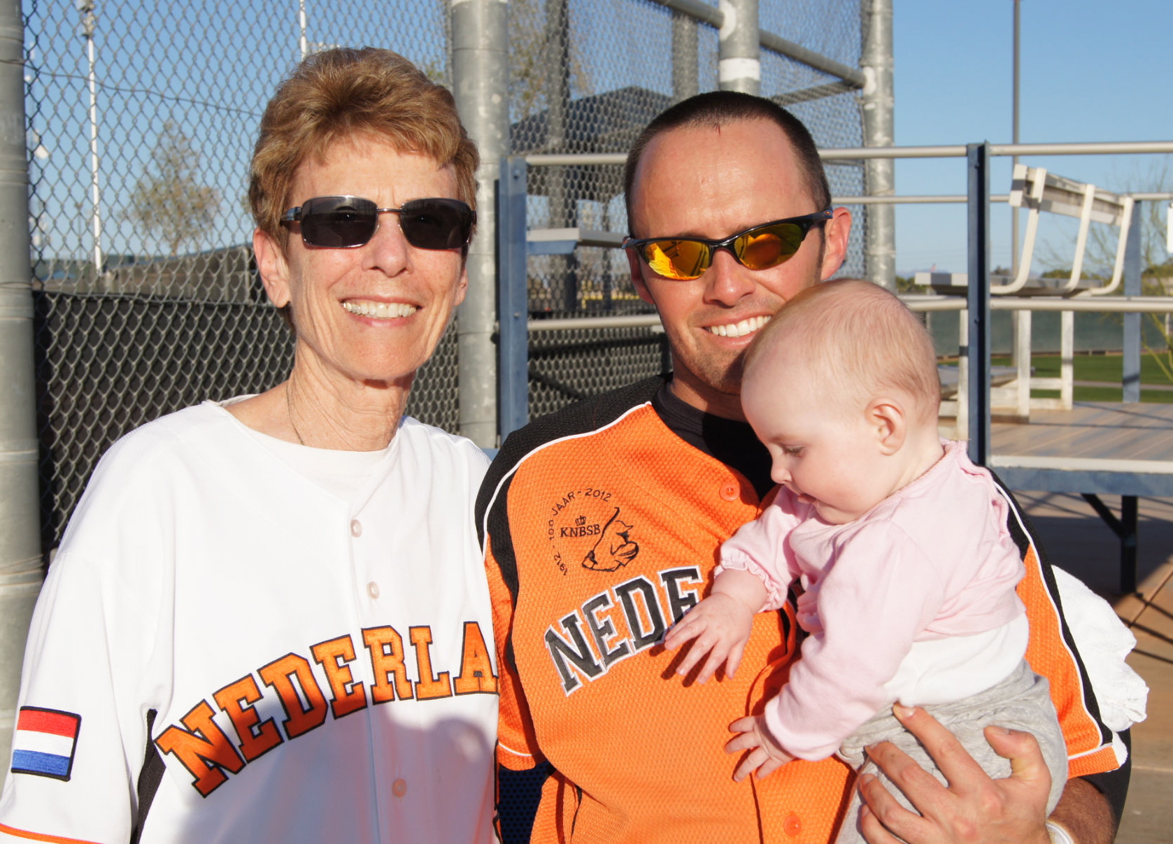
Michael and me after defeating Paradise Valley College

Michael and me after defeating Paradise Valley College

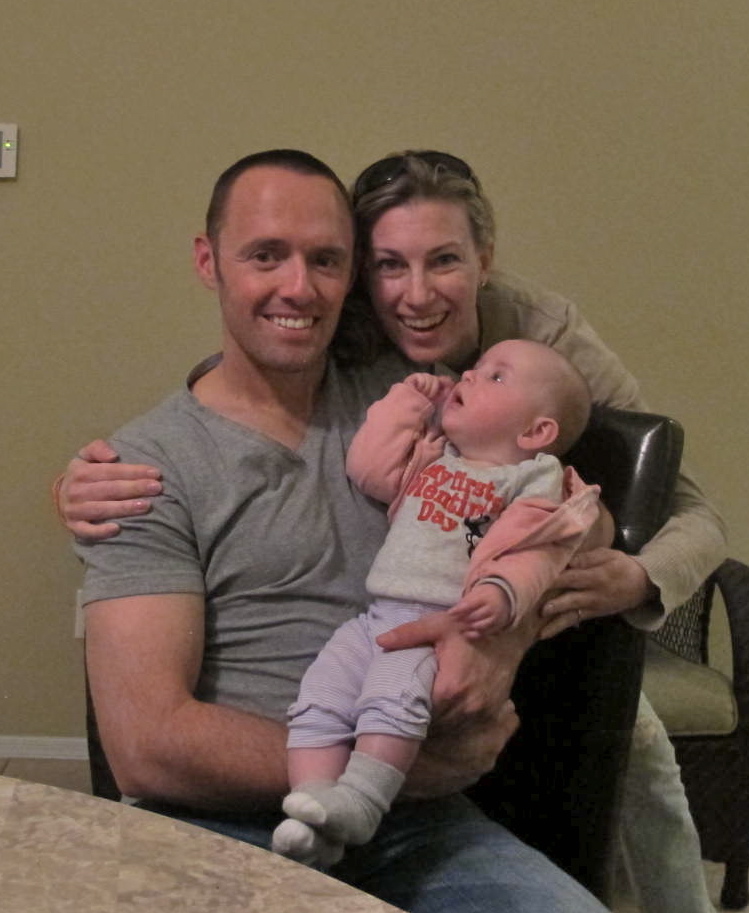
Michael Floor and Kate on Valentine's Day, 2013

Michael Floor and Kate on Valentine’s Day, 2013.  Kate’s first Valentine’s!

The Dutch team usually eats together to help maintain togetherness and camaraderie, but Michael got special permission to be with us for dinner.  Being as how it was Valentine’s Day, there were no nice restaurants with no or small lines, so we just took In and Out burgers home to enjoy at our leisure.  They weren’t the best In and Out that I’ve had, but it was fun being together.  I felt really special to be included with their family time in Phoenix.  It meant very much to me.

Michael didn’t have a game the next day but had to train with the team.  So we decided to go tour the Arizona State University campus in Tempe.  It’s a large

A few of the palms on Palm Walk

A few of the palms on Palm Walk

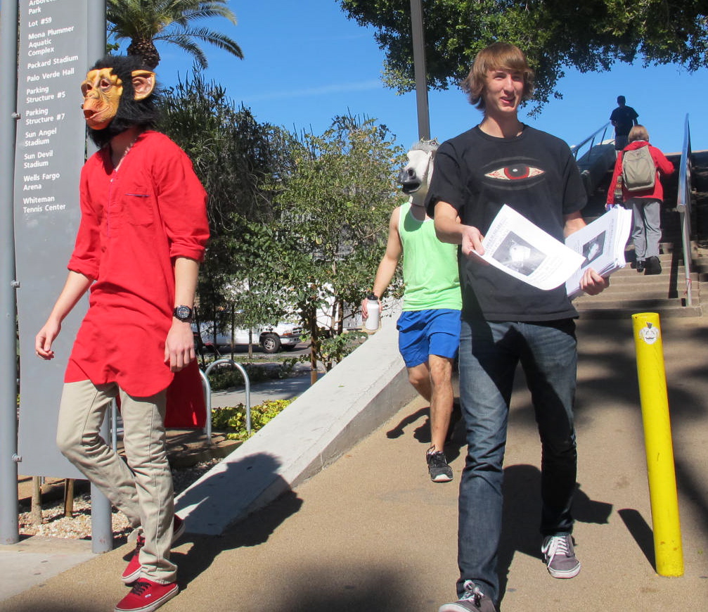
campus with even a Metro line type train that takes students (and I suppose the public) around campus and perhaps to points beyond.  We didn’t ride it, so I don’t know where it goes.  But we did walk around the campus to enjoy a most gorgeous day.  There was some wind, but it was sunny and warming up from previous days.  There are some older buildings from when the campus was begun to much more modern buildings with some still under construction.  ASU is well known for its Palm Walk, a wide promenade with tall palm trees on either side of it.  I thought it was pretty impressive but I particularly liked the sun behind one of the palms that was swaying in the breeze.  As with all campuses, there are a lot of flyers stapled or taped on kiosks and we kept seeing one that had a horse’s head on it.  We didn’t understand the gist of it (and still don’t), but we did see some guys walking around campus, handing out flyers with not only the horse’s head, but a monkey’s head too.  I hope it was a successful even, whatever it was.

Isn’t there a book about a Pale White Horse? I don’t know about a red-shirted monkey.

From the ASU campus, we drove over to Glendale to some outlet stores and enjoyed doing some shopping.  Reinier was telling me that stuff is so much cheaper here, even though we might think it’s expensive.  Holland has much stiffer taxes than we do and also has a value-added tax that really ends up socking it to the consumer.  So while he was here, he stocked up on Levi’s, polo shirts and other apparel.  I think I would do the same, given the same situation.

Kate and Aunt Cora having a discussion about Aunt Cora's delicious finger

Kate and Aunt Cora having a discussion about Aunt Cora’s delicious finger

One morning I got to watch Kate while Floor was taking a shower.  This is not one of my normal activities and was a little apprehensive but since Floor was close by, I thought Kate would be safe.  We had a good time together while we chatted about the day.  Me in English and her in baby babble.  We understood each other exactly.  She became fascinated with one of my fingers and kept sticking it in her mouth as is evidenced by the following photo.  She has a good grip for such a little tyke.

That afternoon we went to Peoria where the Seattle Mariners and San Diego Padres have conjoined training facilities with a nice stadium for their

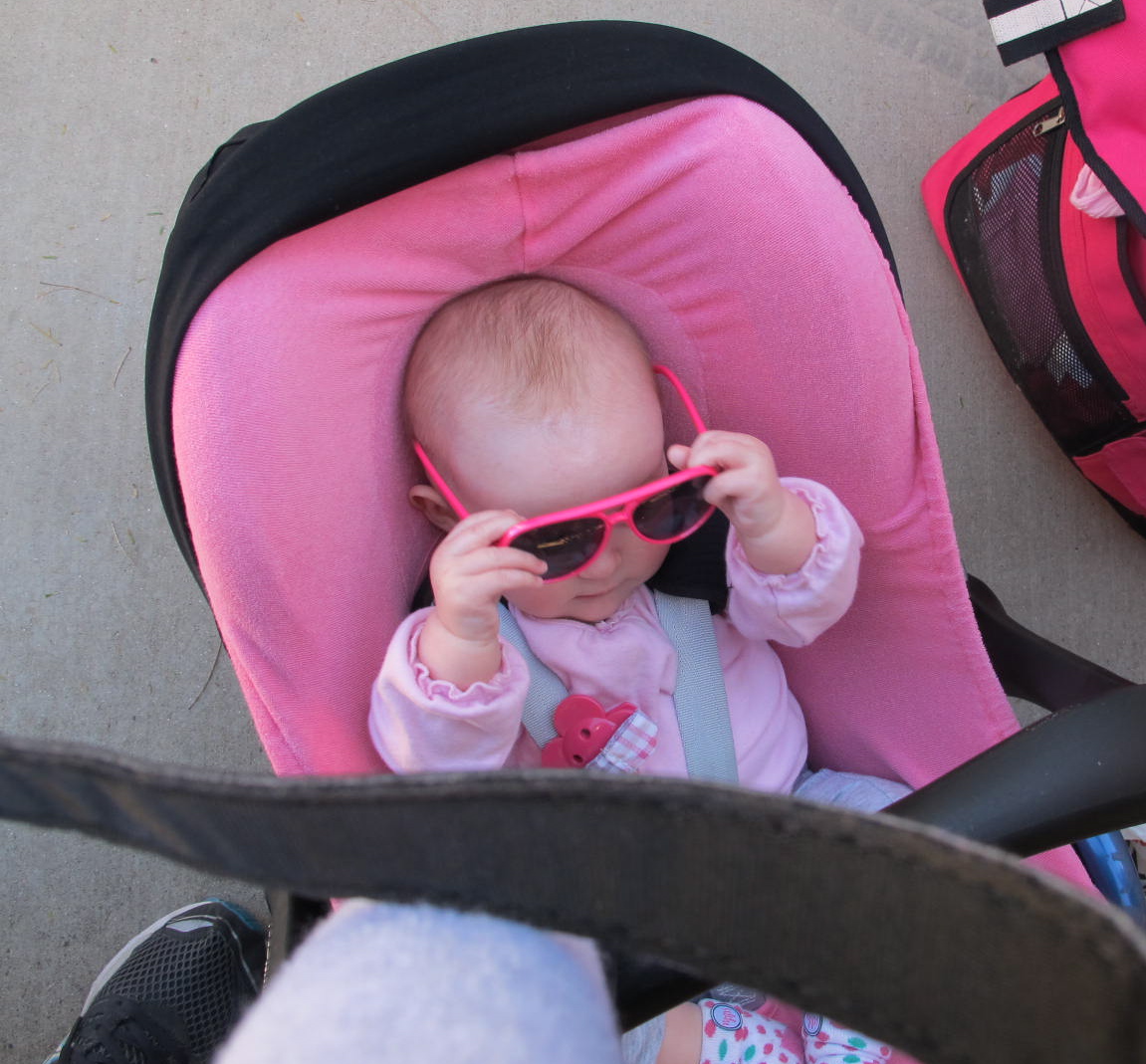
Kate checking out her shades

Kate checking out her shades

minor league teams to play in during their season.  I thought the fields looked very nice and Michael said they were nice to play on.  The stands even had shade over them which is a nice luxury in many ball parks.  It was a very bright, sunny day and, of course, no fashionista would be without her shades.

The Dutch were playing the Chinese who weren’t very good but I loved watching all the runs score even if a few errors were made.  I think the final score was 14 to 1.  There was no score board available and we had to rely upon two little leaguers who were keeping track.  They were two boys from Washington who were visiting their aunt and were quite knowledgeable. I enjoyed hearing their conversation with their aunt who was teaching them some of the finer points of the game.

Intent on the game...bringing the Dutch some Irish luck

Intent on the game…bringing the Dutch some Irish luck

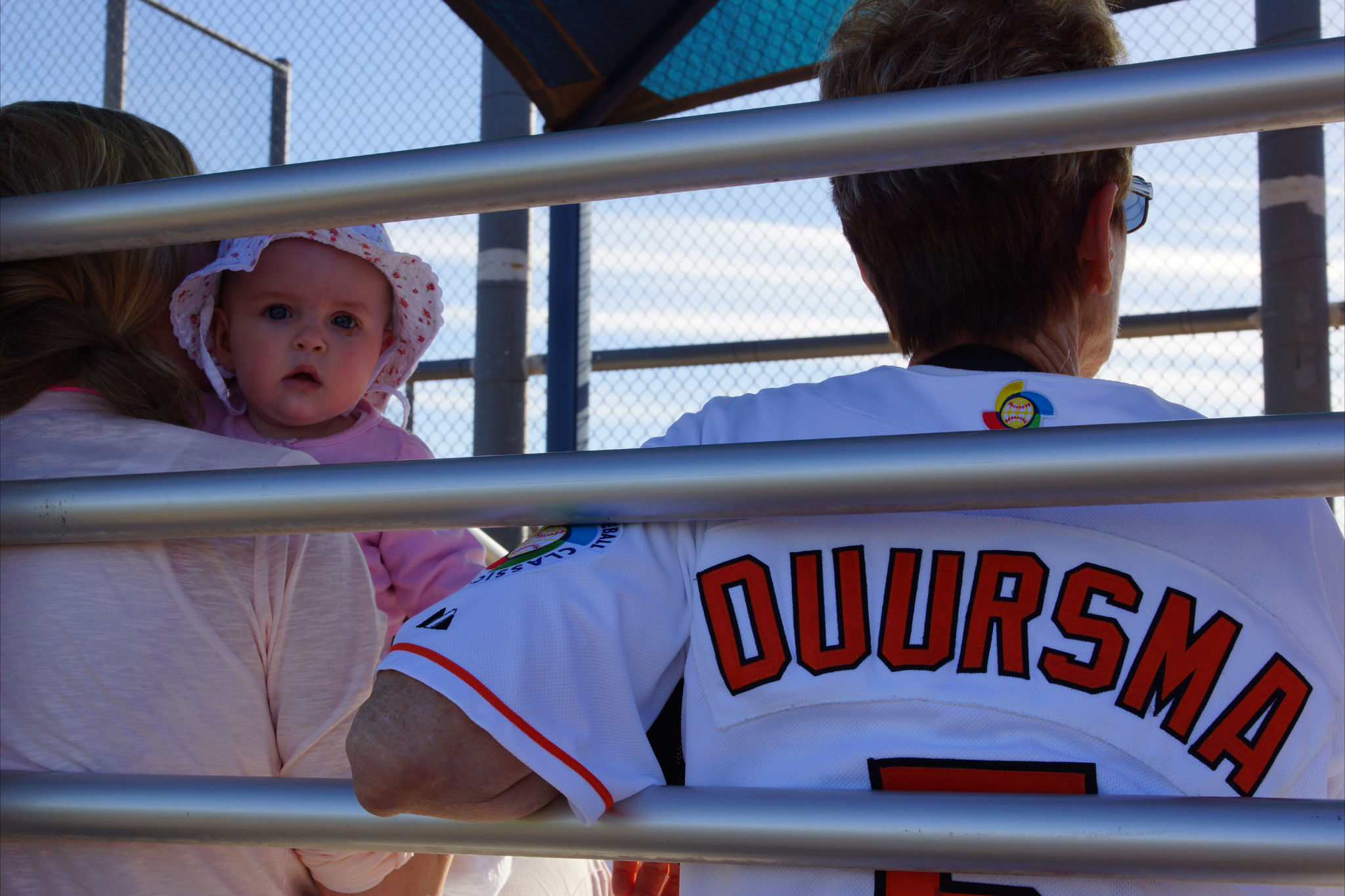
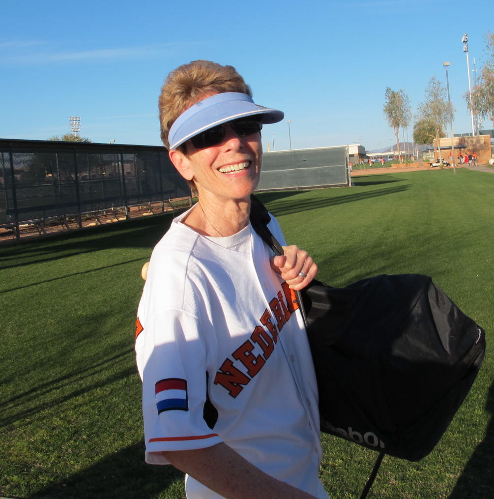
Michael played in the 2009 World Baseball Classic and was nice enough to give me one of his jerseys.  I wore it to this game and it made somewhat of a stir with some folks in the audience.  I thought it was a kick and was very proud to wear it.

Aunt Cora and the proud daddy

Aunt Cora and the proud daddy

Batgirl

Batgirl

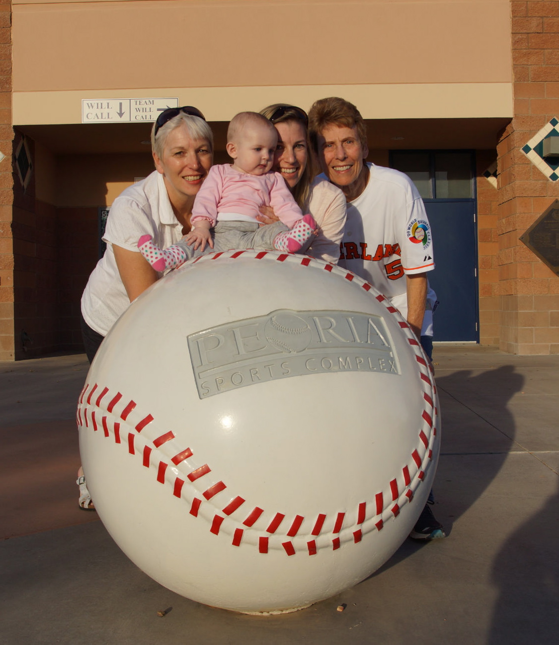
Michael had to ride back to Scottsdale with the team and we stopped to check out the Peoria stadium entrance.  They have huge baseballs lining paths and the gates.  Of course we had to get our pictures taken in front of the stadium by the baseballs.

Jolanda, Kate, Floor and Aunt Cora at Peoria Stadium

Jolanda, Kate, Floor and Aunt Cora at Peoria Stadium

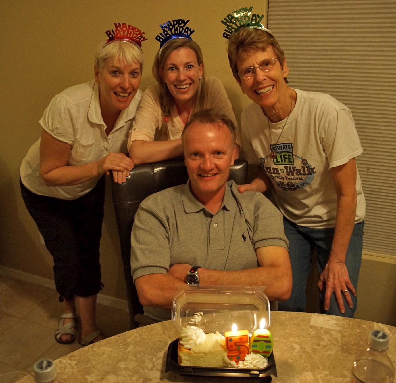
It was Reinier’s 50th birthday a day after we all were going back to our respective homes and we felt we had to celebrate all together in our Phoenix house.  We stopped at a Cheesecake Factory to get each person a favorite flavor and then zoomed over to pick up Michael at the Scottsdale training facility.  We decided to get some pizza to eat at home so as to let Kate stay on sort of a normal schedule.  Reinier dropped us all off at the house and then went out to search for pizza.  He programmed “take out pizza” into the GPS and ended up with a Papa Murphy’s pizza, not knowing that it’s not cooked at the store.  It’s a take and bake.  He was not a happy camper as he’d never heard of such a thing, but it all worked out ok and the pizza tasted good.  Jolanda surprised him with a 50 candle and we celebrated with the cheesecake for dessert.  A good time was had by all!

Happy Birthday, Reinier!

Happy Birthday, Reinier!

Remember how I told you that Kate was practicing her leg lifts?  Well, it seems that she was also practicing her agility and that night she demonstrated to Michael that she could put her big toe in her mouth!  Michael was excited that she could do that and was quite proud that she was so flexible!  It might be several years before she puts her foot in her mouth with regularity (like her Aunt Cora)

This tastes good!

This tastes good!

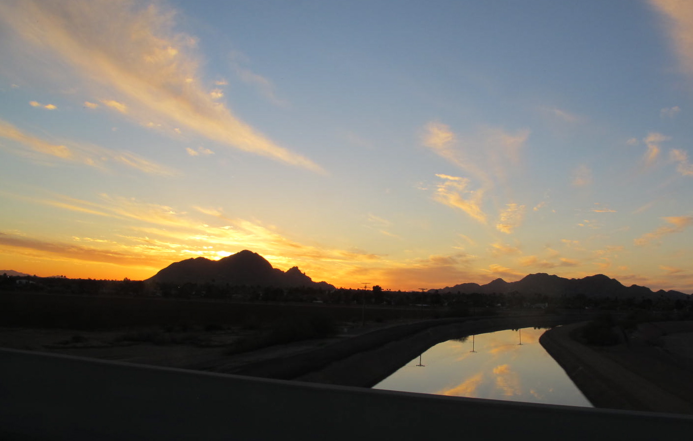
Sunset over the Phoenix Canal with Camelback Mountain in the background

Sunset over the Phoenix Canal with Camelback Mountain in the background

Alas, all good things must come to an end and we all had to go home.  Floor had to go back to work and Jolanda and Reinier had to get back to Delft to their 5 star Hotel de Ark (where Bob and I stayed for Michael and Floor’s wedding).  We all cleaned the house and packed and then went our respective ways.  Michael was practicing with the team when we left and had two more days before he would find out that he was going to Taiwan.  Reinier took one last shot of the happy housemates in front of our house just prior to me leaving.

The happy team

The happy team

It was very exciting for me to be able to join the kids and Jolanda and Reinier in Phoenix even if it was only for a few days.  We had a good time and had a chance to get reacquainted plus have new experiences together.  They are all such fine people and make one feel at home.  It’s just great to have relatives such as these.  Thank you, Floor, Michael, Kate, Jolanda and Reinier!

Temple Bar, AZ and the Dam Tour

12 Feb
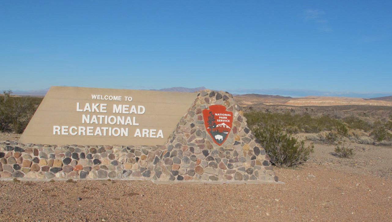
Welcome sign on the way to Temple Bar.

Welcome sign on the way to Temple Bar.

February first saw me zooming toward Las Vegas and points beyond to visit my college buddy, Gale, at Temple Bar, AZ.  I told everybody I was going to Lake Mead because no one (including me) had heard of Temple Bar.  The National Park Service says that Lake Mead is just minutes from Las Vegas.  I guess that is true if one is going only to Hoover Dam.  It’s another 45 miles to Temple Bar from Hoover Dam!  So Gale is basically out away from the hustle and bustle of ANYWHERE in her neat campground.  I should point out that Gale works as a camp volunteer picking up trash, weeding, making rock borders or other chores that need to be done around the 150 campsites and, for that effort, she gets free hookups for her trailer.  This is a pretty good deal since there are not many people at the campground and she’s worked hard to get the place looking nice.  So now she can pick and choose her time to work as the volunteer.

IMG_0641 2

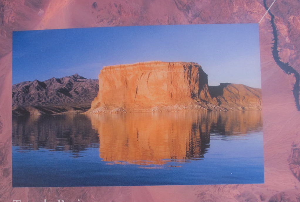
This rock formation is known as The Temple and was a landmark for early travelers on the Colorado River. It was probably named by an early Mormon settler, Daniel Bonelli.  Bonelli Peak is in the background.  I never got a great picture of it.  Hence, the picture from a sign.

Let me tell you about Temple Bar.  It’s located in the Temple Basin on the Arizona side of

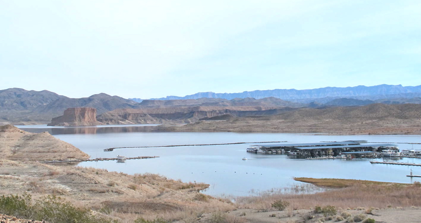
The marina and The Temple in the background

The marina and The Temple in the background

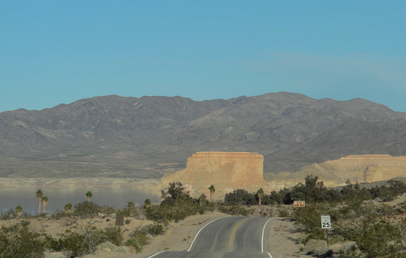
eastern Lake Mead.  It’s the closest marina for Arizonans who want to get away from the more populated Boulder Basin area of Lake Mead.  The area around Temple Bar Marina is especially well known for two things:  the massive rock formation that gave the area its name and its 20 mile long unobstructed water-ski runs that attract people during the summer months.  People also do a lot of fishing and kayaking around the area.

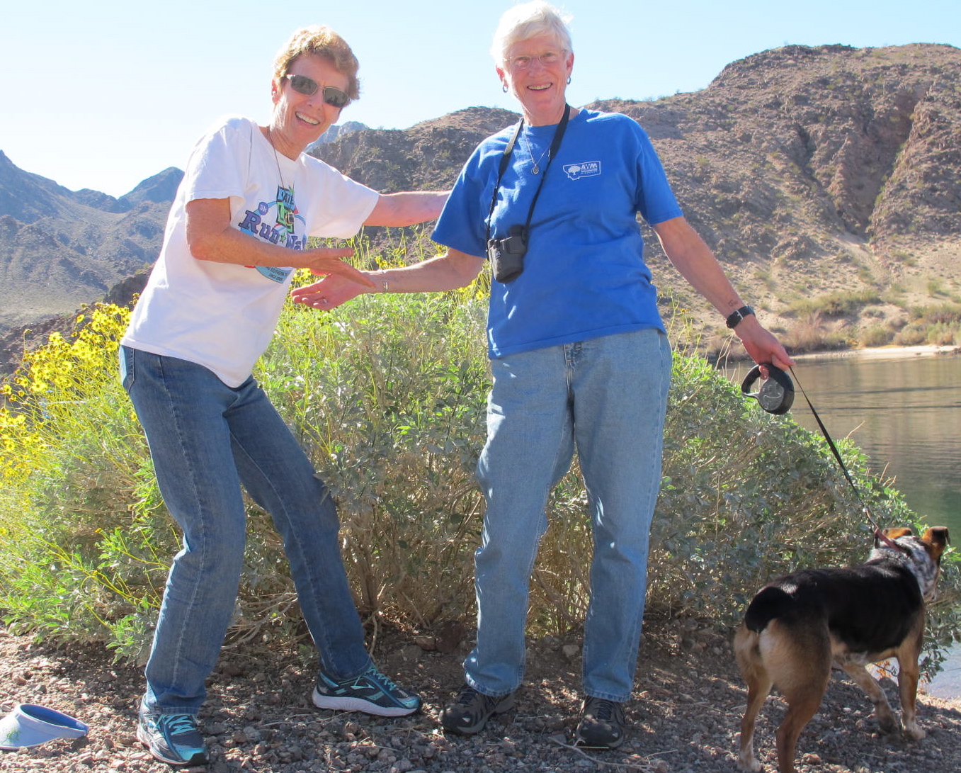
Gale has a nice 24′ trailer that provides ample room to eat, sleep and take care of daily ablutions. A nice fire pit is provided by the camp and we enjoyed several campfires with wood that Gale brought from home and scrounged from around the campsites. When I arrived, Linda and Gene, two Montana neighbors, were parked next to her and we had great conversations during campfires.  Linda and Gene left a couple of days after I arrived to wend their way farther down the Colorado River to Katherine Landing.

A group of 6 fishermen from Idaho and other areas camped a few campsites from us.  They had obviously done this before as they had their camp set up in about 20 minutes with even a 10 x 15 cooking/card playing tent, a sleeping tent and then two truck campers to work with.  Anyway, they set up their stuff and hauled their 2 boats down to the lake to try their luck.  I don’t know how many fish they caught, I think they didn’t much care.  They seemed to be quite interested in quaffing beer and probably many spirits.  They, too, had a campfire that they started by piling the wood into the pit and pouring gas on it.  Then the flames would roar upward in a dangerous manner.  The last night I was there, we could hear them snoring in their campers!  I’m glad that I wasn’t in the same room with them.

Two young men showed up one night in  Jucy van.  I think Jucy was a brand name for a neat camping set up.  The van was equipped similarly to a tear drop trailer with a small stove, fridge, storage and what not in the rear part.  A person could sleep in an area behind the driver and there was a popup tent type affair on top of the van for another sleeping area.  Really, a very handy and a neat idea.

Gregg's Hideout - isolated, huh?

Gregg’s Hideout – isolated, huh?

Gale took me on a long drive to a place called Gregg’s Hideout which is located in an easterly direction from Temple Bar.  It would be a good place

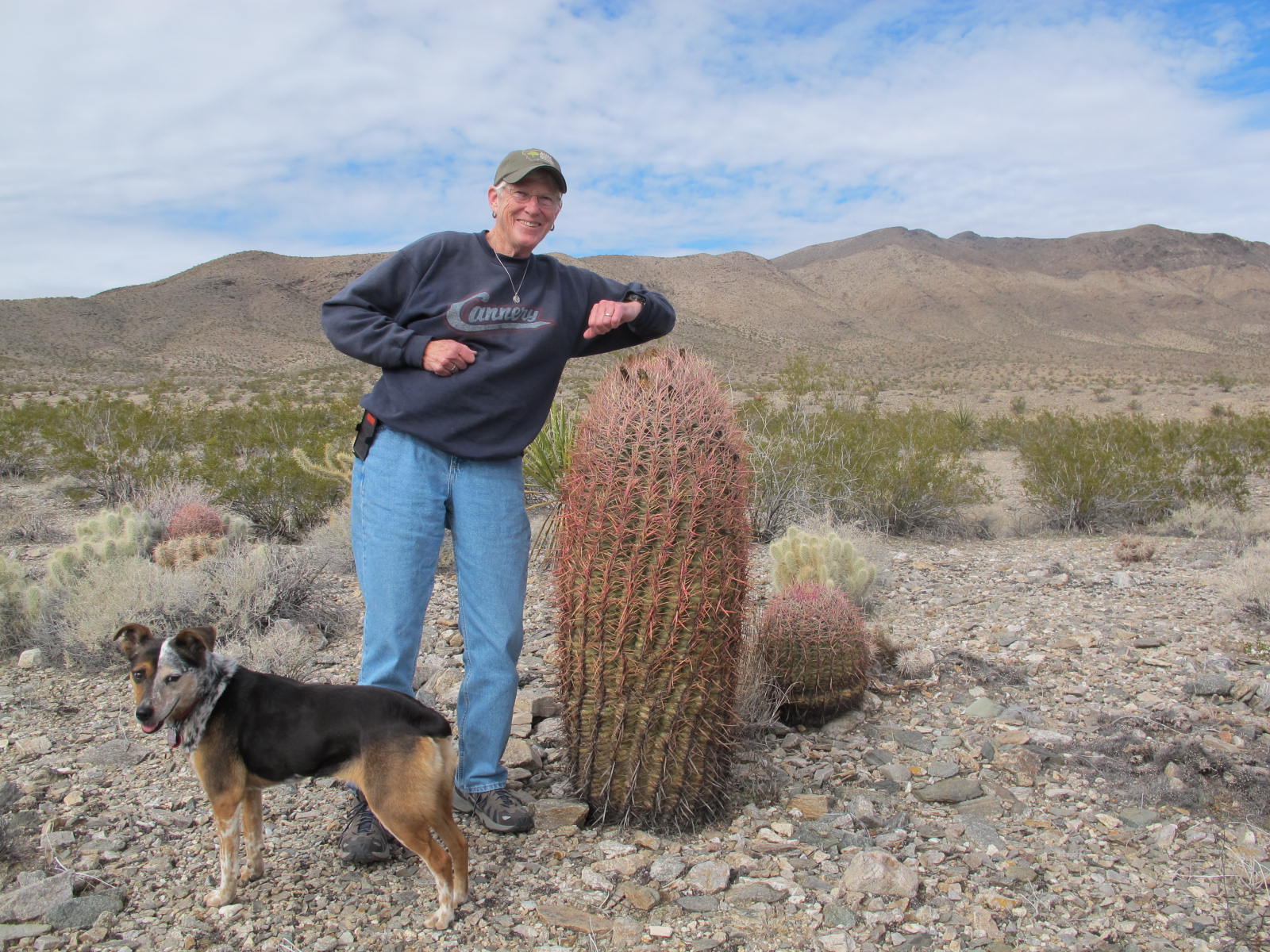
Gale's testing the barrel cactus stickers.  Note Sissy, the dog.  More about her later

Gale’s testing the barrel cactus stickers. Note Sissy’s (the dog) markings.  More about her later

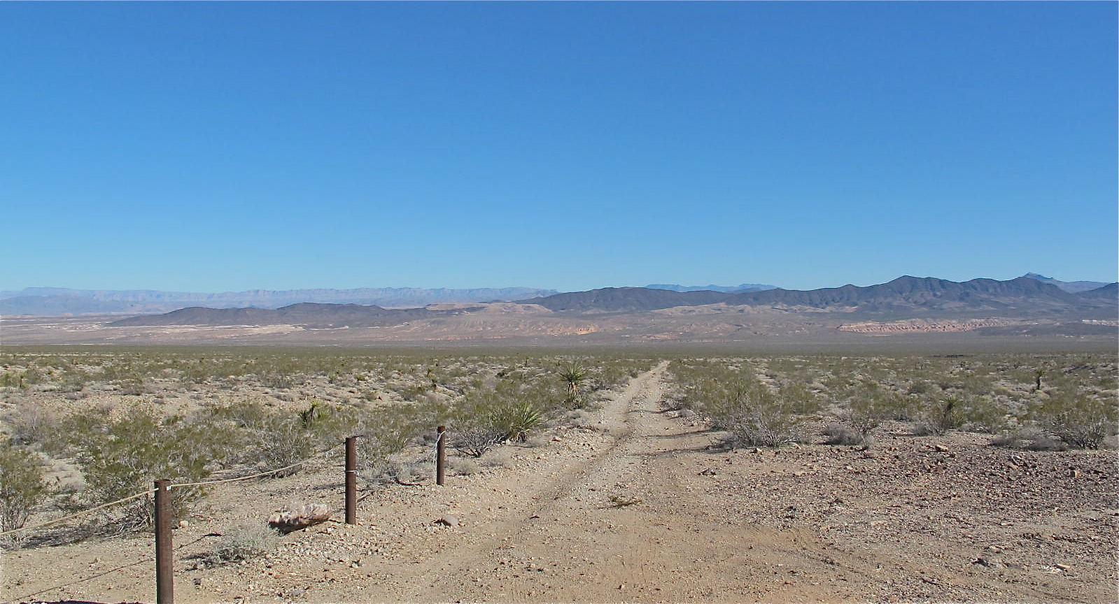
for a hideout because the only access is by dirt road…some of which were pretty rugged.  I was glad that Gale drove her 4 wheel drive truck because my car would have bottomed out in about the first mile. It was a great drive as we explored some old camping sites that people might have used for cattle round ups, maybe small attempts at farming or even some mining.  We didn’t find anything exciting but we speculated on the stories that the land could tell.  As our altitude ascended and descended, we could see good stands of Joshua trees (that only grow in certain climes and altitudes), lots of barrel cactus, chaparral and mesquite.  I was wishing that I knew more about rocks as we saw many different types of stones, rocks and boulders that contained so many colors, layers and designs (for lack of a better word).

The road to Gregg’s was rough but pretty in its own way.  There is a lot of beauty in the desert…you just have to take the time to check it out closely.

Sissy was mistreated by earlier owners.  Butu she's blossomed under Gale's tutelage

Sissy was mistreated by earlier owners. Butu she’s blossomed under Gale’s tutelage

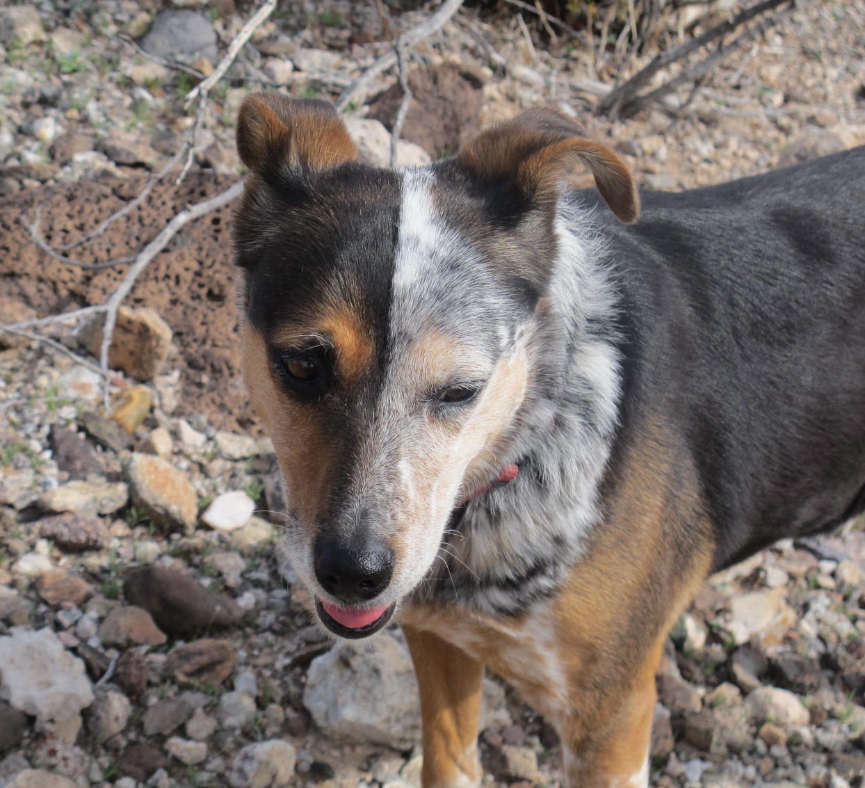
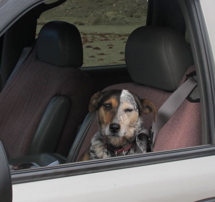
Sissy, Gale’s dog, is half blue-heeler and half beagle.  Quite a combination that made for a well behaved and pretty dog.  I was quite taken with Sissy and had fun throwing her frisbee for her.

Waiting for someone to throw the frisbee

Waiting for someone to throw the frisbee

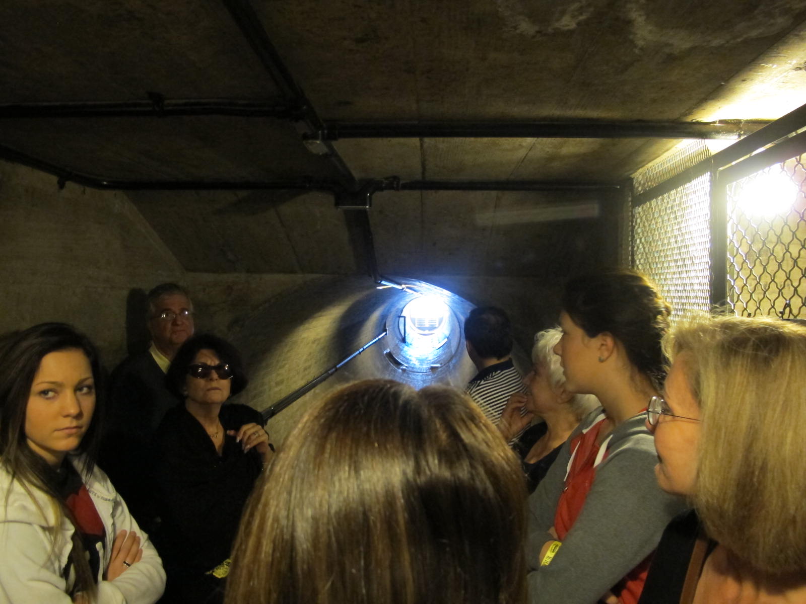
We went to explore that engineering marvel, the Hoover Dam, and took an hour long tour that afforded us a chance to see things the average person doesn’t get to see.  We got to walk in a ventilator shaft

Ventilator shaft from which we took pictures

Ventilator shaft from which we took pictures

from which we could take pictures, experience the coolness of tunnels inside the vast dam,  see marks on the walls that engineers used to get things just right and some graffiti from dam workers.  Hoover Dam is 726 feet high and contains 3.25 million cubic yards of concrete.  This massive project was begun in 1931 and the last concrete was poured in 1935…two years ahead of schedule and well under budget!  (Can you imagine a comparable project finishing like that today?)  Lake Mead is formed by Hoover Dam and has a shoreline of 550 miles.  When full, its length is 110 miles.  Sadly, it is not full now, primarily because of an increasing need for water throughout the Southwest, drought and poor snow falls.  When Gale and I were at Gregg’s Hideout, we could see a waterline that appeared to be at least 90 feet above where we were.  The low water level can be seen from the air and ground.  I liken it to a bathtub ring

Taken from the ventilator shaft.  Black Canyon and the Colorado River are below

Taken from the ventilator shaft. Black Canyon and the Colorado River are below

You can see the bathtub ring around the edge of the lake

You can see the bathtub ring around the edge of the lake

The main highway used to go right over the dam, but the traffic got so bad and since 9/11, the authorities have gotten pretty schiztzy about cars on

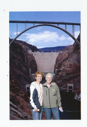
The dam shot of Gale and me

The dam shot of Gale and me. The ventilator shaft was about halfway up the face of the dam

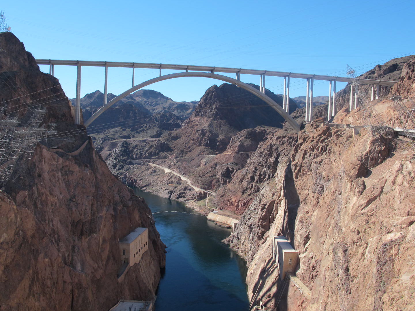
the dam.  So a bypass was built resulting in the beautiful bridge over the river.  Here is the official description of it.  “The Mike O’Callaghan – Pat Tillman Memorial Bridge (Colorado River Bridge) is the central portion of the Hoover Dam Bypass Project. Construction on the nearly 2,000 foot long bridge (with a 1,060 foot twin-rib concrete arch) began in late January 2005 and traffic began using the Hoover Dam Bypass on October 19, 2010.  This signature bridge spans the Black Canyon (about 1,500 feet south of the Hoover Dam), connecting the Arizona and Nevada Approach highways nearly 900-feet above the Colorado River.”  It’s a beautiful bridge, but you can’t see any view while driving across because of high medians and curbs.  One can walk in special lanes however.  I didn’t because I was leery of the height.  Just as we were leaving the dam area, we espied a small herd of bighorn sheep in a ravine.  They are majestic animals but they didn’t get close enough for a good photo op.  Anyway, they increased our total of bighorn sightings to 16.

After the dam tour, we took a side trip into Henderson to introduce Gale to Trader Joe’s.  They don’t have anything like this store in Montana and she was delighted to check it out.  We had a feast that night because of her purchases.

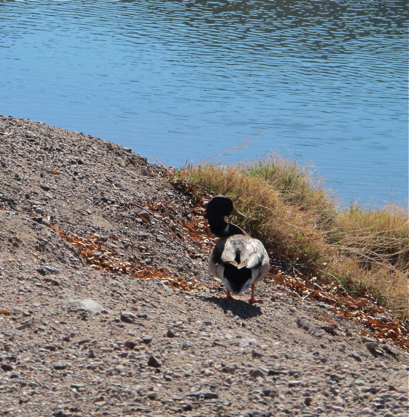
My last day there, we drove to Willow Beach, a nice campsite for tents and trailers (but with no shade, unlike Gale’s place with lots of trees) and a nice beach.  It’s below Hoover Dam a few miles.  Sissy was excited because she got to chase some mallards and even go for a swim in the cold water (about 55 degrees or less).  We had a nice picnic lunch and watched the river flow by for a while.  A mallard tickled us when he would cock his head, lean to the left and sit that way for several minutes.  Then he would cock his head, lean to the right and, again, sit that way for several minutes.  We never did figure out why he did this.  My friend, Dick, suggested he was posing for the lady mallards.  Who knows?

Lean to the left

Lean to the left

Lean to the right.  A pose for the ladies?

Lean to the right. A pose for the ladies?

Horsing around at Willow Beach

Horsing around at Willow Beach

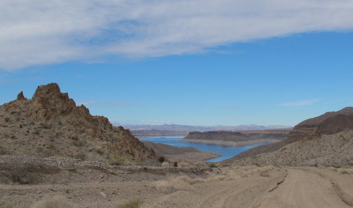
A dirt road going west from our road back to Temple Bar beckoned us that afternoon.  A sign said “Wilderness Area” and we thought that sounded like a good adventure.  The “road” climbed steadily for a couple of miles before it ended in a small parking lot.  I put “road” in quotes because Gale had to use her 4 wheel drive in a few sections that had been washed out and it was pretty rough for a bit.  A hiking trail led to the Mt. Wilson wilderness Area from that little parking lot.  But the real reward was when we turned around to look at the road below us.  It was pretty clear and we could see for what seemed like forever.  I’m pretty sure we were looking at the White Hills, the Grand Wash Cliffs and points beyond.  We were never able to figure out if we could actually see the southern end of the Grand Canyon, but I would like to think we could.  If not, I think we could see almost to the end of it.  Whatever, the hills and mountains were multihued just as they are in the Canyon.

Wilderness Road with hills and mountains in the background

Wilderness Road with hills and mountains in the background

As we neared our camp, the sun was finally at my back and I could get a fairly decent picture of The Temple and a bit of the road into the camp.  I was fascinated with The Temple and how its appearance changed with the different light.  I would have liked to get up close and personal to it but didn’t have access to a boat.  Besides that, the water was pretty cold and I would not have liked to take a bath in it.

The Temple

The Temple

Temple Bar and its environs was an adventure that I really enjoyed…its distinct beauty, the stars, the silence (no TVs, few planes, no traffic noise etc.), the opportunity to learn many new things and being together with Gale and remembering old times while having new good times.  I thank Gale for inviting me out to visit her little kingdom at Temple Bar and sharing it with me.  It was fun!

Here's looking at you, kid!

Here’s looking at you, kid!

Highways, Byways and More Recalculations – Sept. – Oct. 2012

19 Oct

There are several pictures in this tome that will look a lot better if you click on the photo to view it in a larger format.

Off we went to Atlanta, Georgia, via Southwest Airlines on September 24, 2012.  Who knew they flew nonstop across the entire country?  We enjoyed the flight with lots of legroom and not having to pay extra for it.

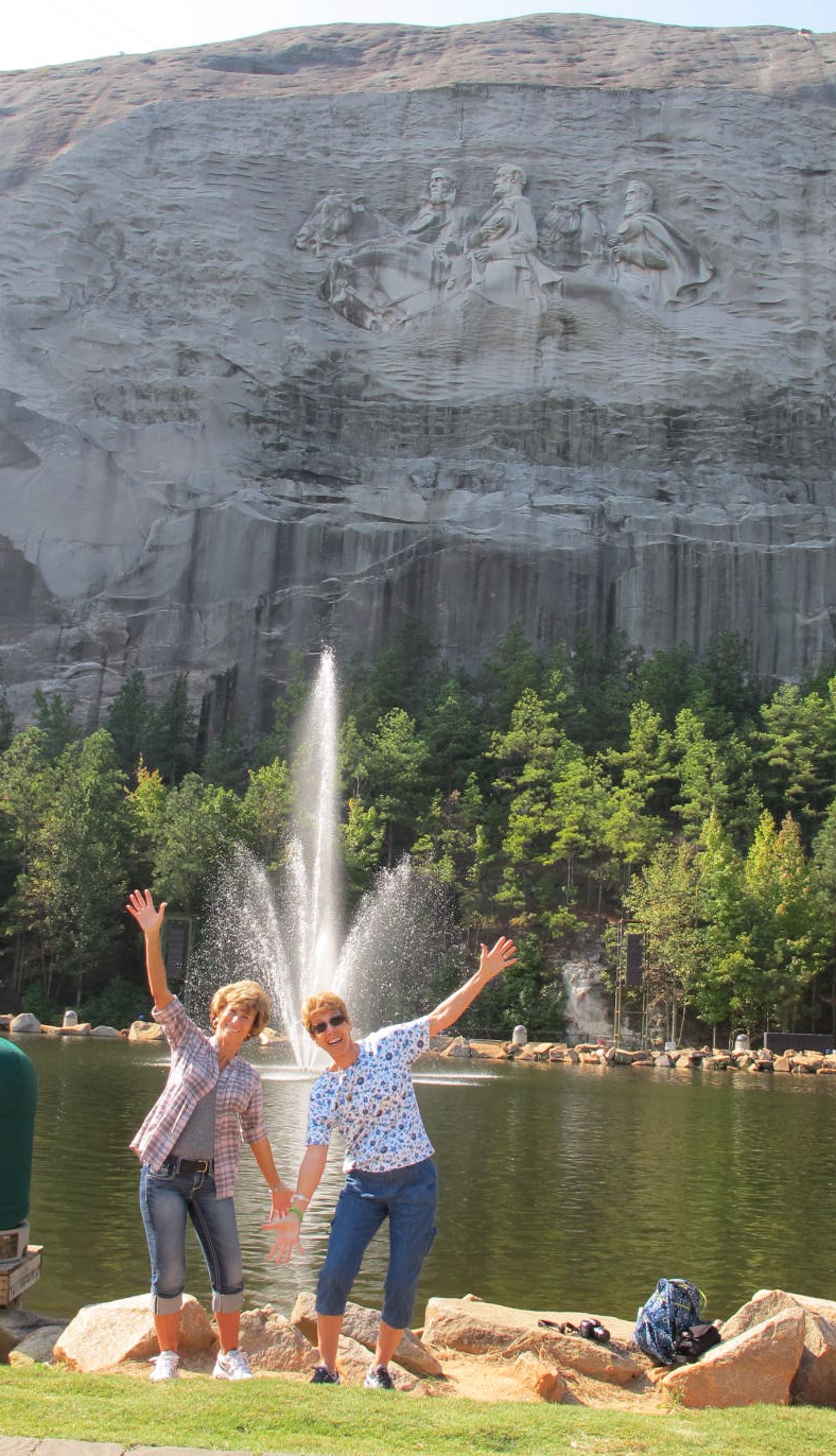
Upon arrival we immediately set off for Stone Mountain, the first leg of our adventure.  It is the largest body of exposed granite in the world and has become Georgia’s largest campground and most
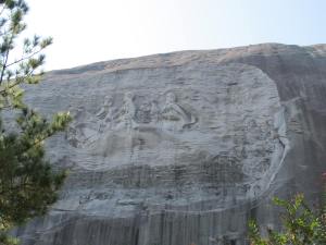
Stone Mountain is bowl shaped rather than craggy snd is very distincting from a distance.

visited attraction.  Entertainment and recreational activities abound but we were there primarily to see the “mountain” with its marvelous carving.  (1,686’ high.  I don’t mean to demean Georgians, but this elevation hardly merits the nomenclature of mountain to a Westerner) It is the largest bas relief sculpture in the world, the “Confederate Memorial”  depicts President Jefferson Davis and Generals Robert E. Lee and “Stonewall” Jackson. The entire carved surface measures 3 acres.  The carving of the three men towers 400’ above the ground, measures 90 by 190’, and is recessed 42’ into the mountain.  It is truly impressive even though it seems small relatively speaking to the actual Stone Mountain granite dome.  We hiked

Two babes horsing around

around a bit and saw not only the sculpture, but lakes, a covered bridge, a museum and lots of friendly people taking their daily constitutional.  Lots of people enjoy Georgia’s outdoor areas in which to exercise.

An aside here.  I found Georgia’s people to be extremely friendly and extraordinarily polite.  Nobody calls me ma’am in California and that was the standard in Georgia.  It was very refreshing and unexpected.

After satisfying our Confederate Memorial curiosity, we drove on south to Macon near the geographic center of Georgia.  It was also Georgia’s capital during the last two years of the Civil War.  A couple of things struck me as we zoomed down I-75.  One is how green Georgia is with what seems like jillions of trees lining all the roads.   They make the state so beautiful.  We seemed to pass many lakes, large and small, on the trip.  We just don’t see that in Southern California.

Another point is the number of counties in Georgia.  We seemed to pass through one about every 5 minutes and Jerri had warned me about this fact.  Come to find out, Georgia has 159 counties!  There is a lot of history involved with this big number, which I won’t go into here.   I just hope Georgia’s students don’t have to memorize all of the counties!
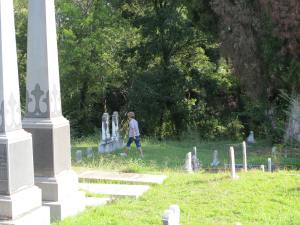
Checking out Rose Hill Cemetery in Macon, GA

I really liked Macon.  It’s a pretty town set next to the Ocmulgee River (pronounced with a soft g) with many beautiful antebellum mansions.  The people were very friendly and spoke with a bit more southern accent than did folks in Atlanta.  Jerri told me it would be much more pronounced as we moved south and east.  She was right.

Jerri loves visiting cemeteries and we went to two in Macon…the Riverside and Rose Hill.  Both of these places dated from just before The War and are still being used, although Rose Hill was very unkempt and spooky.  Civil War soldiers as well as Duane Allman and Berry Oakley (rock and roll stars) are buried here.

The Ocmulgee National Monument was very interesting to me.   It houses some of the most impressive American Indian mounds and archeological
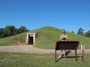
The entry tunnel was about 20′ into the Ocmulgee Mound

remains in the Southeast.  People were known to have lived in the area from around 10,000 B.C. through the early 19th century.  Over 700 acres have been preserved in this monument and one can walk on trails to visit a reconstructed earth lodge, other large mounds, as well as where some Civil War skirmishes were fought…although only one Macon house was damaged by cannonball fire during the war.

We thought the Cannonball House was a cannon museum and weren’t interested in seeing it, but learned it was so named because it was the only

house damaged by the war.   The damage was slight, but certainly is a tourist attraction!  This 1853 Greek Revival-style house not only housed
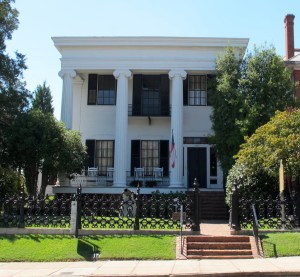
We really enjoyed the tour of the Cannonball House

Judge Asa Holt, well to do plantation owner, it housed meeting parlors for the Alpha Delta Pi and Phi Mu societies, which were founded in Macon.

We didn’t get to tour the Hay House, but took pictures of it.  What a mansion!  It was built in 1855-59 a la Italian Renaissance Revival and sported 24 rooms as well as a plumbing system with hot and cold running water in several INDOOR bathrooms!  I wish we could have seen this interesting place.  But here is a picture of the entrance.
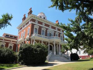
We were told this house had 8 stories. We could only figure out 7. But what the Hay, let them decide what is a story.

Jerri discovered several streets lined with these beautiful mansions and we took pictures of many of them, but alas, tours were not available for most of them.  They are still regular houses and are being used in every day life.

It just took a couple of hours to drive to Savannah but we could begin to see a bit of a change in the climate…such as Spanish moss hanging from the trees.  Savannah is located beside the navigable Savannah River (Our hotel was less than 50 yards from the river and a container ship blew its horn about 1 AM one night and sounded like it was in bed with us!) and was founded by General James Oglethorpe in 1733, the last English colony.

Oglethorpe (and Col. William Bull) eschewed the usual village grid system and laid out Savannah in a series of wards in which commercial and residential buildings were centered on public squares.  Originally, cannon facing south were set in these squares as part of a defense system against the Spanish who were in Florida.  Today 22 of the original 24 squares survive, lined with handsome houses and bedecked with fountains and statues.   I’m sure a lot of dedicated people worked hard to maintain the historic district against rich developers who would have transformed Savannah into another run of the mill city.  Jerri and I walked to many of the squares and marveled at how gorgeous the landscaping is.  It just made us feel like we had been transported back to antebellum days (without all the inconveniences of that day)

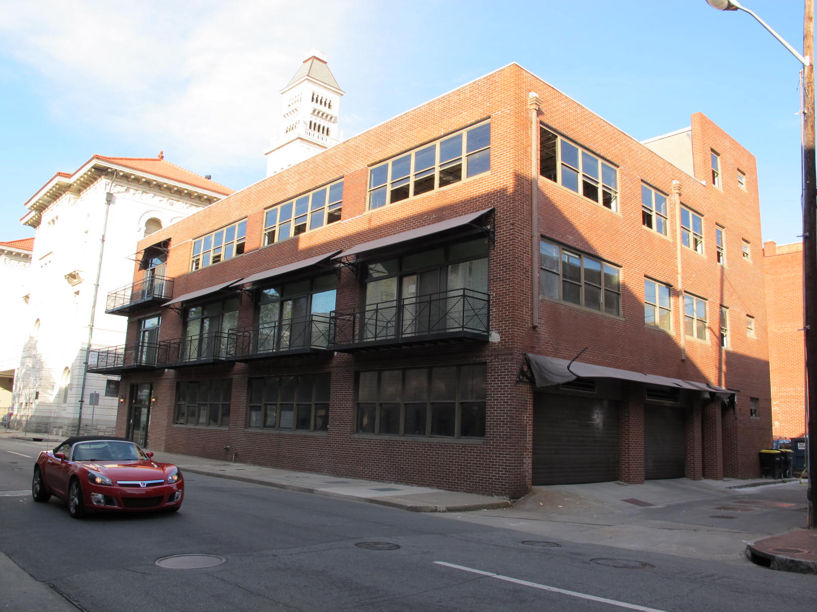
Historical monument. Jerri worked here in ’72 and ’73!

Jerri and Allan lived in the Savannah area while he was in the military in 1972-3 and she was excited to see where she worked and show me the places they lived.  We found her work place, which is now abandoned and since it’s in the historic district probably going to be redeveloped for something historic.  It is apparent that the phone company does not operate it anymore.  She worked on the 3rd floor and then moved to the 2nd floor.  When we went to find their homes, it was as if they’d fallen off the face of the earth.  Roads were widened, addresses changed, landmarks changed and they just weren’t there.  Stuff happens in 40 years!

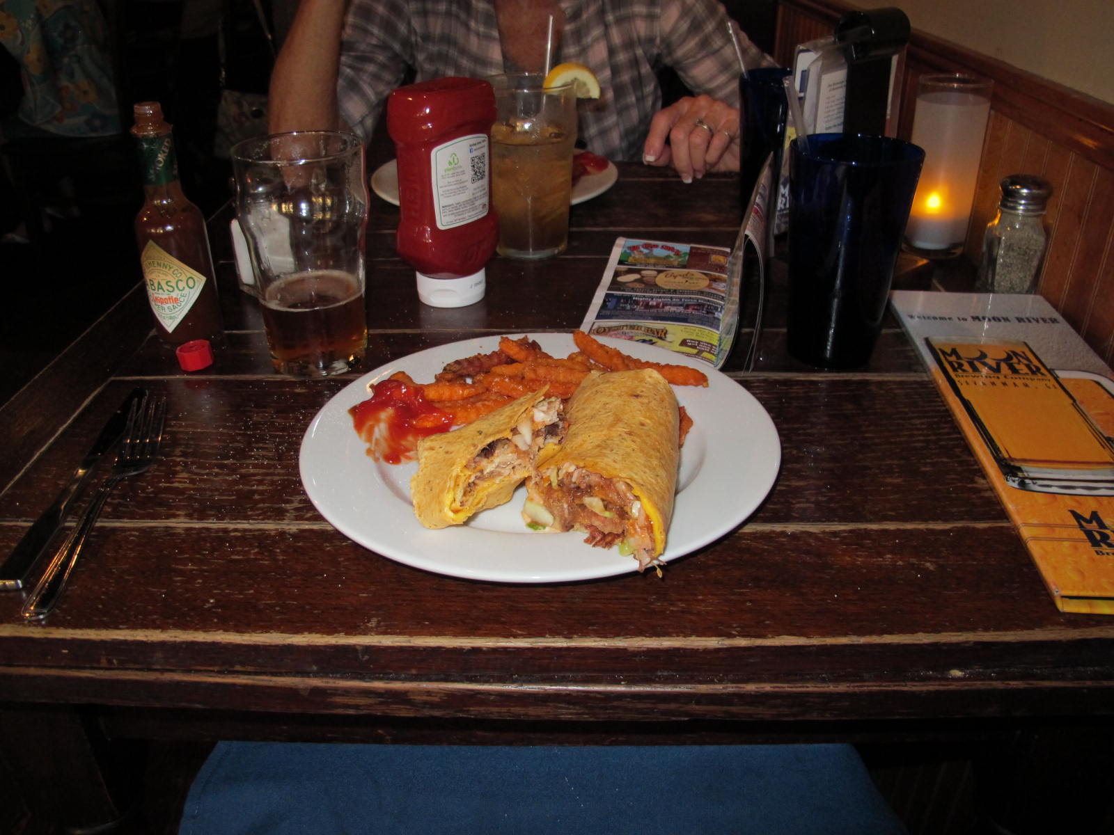
This was our first dinner in Savannah.  A nice pulled pork barbque wrap filled with coleslaw at the Moon River Brewery on Bay Street. Sweet potato
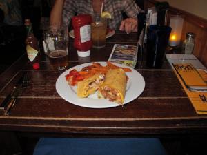
Good grub at the Moon River Brewery!

fries were the side dish.  Yum! What a feast it was!  We wished that we’d split one as neither one of us could finish it.  Pubs or neighborhood diners are our favorites as they tend to have really good food for good prices plus the service people tend to be friendlier.

We discovered a branch office for Phillip Marlowe in Savannah even though he’s supposed to be in LA.  Who knew?
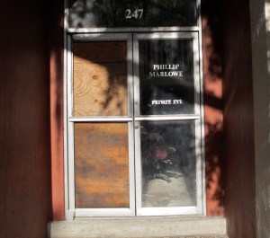
Phil’s branch office
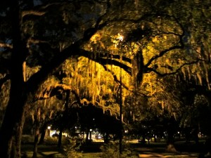
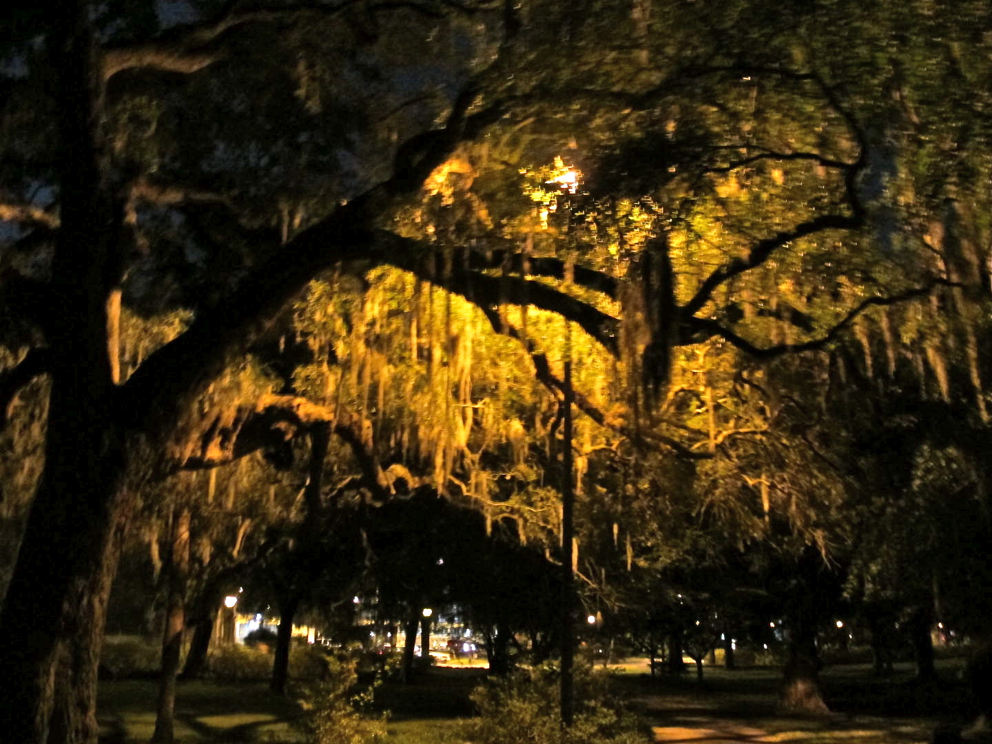
Spanish moss is all over the place in Savannah. Pretty to look at but not nice to take home in your car. Jerri says there are many bugs in the stuff.

The Spanish moss hanging from the trees really intrigued me and I took way too many pictures of it.  But it seemed so photogenic, eerie and spooky!   This picture was taken on our ghost tour, which made it all the more eerie.

We found the Forsyth (pronounced Fore-sith) Fountain at the far end of our long walk on Bull Street.  It sits at one end of the very large and well
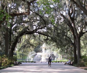
Forsyth Fountain features mermen in lieu of mermaids!

used Forsyth Park.   Its popularity today is reflected in the fact that many weddings take place there as well as many other special occasions.   I can’t remember its entire history, but suffice to say that it is very old – 1858.   We learned on our ghost tour that at the peak of a yellow fever plague, a tunnel was dug from the nearby Candler Hospital to an area under the fountain where a large morgue was set up.  It seems that the city fathers didn’t want the populace to know how many people had died of the fever.  I looked it up and this appears to be a true statement.

We also toured the Sorrell-Weed House just a few blocks from Forsyth Park and found it pretty neat too.  As most places in historic Savannah, it’s supposed to be haunted because the wife of the owner flung herself off a balcony upon learning of her husband’s infidelity.   We didn’t see any ghosts or any orbs.  Dang!  It would be so cool and scary to do so.

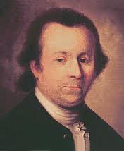
Button Gwinnett

All during our trip, Jerri had been pointing out street names, towns and what not that were named for someone of historical significance in Georgia history.  I was impressed that she knew so much because she was in Georgia only 2 years while Allan was in the military.   She had mentioned a guy named Button Gwinnett, who, it turns out, was a signer of the U.S. Declaration of Independence and wrote the first draft of the Georgia constitution. (Another aside here from Wikipedia: Studies usually suggest an example of an original Gwinnett signature would be valued only behind the likes of Julius Caesar and William Shakespeare, making Gwinnett’s, by far, the most valuable American autograph.  Its extraordinarily high value is a result of a combination of the desire by many top collectors to acquire a complete set of autographs by all 56 signers of the U.S. Declaration of Independence, and the extreme rarity of the Gwinnett signature; there are 51 known examples, since Gwinnett was fairly obscure prior to signing the Declaration and died shortly afterward.)  So he was an important and prosperous dude in Georgia and many things are named after him.

While we were on our long walk on Bull Street, we crossed W. Gwinnett Street.  I asked Jerri if Gwinnett’s name was William and was his nickname Button…whereupon she went into hysterical laughter saying that his real name was Button and the W. was for West!   She did not let me forget that faux pas for the rest of the trip.  Believe me, we saw many more references to Mr. Gwinnett while on our adventure and much laughter ensued after each sighting.
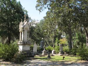
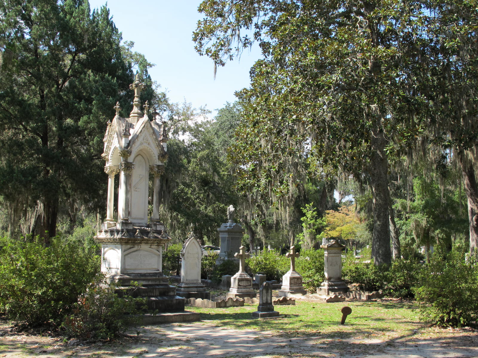
A small portion of the Bonaventure Cemetery

After many recalculations with the GPS, we spent part of that morning at the large Bonaventure Cemetery, a former plantation that overlooks the pretty Wilmington River.  I don’t know what happened to the plantation but it has been a cemetery since the mid-19th century.  With really old live oaks, a lot of Spanish moss and many of the graves incorporating beautiful statues and ornate carvings, this place was eerie even in the daytime.  I think I would have been too scared to take a ghost tour there at night.   I’m sure we would have seen lots of orbs or even ghostly presentations on such a tour.  I took a lot of pictures here but none convey the spookiness I felt there.   Jerri and I both would not have wanted to be a woman wearing the regular 8 layers of black widow’s weeds during the 1800s.  We probably would have swooned from the heat and humidity.  It was hot enough wearing our contemporary togs.

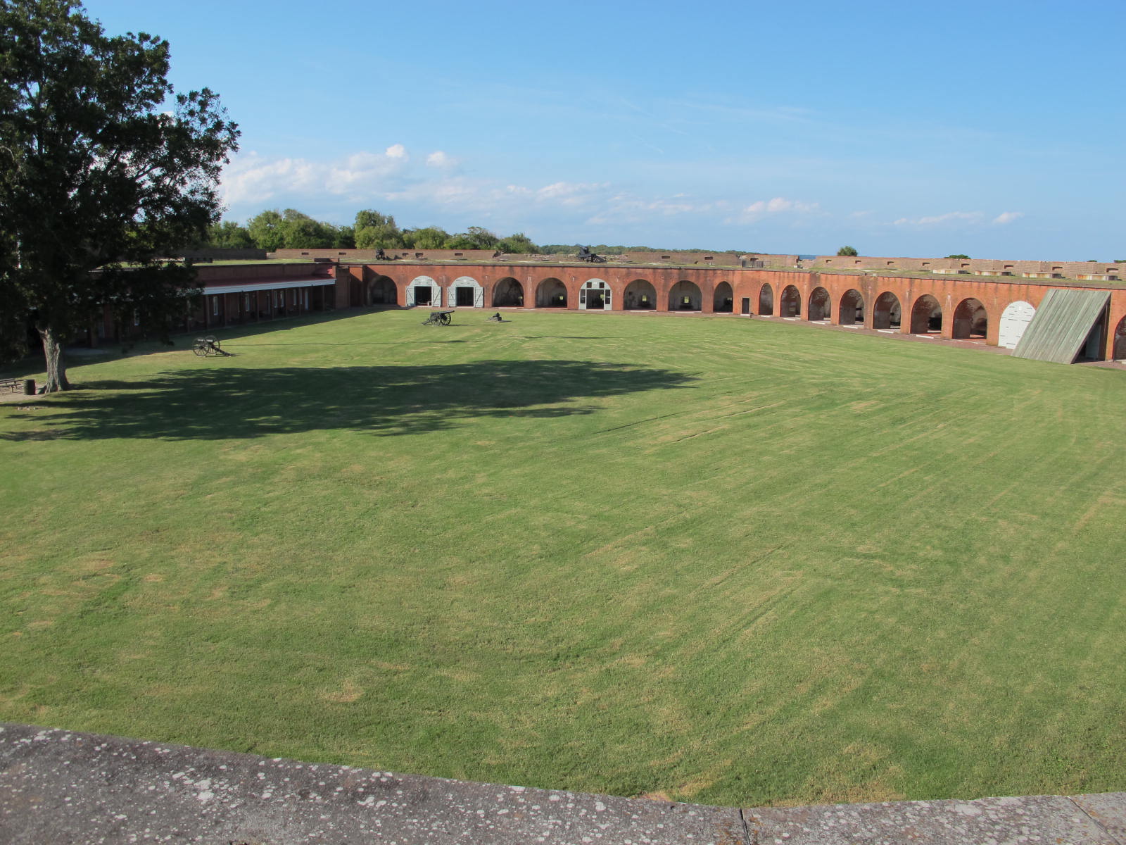
Fort Pulaski was sort of near the Bonaventure Cemetery and we drove out to Cockspur Island to see this national monument at the mouth of the

Fort Pulaski interior looking at cannon bays

Savannah River.  I thought it was a pretty neat edifice with its own moat, a cool drawbridge and 7 foot thick brick walls.  But I learned that while it was formidable in the time it was built, it marked a turning point in military history.  Union forces on nearby Tybee Island used rifled cannons and bombarded Pulaski, ruining one of its sides.  The 1862 battle clearly demonstrated the power, range and accuracy of rifled cannon and signaled the end of masonry fortifications.  We had an excellent tour guide who took us around to the cannon galleries and explained how the cannons were moved, loaded and how cannon balls were heated and shot at the enemy. (They shot red-hot cannon balls at ships in the river in hopes of setting them on fire.)  The fort is very well preserved and one can get an idea of how things were done during the Civil War in a fort such as this.   This next picture is a duplicate of one taken 40 years ago when Jerri and Allan visited Fort Pulaski.
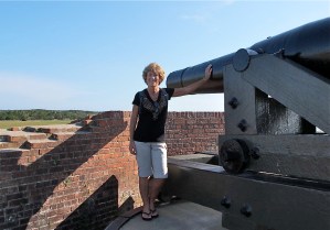
Jerri and the cannon. You can see some of the damage done by Union cannon

While living in Georgia, Jerri and Allan lived near Ft. Hunter and Ft. Stewart.  She wanted to show me where they lived and how different it was from little old Orange County. Well, I could tell things

Fort Stewart HQ

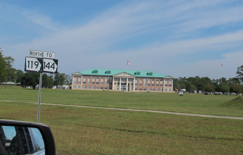
had been and are different from the OC…so rural, lots of trees, a few cotton fields and some swampy land with many trees.  Even though we couldn’t find their place in Hinesville, we were able to drive onto Ft. Stewart and saw many changes there.   This picture is of the headquarters, which was a big white building in 1972.

We also visited Fort McAllister, a Confederate earthwork fortification, on a bank of the Great Ogeechee River.   It was interesting to see how the earth was pushed around to protect the personnel as well as allowing the cannons a way to shoot at the enemy.  The soldiers also used pointed stakes pounded at an angle into the ground around the fort for extra protection.

As soon as we got to Savannah, we scheduled a ghost tour in anticipation of seeing the city at its haunted best.  Needless to say, we were sorely disappointed when it was canceled as we’d rearranged our schedule to meet theirs.  We found another company, booked with them and then discovered it was the one I had originally wanted to go with.  I had erred with the name of the company.  So all worked out well.

No orbs at the Candler. What a bummer.

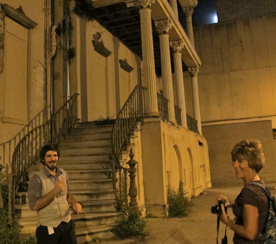
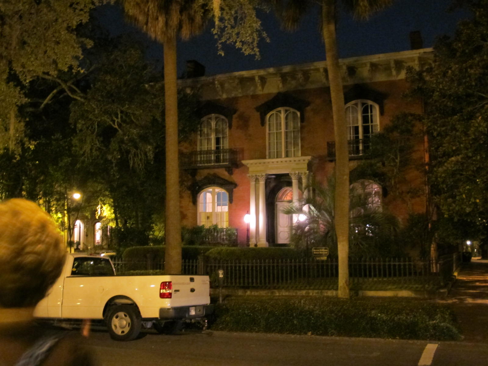
Christopher Thomas was our guide and he was excellent in creating the mood and telling the stories of Savannah and the buildings we visited. From Christopher, we learned that many of the people who lived on Jones Street were well-to-do and were often trend setters.  People wanted to be like them and thus, the saying arose, “Keeping up with the Joneses.”  We learned many stories that night, too many to recount here, but suffice to say, we were well entertained.  We visited the Mercer-Williams house where events central to the book Midnight in the Garden of Good and Evil took place.   This 1860 mansion was built for Gen. Hugh w. Mercer, great-grandfather of singer and songwriter, Johnny Mercer.
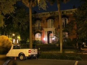
The Mercer House

When we decided to go to Georgia, Jerri really wanted to eat at Paula Deen’s restaurant, but when we went by it, there was a line ‘clear ‘round the block of folks waiting to get in.  She said forget it.  She had more important things to do than wait in line.

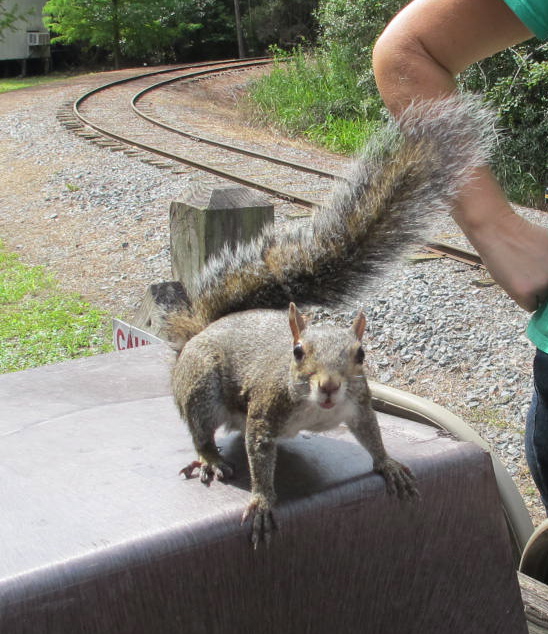
Georgia, the greeter squirrel

The morning after the ghost walk, we drove on down the road to the Okefenokee Swamp.  What a fun place!  However, it’s another area that I wouldn’t like to be alone at night.  Creatures and critters were all over the place.  Oddly enough, mosquitoes don’ t live in the swamp because they don’t like the tannic acid in the water (it looks like very strong tea).  Jerri found that there were other biting bugs, though, as she got bit on her legs and feet.  We took a little train ride and then a boat ride through part of the swamp.  We saw many plants that the Cherokee and Creek Indians used for medicine and general living as well as trees used for lumber and also some ‘gators.  We met little Georgia, a squirrel, that met our train and posed for pictures before she bounced off with the train engineer to get some pecans for treats.
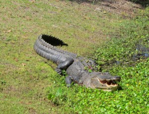
This is one of the big guys who was running around wild in the swamp. Don’t want to mess with him.

This 7 legged spider measured at least 3 maybe 4 inches. I would not have liked to walk into its web. Eewww!
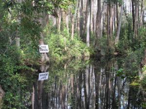
Mirror Lake was so reflective and pretty.

We headed to a little town named Americus after the swamp.  The highway was pretty and lined with many trees and then Glenda (the GPS) directed us to turn off on a little byway of a road.  We thought that was strange, but Georgia doesn’t have particularly good signage, plus the ones they do have are small in print.  Even glasses don’t help.  Anyway, we zoomed on going over small hill and dale and did get to see a large deer bounding across the road.  After about twenty miles, we came back to the original highway and then went straight to our hotel.  Bizarre, but if we hadn’t taken that road, we wouldn’t have seen the deer (although I must admit that I was getting a tad nervous after 20 minutes of the beautiful road we were on).  The clerk at the hotel said that misdirection happens all the time.  Must be a glitch in the system.

Our hotel was called the Windsor and is called the crown jewel of Southwest Georgia.  It was built in 1892 and even had a tower, a turret and a three-story atrium-lobby with balconies.  It was gorgeous and all for $103 per night!  It even had a pub in which we ate our dinner and an upstairs porch complete with rocking chairs that we sat in after dinner.  Couldn’t ask for more.  President and Mrs. Carter presided at the grand re-opening in 2010 and we reaped the benefits of that remodeling.  We loved the hotel (which is also supposed to be haunted, but we missed the ghost).
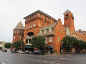
Windsor Hotel. Our room was under the big tower

Jimmy Carter is big in this part of Georgia and we decided to visit Plains, which was just a few miles from Americus.   We recalculated a few times(due to missing some signs) before we arrived in Plains , grand population of 779.   The entire downtown is pictured below.  Billy Carter’s Gas Station is a stone’s throw across the railroad tracks.
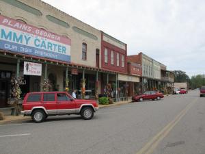
Downtown Plains, GA

Plains has a very nice Jimmy Carter Museum that is housed in the old high school he and Rosylynn attended.  There is a replica of his presidential desk in the Oval Office and Jerri and I took full advantage of it, playing with multiple exposures of delayed picture taking or whatever that function is called on the camera.  For a few seconds we were the Prez.  The ranger must have been laughing at us while we were playing around with the photos.
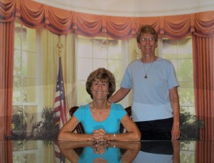
The Prez and VP

The Plain Peanut (where we saw a sign they served peanut butter ice cream…and after all it is Plains, GA, sort of a peanut capital) was closed when we got there and so we drove on out to Jimmy’s boyhood farm to see what is there.  We encountered no one else but an extremely friendly Siamese cat who just wanted to be skritched and get lots of attention.   He was obviously well cared for and we couldn’t figure out where he came from.  Perhaps he just liked tourists and enjoyed being the host.  We toured Jimmy’s farm house and the grounds and got some good pictures of a good looking rooster.  You could tell he was king of the ol’ bucket.  I hope he wasn’t destined to be in the bucket soon.
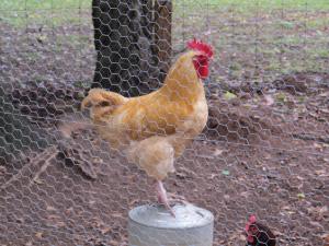
King of the bucket
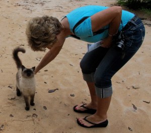
Loving the attention

We buzzed back to downtown Plains to the Plain Peanut and enjoyed the ice cream, lots of different peanuts and some good conversation with the proprietress.  I think she sold us a lot more peanuts with her down home hospitality than she would have by just saying “hi” as we entered the store.  It was a fun lunch.

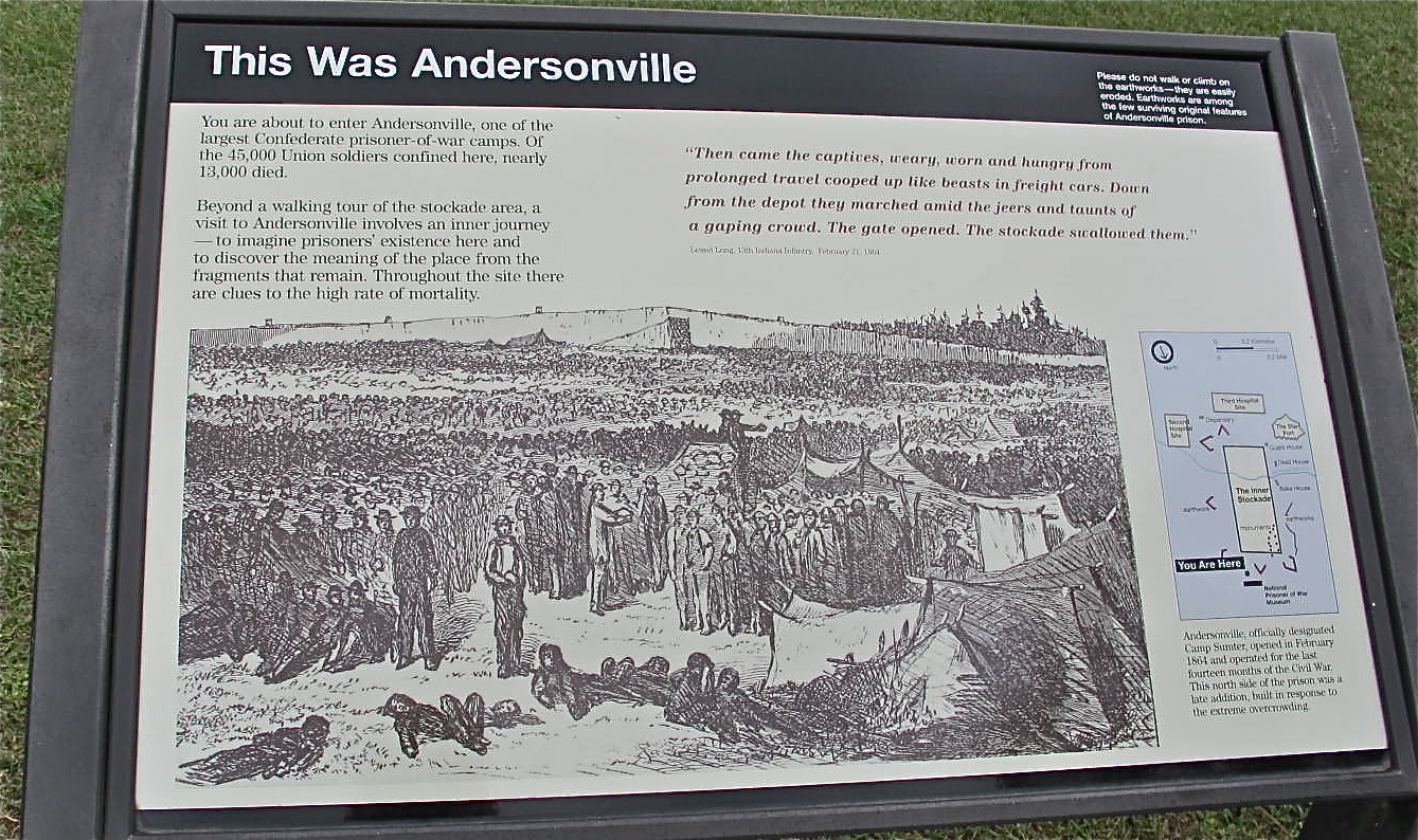
From there, we went to Andersonville (aka Camp Sumter), the scourge of prison camps during the Civil War.  The beauty of the place today belies the hell on earth that it was almost 150 years ago.  In the space of about 26 ½ acres, more than 45,000 Union soldiers were confined here, 13,000 of who died from disease, poor sanitation, malnutrition, overcrowding or exposure.  These terrible conditions were the result of the Confederate government being handicapped by a deteriorating economy, inadequate transportation and the need to concentrate all available resources on its army.  The prisoners lost out.
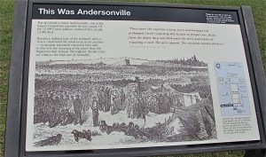
Andersonville was not a pretty place during its existence.

The prisoners were confined in a 15’ high stockade with an inner line about 19’ inside the wall called the “deadline,” which prisoners were forbidden to cross upon pain of death.  I think this is where the word “deadline” came into our language.  Jerri and I were also told that soldiers in that war each carried half of a tent that, when put together, was called the “whole shebang.”  That is supposed to be where we got that expression in our language but I am not able to substantiate that claim.  I like that explanation so I’m going to count it as real.  (Another aside:  Our dad told us that when he was in the army in WWII, guys would carry half of a tent and then put it together to make a tent for 2 people.  He never mentioned the “whole shebang,” however.)

It started to rain and then pour while we were there so our pictures did not turn out as well as we would have liked.  It’s neat and green and beautiful today, not giving much hint of what happened there (except for signs and some examples of the stockade and deadline) in just 14 months.  The National Prisoner of War Museum is also housed on those grounds and provides insight of POWs’ ordeals throughout the nation’s history.  Our visit there was tempered by the solemnity of the site, but buoyed up a bit with its beauty.

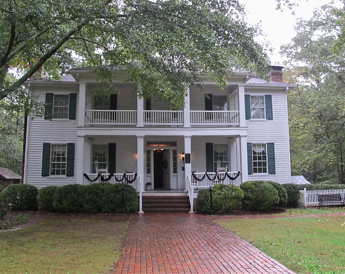
Jerri had wanted to see some big plantations, but it never worked out to see the “ideal” one with the long, oak lined driveway and huge house with a few out buildings.  A sort of a last chance deal, we

Stately Oaks was arrayed with mourning shrouds due to the death of a prominent volunteer.

zoomed through some real byways to finally arrive at Stately Oaks plantation in Jonesboro, a small suburb of Atlanta.  Even though it was not the “ideal” plantation, this turned out to be a real treat!

It is an 1839 Greek Revival plantation house furnished with antiques of the antebellum era with out buildings that include a tenant house, a small school, a well house and the original log kitchen.  The tour was very interesting and we found that while Union soldiers were in and around the area and there were battles fought in Jonesboro, Stately Oaks was not destroyed.  Then we found that Margaret Mitchell’s grandfather or perhaps great-grandfather built the place.  She visted there often and asked many questions about the war and what happened while the war was going on.  It is widely assumed that Mitchell used Stately Oaks as the inspiration for her famous Tara Plantation in Gone with the Wind.   Jerri and I always marvel at how things turn out and we often get to see totally cool places/people by happenstance.

We zipped through Atlanta to Kennesaw Mountain, another important Civil War battlefield.   Some very bloody battles were fought for these high points that provided good views for the soldiers and also gun emplacements. This was basically the last major obstacle that Sherman had to defeat before putting Atlanta under siege.  The visitor center provided an informative orientation film and also small exhibit area that really gave some good info about the battles and people in the area.

Since it was raining cats and dogs, we wound our way around some more byways and found Marietta, a town that more well-to-do folks moved to prior to the Civil War seeking the healthier climate of Piedmont Georgia during the summer malaria season.  It was a pretty town surrounded by small hills.  We toured the Marietta Museum of History and saw several galleries documenting the history of Marietta and Cobb County.  They even had on display an old machine that would give perms to ladies (from the 30s).  I thought it looked like an electric Medusa designed to electrocute the unfortunate lady.  It was a pretty thorough display of local odd and ends.

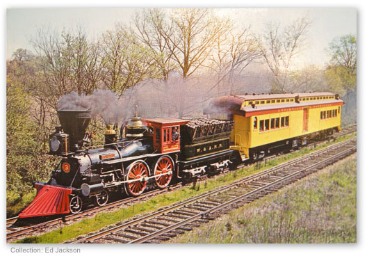
A picture of The General during a commemorative trip.

We also made time to visit the Southern Museum of Civil War and Locomotive History in the town of Kennesaw.  This is a Smithsonian affiliate that focuses on the history of Georgia railroads during and after the Civil War and has some great exhibits.  Several of the exhibits tell the story of “The General” which was stolen during an incident known as “The Great Locomotive Chase.”  You may have seen the movies made by Buster Keaton in 1926 and Fess Parker in the ‘50s of the same name.  It is quite a story and lends itself to a movie very well.  The real General is right there in that museum.  It was fun to see.

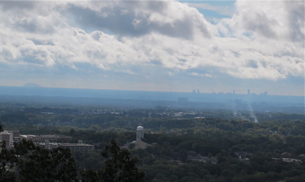
The rain caused us to wind our way around again and again due to crummy street signs and misunderstandings with local instructions and/or Glenda, but we eventually arrived at our hotel and then to a recommended restaurant.  The next morning was still damp, but we went back to Kennesaw Mountain to get to the lookout to see what was supposed to be a great view.   And it was!  Despite there still being clouds in the area, we could see Stone Mountain and Atlanta, both more than 20 miles away.  That was pretty exciting for a Southern California kid.  Stone Mountain is the bump on the left and Atlanta is the skyline on the right.
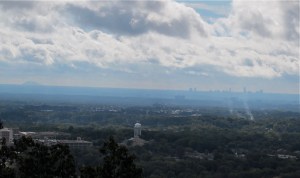
Not real clear, but one could still see almost 30 miles in the distance.

Since the weather was iffy and we’d about done enough Civil War stuff, we decided to spend our last afternoon in Atlanta at the World of Coke and the CNN office building.  I wasn’t real excited about driving in Atlanta, given the trouble we’d had with street signs and all, but we managed to home in to the correct parking structure and have a great afternoon.
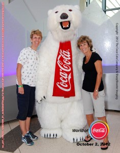
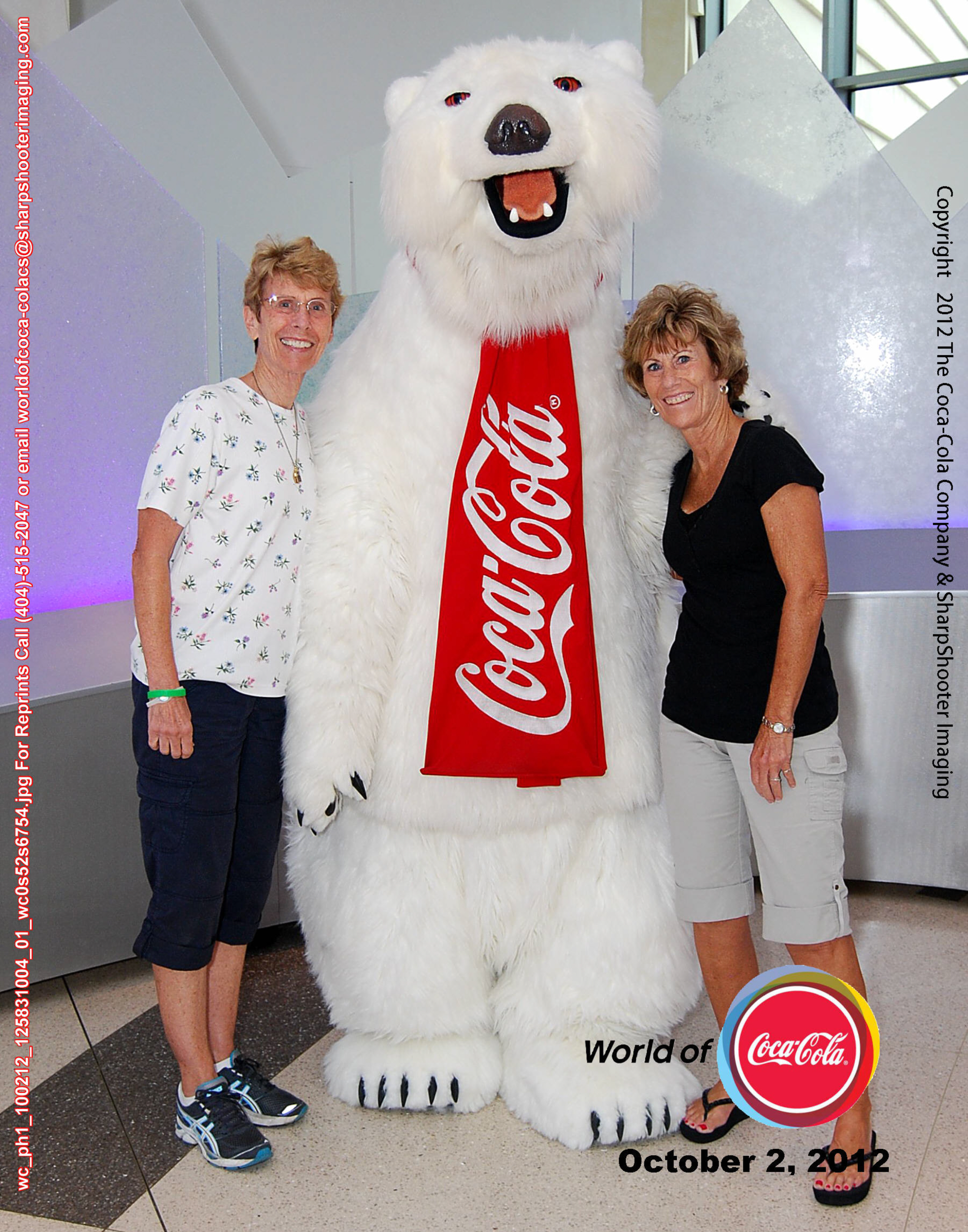
The bear and friends

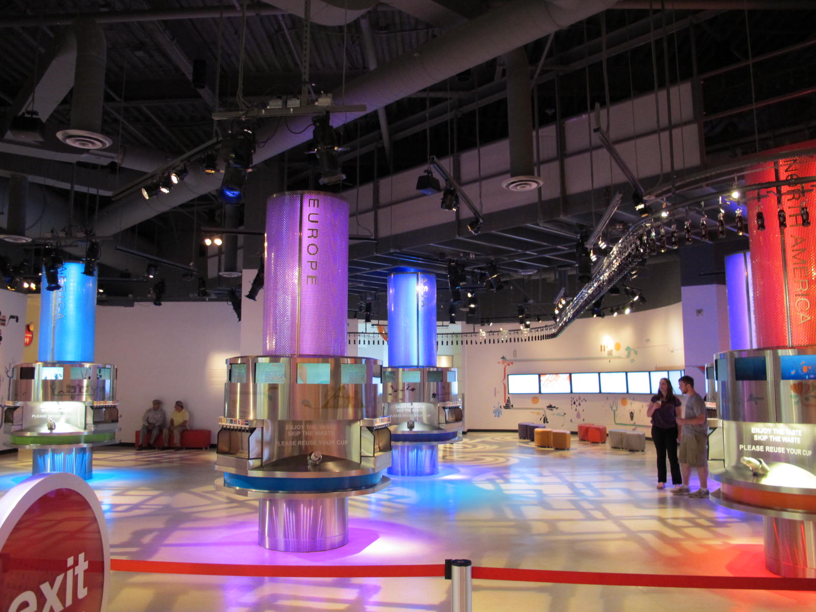
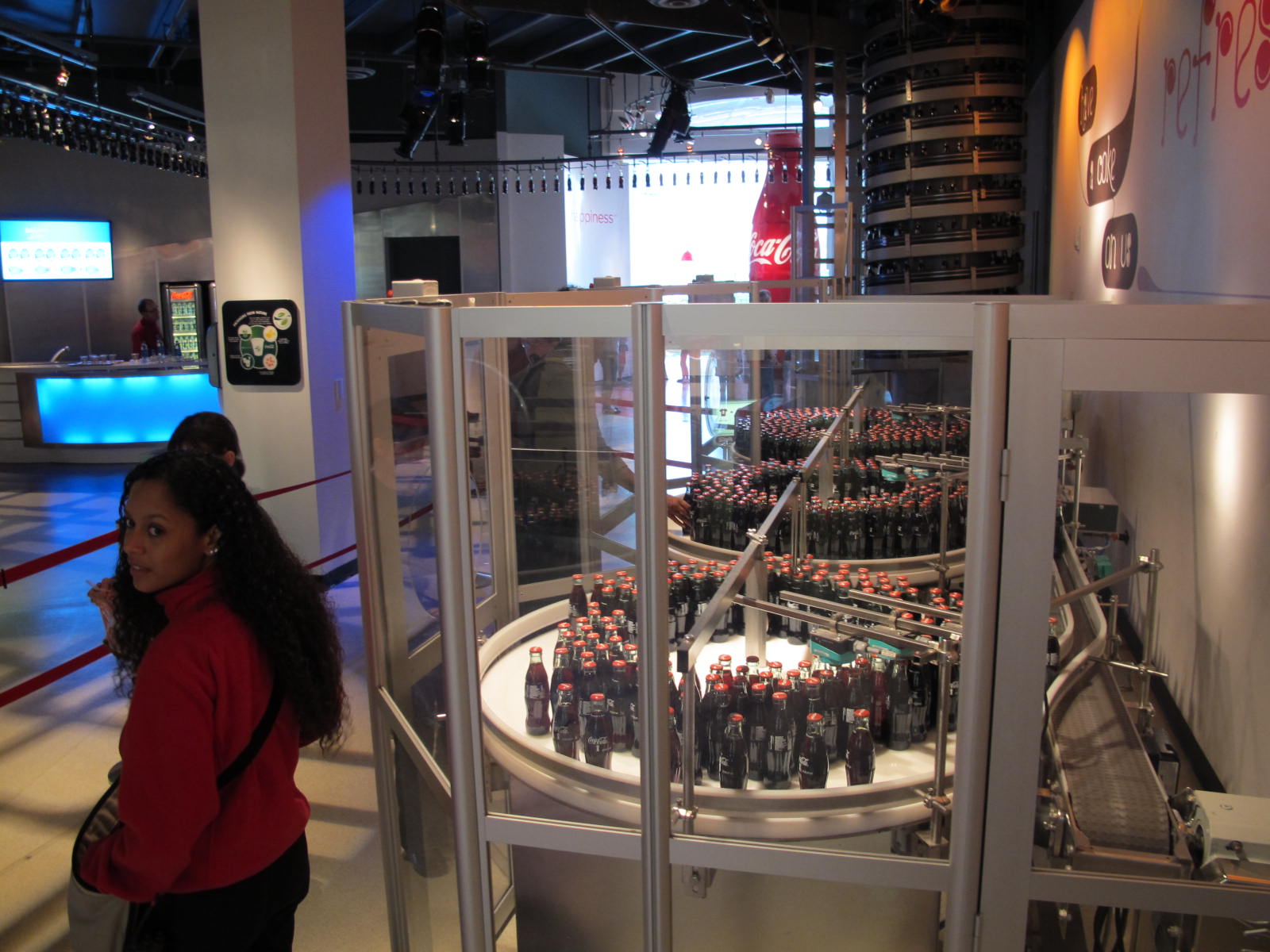
The World of Coke was very well done and a lot of fun, but I think I was tired and thought parts of it were too loud.  We went through assorted “rooms” and learned the history of Coke, how it began and how the company evolved into what it is today.  One of the rooms had a lot of commercials for Coke from all over the world.  How weird it is to enjoy watching commercials?  But one of my favorites is the one where a lot of people from around the world sing “I’d like to Buy the World a Coke…”  We got to take our picture with the Coke polar bear and also with Mr. Pemberton, the guy who invented Coke.  One of the rooms had a ton of memorabilia from around the world as well as specific Coke bottles from Nevada and California.  We both got to hold an Olympic torch from the 1996 Atlanta games.  It was a lot heavier than I had expected and I don’t think I could have run with it very far in the torch relay.  There was a small bottling room so that we could see basic process of how Coke gets into bottles.  The bottles went out on a conveyor of sorts into the tasting room.  The pentultimate room was a tasting room that was sectioned off into continents.
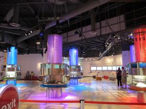
The tasting room

There were 64 Coke products from the various continents and we could taste as many or few as we wished.  There was no Coke as that formula is the same around the world, but other flavors were available.  Some were too sweet, too bitter and none seemed just right.  (I sound like Goldilocks, huh?)  Funny thing about the tasting room picture.  There were people milling about, tasting, discussing and tasting again and I happened to get a picture without many people in the view.  But you get the idea of how the room was divided into continents.  If you will notice a sort of curved line or illuminated line along the right side, that is the bottle carrier from the bottling room.  The bottles were quickly deposited into 3 turntables where we could pick up a free bottle of Coke.
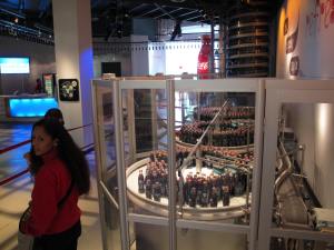
Free Coke for all!

The very last room was, of course, the gift shop.  Anything you could possibly think of with a Coke logo was available with the appropriate price tag.  One could go nuts in there.
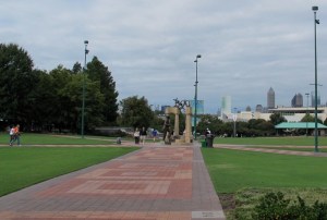
While walking toward the World of Coke, we could see a Coke bottle on one of the towers.
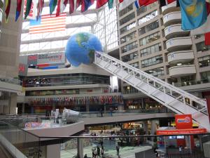
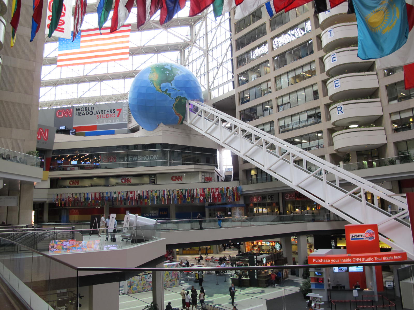
This picture depicts about half of the 8 story escalator. Jerri and I had our news anchor picture taken in the globe at the top.

Jerri and I left the World of Coke and walked about 2 blocks through the Olympic Park to the CNN building.  This is a cool place to visit to see how a mega company like Ted Turner’s works.  Our tour began riding up the longest escalator in the world…8 stories worth up into a sort of hollowed out large building.   This picture is only a portion of the escalator which ended in the blue globe at the top.  There, Jerri and I got our picture taken auditioning to become news anchors.  Luckily, we didn’t quit our day jobs.

New CNN anchors

I got to try reading from a teleprompter and found that it wasn’t very easy, especially when our tour guide sped up the teleprompter.  We took a ton of pictures as we learned about the news process from beginning to end in that building.  It is certainly impressive and I’m glad that I don’t have that job.  Too much pressure, I think.

We walked back through Olympic Park to our car and then programmed Glenda to get us to our hotel.  It was quitting time in Atlanta and the traffic was building.  But we managed to arrive without too much hassle.  It was when we tried to go out to dinner that we had a problem.  Around and around the mulberry bush we went trying to find this place.  Finally, we had to admit defeat and go back to the hotel and try for more instructions.  How embarrassing!  I think I mentioned before that Glenda doesn’t work without an address and we didn’t have one, plus I couldn’t find the place in a phone book because I was spelling it wrong.  Good thing it was a good dinner!

Then the next morning was a challenge to get the car back to the rental company.  We thought we had an address, but it was the corporate office near the airport and since it was dark we didn’t see anyone to ask for help…PLUS the danged signs either weren’t present or they weren’t clear or they were too small and we missed them.  Finally, after backtracking, we finally arrived, turned in the car and made our way to the Southwest terminal.  The Atlanta airport is cool to get from the car rental area to the terminal…just hop a little train and off you go.  No, we didn’t manage to mess that up!

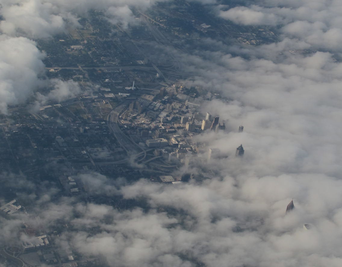
The clouds were breaking up over Atlanta when we left and the sight was neat with the tall buildings breaking through the clouds.
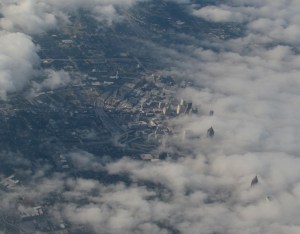
An aerial view of downtown Atlanta

Our trip was fun, educational in many ways for me, and FUN!  Jerri is so much fun to travel with and she makes me laugh (and I think, I make her laugh, too) and that makes the trip even more better.  Thank you, Queenie, for being my sister!


Lanai – Land of No Pineapples, But Lots of Fun

29 Jun

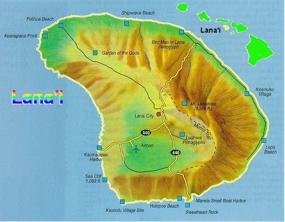
Uninhabited until the 1500’s, Lanai was always a place of mystery even to Native Hawaiians. Legends tell the story of a challenge between kahuna (priests) that scorched the earth

Lanai and its relationship to the other Hawaiian Islands.

of Keahiakawelo (Garden of the Gods), explaining some of the otherworldly terrain of the island. Lanai was a sovereign land until King Kamehameha united the Hawaiian Islands into one royal monarchy in 1810. The ruins of Kamehameha’s favorite summer fishing retreat can still be seen.  Called Kaunolu, this sacred spot and fishing village has been registered as a National Historic Landmark. Home to Halulu heiau (religious temple) you can also find ancient petroglyphs carved into the stones here. After contact with the west, Lanai was eventually purchased and converted into a cattle ranch. The Lodge at Koele now resides in the area that was once the center of the island’s ranching operations. As a former manager of this ranch, George Munro made an indelible mark on the landscape by planting the first of what became the island’s many Cook pine trees. The Munro Trail, named after Munro, leads to Lanaihale, Lanai’s highest point.  Later, under the leadership of James Dole, Lanai became the world’s foremost grower and exporter of pineapples – a title the former “Pineapple Isle,” held for most of the 20th century. As the cost of business rose, pineapple production was moved overseas and Lanai was eventually sold to David Murdock who did away with agriculture and built two lavish resorts in an effort to build tourism income.  He consistently lost millions. Recently, 98% of Lanai (State of Hawaii owns the other 2%)was sold to Larry Ellison, a billionaire who likes to make trophy real estate purchases.  So the course of Lanai might change again.  Who knows? Throughout its history, man’s impact on the Lanai has been minimal.  Even with the two resorts, only a scant 30 miles of paved road.  The timeless landscape is largely as it was, offering a glimpse into the Lanai of another time, on an island unlike any other in Hawaii.   With some of this history in mind, it was that three intrepid explorers ventured over to Lanai, spending a glorious 3 ½ days.

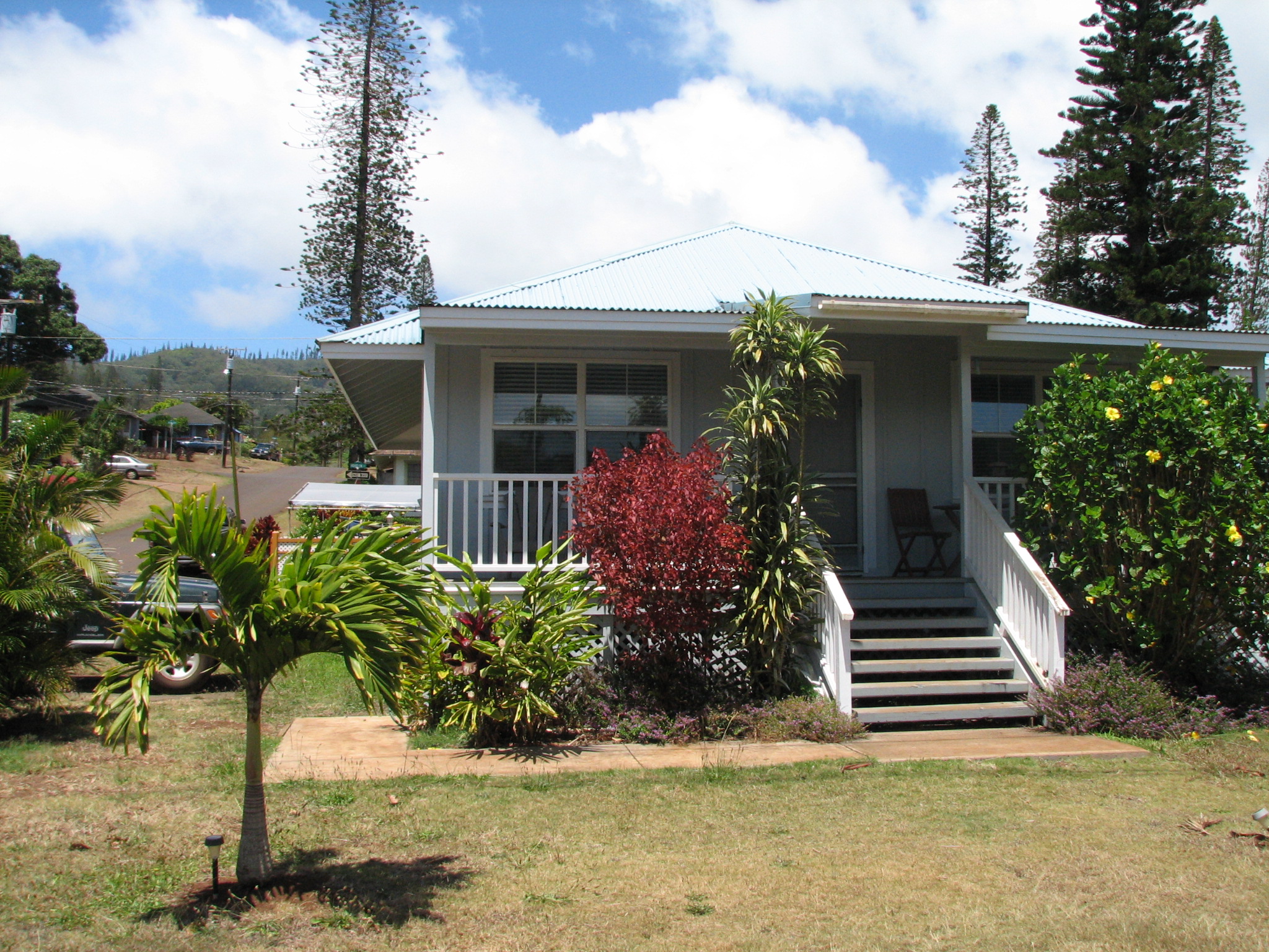
Our cute little house right in downtown Lanai City

Jan, Dick and I enjoyed the voyage on the local Lahaina-Lanai ferry on a beautiful sunny day.  Upon landing, we found our

Calico Kitty posing with Dick

reserved jeep (from our house owner) and made our way to our new digs.  And were they nice!  A 2 bedroom modernized plantation style house that was just perfect.  It even came with a resident calico kitty.  She was such a nice kitty and greeted us every time we got near the door…inside or out.  Of course we got some food for her and fed her and her mom who also came by on occasion.  We left a note for the next tenants and some food to give to the kitties. We had lunch at the Blue Ginger (famous for its apple turnovers and tuna melts among other local plates), shopped for supplies at Richard’s Market and made a short trek over to the Lanai Cultural Center.

We found a total of 9 varieties of Spam in Richard’s Market and the Pine Isle Market!
(RDS Photo)

The Center has recently been remodeled and has a very nice museum displaying many photos and artifacts of the island.  Dick had contributed some of his photos taken over the years and, lo and behold!  Some of them were on display in cases outside the building and also on the inside with professionally done signs attributing the photos to him.  The volunteers in the building knew of him and were very happy to meet him in person.  It’s cool to know a celebrity!

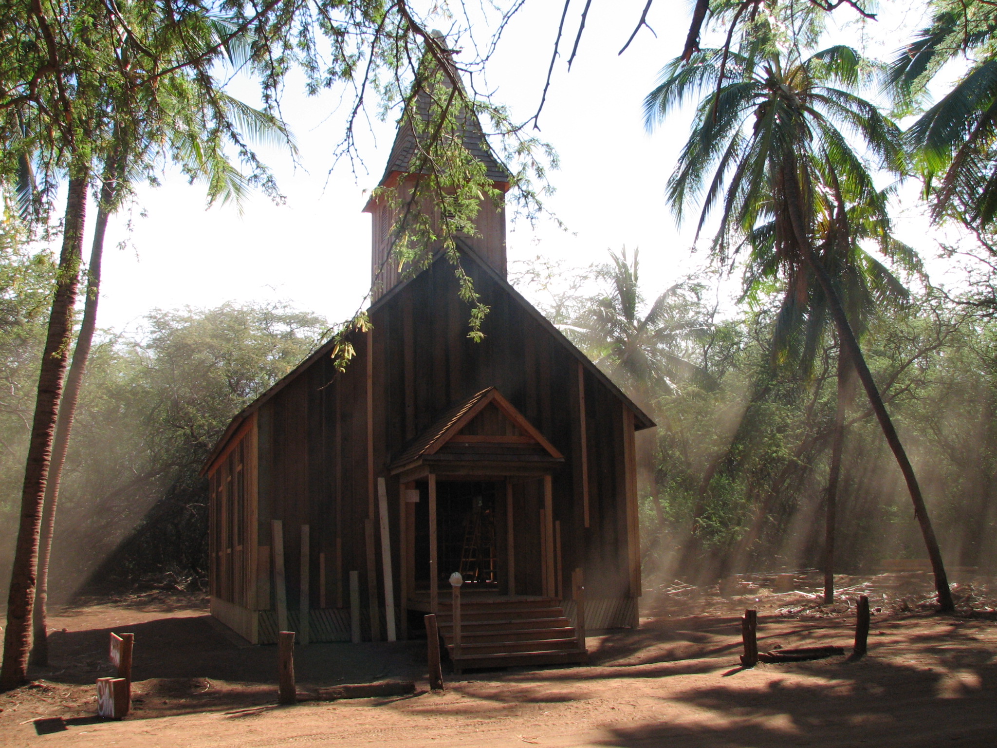
Kalanakila O Ka Malamalama Church in God dust

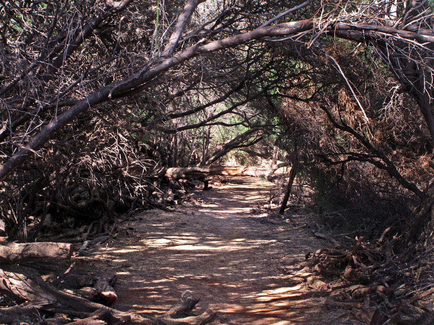
After seeing Dick’s photos, we hopped into the jeep and took a ride to the north shore to see an old church being restored at Keomoku.  I found it to be very interesting because the rebuilders had to raise the church up out of the dust and basically rebuild the entire thing.  The grand re-opening was to be this month(June, 2012), I hope it went well and that it was very well attended.  Hidden in the surrounding underbrush (some of which is tricker than the briar patch that Bre’r Rabbit lived in)

Check out the surrounding brush. I half expected trolls to jump out at us.
(RDS Photo)

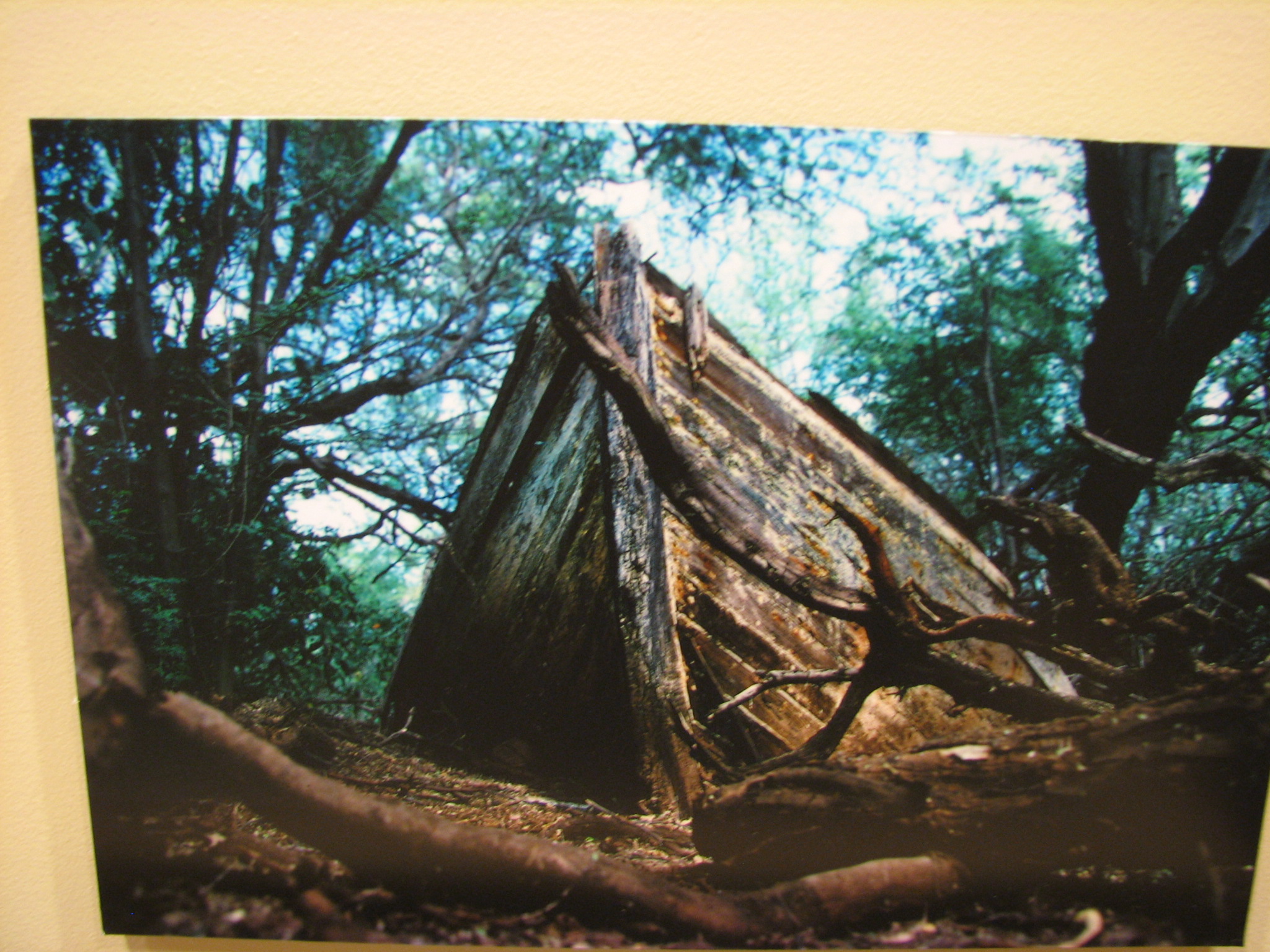
were the remnants of the Maunalei Sugar Company which operated from 1899 to 1901.  We were able to find a stone oven and a stone church (not part of the sugar company), but were unable to find a small locomotive.  We met two young men while looking around and they knew of Dick’s picture collection at the Cultural Center and had used them in some research they were doing with film production.  They were very impressed to meet Dick in person.  As I say, it’s cool to know a celebrity! Back in 1992, Dick found the wreck of a sailing canoe (that was once

Dick’s 1992 picture of the old sailing canoe wreck that is on display at the Cultural Center

near the ocean and now in the brush) and took pictures of it.  We found it again and took pictures of its demise in the last 20 years.  It’s amazing what the elements can do.

The same boat in 2012 (not the same quality of picture as what Dick took)

The rest of our adventure that day included visiting a Buddhist shrine honoring Japanese workers killed by a plague in 1900 and the remnants of the “Trilogy Club,” a sort of day camp that a tour group brought tourists from Maui to spend the day swimming, playing on the beach and eating treats. The next day, we treated ourselves to the Blue Ginger’s apple turnovers and rode out to Kaiolohia, aka Shipwreck Beach.  Strong trade winds are funneled between the island of

Jan adding to a sort of flotsam shrine built by passing hikers

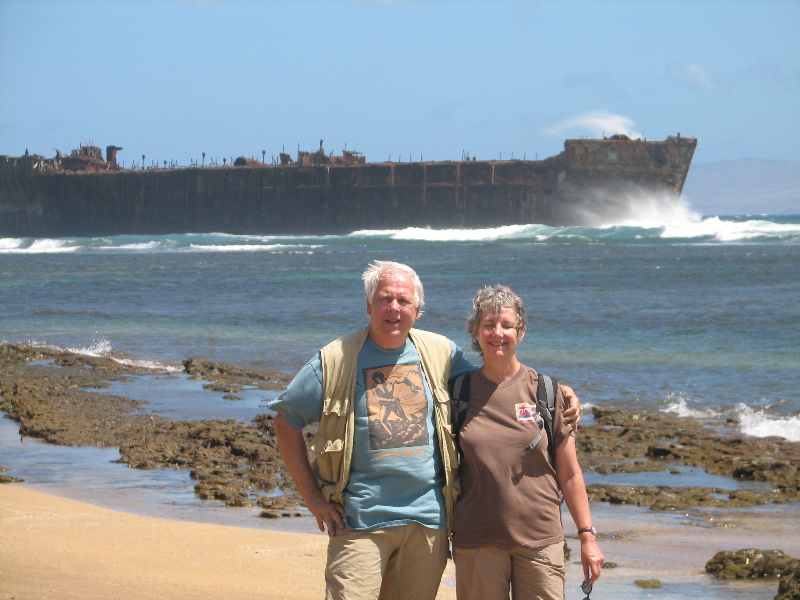
Dick and Jan with the YOGN-42

Moloka’i and Maui, directly onto Lana’i’s north shore.  Vessels emerging from the wind shadow  in either direction encounter sudden gusts and rough seas.  The more than six mile stretch of coastline gives one an opportunity to see all kinds of flotsam and jetsam as well as actual wrecks still being pounded by the currents and waves.  We hiked about a four mile round trip and were tired from being constantly windblown.  But it was a great day and I enjoyed every minute of it!  The first actual wreck one sees is the YOGN-42, an old ferro-cement navy fuel barge, abandoned about 1950.  We don’t know the reasoning of letting it run aground in this location.  But it’s great for picture taking.  Later, we noticed a wind surfer spending a lot of time near the old barge, apparently having a great time.  We were entertained for a long time checking out old timbers, other wreckage, sea salt deposits, shells and critter tracks (such as deer and turkeys).

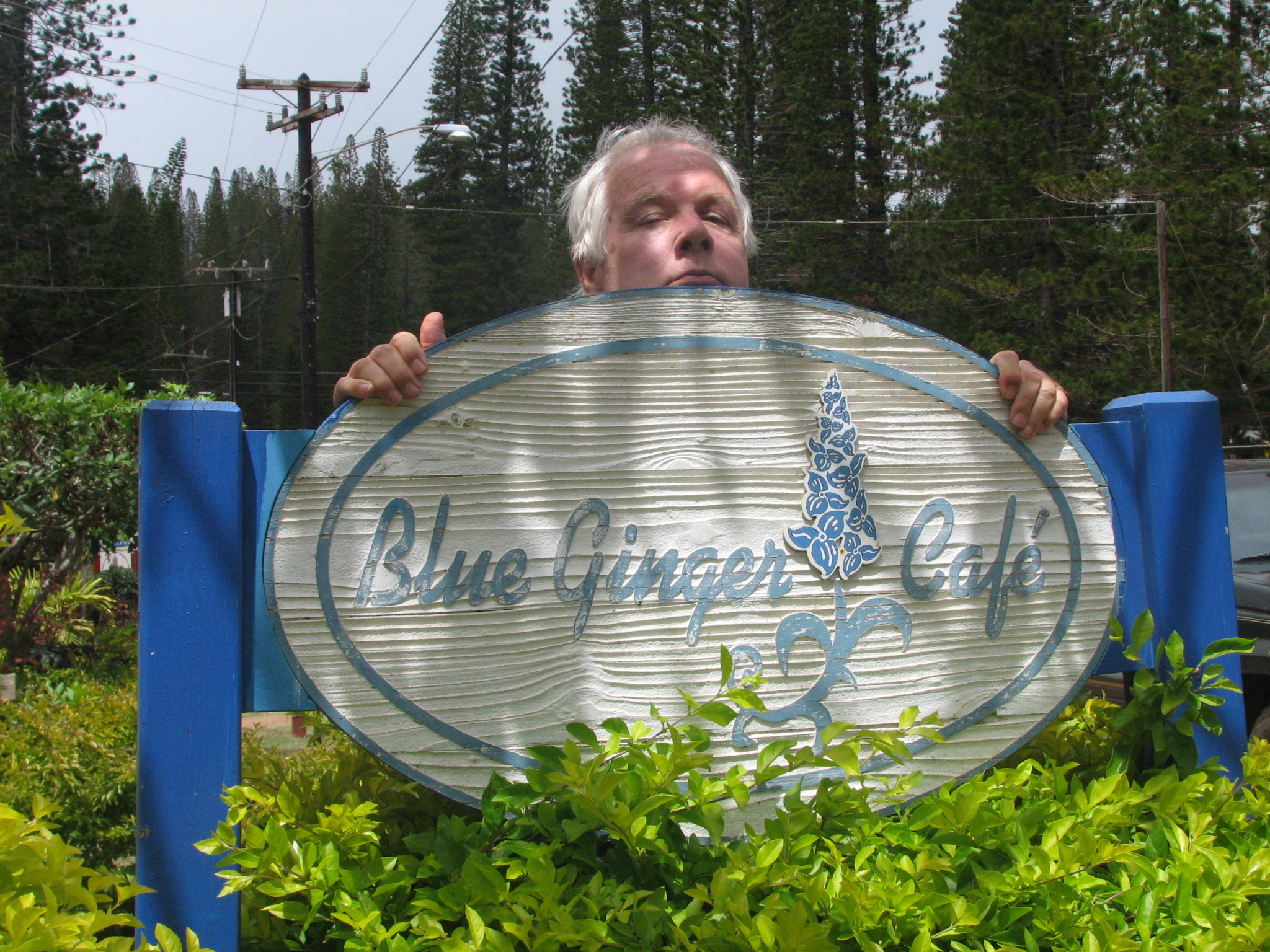
Dick peeking over the Blue Ginger sign

We had lunch at the Blue Ginger as it seemed to be our favorite place and, after some down time, took a drive out to

Looks surreal, doesn’t it? And you wouldn’t believe the wind was whipping around at 50 mph either. (RDS Photo)

Keahiakawelo, Lana’i’s version of Garden of the Gods.  We drove through an iron wood forest and some hills and dales to get there and found ourselves in the midst of a gale.  Jan and I didn’t even get out of the jeep, it was so strong.  But our intrepid guide/photographer did get some great shots of the collage of red rock formations that were once scorched by ancient eruptions and then carved by the elements.  Jan told me these rocks were formed by lava burps or “lava vomit.”  Whatever, it’s a unique moonscape biome right in Hawai’i.  I was impressed.

The next day, we bounced out to Kaunolu.  I say bounced because Dick had to put the jeep into 4 wheel drive when we drove down a very rugged old pineapple field road.  Man!  It was rough!  But it was worth

The very large Halulu Heiau was once a place a sacred place of refuge

it because we were able to see the ruins of King Kamehameha the Great’s favorite summer fishing retreat.  On the west bank of the valley, 200′ above the sea, stands Halulu heiau (place of worship).  It was still in use up to circa 1819.  Near the heiau was

Notice Jan and me hanging onto the rocks at Kakelili’s Leap. It was scary looking down! (RDS Photo)

Kahekili’s Leap (also known as the Warriors Leap.  It is a natural platform 63′ above the ocean and Kamehameha’s elite warriors would prove their bravery by leaping into the ocean.  Made my stomach turn to look over the edge.  But then, heights scare me.  Jan and Dick told me that Dick often gets his hair cut in novel places on some of their trips.  The new place on this trip looking out on the bay at Kaunolu with the “stacks” in the background (“stacks” being a unique volcanic structure).

Got scissors?

We left that rugged, primitive summer retreat and drove to the upscale Manele Bay Hotel/Resort that overlooks the gorgeous Hulopoe Bay to have a gourmet lunch.  For some

Hulopoe Bay
(RDS Photo)

reason, we didn’t have any problem adjusting to the cultural change.  Jan and Dick greeted Mike Carroll, a Lana’i artist they had previously met, who was painting in the lobby of the hotel.  It was fun to hear the chat.  Lunch was fantastic with a view to match.  It made the three of us feel like royalty.  We hiked around Hulopoe Bay and checked out where Bob and I had spent

Pu’upehe Cove with Sweetheart Rock in the background on the right. Technically, Pu’upehe is Sweetheart Rock, but also the name of the cove (RDS Photo)

several days basking in the sun and snorkeling when we were last there. The bay is a marine preserve and the snorkeling is excellent.  We also   went around the far point of Hulopoe to Pu’upehe Cove that is guarded by Sweetheart Rock.  It’s also a good place to snorkel.  That night, Craig, the owner of our house, came over and asked Dick to go with him on a flight around the island the next morning.  Of course, Dick said yes and was treated to Craig taking him in his own plane on a tour of Lana’i.  They flew over our house but I didn’t get a very good picture of the little Cessna.  Bummer.

The was the beginning of our last day on Lana’i.  We visited the Cultural Center to take more pictures and did some shopping in the little shops around Dole Park (the town square).  We had to have lunch one last time at the Blue Ginger to get that one last scrumptious tuna melt and then we drove back to Hulopoe Bay for more photos.  We drove over a little hill to Manele bay to return the jeep to its parking spot and then caught the ferry back to Lahaina.

Being in Lahaina for a short time and then going to Kahalui, was a culture shock for me.  It was so quiet at Kalaupapa and then on Lana’i, that it was not easy to adjust to the hustle and bustle of noise and traffic onMaui…and Maui is much slower than LA.  I knew I was back in LA in about 2 second when I heard horns blaring and kids having a melt down and saw a traffic jam at LAX.  It makes one very thankful for having the opportunity to experience the serenity of places like Lana’i and Kalaupapa and know that peace can be achieved.

Here are a few more pictures from Lana’i.

The only pineapples on Lana’i now are at the Cultural Center.

Sign from times past

Shipwreck trio
(RDS Photo)

Maintaining the workout routine with the weights!
(RDS Photo)

The tuna melts are fabulous at the Blue Ginger
(RDS Photo)

The wind surfer at Shipwreck Beach. Click on the picture to see him better

Maui – the Valley Isle and Much More!

19 Jun

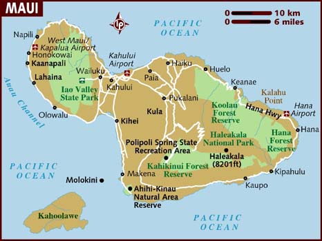
Maui is shaped much like a bust with the isthmus being the neck

The island of Maui is the second-largest of the Hawaiian Island at 727.2 square miles and is the 17th largest island in the United States.  Maui is part of the state of Hawai’i and is the largest of Maui County’s four islands, Moloka’i, Lana’i, and unpopulated Kaho’alawe.  Native Hawaiian tradition gives the origin of the island’s name in the legend of Hawai’iloa, the Polynesian navigator credited with the discovery of the Hawaiian Islands.  According to that legend, Hawai’iloa named the island of Maui after his son, who in turn was named for the demigod Maui.  The island is also called the “Valley Isle” for the large isthmus between its northwestern and southeastern volcanoes and the numerous large valleys carved into both mountains. I flew to Maui the week prior to our adventure at Kalaupapa to meet my friend, Dick, photog emeritus, who I knew would give me the finest kind tour of the Valley Isle.  He didn’t disappoint me as we did an in-depth expedition of many places that I had not visited in 15 prior visits to Maui.  Bob’s and my priorities were a bit different back when we were going to the Islands…Rest, golf and little touring was Bob’s motto. The first thing Dick and I did was to meet Craig, the owner of the plantation house we were to rent on Lanai.  Dick had been trying to finish the rental agreement with him for some time but Craig was so laid back until about 10 days prior to the actual rental.  The house and our time on Lanai were outstanding, but more about that in the Lanai posting.  Then we went to lunch at Leilani’s on Kaanapali Beach.  It’s such a pleasant feeling to dine on the beach with the trade winds ruffling your hair, small birds flitting around the restaurant begging for tidbits, and receiving a lot of the Aloha spirit that the Islands offer.

Getting into the Maui Mode
(RDS Photo)

How much better can it get?
(RDS photo)

Looking toward Lana’i from our condo at daybreak

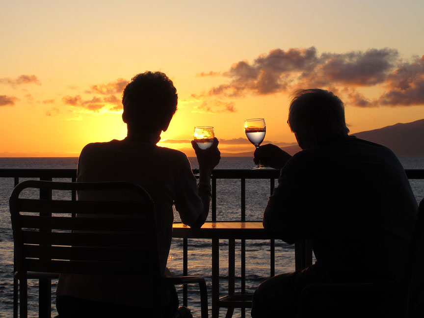
Our condo was a second floor corner unit that was about 15′ from the ocean’s edge with exquisite vistas of Moloka’i and Lana’i and sometimes when the trades were right, a view of Oahu, about 50 miles away.  With this setting, it didn’t take me long to kick off my shoes, adjust to Aloha time and the pleasant trade winds.  Within a couple hours of my arrival, a large honu (sea turtle) was grazing on the rocky reef not more than 30′ from the shore.  I didn’t get a good picture of him, but he was about 3′ long with a sort of green back.  That was the first time I’d seen a sea turtle in Maui and I really enjoyed the sighting.  I kidded Dick about arranging that sighting for me.  You can see the reef closest to shore in the left hand picture.   It was so blissful to sit on the lanai that we never ate pupus or dinner out (except when we were away from the condo at dinner time).  The dazzling sunsets provided us with so much camera fodder that I’m surprised we didn’t run out of battery power on the first day.  I bet I had 50 pictures during my first sunset and only a few of them were worth keeping.  But it was fun and SOOOOO relaxing. Dick took me to places that Bob and I had been such as Napili Sunset; beaches we had visited like Honolua Bay, Slaughterhouse Beach and Kapalua Bay; and courses we had played like  the Village and Bay Courses.  Bob so enjoyed them and I did too. It was a nostalgic drive that I wish I could have shared with Bob. The next morning, we toured Hale Pa’i (the house of printing), a small coral and timber building on the Lahainaluna (upper Lahaina) high school campus, that starting in 1834, served as the home of Hawaii’s first printing press.  The early missionaries not only learned Hawaiian, they transcribed the language and printed (after teaching students to set type and run the press) a Bible, textbooks, maps, Hawaiian culture and traditions, the first newspaper west of the Rocky Mountains (1834) as well as Hawaii’s first paper currency.  An interesting side note is that in 1844, a student was expelled for counterfeiting, causing all the paper money to be re-issued with secret marks.

Mama’s Fish House Beach

Lahainaluna High School was founded as a seminary in 1831.  It was the first school west of the Rockies and survives today as Lahaina’s public high school.  It has the distinction of being one of the few public boarding schools in the USA and accepts students from not only Lahaina but neighbor islands as well.  We happened to be there a few days before graduation and were greeted on the long road going up to the school by printed banners and bed sheets hung from fences and houses congratulating the graduating seniors.  I thought it was a fun custom. Lunch was a real treat at Mama’s Fish House,  a converted beach house in a coconut grove on a secluded white sand beach. It was voted one of the best 100 restaurants in the USA in 2011 and I can see why.  In addition to the beautiful setting, the fish was probably the best I’ve ever tasted.  Man, it was good!  The menu actually lists when, where and by whom the fish was caught.  So we knew it was very fresh and oh, so tasty. Just a bit away from Mama’s, is  Ho’okipa Beach Park, “the wind surfing beach capital’ (according to a Pa’ia web site) that was being well used.  Lots of surfers were out there trying their luck.  To me, it looks like such a demanding sport, especially on the shoulders and back.  I think it’s better for me to observe the people plying their skills than to try it.  We visited Pa’ia which is noted as a “quaint” town.  It’s supposed to be a reflection of its history as a booming sugar cane plantation town with its old plantation style wooden buildings still intact and an array of  specialty shops, boutiques, surf shops, antique stores, bakeries, and even an old fashioned tattoo parlor.  It might be a great place to browse if you like to shop.  I didn’t check it out as that’s not really my game.  We did check out Mana Foods, a ramshackle looking building with has a vast array of organic, natural, international and gourmet offerings on the inside.  I was amazed at what was inside this store.  As a matter of fact, it reminded me of Mother’s in Costa Mesa before it was remodeled.  A lot of people know about this place as there were a lot of people in its narrow aisles.  It was fun to visit.  We then drove mauka (toward the mountain or inland) to visit up country towns, Makawaoand Haiku.  Such a pretty drive seeing nice homes, some small ranches and farms, and churches.

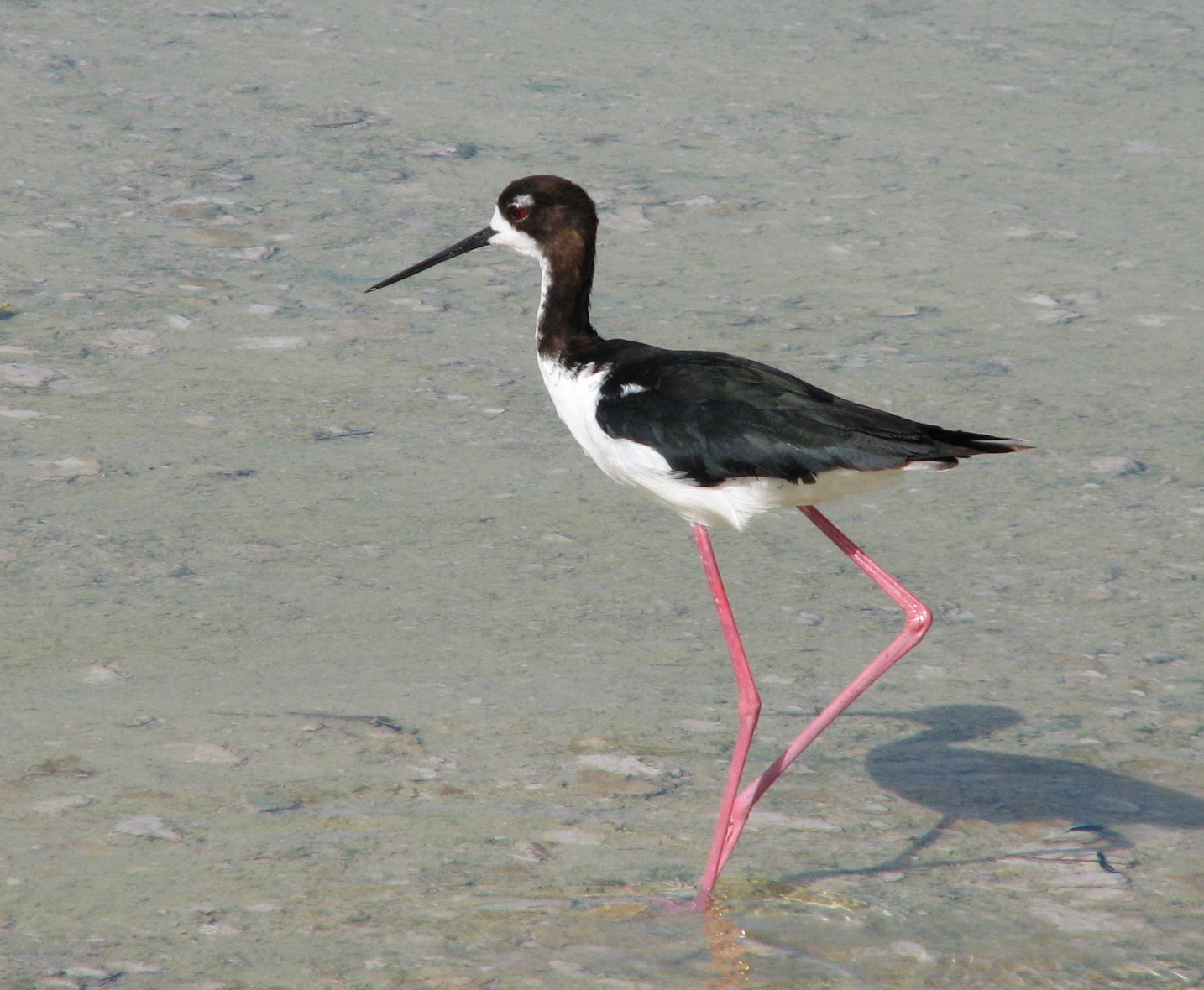
An Ae’o in Kanaha

On the way back to our condo, we stopped at the Kanaha Wildlife Sanctuary, home of the Ae’o (black-necked stilt).  The wetland sanctuary is near the Kahului Airport and has some noise from planes as well as nearby traffic that does not seem to affect the birds.  We saw Ae’o in all stages, from little puff balls on stilts to adults wading in the shallow water.  I like these birds as they appear to be in long-legged tuxedos as they stealthily walk and stalk the shallows to catch their prey.  They are a bit territorial as we saw them arguing a bit with each other by squalking  and flying at each other.

Surfacing in Kapalua Bay in front of Kapalua condos
(RDS photo)

Thursday was snorkeling day.  We checked out Black Rock near the Sheraton at Kaanapali and Kapalua and saw many fish varieties including some eels and trumpet fish.

Trumpet fish
(RDS photo)

We followed our snorkeling excursion with lunch at the Pineapple Grill (aka Grill and Bar where Bob and I had many contented, filling meals back in the ’80s).  LaPerouse Bay was

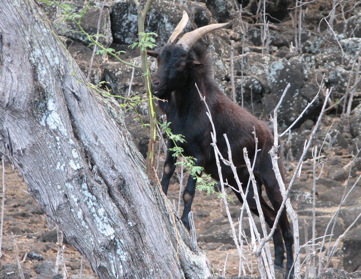
The “Old Goat” leader

our next stop on the day’s tour.  This bay is at the end of the road on the south end of Maui and is known for two things, dolphins (which we didn’t see) and wind (which we felt).  The dolphins apparently like to rest in the bay in the morning but had left for other areas by the time we got there.  There are signs all over the place to not harass the dolphins, so I guess they really do hang out there.  The wind is ever present and tousled our hair the entire time we were there.  What we did see were wild goats, which were grazing close to the path we were on.  Dick declared that we were on the “Old Goat’s Tour.”  And tour we did, seeing a blow hole, coral beach, some black sand and remnants of the 1790 lava flow, the last eruption on Maui.  It was a good hike and I enjoyed every minute of it.

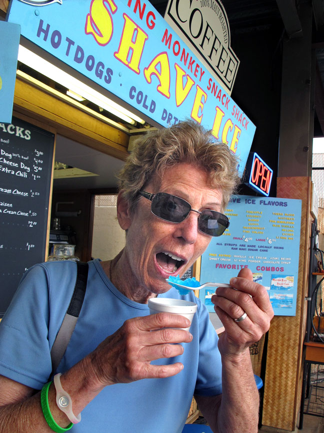
That blue vanilla is great! I’m a shave ice fan!
(RDS Photo)

On the way back to our condo, we stopped in Kihei so that I could sample for the first time, a Hawaiian delicacy know as “shave ice.”  I would have called it a snow cone, but it was much better than that.  The ice is shaved and becomes a smooth powdery snow type substance.  Much better and tastier than a regular snow cone.  I had a combination of grape and lemon-lime, much to my delight.  I noticed a flavor called blue vanilla and the lady gave me a sample of it.  Ooh!  That was good! We made it back to our condo that evening in time for another nice sunset and dinner.  Life is good!

Jan was to arrive Friday evening and we had the entire day to use to explore or goof around.  Dick knew that I’d never been on the Hana Road (Bob and I had flown in when we stayed there) and told me that it is quite a journey that everyone should see.  The guide books tell you that there are 620 curves and 46 one lane bridges (who counts these things?) on the 52 mile long “highway” from Kahului.  I put highway in quotes because the road narrows from four lanes to two to about one and a half or even one in some cases beyond ‘Ohe’o Gulch (aka Seven Sacred Pools).  Off we went from our condo about 7:30 AM (early departure) in anticipation of an exciting adventure, seeing places, things and people I’d never seen before. It was fun seeing the flora change from sugar cane waving in the breeze to very lush vegetation with ferns, bamboo, and other jungle plants  so thick that you’d be lost if you ventured more than 15’ from the highway.  It’s good to be green in this vicinity.  Sometimes we would come out of a turn espying a beautiful vista of a valley or peninsula with little houses and taro fields dotting the valley floor or be hugging the edge of a steep cliff.  Witness these two pictures.

Keanae Peninsula with houses, taro fields and the ocean in the background

Highway to Heavenly Hana. Click on the picture to better see the cut in the cliff.

Waikani Falls (aka the 3 bears) before arriving at Hana

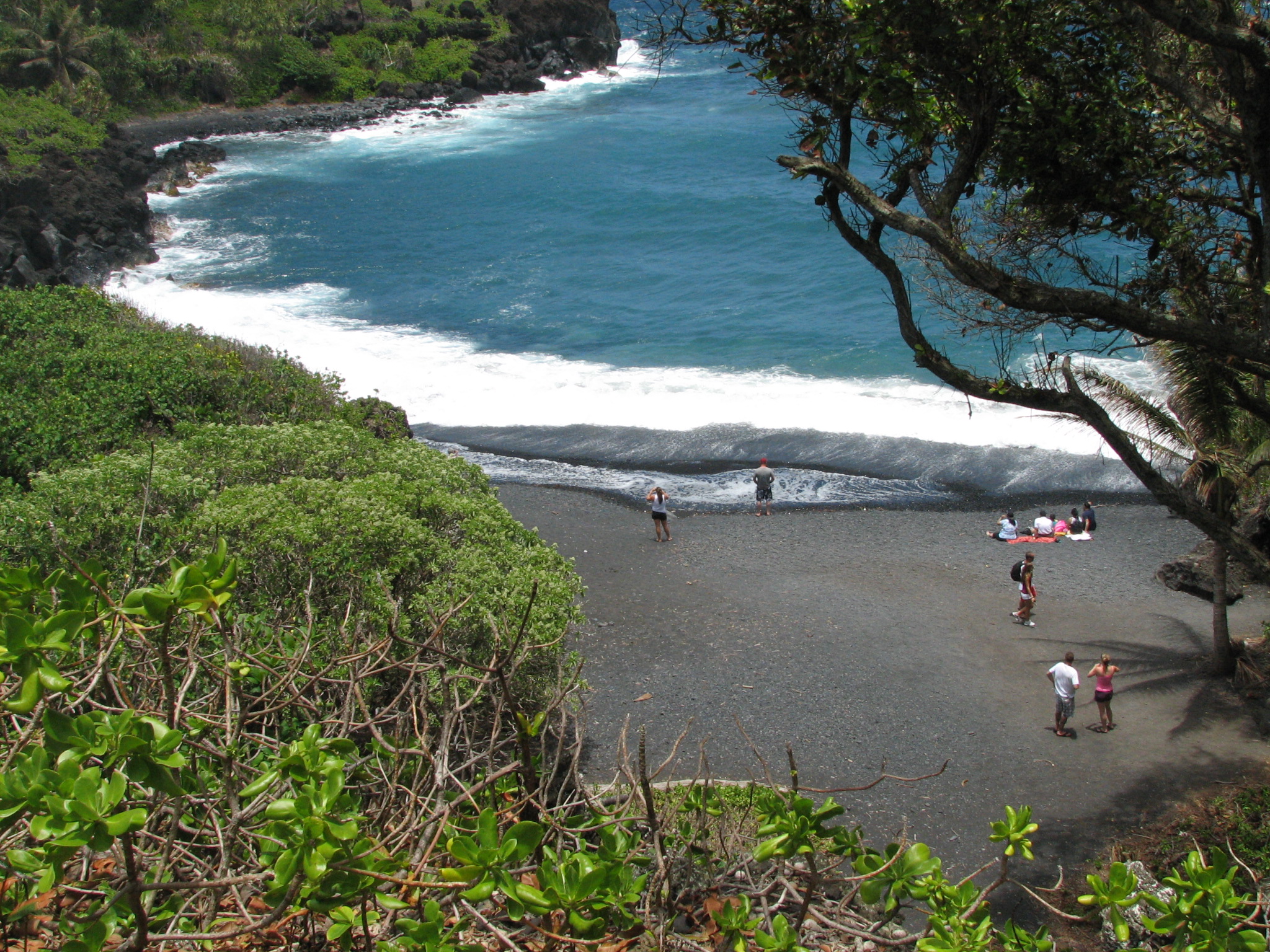
There were not as many waterfalls as advertised in the brochures because East Maui Irrigation company (EMI) has ditches throughout the way to Hana that have diverted much of the water previously destined for the gorgeous waterfalls.  So some of them are dry or not flowing as dramatically as in previous years.  I guess it depends on the time of year or water needs as to how much water is flowing (or falling, as the case may be)  We did see several spectacular falls but the light wasn’t just right so as to duplicate what we saw.  I was still pretty impressed with the falls we saw, however. We had lunch at Tutu’s Snack Shop on the beach at Hana Bay.  It’s basically a burger joint but serves very good BBQ pork sandwiches.  I had one of the best hamburgers I’ve eaten in a long time.  So Dick and I vote for Tutu’s.  We visited Hasegawa’s General Store which features the most diverse assortment of stuff ever put together in a store.  It’s an amazing place that sells groceries, fishing equipment, clothes, galvanized pipe and you name it and it’s probably there.  I helped out their bottom line and bought a Hasegawa tee shirt.  Hana is a quiet little town that doesn’t impress you until you get out and walk around a bit and let its essence sort of creep up on you.  It’s a great place to get away from it all because “it” isn’t there.  And sometimes that’s a nice thing to do. We buzzed back to the Wai’anapanapa State Beach which has the only volcanic black sand beach on Maui.  I like this park and beach because it sported camp sites, cabins,

Pa’iloa Beach at Wai’anapanapa State Park

showers, picnic tables, freshwater caves, a sea arch, black sand beach and brown noddies (which I’ll explain in a bit).  Technically, the freshwater caves are a bit brackish according to some kids we talked to, but they looked inviting to swim in.  People were on the beach enjoying the cool water (although not in very far…it looked a bit tricky to me in terms of currents and such)

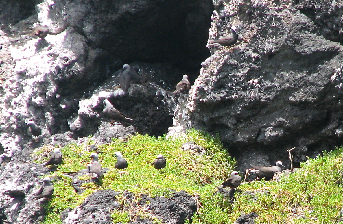
The brown noddy rookery. They forage far out to sea catching squid or fish.

A brown noddy is a bird about the size of a small sea gull (16″ long, 33″ wingspan as opposed to 18″ and 48″ for the our local gulls).  There was a noddy rookery at this beach and there were many flying around the area and resting in the rookery.  A characteristic “nodding” display between adult birds is often seen at nesting colonies, hence their name.  This was fun for me as I’d never seen a noddy before. We continued on our way, stopping at Wailua Falls for photo ops and on to ‘Ohe’o Gulch formerly known as 7 Sacred Pools.  Apparently, ‘Ohe’o Gulch is the original name of this area and 7 Sacred Pools was a monicker put out for the tourists.  What a different experience from when Bob and I were there!  Bob and I were covered in mosquitos when it wasn’t raining.  We really didn’t get to see much.  This time, the weather was perfect and there were no

Jumping at ‘Ohe’o Gulch

bugs.  Yea!  Many, many people were visiting the pools nearest the shoreline; swimming, hiking, sun bathing and just relaxing.  The pools are quite deep and lots of people like to jump from fall to fall.  Check out the guy in the red trunks who happened to jump

Ala ‘Aina grounds Could you ask for a more gorgeous view?
(Jan photo)

when I was taking pictures. Dick took me to Kipahulu and Ala ‘Aina Ocean Vista, a one bedroom B & B that he and Jan like to stay at.  It’s a beautiful place with banana trees growing all over the place.  There are many stories that Dick told me about this area, but suffice to say that it’s gorgeous and so off the beaten path, that one can totally unwind and experience culture shock just going to the little town of Hana.  It was amazing! In the little graveyard behind the small  Palapala Ho’Omau church, Kipahulu,  is the final resting place of Charles Lindbergh.  His grave is very simple in the Hawaiian style of a plot surrounded by lava rocks.  Nearby are the graves of Sam Pryor, a retired airlines executive, who had a ranch in the area.  Pryor was good friends with Lindbergh and persuaded Lindbergh to visit Maui and build a small place on his ranch.  Pryor is also remembered for his gibbon apes who he considered to be his “children.”  Their six graves are between the Pryors’ and Lindbergh graves.

Godlight looking over the Pacific Ocean

Car rental companies used to prohibit rentals from continuing on around the island on the “highway.”  I don’t know if they still do, but the road is fine (at least when we were on it).  It is a narrow, one lane dirt road for part of the way, but that aspect added to the charm of it.  It was also interesting to see the climate change almost instantly from green and lush to brown and arid.  It has to do with the wind and rainfall…which is evidently not great in this area.  We saw the top side of the two cinder cones that made the 1790 lava flow and looked down on LaPerouse Bay that we had seen the day before.  That was an interesting perspective.  The road improved to being paved and two lanes and began to climb the side of the big mountain, Haleakala.  Clouds were coming in over Haleakala and also the ocean which gave us some beautiful views.  Dick likes to call this Godlight.  We celebrated our safe return to Kahului by consuming a sumptuous Costco hot dog and then we went to pick up Jan upon her arrival from Sacramento.

Jan got up early the next day as she was still on mainland time and we went for an early morning walk.  It was so pretty to walk as the sun rose over the mountains and listen to the birds wake up with their many tunes.  I love that time of day when the world is waking up.  We also waded a bit in the ocean and saw a small eel and many little minnows. Later that day, we visited the ‘Iao Valley and Needle (A sacred burying place for chiefs and the location of Maui’s last giant

Yeow! at the ‘Iao Needle
(RDS Photo)

battle for supremacy.  The Needle itself was used as a lookout base.  It is another lush, verdant valley with a prominent point sticking up from the valley belying a violent, bloody history.  Dick’s picture shows us needling the needle.  Following our antics at ‘Iao Valley, we visited the Bailey House Museum, the house of a mid-19th century missionary.  I enjoyed this little museum and its display of Hawaiian stone tools, weapons and even a century old surfboard.  There were also exhibits from the missionary era that were very interesting.  It’s good to get some education on a vacation and be sort of well rounded.  🙂

From Maui, Jan, Dick and I went to Kalaupapa for 5 days, Lanai for 3 1/2 and then back to Maui.  We stayed at the Maui Beach Hotel, not far from the airport, to pack and readjust our thinking for future events.  I was flying home the next day and Jan and Dick were going out past Hana to the Ala ‘Aina for a few days of real Hawaiian time together.  Jan and I were walking around the hotel grounds when we happened upon a trio called “Power of Ten,” a kane singing and playing the ukelele and a kane and wahine dancing to the tune.  They were rehearsing for a show they were putting on later.  It was vigorous, beautiful and exciting.  Did you ever see such gorgeous smiles as on the “Power of Ten?”  Aloha spirit epitomized!

What a good looking group!
(RDS Photo)

The Power of 10
(RDS Photo)


The lei toss
(RDS Photo)

Sadly, it was time to say aloha to the Islands on May 30 and I was to wing my way home.  Dick and Jan took me down to the beach where they told me I had to complete the tradition of throwing a lei into the water to see if I’ll go back or not.  Yea!  The lei did so, thanks to the wind and a not so great toss (but with great form!).  I’m looking forward to the next adventure in Hawaii which I hope won’t take another 20 years to happen.

A Hawaiian adventure wouldn’t be complete without some geckos. Here they are catching their supper near a light fixture in Ala ‘Aina (Jan Photo)

Kalaupapa – Enduring Spirit, Sacred Ground

6 Jun

For several days, I have mulled over the impact of the Kalaupapa peninsula and community on me and find it difficult to express their essence in words.    I am going to attempt to recount my experience upon the peninsula even though it might not jibe or seem adequate to those who were there and saw the experience differently than I did.

First, a bit of history taken from the National Park Service’s Kalaupapa brochure.  “Surrounded mostly by ocean and cut off from the rest of Moloka’i by 1,600′ cliffs, the Kalupapa

A portion of the peninsula from our final approach to begin our adventure
(RDS Photo)

peninsula has always been one of the most remote places in Hawaii.  Native Hawaiians live here for many centuries, but in the mid-1800s Kalaupapa’s remoteness secured its role as the setting for two tragic human sagas.”  …in 1865 and again in the mid-1890s, the indigenous Hawaiian communities were displaced and the forced exile of those afflicted with or suspected of leprosy was begun.  Isolation was done because it was believed just touching a leper could cause a person to get it. The isolation policy was not officially abolished

until 1969, but forced isolation ended in 1949 when medications were made available to help patients.  Patients who still live there (about 10) are free to come and go from the settlement, but they choose to stay there as it’s more in their comfort zone.  I heard that more than 8,000 people died at the settlement which is about the same as the present-day population of Moloka’i.

Father Damien ( St. Damien since 2009) arrived at Kalaupapa in 1873 and worked tirelessly to promote the dignity of the afflicted and to improve conditions for the patients.  To see what Kalaupapa was like in those days, a good movie to watch is “Molokai,” a story of Father Damien.  It was filmed at Kalaupapa, thus giving you an idea of what the peninsula looks like and the conditions those poor folks dealt with on a daily basis.

Today, Kalaupapa National Historical Park is administered by the National Park Service in cooperation with several Hawaii state agencies.  One of the park’s primary missions is to protect the lifestyle and privacy of the aging resident community.  In accordance with residents’ wishes and State of Hawaii Department of Health regulations, Kalaupapa is a closed community.  As members of a Sierra Club Service Trip, we received special permission to stay in the community for 4 nights and 5 days…something most people will never get to do.  I felt very privileged to be a part of this endeavor.

Our group consisted of nine people (two leaders, Ruth and Lynne; one cook, the VERY able Jan; six participants, Barbara,  Elyette, Puanani and my good buddies, Jan & Dick).  We arrived mid-morning of May 21, were met at the tiny airport and after signing in at the Park office were taken to our housing for the week.  We stayed in two historic buildings that were once housed a doctor and dentist.  They weren’t very clean at the beginning, but they were cleaned after a fashion and we settled in.  Jan fixed an excellent lunch and off we went to the nursery to begin our work week.

Luana helped me to understand local culture, some history and customs as well as some of the native plants

One of the goals of the Park Service is to replace the non-native plants (of which there are many) with native plants and the

Williwilli seeds
(RDS Photo)

Rise up Wiliwili fingers! (Click on this photo to get the full effect of the fingers)

nursery is the place where this process begins.  Luana was our first boss and she taught us what to do to help her expedite her efforts to achieve her goals.  That first day, we weeded out various plants, cleaned up the nursery a bit and sanded edges of the of wiliwili seeds.  It sounds weird, but we did this to give the seeds a faster sprouting time.  Yes, the seeds were small (a bit bigger than a navy bean), difficult to grasp and tough to sand off even a small spot.  We sanded our fingers and nails, too, giving rise to many jokes and puns.  The next time we worked on the wiliwilis, we taped painter’s tape to our fingers to try to make it easier and faster.

We finished our chores early enough that some of our group walked down to the harbor to go swimming and wash off some of the dirt.  Few boats/barges arrive in the harbor, thus leaving the water very clean and refreshing.  I swam there a day or so later and really enjoyed the warm water and outstanding snorkeling.

The next day was beautiful and we were up early to get ready for our day’s tasks.  Ruth, our fearless leader, instituted a Hawaiian word of the day after breakfast to get us thinking about the spirit of the islands and why we, as Sierra Club members, were there as volunteers.  We discussed the word, its meaning and what it meant to us.  I liked that approach and I did think about the daily words often as I was working on our assigned chores.

Leimomi shared her culture as well as her knowledge about Kalupapa with us.

Our second day’s task took us to a very large cemetery (I failed to write down the name, but it was used from 1887 to 1920 and had many unmarked graves) surrounded by a

Puanani, who knows much about local and native plants and their uses and shared her knowledge with us. I learned a great deal from Pua.

rock wall.  Other crews had been in to clear lantana bushes and other brush and stacked them in large piles.  It was our job to move the brush to outside the rock walls so that “the boys” (a crew of two could take it to the dump in dump truck)  We also raked leaves and cleared a lot of weeds and thistles.  Leimomi (aka Momi) was our boss for the day and led us very ably.  She worked right with us and got just as dirty and sweaty as we did. Before we even stepped inside the cemetery, we had a blessing to assure the spirits we meant no harm and that we wanted to please them by cleaning up their resting place.  One of our group, Puanani, a Hawaiian from Maui, sang a Hawaiian blessing with a rich, powerful voice.  Her singing really moved me.  After her blessing, the Doxology was sung in Hawaiian.

The air and mood seemed clearer as we moved into the cemetery to begin our work.  I thought at first that this was going to be a piece of cake… just putting brush on tarps and carrying it outside the cemetery and raking and weeding some.  I mean, after all, we working in teams, right?  Well, I got a sweaty education that morning.  Stacking, tromping, lifting, carrying and pushing all take a toll on one’s older body after a bit.  But we were pleased that the cemetery floor looked clearer than when we started and I think the spirits were pleased with our efforts.

Placing brush on a tarp

Haul it day

Carrying brush outside the cemetery to a wood pile in an area that used to be a dairy.

We had lunch at the Kalawao Lookout where the original Hansen’s Disease settlement was begun.  We raked up leaves and

Our group plus Luana and 2 of the “boys” around the skip loader used to put trash & leaves into the dump truck (RDS Photo)

At Kalawao Lookout

a bit of debris in the park that surrounds the lookout and sanded some more wiliwilis but had time to take at look at some of

Looking down into the Kauhako Crater with the pond in the bottom

the ruins and artifacts from that era.  We could also see places where boat would bring in new people to join the settlement.  Sometimes the boat captains would take them ashore in a small boat and other times they would force the people to swim for the shore.  I saw how rough that coastline and water could be and I don’t know how any able bodied person could make it ashore, much less a sick person with poorly functioning hands and feet.

The flat, leaf-like Kalaupapa peninsula of today was created by an offshore volcanic eruption at Pu’u ‘Uao that resulted in the remnant Kauhako Crater.  We had the opportunity to visit the crater after we finished our clean up job at Kalawao.  Wow!  It was stunning!  It’s a relatively small crater overgrown with thick vegetation and trees and with a pond at the bottom of it.  Someone told us that the pond’s bottom had not been found and I read later that it was more than 800’ deep.  Don’t know as I didn’t hike down to the water.  There were stone graves on the rim of the crater which must be wind blown every day and will some day be blown into gravel.  I was knocked off balance several times by the STRONG, gusty wind as I was gazing into the crater.  It was hard to hold the camera with the wind knocking me around.

Our third day saw us going to what I would call the Lighthouse Beach as it was a bit windward from the tallest lighthouse in the Pacific. (More about that later)  We were charged

The monk seals

with picking up as much trash and junk that we could as this particular beach is in the way of a lot of floating stuff.

Portuguese Man-o-War – so small but, oh so venomous
(RDS Photo)

We

Even some type of light bulb was found on the beach

found ropes, bottles, baskets, broken glass, light bulbs, boxes,  and much more.  I found a Portuguese Man of War jelly fish clinging to a rock.  I thought they were large critters, but this one was about and inch and a half long and was told they don’t get much bigger in the Islands.  I’m pretty sure it was dead as it was out of water, but was careful not to touch the tentacles.

Is that a hangman’s noose? Check out the white stuff. That is broken coral that will some day be white sand (RDS Photo)

I reveled in this day as I was at the beach enjoying the surf pounding on the black lava rocks, the wind was blowing my hair and the rain was spritzing on us…and yet it wasn’t cold.  I loved being out there picking up the stuff.  We filled the bed of a large pick up with the junk we picked up.  On the way back to our houses, we stopped by another beach to see a mother monk seal and her “baby.”  The baby was at least half or two-thirds the size of its mom.  but they were lazing on the beach enjoying the afternoon sun. A day or so later, a black tipped shark was seen cruising the little bay checking out the monk seals.  They make good meals for the sharks.

Later that day, I went swimming and snorkeled some.  The water was perfect and the colorful fish were abundant.  It was like being in my own little world with no cares to think about.  All of us went to the local volleyball court to play some games with the locals…those being mostly park employees who

The volleyball game

play every Wednesday afternoon.  Ruth and I played some but the wind (the ever present wind) was blowing so hard that it misdirected the ball a lot and we felt silly missing it or not making a good play.  Some of also visited the local bar to get a beer or soda.  We would call it a hole in the wall at home, but I really enjoyed going there to chat with the folks in there as well as to have a $3 Heineken.  I think that’s the cheapest beer on any island or even at home!

The local (and only) bar at Kalaupapa

Dick, Jan and I chatted with Edwin, a patient who had been at Kalaupapa for 70 years.  We had seen him before when he drove his white pickup with the dashboard filled with little stuffed animals.  We always waved to each other and felt a comradeship.  He served as the referee for the volleyball games and confessed to us that he cheated sometimes to help teams.  He was quite a character.  Rain was threatening as we trooped back to our houses and received a big surprise.   Leimomi came over and shortly after, Moke, another Park Service employee came with his ukulele.  He played and

Moke and his ukelele. What a sweet voice he had

sang with a beautiful sweet voice.  We sometimes joined in and even beat out some rhythm on some makeshift percussion instruments.  The aloha spirit and camaraderie was so strong that it brought tears to my eyes.  It was a grand evening.

Thursday’s word of the day was “kokua” meaning to help.  That was certainly apropos for our week as we were trying to help the settlement as much as possible.  Ruth had asked us to think about what we expected from our time at Kalaupapa and I had said something about spreading aloha spirit…thinking about giving.  But I didn’t really expect to receive as much as I did.  I truly believe that I received and learned much more than I gave.  This feeling is very difficult for me to express adequately.

We were given a tour of the new archives building just across the park from our houses.  This was a real treat as we got to see many artifacts, hear more stories and see more old

The noni fruit

photos.  We also got to see a PowerPoint presentation on grave restoration.  Many of the gravestones need to be repaired and/or restored and our presenter (whose name I can’t remember) was the one who did that work.  He also had several stories and many pictures to show us his work.  We were also able to see more of it when we walked through the cemetery later.  We then worked outside the building weeding and making it look a lot nicer.  Puanani got stung by a yellow jacket just as we were finishing up our chores.  She asked us to get some noni fruit and leaves from its tree to help take the sting and swelling down.  She had been telling us about this tree and that many natives use it as a medicine cabinet to help cure many things.  That night, she and Lynne wrapped my knee (that was sore that day) with heated noni leaves and then wrapped it in plastic for the night.  It did help relieve the soreness, but it kind of stunk like tobacco.

The doctor’s house where 6 of our team stayed

Speaking of our houses, here are a couple of pictures of them.  The white gate is a symbol of a hedge and fence that prohibited

The dentist’s house where we stayed. I’m not sure what Jan’s doing here. Maybe she saw the mongoose that lived under our house.

patients from just knocking on the door of a staff member.  They had to ring a bell and ask for permission to enter.  The gate and fence were the same at all staff houses. Our rooms were pretty Spartan with just a mattress and springs on the floor with not much light available.  We all had to wear red Visitor’s tags to identify us to the patients and employees that we had permission to be walking around the settlement.  There were no problems and it wasn’t a big deal to wear the tag.

My quarters. Plain but it was closest to the bathroom 🙂

The red tag ready for the next adventure

Luana and the “boys,”  Rick and Albert, took us out to where part of the original settlement was at Kalawao so that we could see where the patients had to “swim for it.”  Part of this

Looking out to the rough sea. Click on the picture to enlarge it and check out the billowing pants and shirts

area was also where the “Moloka’i” film was made.  So rugged and unprotected from the wind that I wonder how people survived, especially when they were sick.  We saw two turtles (honu) off the coast and it seemed to me that even they were having troubles negotiating the rough water.  We then made our way over a rocky trail to the “Old Ladies” cave.  We were told that people lived in the cave (a lava tube) that opened out to the ocean and served as lookouts for strange canoes and/or

Looking out from “Old Ladies” cave

sailing ships.  It used to be a very long tube going back to the Kauhako crater that we had visited on Tuesday, but part of it caved in when the US Navy used that part of Kalupapa for target practice during WWII.  I wondered how much more indignity could these people handle?  I guess no one was hurt but it just seems to me that it would have been a bit too close for comfort for me.

We continued our rocky ride around the north side of the island to the beach that we cleaned up a couple of days before.  We picked some acai (not sure of spelling or even the name)berries for Luana to transplant to other parts of the peninsula.  I felt sort of like a bear looking for food to eat.

Picking the acai berries about 50 yards from the beach that we cleaned up

Up close and personal with the berries

The Moloka’i Light Station…all 133′ of it

From the beach, we turned around and saw the Moloka’i Light Station towering 133′ above us.  It is the tallest lighthouse in the Pacific Ocean and is now 102 years old.  Actually we didn’t just turn around…it was very obvious that it was there.  We were all very excited to get to clamber up the stairs to the top of it to see what we could see.  It was a stupendous view of pretty much the entire peninsula and the pali.  Unfortunately, I didn’t get any good pictures from that vantage point because I couldn’t hold the camera steady enough.  I think the wind was blowing about 70 mph up at the top where we went outside.  Lynne’s watch blew off her wrist and Dick’s glasses blew out of his vest.  So it was an expensive trek up those stairs.  I felt good about going around the top without getting too scared but once I got back inside where the light was, my stomach began doing flip flops.  So I decided that I ought to descend to the ground once again.  It was very exciting for me to do that knowing that I have some acrophobia and that I conquered it to some degree.  I was proud of everyone else as they did it too.

Several of us swam in the harbor that afternoon and enjoyed the array of fish one more time.  It was great!  Then we went home to a great dinner of chicken, rice, green beans and 2 kinds of ice cream!  Yum!

Our last morning saw us going back to the nursery where we helped Luana tidy up the nursery a bit more.  Tables were moved, equipment

Helping at the nursery

was stacked neatly, weeds were pulled and more mangos picked up.  It was just enough work to get us pretty hot and sweaty again.  After lunch, I trekked with Ruth and Elyette up the Kalaupapa trail.  I don’t know how far we went, but that climb gets to one’s knees after a while…particularly going back down.  The Moloka’i mule train had left just before we began our hike and, of course, left evidence of its

This trail is how many of the Park Service employees get to work Monday mornings. They usually stay and then go home up topside on Fridays.

passing.  I discovered that I’m allergic to the mixture of dust and dung, that it makes a rash on my ankles.  Such a bummer, but it didn’t itch, just looked bad.  That’s another reason not to hike that trail.  We saw and hear a white-rumped shama, a member of the thrush family that sounded like a mockingbird to me.  He had such pretty songs.

The white-rumped shama

We had just enough time left for a short swim in the harbor before dashing up to the house to shower, change clothes and finish packing for our flight back to Maui.  I’ve talked about the ever present wind, sometimes like a gale, oftentimes not.  I grew to embrace it because it blew allergens out of the air and I had practically no nose-blowing for the entire week.  That was a gift!  We all enjoyed the quiet of Kalaupapa.  The two primary sounds I remember were birds and the wind.  I liked that sense of peace.

None of us wanted to leave this beautiful, idyllic place filled with so many stories and so much adversity, strength and courage as we had all enjoyed our brief time at Kalaupapa.  Robert Louis Stevenson said Kalaupapa is a land of “beauty springing from the breast of pain.”  I think it was fitting that our little airplane took off into a double rainbow which to some represents a transformation or something wondrous or amazing.  Such feelings were abundant in my head as I bid my farewell to Kalaupapa.

My priceless room
(RDS Photo)

Ruth and me playing volleyball in gale force wind. Not easily done.
(RDS Photo)

Our group at the last night’s dinner table
(RDS Photo)

2012 Donate Life Run/Walk

13 May

Since last November (2011), a committee has been working toward putting on the Tenth Annual Donate Life Run/Walk to be held at Cal State Fullerton on April 28, 2012.  There

The GGs

have been meetings upon meetings as well as many preparations performed by the Golden Girls (The GGs).  We do much of the grunt work in the office such as making buttons (large, small and square), getting supplies, sending thank you notes to every registered participant and monetary donors and doing our normal duties of taking inventory, sending supplies to Donate Life Ambassadors and a multitude of other tasks that save our bosses lots of time.  But the final six weeks prior to the actual Run/Walk event finds us shifting into high gear.  I’m there every day putting in just about a full 8 hours (some days) and the other “girls” are, too.  This year, the pressure seemed to get to us more than in past years, due to various factors over which we had no control…illness, accidents and fatigue.

The aisles are getting smaller!
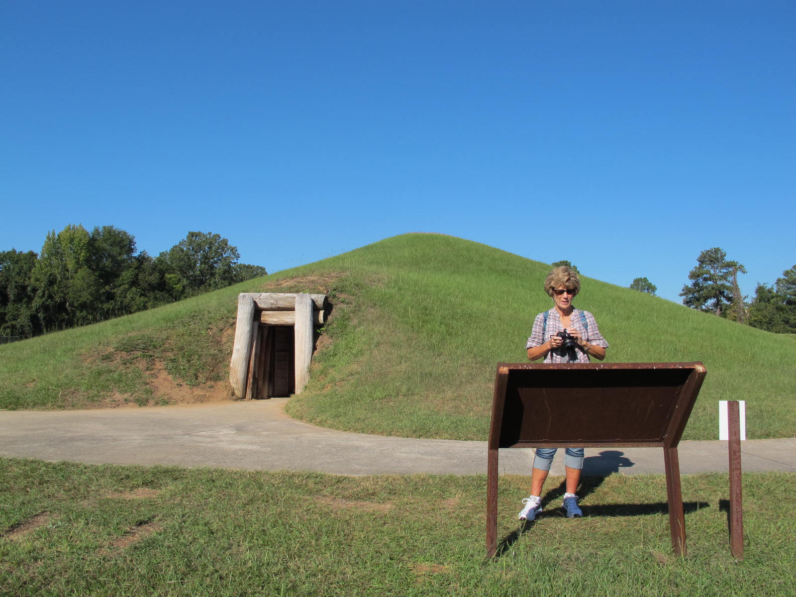
We’ve known for some time that our little warehouse is too small, but these past 6 weeks proved it.  We received many boxes of flying rings (frisbies), chap sticks, mints, key chains, coffee mugs, and other too dads that we send to ambassadors and will give away to the 10,000 runners/walkers.  I was able to get most of that stuff off the floor and onto shelves just in time to begin receiving the donor family t shirts.  Each donor family team member received a special shirt with our logo on the front and their loved one’s picture on the back.  Each shirt had to be counted and sized, matched up with the correct number of buttons that we’d already made and then placed into a plastic bag to be stored until the day before the event when they were moved to special box which then went to Cal State Fullerton to await the donor families.  231 donor families had teams ranging from 1 to 105 members which extrapolated out to more than 3000 shirts.  Normally, this is not too big of a problem, but the t shirt man caused great consternation this year with short orders, many wrong sizes, and doubling of orders.  Plus he had a terrible habit of not arriving with the order when he said he’d be there.  He delivered his final order about 11 PM Friday night and the families arrived before 7 AM the next morning.  That’s cutting it too close!  Needless to say, we’re looking for another t shirt person.

Shirts ready to transport

This shot shows a few of our shirts ready to go to the special boxes.  They represent a lot of sweat and aggravation But we respect the donor families so much that we try very hard to get them just right so that the families will have this to help

Moving the shirts to boxes and then to the campus

them enjoy the day.  The picture to the right shows just part of the process of getting the shirts in the right boxes.  The morning of the event, the boxes are lined up on a field where the families gather around and don their new shirts along with signs we have made for them to carry.  It’s quite a to-do these days.  Many of the families have made it like a family reunion and even bring their barbecues, EZ ups and their own banners.  It’s an amazing sight.

Jolee, Jason and Scott (niece and nephews) came down from Minden, NV to help us get ready and help they did.  Luckily, they have muscles and incredible stamina that take quite a load off us.  They also have a lot of fun with each other and make light of hard work.  I enjoy being with them so much.  They make me feel a lot younger!

Preparing signs for the walk route

This was just one of the tasks they did at the office.  They also went to the campus and spent hours placing hundreds of signs along the route.  They earned their stripes those two days!
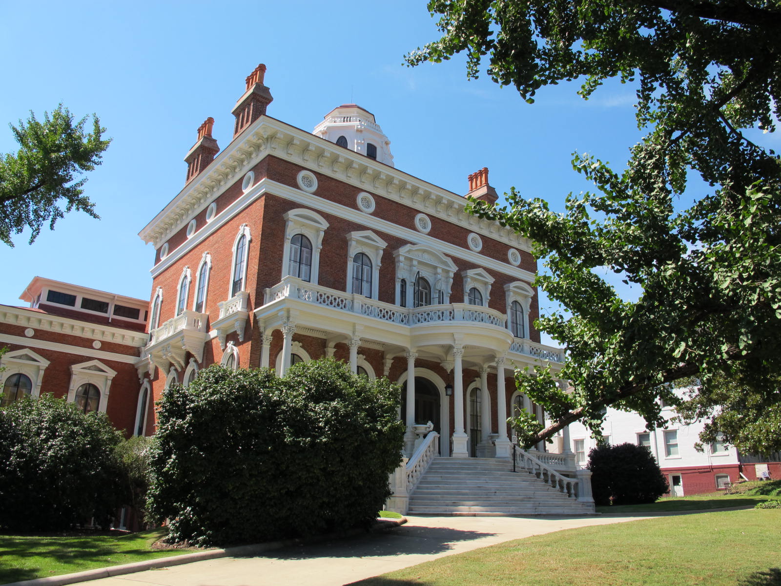
Saturday morning arrived very early.  I was on campus about 5:15 preparing my VIP checkin area and the kids arrived to finish off their area about 5:30, I think.  I liken the Run/Walk to a rainstorm.  It begins with a little sprinkle as people trickle in to register, then the storm really arrives with thousands of people swarming around the site before, during and after the race.  Then the rain peters out again as the event winds down, people go home and we begin our cleanup detail.  It is an amazing event when all our preparation coalesces into a successful happening.  More than 11,000 people attended the event this year…about a thousand more than we expected.

The kids and I posed for a couple of pictures before the race using Scott’s infamous pose that we all have to use at one time

The Pose in front of the Porta Potty

or another when we get together.  Luckily, he doesn’t have a copyright on it or he’d sue us for infringement.

Scott trained very hard for this race as he wanted to improve his 3rd place in the 2011 race.  One of his training methods was to run for miles wearing his fire fighting gear at altitude in Nevada and his

Yea, Scott!

hard work paid off.    He came in second in his age division with a 5K time of 18:50 and he was sprinting when he crossed the finished line!  Scott said his time improved by almost 2 minutes.  That’s my nephew!  Jolee and Jason also finished well ahead of the pack but didn’t place in the top three.  I was proud of all three of them.  Scott really touched me when he said it was an honor to run in memory of Uncle Bob and Bob’s heart donor, Tim.

After they cooled down a bit, we went to the Garden of Life which has many pictures of donors, people who are waiting for organs and people who have passed.  About 165 posters were made and placed in the Garden.  It has become such a focus point and memorable place that families sort of camp out by their loved one’s picture.  Some bring flowers or other tokens of affection to remember them and then they take the poster home with them.  It’s quite an inspirational place, one that often brings tears.  I had a picture of Bob, one of Tim on a raft in Lake Tahoe and one of Joan, a good friend who recently passed away.

In the Garden with Uncle Bob

I had to go back to work in the VIP area, but the kids wandered around the exhibitors’ area, bought some raffle tickets and even won a prize.  The medals were presented and we cheered Scott like the fan club we were.  The kids helped me pack up the VIP area and we were ready to go to the Pint House for their special treats of the the afternoon.  Kathleen gave me special dispensation to leave early for which I was thankful.  I was very tired and wanted to spend some quality time with the kids.  We had a great afternoon and evening together.

In my estimation, the 2012 Run/Walk was a great success as evidenced by the numbers of people attending, participating and having fun.  Kathleen said a week later that she had received no negative reviews and had many positive comments along with many thanking her for providing such a positive, inspirational event.  We know that we always have room to improve, but we feel that we met our goal of celebrating life, donor families and those who are awaiting organs, tissue and eyes.

In closing, they say pictures are worth a thousand words and here are a few more thousand words to let you see a bit more of the event.

The starting line. Did you ever see so many white shirts?

Us with our heroes

Scott’s Chicks

‘Nuff said!

The Perpetual Songster

23 Apr

A few days ago, I awoke in the middle of the night to a rich variety of trills (no spills) and warbles.  It was one of my favorite songsters, the mockingbird, who loves to serenade his lady love in the dark of night, much to the chagrin of some folks.  Since I’ve grown up with the mockingbird’s tunes, I enjoy them anytime of day or night.

Singing his little heart out

The mocker is a tidy, trim bird, which can sing his own song (although I am not sure which is his own) as well as mimic many others.  Some experts say some mockingbirds can imitate up to 200 other birds’ songs as well as some non-human noises, such as sirens or cats.  I don’t know about that.  Every time I try to count a mockingbird’s songs, I max out about 9 or 10 because I lose track of what I’ve heard before.

I love to watch and listen to them as they make their way through the day.  The Cerritos mockers love to perch on something high, such as the top twig of a tree, the highest gable of a house or a light post.  They don’t like crows, cats or hawks and will chase them alone or sometimes in tandem.  Our ol’ cat, Bert (from many years ago), literally crawled on his belly across the street to get home when a pair of mockingbirds were chasing him.  He couldn’t get inside the house fast enough to escape their torment of plucking his short hairs and beak nips.  I think the crows might like to get into the mockers’ nests because they will chase crows in flight.  It’s amazing to me that neither the mocker nor the crow ever run into anything while the pursuit is going on.  I’ve even seen a crow do a barrel roll in an effort to escape those sharp beaks.

I have several bird pepper bushes in the back yard that are favorites of mockingbirds in the fall.  These little red peppers are hotter than Hades (Bob tried one once and told me

They like fruit and berries in the fall

not to even put my tongue on one which I took for the Gospel) and the mockers love them.  They land on the block wall and hop down to one of the branches to gobble up as many peppers as they can.  They try to be sneaky about it, but every time I see the bushes wiggle some, I know it’s them.  This picture is of a mocker eating a crab apple, but the effect is similar as one eating my bird pepper bush.

I had always heard that it was only the male of the species that sings, but the National Geographic Field Guide to Birds claims otherwise.  Both sexes sing in the fall to claim feeding territories.

I’ve sometimes seen a mockingbird spread his wings as if to pump himself up or make himself look bigger.  This wing

Wing-flash

movement is called a wing flash.  A Wikipedia article says it might be to cast a different shadow on the grass so as to fool insects or whatever the prey may be at that time.  I guess that makes sense, but I like my thought better.  They are saucy birds and I think they’d like to make themselves look bigger.

I wish I had taken all these pictures, but I never have the camera at the right moment nor do I have the skill or patience to get shots like these.

As I was outside this morning doing some weeding, I was treated to quite a symphony by mockingbirds, finches, sparrows, phoebes, a few warblers and even some starlings.  Some people might think all the songs are a cacophony but I choose to think they are a symphony because they were all blending into happy, contented sounds of creatures carrying on their lives without bothering each other or worrying about who has the correct religious or political viewpoint or who has more money than the other.  While I don’t particularly enjoy weeding the yard, I do really enjoy being outside listening to and watching God’s creatures.

7 Apr

Some have asked me why “Buzzard Notes.”  That’s a fair question and I’d like to explain how this blog title came about.

When I finally got enough gumption to figure out how to do this thing and got some good information from Güd Writer who also has a blog on Word Press, I began to tinker with this thing.  One of the first things they ask you is what you want to call your blog. I tried “cora” with many variations and numbers along with “cjohnson” and many of its variations.  They were all taken.  What to do?

Jerri, my sister, has called me “Buzzard” for just about as long as we can remember but we don’t remember why.  There must have been a reason, but it escapes us.  (Maybe because I have a skinny neck?)  I figured no one could possibly have “buzzard notes” and tried that title.  It worked!  So there you have it.  buzzardnotes@wordpress.com

Periodically, I add some little tidbit of something that interests me and post it (Please realize that many things interest me and I love to share them, but time, sometimes, is of the essence)  So if you are interested in being alerted as to when a new post comes along please look for the small “follow” box in the bottom right hand side of the latest post.  If you click on that, it will ask you for your email and then you should be alerted as to when the latest posts happen.

Spring Feelings

7 Apr

Today is a gorgeous day in Cerritos…a bit too warm with 89° but nice, nice the less.  No smog or haze and a slight breeze.    I was outside talking to one of the neighbors when I noticed a mockingbird was serenading us with his many songs.  I’m sure he’s trying to attract a mate as he just kept on singing with hardly a breath.  I know it was a male mocker because it’s only the males who sing the many tunes.  I enjoy hearing them  because it reminds me of  spring days of yore…many birds singing their tunes with seemingly no cares, blooming flowers galore and a nice feel to the air.  Life is good!

Water Henge's 5 pieces

On the first day of spring, I walked over to the Cerritos Regional Park to check out “Water Henge: H2O = Life,” a sculpture near the community pool.  Cerritos has many sculptures throughout the city, but this is my favorite because I can understand it.  It’s also different from all the other sculptures in Cerritos because of its composition is of Expanded Polystrene (EPS) that is coated with one” thick cement.  Ceramic tiles accented with glass pieced surround the cement.  The piece was commissioned by the City of Cerritos and Los Angeles County and was created by artist Kim Emerson. The artwork is made up of five mosaic landscape sculptures that represent a visual timeline of the presence of water, or lack of water, in the region. The pieces range in size from 9 inches high to 15 feet high.  The tallest piece has a part on top that looks like the sun and the sun is supposed to shine through the hole onto the smallest piece on the first day of spring.  This is why I went over to see it.  But I didn’t think far enough ahead and failed to realize that I had to wait until the sun

Cerritos Water History

had risen higher.  Well, I couldn’t wait that long and so I’ll just have to rust that this really happened.  I don’t know if it ever does because I’ve never seen an article in the newspaper or online about this little piece of trivia.  The smallest piece of Water Henge represent an 11,000 year drought 10,000 years ago.  And we think we’re in a drought now after a year or so!  After being a bit disappointed in not seeing the sun shine, I continued my walk around the park and took a picture of a large flock of coots (what Dad used to call mud hens).  They were “grazing” on the grass, probably leaving their evidence everywhere.  Those birds are really messy!

The messy coots!

Speaking of birds, I’ve seen evidence of several sparrow and finch nests around the house and one of the neighbors told me he has a swallow’s nest attached to his house.  Since the birds have completed it, he’ll let them finish out their cycle before knocking it down.  Swallows are persistent little birds as they will try two or three times before giving up on a nest if someone knocks down their attempts at building their little mud house.

Spring has sprung and hope springs eternal (most of the time)  Happy Spring and Happy Easter to you all!